Lansare RO.A.D.2015.30
Astăzi, 8 decembrie 2015, la 12 ani de la lansarea Proiectului România Digitală, Sheba Distribution SRL, reprezentant al firmei Garmin în Romania, are plăcerea să anunţe disponibilitatea noii ediţii a Atlasului Digital al României v7.30, RO.A.D.2015.30.
RO.A.D.2015.30 Launch
Today, on the 8th of December 2015, marking the 12th anniversary of our Digital Romania Project, Sheba Distribution SRL, a Garmin representative in Romania, has the pleasure to announce the availability of the new edition of the Digital Atlas of Romania v7.30, RO.A.D.2015.30.
Continuând în tradiţia binecunoscută deja clienţilor Garmin din România, Atlasul Digital al României se menţine în continuare pe locul I în clasamentul hărţilor de navigaţie rutieră, aducând în plus faţă de ediţia precedentă 1.219,77 km de drumuri, ridicând la un total de 375.240,29 km de căi de comunicaţii acoperirea în teritoriu, cu acoperire îmbogăţită semnificativ în judeţele Constanţa, Cluj, Brăila, Mureş şi Harghita şi, iar numărul de informaţii de tip punct se ridică în această ediţie la 572.435 puncte împărţite în 510 de categorii.
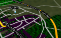
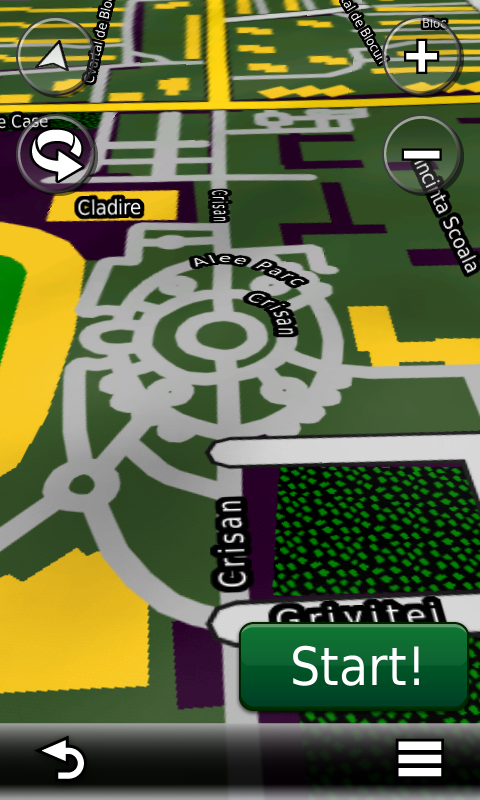
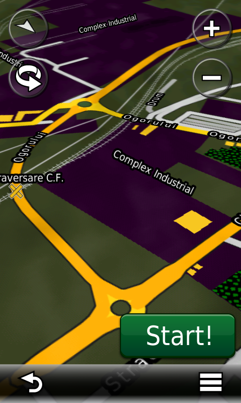
RO.A.D.2015.30 este singura hartă de navigaţie din lume care combină detalii topo cu o structură de drumuri rutabilă – la nivel inclusiv de drumuri de pământ şi poteci – cu adrese poştale de o precizie neegalată, oraşe cu blocuri 3D şi modele minuţios realizate la construcţii vechi, de patrimoniu, sau noi, definitorii pentru peisajul urban actual. Actualizările la hartă sunt constante şi consistente de la o ediţie la alta şi sunt documentate în Jurnalul Hărţii, în care sunt trecute contribuţiile şi autorii acestora, datele la care s-au efectuat precum şi denumirile localităţilor şi planşelor afectate.
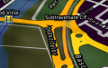
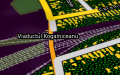
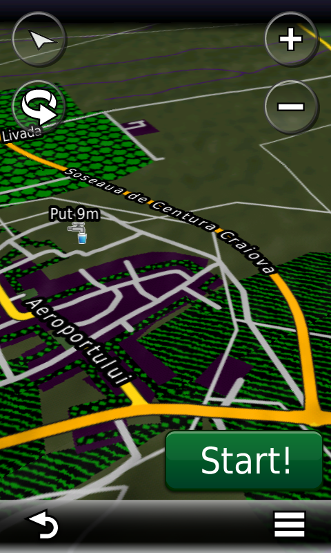
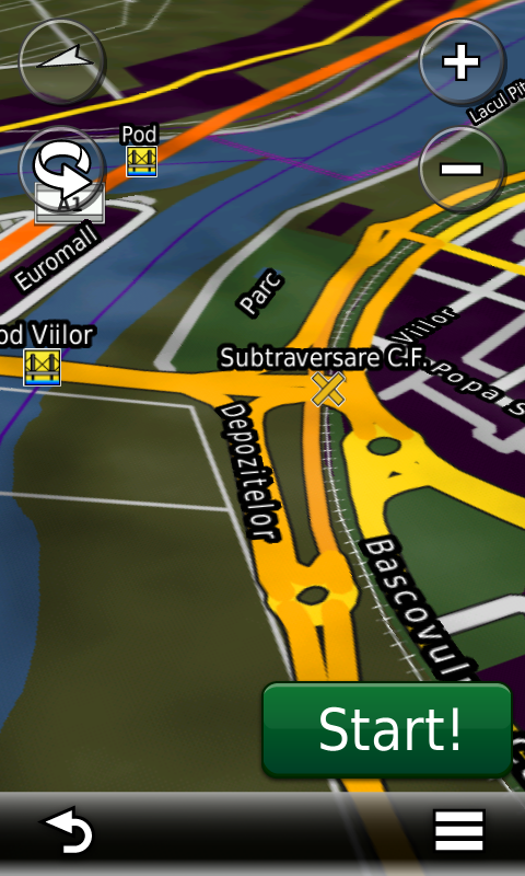
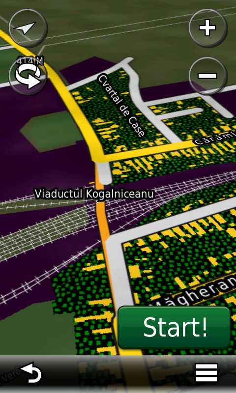
Faţă de hărţile comune de pe piaţă, Atlasul Digital al României are un grad de detaliu şi actualitate fără egal, în această ediţie fiind introduse, printre multe altele, Pasajul nou peste calea ferată din Oradea, noua soluţie de rutare din Vama Giurgiu, Viaductul Kogălniceanu din Sibiu, Pasajul Viilor din Piteşti (fără rutabilitate) şi centura de SE a Craiovei. S-au cartat două câmpuri de sonde din Ianca, fermele solare din Bărăganu şi Însurăţei, parcul eolian din Însurăţei, parcului eolian din Ciochiş, ferma solară din Bobiceşti, ferma solară de la Peretu, 4 ferme solare în Ploieşti Vest, ferma solară din Măxineni, parcul de eoliene din Pechea şi parcul de eoliene din Frumuşiţa, împreună cu accesul la acestea.
În această ediţie s-au introdus şi completat adrese poştale în localităţile MANGALIA, SATURN, VENUS, CAP AURORA, JUPITER, NEPTUN, OLIMP, CHINTENI, CÂMPENEŞTI, TĂUŢI, SĂLICEA, FELEACU, BACIU, SĂCĂLAIA, SÂNNICOARĂ, SÂNTEJUDE, SÂNTEJUDE-VALE, BONŢ, REDIU, SĂRĂDIŞ, VÂLCELE, GHEORGHIENI, DEZMIR, CLUJ-NAPOCA, Însurăței, Măru Roșu, Lacu Rezii, BUNEŞTI, NIREŞ, MICA, DÂMBU MARE, MĂNĂSTIREA, URIŞOR, CĂŞEIU, COPLEAN, NICULA, HĂŞDATE, BĂIŢA, PEŞTERA, OCNA DEJULUI, DEJ, GHERLA, TÂRGUŞOR, SÂNTIOANA, VÂGANI, CĂLIMĂNEL, TOPLIŢA, GĂLĂUŢAŞ, NUŢENI, TOLEŞENI, PLATONEŞTI, SARMAL, HODOŞ, FUNDOAIA, RUNC, FILPEA, SUBCETATE şi CĂLNACI.
S-a introdus accesul detaliat la centrele comerciale Deva Shopping City, Altex şi Penny Mangalia, Penny Feteşti-Gară, Metro 2 Braşov, Lidl Mizil, Metro Timişoara, Lidl Câmpia Turzii şi Kaufland Miercurea Ciuc,s-au adăugat unele sensuri unice noi şi 50 (cincizeci) sensuri giratorii noi.
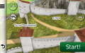
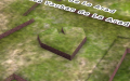
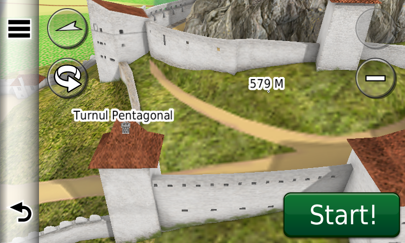
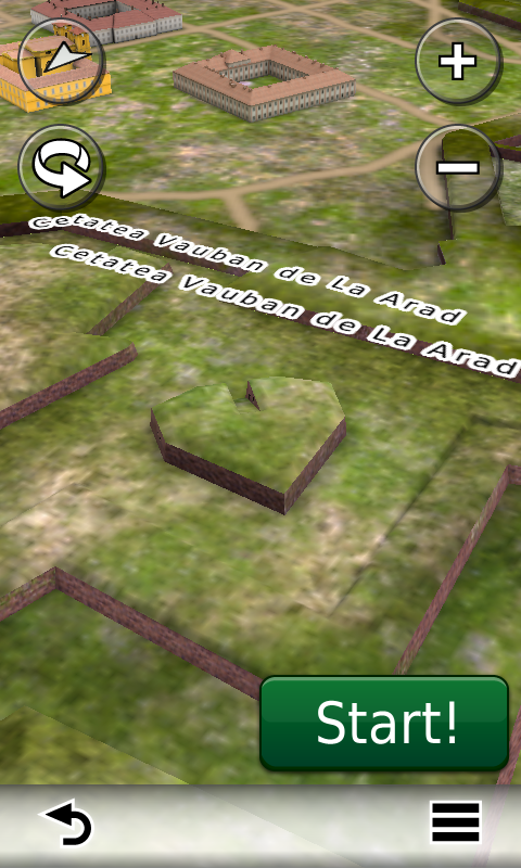
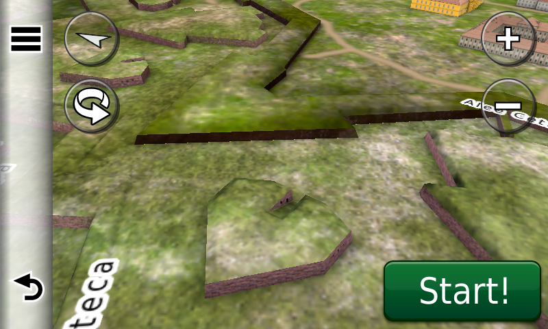
S-a continuat de asemenea cartarea monumentelor istorice reşedinţe nobiliare din Transilvania precum şi a schiturilor şi mănăstirilor de rit ortodox de pe întreg teritoriul ţării. S-au introdus modele 3D texturate ale cetăţii Vauban de la Arad şi cetăţii medievale de la Rupea.
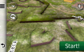
Pasionaţii de istorie vor descoperi în această ediţie în premieră elementele de detaliu ale Burgus-ului Roman de la Bradu-Clocotici, şanţurile cetăţii hallstattiene mari de la Dagâţa, ale aşezării dacice de la Cândeşti-Cetăţuia, ale unei fortificaţii inedite din Ceraşu-Crucea de la Vârful lui Crai, câteva zeci de monumente comemorative din primul şi al doilea război mondial, monumente de for public şi cimitire militare precum şi cvasitotalitatea monumentelor de for urban din localităţile Braşov, Câmpia Turzii, Blaj şi Slobozia.
Dispunând de un concept original, cu actualizări trianuale, rodul muncii timp de doisprezece ani fără întrerupere a pasionaţilor şi specialiştilor din echipa Proiectului România Digitală, Atlasul Digital al României este opţiunea profesioniştilor din toate domeniile şi unealta preferată de navigaţie a amatorilor de drumeţii în aer liber.
Ediţia actuală are 836,3 MB mărime şi rulează exclusiv pe echipamente de navigaţie Garmin, o listă a acestora fiind disponibilă la linkul de mai jos
http://www.rqa.ro/produs.php?id=442&subcat_id=39&cat_id=19
Atenţionare!
Utilizarea hărţii RO.A.D.2015.30 poate crea dependenţă de calitate, valoare, funcţionalitate şi frumos!
Continuing in the well known tradition for the Romanian Garmin customers, the Digital Atlas of Romania holds on to the number one place in the GPS road navigation map charts by bringing an extra 1,219.77 km of roads up to a grand total of 375,240.29 km, having significant increased coverage added in the counties Constanţa, Cluj, Brăila, Mureş and Harghita and the number of POIs raises in this edition to a staggering 572,435 points divided into 510 categories.
RO.A.D.2015.30 is the only GPS navigation map in the world that combines topographic details with a routable road network – including dirt roads and trails – with postal addresses of unequaled precision, towns with extruded 3D blocks of flats and detailed 3D textured models for both old patrimony buildings and new skyscrapers, true landmarks of today’s urban space. Map updates are constant and consistent from one edition to another and are documented in the Map Diaries, where all the contributions and their respective authors are mentioned together with the names of the cities and the map tiles that have changed.
Compared with common maps on the market, the Digital Atlas of Romania has an unequaled level of detail and actuality, featuring the passage over the railway from Oradea, the new routing solution at Giurgiu Customs, the Kogălniceanu Viaduct from Sibiu, the Viilor Passage from Piteşti (without routability) and Craiova’s South East ring, plus the two oilfields from Ianca, the solar farms from Bărăganu, Însurăţei, Bobiceşti, Peretu, Ploieşti Vest and Măxineni, the wind farms from Însurăţei, Ciochiş, Pechea and Frumuşiţa, together with access to them.
In this edition we have postal addresses added in the following towns: MANGALIA, SATURN, VENUS, CAP AURORA, JUPITER, NEPTUN, OLIMP, CHINTENI, CÂMPENEŞTI, TĂUŢI, SĂLICEA, FELEACU, BACIU, SĂCĂLAIA, SÂNNICOARĂ, SÂNTEJUDE, SÂNTEJUDE-VALE, BONŢ, REDIU, SĂRĂDIŞ, VÂLCELE, GHEORGHIENI, DEZMIR, CLUJ-NAPOCA, Însurăței, Măru Roșu, Lacu Rezii, BUNEŞTI, NIREŞ, MICA, DÂMBU MARE, MĂNĂSTIREA, URIŞOR, CĂŞEIU, COPLEAN, NICULA, HĂŞDATE, BĂIŢA, PEŞTERA, OCNA DEJULUI, DEJ, GHERLA, TÂRGUŞOR, SÂNTIOANA, VÂGANI, CĂLIMĂNEL, TOPLIŢA, GĂLĂUŢAŞ, NUŢENI, TOLEŞENI, PLATONEŞTI, SARMAL, HODOŞ, FUNDOAIA, RUNC, FILPEA, SUBCETATE and CĂLNACI.
Detailed acces to the retail stores Deva Shopping City, Altex and Penny Mangalia, Penny Feteşti-Gară, Metro 2 Braşov, Lidl Mizil, Metro Timişoara, Lidl Câmpia Turzii and Kaufland Miercurea Ciuc plus many new oneway streets have been added together with 50 (fifty) new roundabouts.
We also continued mapping the aristocratic mansions representing historical monuments from Transylvania, as well as orthodox monasteries from all over the country. 3D textured models of the Vauban fortress from Arad and the medieval fortress from Rupea have also been introduced.
History aficionados will discover in this edition in premiere the detailed elementes of the Roman Burgus from Bradu-Clocotici, the fortifications of the large iron age fortress from Dagâţa, the dacian settlement from Cândeşti-Cetăţuia, a previously unknown fortress from Ceraşu-Crucea de la Vârful lui Crai, tens of monuments from the first and second world wars, the public forum monuments and military cemeteries together with almost all of the monuments from Braşov, Câmpia Turzii, Blaj and Slobozia.
Featuring an original concept, with updates three times a year, the result of 12 years of continuous development of the experts and contributors of the Digital Romania Project team, the Digital Atlas of Romania is the choice of professionals in all fields and the preferred navigation tool for all nature goers.
This edition has 836.3 MB in size and runs exclusively on Garmin navigation equipment, an updated list of compatibility being available at the below link:
http://www.rqa.ro/produs.php?id=442&subcat_id=39&cat_id=19
Warning!
The use of RO.A.D.2015.30 map can create addiction to quality, value, functionality and beauty!