Lansare RO.A.D.2021.01
RQA, dealer de tehnologie Garmin în Romania, are plăcerea să anunţe disponibilitatea noii ediţii a Atlasului Digital al României v13.01, RO.A.D.2021.01.
Continuând în tradiţia binecunoscută deja clienţilor Garmin din România, Atlasul Digital al României se menţine în continuare pe locul I în clasamentul hărţilor de navigaţie rutieră, aducând în plus faţă de ediţia precedentă 1.907,52 km de drumuri, ridicând la un total de 462.681,85 km de căi de comunicaţii rutiere şi navale acoperirea în teritoriu, iar numărul de informaţii de tip punct se ridică în această ediţie la 940.591 puncte împărţite în 531 categorii.
RO.A.D.2021.01 este singura hartă de navigaţie din lume care combină detalii topo cu o structură de drumuri rutabilă – la nivel inclusiv de drumuri de pământ şi poteci – cu adrese poştale de o precizie neegalată, oraşe cu blocuri 3D şi modele minuţios realizate la construcţii vechi, de patrimoniu, sau noi, definitorii pentru peisajul urban actual. Actualizările la hartă sunt constante şi consistente de la o ediţie la alta şi sunt documentate în Jurnalul Hărţii, în care sunt trecute contribuţiile şi autorii acestora, datele la care s-au efectuat precum şi denumirile localităţilor şi planşelor afectate.
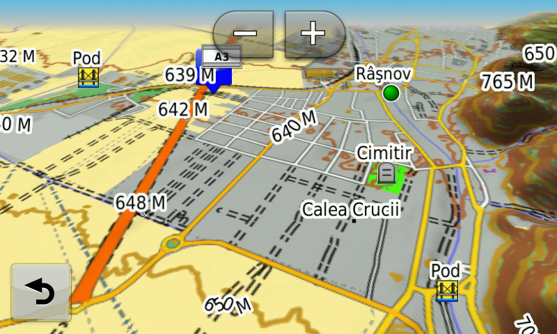
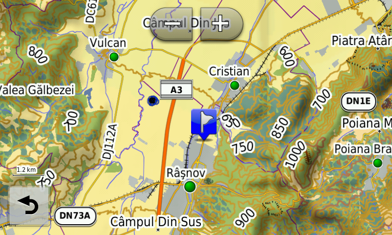
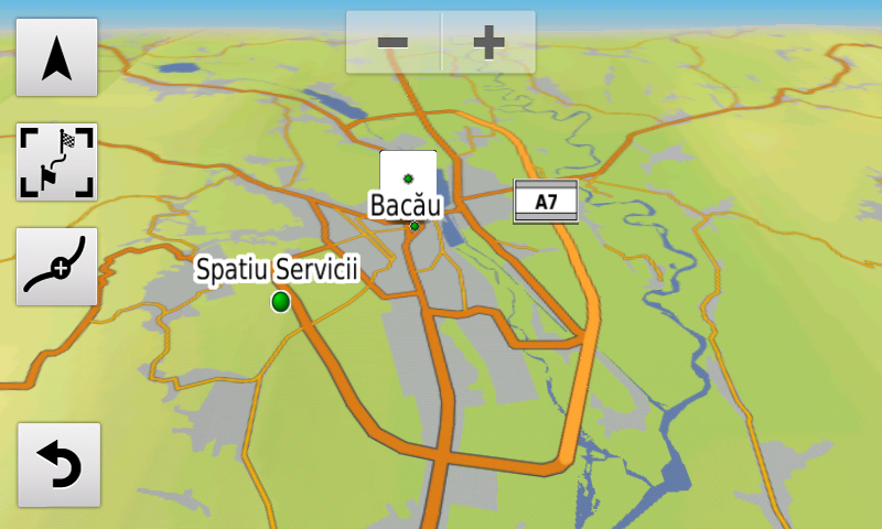
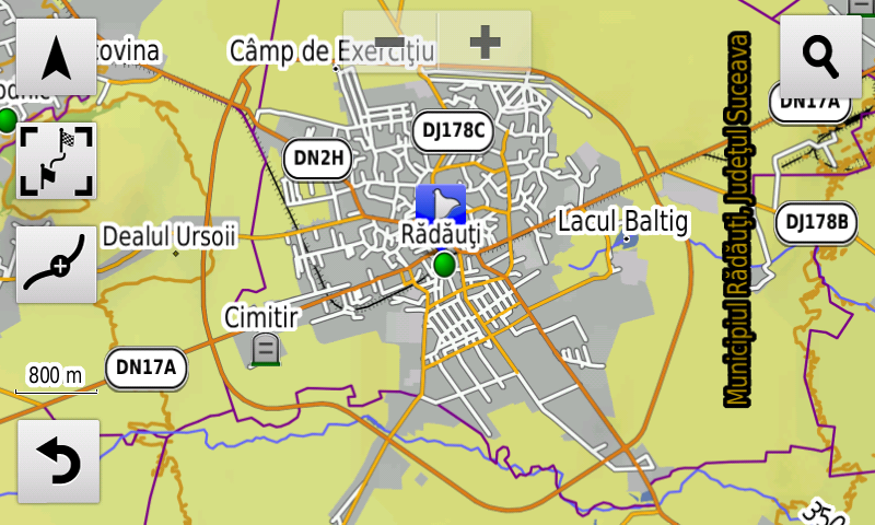
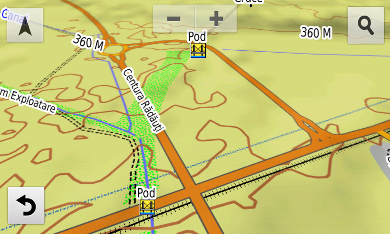
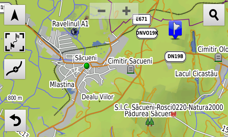
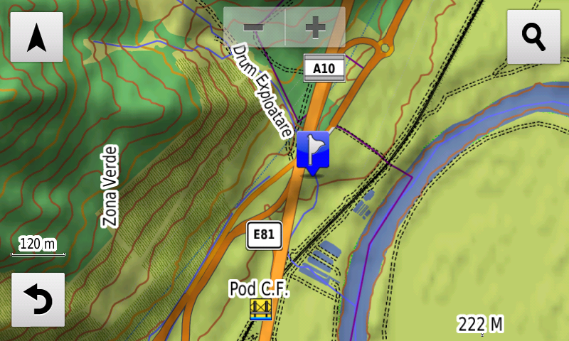
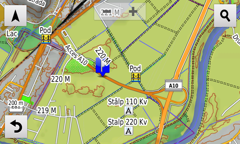
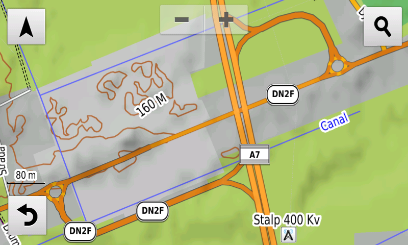
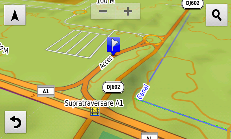
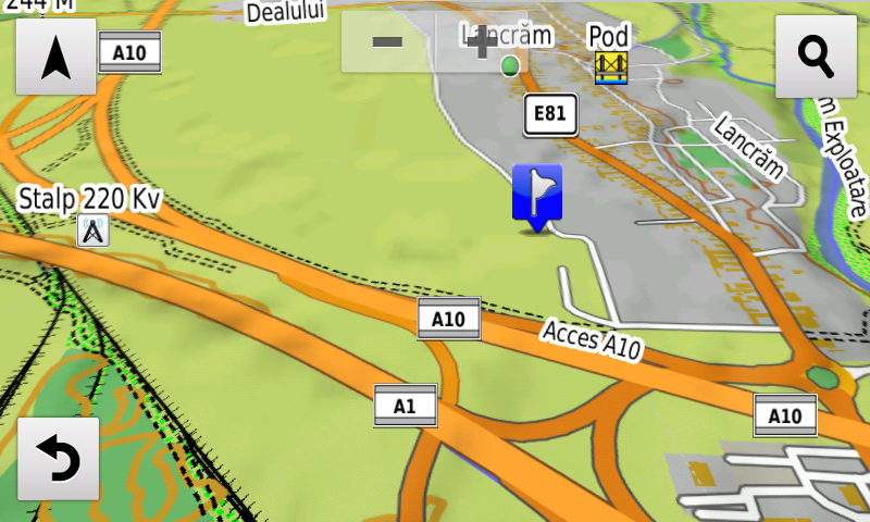
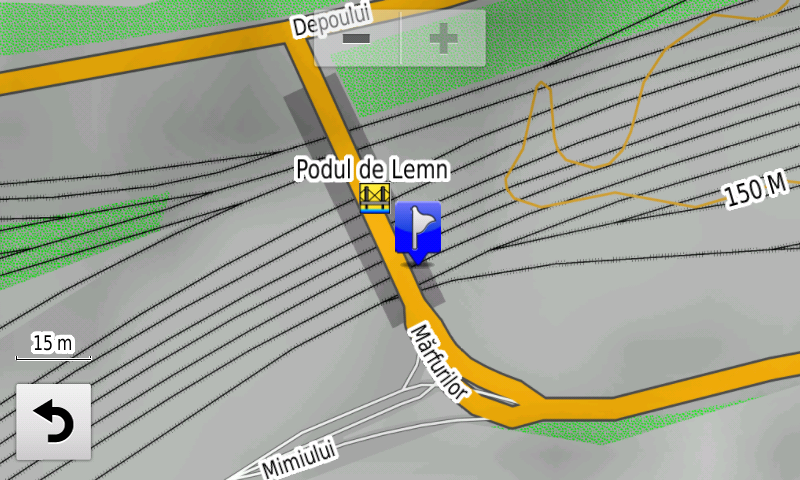
Faţă de hărţile comune de pe piaţă, Atlasul Digital al României are un grad de detaliu, acoperire şi actualitate fără egal, în această ediţie fiind introduse traseul Centurii Rădăuţi, al Centurii Săcueni, al Centurii Bacăului, inclusiv porţiunea în regim de austostradă A7, nodul DN2F de la Bacău pe autostrada A7, lotul 1 autostrada A10 cu nodurile Alba Iulia Sud şi Nord, nodul Sebeş din lotul 1 al autostrăzii A10, traseul Centurii Râşnovului, inclusiv porţiunea în regim de autostradă A3 şi drumul de legătură la DN73, traseul noului DJ109G la Bărcăneşti, s-a reintrodus accesul pe podul mare peste Argeş la sud de Adunaţii-Copăceni, s-au eliminat restricţiile de viteză de pe autostrada A1 lotul 2 Lugoj-Deva între Ilia şi Holdea, s-au introdus pasajul rutier Universităţii din Oradea, nodul Joiţa de pe autostrada A1 şi „Podul de Lemn” din Ploieşti.
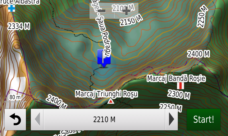
S-au introdus potecile şi marcajele turistice din Munţii Făgăraş şi din Parcul Naţional Buila-Vânturariţa. A fost generalizată echidistanţa curbelor de nivel la 10 m în toată harta.
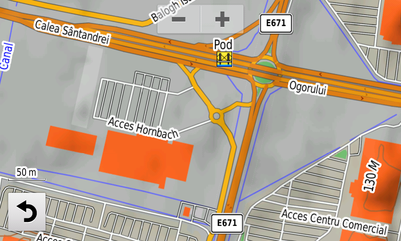
S-a introdus accesul detaliat la Baia Mare Value Centre şi Selgros Baia Mare, Penny Market Focşani Vâlcele, Deco Flora Snagov, Dedeman Călăraşi, Lidl 1 Decembrie, Hornbach Oradea şi Kaufland Oradea Calea Clujului, Kaufland Bragadiru, Mega Image Jilava, Mega Image Roşu, Penny Market Făgăraş, Kaufland Ferentari, Mega Image Concept Store şi Decathlon Băneasa, Kaufland Odăii, Penny Market Fizicienilor, Extinderea Dedeman Giurgiului şi Profi Berceni din Bucureşti. S-au adăugat multe sensuri unice noi, restricţii de viteză precum şi 43 (patruzecişitrei) sensuri giratorii noi.
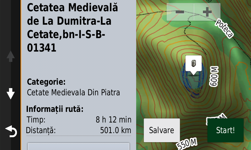
Pasionaţii de istorie vor descoperi în această ediţie în premieră elementele de detaliu (val, şanţ) ale cetăţii preistorice de la Valea Leşului-Cetăţuia, elementele de detaliu (val, şanţ) ale unei fortificaţii inedite de epoca bronzului la Mirşid-Secătura, elementele de detaliu (val, şanţuri) ale unei fortificaţii preistorice inedite la Ghinda-Dealul Corbului, elementele de detaliu (zidul) ale turnului roman şi cetăţii dacice de la Mirşid-Poguior, un val de pământ inedit, probabil dacic, la Mirşid-Poguior, mai mulţi tumuli pe coama dealului Pietros, două posibile castre romane inedite la Mirşid şi Creaca, un posibil turn roman inedit la Băbeni, elementele de detaliu (valuri, şanţ) ale Burgus-ului Roman de la Hurez-Poic, două posibile turnuri romane inedite la Dumitra şi un posibil turn roman inedit la Rebrişoara-Pădurea Hohen Eichen, elementele de detaliu (val, şanţ) ale valului roman de pământ de la Zalău (Vârful Păstaie-Sub Păstaie), ale valului roman de pământ de la Prodăneşti-Pe Şanţ, elementele de detaliu (şanţul) Burgus-ului roman de la Negreni-Cetatea lui Cimpoca, elementele de detaliu (şanţul) Burgus-ului roman de la Hodişu-Dosu Turcului, elementele de detaliu (şanţul) Burgus-ului roman de la Hurez-Dealu Secuiului, Turnul roman de la Treznea-La Şuvar, ca denumire şi poarta în valul roman de la Treznea-Sub Păstaie, ca punct, s-a introdus o porţiune din drumul roman de la Geoagiu, s-a corectat aspectul quadriburgium-ului de la Mircea Vodă, elementele de detaliu (val) ale aşezării fortificate medievale timpurii de la Tărtăria-Gura Luncii, elementele de detaliu (punct, ziduri, şanţuri) de la Cetatea Medievală de la Dumitra-La Cetate, o construcţie inedită la Almaşu, mai multe tranşee şi ceea ce pare un şanţ anticar la Jibou, s-au introdus o serie de cazemate şi completări la şanţul anticar de la Techirghiol. S-au introdus de asemenea varii monumente comemorative ale eroilor din cele două războaie mondiale.
Dispunând de un concept original, cu actualizări trianuale, rodul muncii timp de peste şaptesprezece ani fără întrerupere a pasionaţilor şi specialiştilor din echipa Proiectului România Digitală, Atlasul Digital al României este opţiunea profesioniştilor din toate domeniile şi unealta preferată de navigaţie a amatorilor de drumeţii în aer liber.
Ediţia actuală are 1,58 GB mărime şi rulează exclusiv pe echipamentele de navigaţie Garmin din linkul de mai jos
http://www.rqa.ro/produs.php?id=442&subcat_id=39&cat_id=19
Atenţionare!
Utilizarea hărţii RO.A.D.2021.01 poate crea dependenţă de calitate, valoare, funcţionalitate şi frumos!
RQA, a Garmin technology dealer in Romania, has the pleasure to announce the availability of the new edition of the Digital Atlas of Romania v13.01, RO.A.D.2021.01.
Continuing in the well known tradition for the Romanian Garmin customers, the Digital Atlas of Romania holds on to the number one place in the GPS road navigation map charts by bringing an extra 1,907.52 km of roads up to a grand total of 462,681.85 km and the number of POIs raises in this edition to a staggering 940,591 points divided into 531 categories.
RO.A.D.2021.01 is the only GPS navigation map in the world that combines topographic details with a routable road network – including dirt roads and trails – with postal addresses of unequaled precision, towns with extruded 3D blocks of flats and detailed 3D textured models for both old patrimony buildings and new skyscrapers, true landmarks of today’s urban space. Map updates are constant and consistent from one edition to another and are documented in the Map Diaries, where all the contributions and their respective authors are mentioned together with the names of the cities and the map tiles that have changed.
Compared with common maps on the market, the Digital Atlas of Romania has an unequaled level of detail, coverage and actuality, featuring the Rings of Rădăuţi, Săcueni, Bacău – including the A7 motorway portion – the DN2F node from Bacău on the A7 motorway, the 1st lot of the A10 motorway with Alba Iulia South and North nodes, the Sebeş node on the 1st lot of A10 motorway, the Râşnov Ring, including the A3 motorway portion and the link to DN73, the new Arterial DJ109G from Bărcăneşti; acces has been reintroduced on the high bridge over the Argeş river South of Adunaţii-Copăceni, speed restrictions on A1 motorway on the 2nd lot Lugoj-Deva between Ilia and Holdea have been cancelled, the road passage Universităţii from Oradea, the Joiţa node from the A1 motorway and the „Wooden Bridge” from Ploieşti have also been added.
.
The touristic trails and markings have been introduced in the Făgăraş Mountains and in the Buila-Vânturariţa National Park.
Detailed acces to the retail stores: Baia Mare Value Centre and Selgros Baia Mare, Penny Market Focşani Vâlcele, Deco Flora Snagov, Dedeman Călăraşi, Lidl 1 Decembrie, Hornbach Oradea and Kaufland Oradea Calea Clujului, Kaufland Bragadiru, Mega Image Jilava, Mega Image Roşu, Penny Market Făgăraş, Kaufland Ferentari, Mega Image Concept Store and Decathlon Băneasa, Kaufland Odăii, Penny Market Fizicienilor, the Dedeman Giurgiului Extension and Profi Berceni from Bucharest. New oneway streets and speed restrictions have been added together with 43 (fortythree) new roundabouts.
History aficionados will discover in this edition in premiere the detailed elements (rampart, ditch) of the prehistoric stronghold from Valea Leşului-Cetăţuia, the detailed elements (rampart, ditch) of an unknown bronze age fortification from Mirşid-Secătura, the detailed elements (rampart, ditches) of a previously unknown prehistoric fortification at Ghinda-Dealul Corbului, the detailed elements (wall) of the roman tower and the rampart of the Dacian stronghold from Mirşid-Poguior, a previosly unknown earthen vallum, probably Dacian, at Mirşid-Poguior, several tumuli on the ridge of the Pietros Hill, two possible Roman march castra at Mirşid and Creaca previously unknown, a possible Roman tower at Băbeni, the detailed elements (ramparts, ditch) of the Roman Burgus from Hurez-Poic, two possible Roman towers, previously unknown, at Dumitra and a possible Roman tower, previously unknown, at Rebrişoara-Pădurea Hohen Eichen, the detailed elements (rampart, ditch) of the Roman earth vallum from Zalău (Vârful Păstaie-Sub Păstaie), of the Roman earth vallum from Prodăneşti-Pe Şanţ, the detailed elements (ditch) of the Roman Burgi from Negreni-Cetatea lui Cimpoca, Hodişu-Dosu Turcului, and Hurez-Dealu Secuiului, the Roman tower from Treznea-La Şuvar, as a named point and the Roman vallum gate from Treznea-Sub Păstaie, as a point; a portion of the Roman road from Geoagiu has been mapped, the aspect of the quadriburgium from Mircea Vodă has been updated, the detailed elements (rampart) of the early medieval fortified settlement from Tărtăria-Gura Luncii, the detailed elements (point, walls, ditches) of the Medieval Fortress from Dumitra-La Cetate, a previously unknown construction from Almaşu, many trenches and what looks like an antitank ditch at Jibou, a series of casemates and addings to the antitank ditch from Techirghiol have also been mapped. Various heroes commemorative monuments from the two world wars have been mapped as well.
Featuring an original concept, with updates three times a year, the result of more than 17 years of continuous development of the experts and contributors of the Digital Romania Project team, the Digital Atlas of Romania is the choice of professionals in all fields and the preferred navigation tool for all nature goers.
This edition has 1.58 GB in size and runs exclusively on Garmin navigation equipment, an updated list of compatibility being available at the below link:
http://www.rqa.ro/produs.php?id=442&subcat_id=39&cat_id=19
Warning!
The use of RO.A.D.2021.01 map can create addiction to quality, value, functionality and beauty!