Journal – Arhive
-

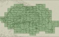
RO.A.D. 2008 Statistics
Statistics of the main types of roads Alley : 911Km Arteries/Avenues : 3362Km Main roads/Streets : 6431Km Entrances : 354Km Sea routes…
-
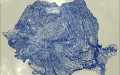
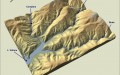
Relief
Objective Fulfillment of a layer that includes the level curves for the entire Romanian territory (plus a buffer of 10 kilometers). The…
-
Hydrography
Objective Fulfillment of a database with the hydrographic network of the Romanian territory. Persons in charge INMH, Adrian Barbieru, RQA, Constantin Manea…
-
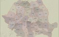
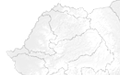
Administrative
Objective Fulfillment of a database with the main administrative limits (county limits, state frontier) of the Romanian territory. Persons in charge RQA…
-
Roads
Objective Fulfillment of a database that includes the digital representation of all the roads in the Romanian territory (European, national, regional, village,…
-
Railways
Objective Fulfillment of a database that should include the digital representation of all the railways in the Romanian territory. Persons in charge…
-
Toponyms
Objective Fulfillment of a database with toponymic information for the Romanian territory. Persons in charge RQA, myNature Constantin Manea Last update 07.03.2005…
-
Localities
Bucharest Authors: Cartogate Group Reference scale: — Spacial data: Rauri Lacuri Puncte de interes Drumuri Parcele Cladiri importante Last update: 08.09.2004 Bucharest…
-
The necessary honesty
Onestitate necesara De-a lungul timpului am fost abordat de clienti sau am urmarit mai multe discutii pe forumuri cu intrebari apropo de…
-
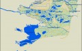
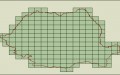
Danube Delta
Objective Fulfillment of a space database for the region of the Danube Delta. Persons in charge Stefan Constantinescu, Vasile Craciunescu, Florin Filip,…
-

RO.A.D. 2008 Map Journal
Modificari de la v2.16 la v3.1 Modificari v3.0 fata de v2.16 Corectat denumirea localitatii Unirea in 23 August din K35-010; Adaugat localitatile…
-
Electric Lines
Objective Fulfillment of a database that should include the digital representation of the electric current lines from the Romanian territory. Persons in…
-
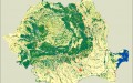
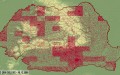
Land Cover
Objective Fulfillment of a database with the main categories of coverage/use of the land on the Romanian territory. Persons in charge RQA…
-
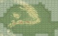
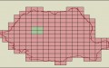
Details
Bathymetric map sector Capul Tuzla – Costinesti Authors: Stefan Constantinescu, Alfred Vespremeanu-Stroe, Viorel Ungureanu Reference scale: — Spatial data: Bathymetry Last update:…