Lansare RO.A.D.2012.40
Sheba Distribution SRL, reprezentant al firmei Garmin în Romania, are plăcerea să anunţe disponibilitatea noii ediţii a Atlasului Digital al României v4.40, RO.A.D.2012.40.
Continuând în tradiţia binecunoscută deja clienţilor Garmin din România, Atlasul Digital al României se menţine în continuare pe locul I în clasamentul hărţilor de navigaţie rutieră, aducând în plus faţă de ediţia precedentă 17.241,53 de kilometri de drumuri, ridicând la un total de 267.261,99 km de căi de comunicaţii acoperirea în teritoriu, cu acoperire îmbogăţită în judeţele Vaslui, Iaşi, Caraş-Severin şi Hunedoara, iar numărul de informaţii de tip punct se ridică în această ediţie la 314.941 puncte împărţite în 437 de categorii.
ROAD2012.40 este singura hartă de navigaţie din lume care combină detalii topo cu o structură de drumuri rutabilă – la nivel inclusiv de drumuri de pământ şi poteci – cu adrese poştale de o precizie neegalată, oraşe cu blocuri 3D şi modele minuţios realizate la construcţii vechi, de patrimoniu, sau noi, definitorii pentru peisajul urban actual. Actualizările la hartă sunt constante şi consistente de la o ediţie la alta şi sunt documentate în Jurnalul Hărţii, în care sunt trecute contribuţiile şi autorii acestora, datele la care s-au efectuat precum şi denumirile localităţilor şi planşelor afectate.
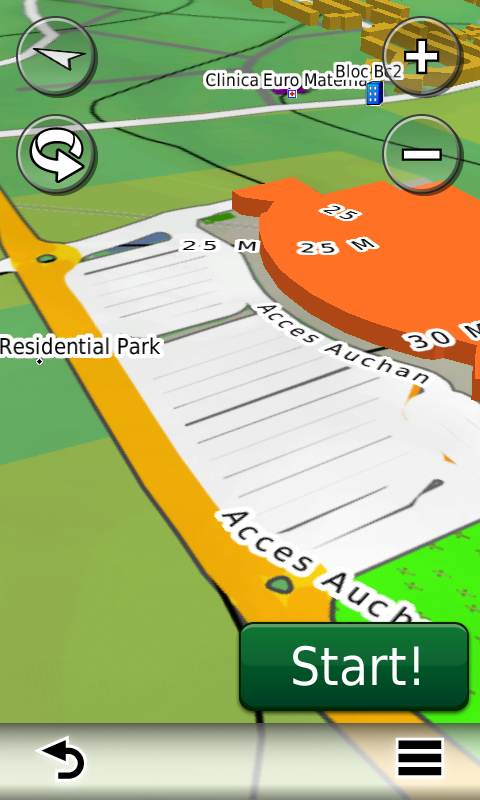
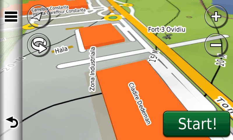
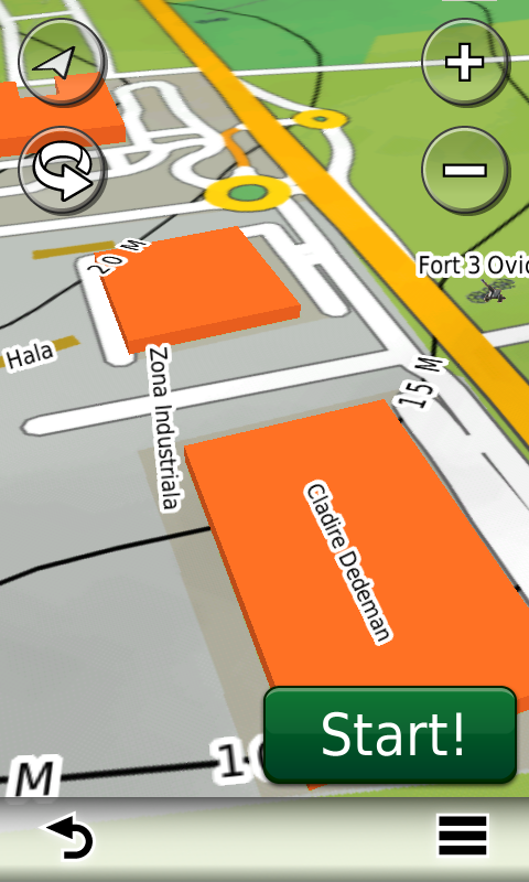
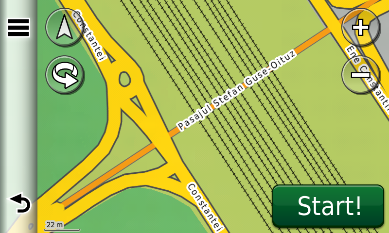
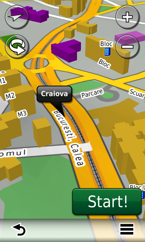
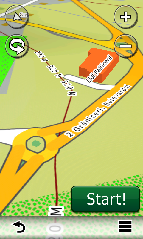
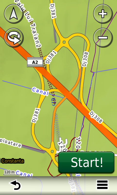
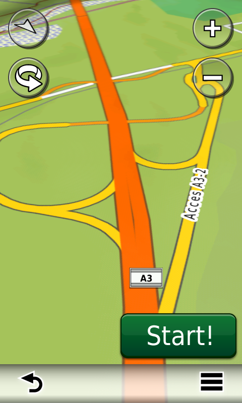
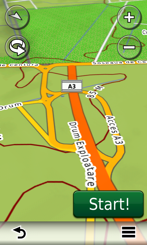
Faţă de hărţile comune de pe piaţă, Atlasul Digital al României are un grad de actualitate fără egal, în această ediţie aflându-se în premieră autostrada A3 între Bucureşti şi Ploieşti cu legătura de la Snagov, autostrada A2 completă, inclusiv segmentul Cernavoda-Medgidia cu legătura de la Valea Dacilor, continuarea centurii A4 si legatura la A4 din Ovidiu, pasajul subteran Ştefan Guşe-Oituz din Bacău, pasajul rutier suprateran din Craiova, pasajul subteran de acces la Prisma-Hornbach de pe DN1 din Baloteşti, pasajul subteran de acces la Carrefour Tom din Ovidiu, podul rutier nou peste Cibin din Sibiu, străpungerea Popişteanu Cristian din Bucureşti, accesul la centrele comerciale Maritimo din Constanţa şi Lidl din Fălticeni, legătura Coresi din Braşov precum şi multe cartiere rezidenţiale de dată recentă (cartierul A.N.L. Henri Coandă, zonele rezidenţiale FeliCity, Upground, Quadra Place, Greenfield Residence, etc. din Bucureşti, Militari Residence din Roşu, Ibiza Sol, Ibiza Golf si Oxford Gardens din Voluntari, etc.), sensuri unice şi 38 (treizecişiopt) sensuri giratorii apărute între timp.
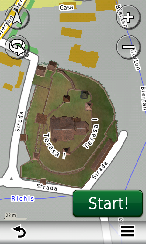
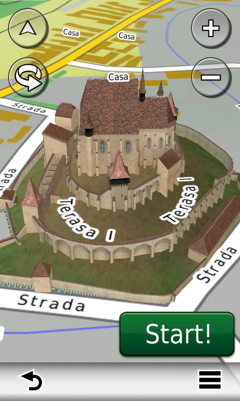
Galeria modelelor 3D s-a îmbogăţit cu reprezentarea detaliată a bisericii evanghelice fortificate din Biertan.
Graniţele, componenţa şi denumirile parcurilor şi rezervaţiilor naturale din România au fost şi acestea reactualizate după cele mai noi limite publicate de Ministerul Mediului în 2011.
Pasionaţii de istorie vor descoperi în această ediţie în premieră elementele de detaliu ale cetăţii de epoca fierului de la Herneacova, ale aşezărilor fortificate e-neolitice ale Culturilor Precucuteni de la Târpeşti – Râpa lui Bodai, Culturii Cucuteni de la Ruginoasa – Dealul Drăghici, Culturii Vădastra de la Vădastra – Dealul Cişmelei, Culturii Ceramicii Liniare de la Isaiia – Balta Popii, ale cetăţii de epoca bronzului şi dacică de la Năeni – Zănoaga, ale cetăţilor dacice de la Pietroasele – Gruiu Dării şi de la Todireşti – La Şanţuri.
Dispunând de un concept original, cu actualizări trimestriale, rodul muncii pasionaţilor şi specialiştilor din echipa Proiectului România Digitală, Atlasul Digital al României este opţiunea profesioniştilor din toate domeniile şi unealta preferată de navigaţie a pasionaţilor de drumeţii în aer liber.
Ediţia actuală are 482 MB mărime şi rulează exclusiv pe echipamente de navigaţie Garmin, o listă a acestora fiind disponibilă la linkul de mai jos
http://www.rqa.ro/produs.php?id=442&subcat_id=39&cat_id=19
Atenţionare!
Utilizarea hărţii ROAD2012.40 poate crea dependenţă de calitate, valoare, funcţionalitate şi frumos!

RO.A.D.2012.40 Launch
Sheba Distribution SRL, a Garmin representative in Romania, has the pleasure to announce the availability of the new edition of the Digital Atlas of Romania v4.40, RO.A.D.2012.40.
Continuing in the well known tradition for the Romanian Garmin customers, the Digital Atlas of Romania holds on to the number one place in the GPS road navigation map charts by bringing an extra 17 thousand km of roads up to a grand total of 267.261,99 km, having increased coverage added in the counties Vaslui, Iaşi, Caraş-Severin and Hunedoara and the number of POIs raises in this edition to a staggering 314.941 points divided into 437 categories.
ROAD2012.40 is the only navigation map in the world that combines topographic details with a routable road network – including dirt roads and trails – with postal addresses of unequaled precision, towns with extruded 3D blocks of flats and detailed 3D textured models for both old patrimony buildings and new skyscrapers, true landmarks of today’s urban space. Map updates are constant and consistent from one edition to another and are documented in the Map Diaries, where all the contributions and their respective authors are mentioned together with the names of the cities and the map tiles that have changed.
Compared with common maps on the market, the Digital Atlas of Romania has an unequaled level of actuality, in this edition one being able to find the newest A3 motorway (between Ploieşti and Bucureşti) with the complete Snagov bypass and the complete A2 motorway (from Cernavoda to Medgidia), with the ruttier bypass in Valea Dacilor, the extended A4 ring (from Constanţa to Ovidiu), the overhead passage from Craiova, the undeground passages from Bacău (between Oituz and Ştefan Guşe) and Corbeanca (Prisma), the underground passage to Carrefour Tom in Ovidiu, the ruttier bridge over the Cibin in Sibiu, the Popişteanu Cristian breakthrough in Bucureşti, the access to the commercial centres Maritimo from Constanţa and Lidl from Fălticeni, the Coresi link in Braşov together with many recent residential areas (A.N.L. subdivision Henri Coandă, the residential areas FeliCity, Upground, Quadra Place, Greenfield Residence, etc. from Bucureşti, Militari Residence from Roşu, Ibiza Sol, Ibiza Golf and Oxford Gardens from Voluntari, etc.), together with many one way streets and 38 (thirty-eight) roundabouts that have been implemented in the last three months.
The 3D model gallery has been enriched with the detailed representation of the fortified evangelic church from Biertan.
All natural parks and reserves in Romania have been updated in this edition to the latest boundaries, types and denominations published by the Ministry of the Environment in 2011.
History aficionados will discover in this edition in premiere the detailed elements of the iron age stronghold from Herneacova, the e-Neolithic fortified settlements of the Precucuteni Culture from Târpeşti – Râpa lui Bodai, the Cucuteni Culture from Ruginoasa – Dealul Drăghici, the Vădastra Culture from Vădastra – Dealul Cişmelei, the Linear Ceramics Culture from Isaiia – Balta Popii, of the bronze age and Latene fortress of Năeni – Zănoaga, of the Latene fortresses from Pietroasele – Gruiu Dării and Todireşti – La Şanţuri.
Featuring an original concept, with quarterly updates, the result of the work of the experts and contributors of the Digital Romania Project team, the Digital Atlas of Romania is the choice of professionals in all fields and the preferred navigation tool for all nature goers.
This edition has 484 MB in size and runs exclusively on Garmin navigation equipment, an updated list of compatibility being available at the below link:
http://www.rqa.ro/produs.php?id=442&subcat_id=39&cat_id=19
Warning!
The use of ROAD2012.40 map can create addiction to quality, value, functionality and beauty!