Lansare RO.A.D.2018.01RO.A.D.2018.01 Launch

Lansare RO.A.D.2018.01

RQA, importator de echipamente Garmin în Romania, are plăcerea să anunţe disponibilitatea noii ediţii a Atlasului Digital al României v10.01, RO.A.D.2018.01.

Continuând în tradiţia binecunoscută deja clienţilor Garmin din România, Atlasul Digital al României se menţine în continuare pe locul I în clasamentul hărţilor de navigaţie rutieră, aducând în plus faţă de ediţia precedentă 5.772,67 km de drumuri, ridicând la un total de 412.385,25 km de căi de comunicaţii acoperirea în teritoriu, cu acoperire îmbogăţită semnificativ în judeţele Gorj, Mehedinţi, Ilfov şi Vaslui, iar numărul de informaţii de tip punct se ridică în această ediţie la 852.928 puncte împărţite în 518 categorii.

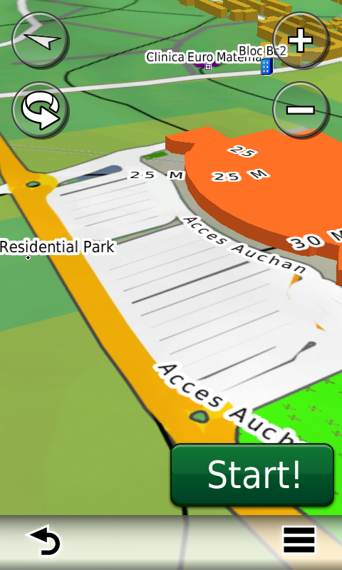
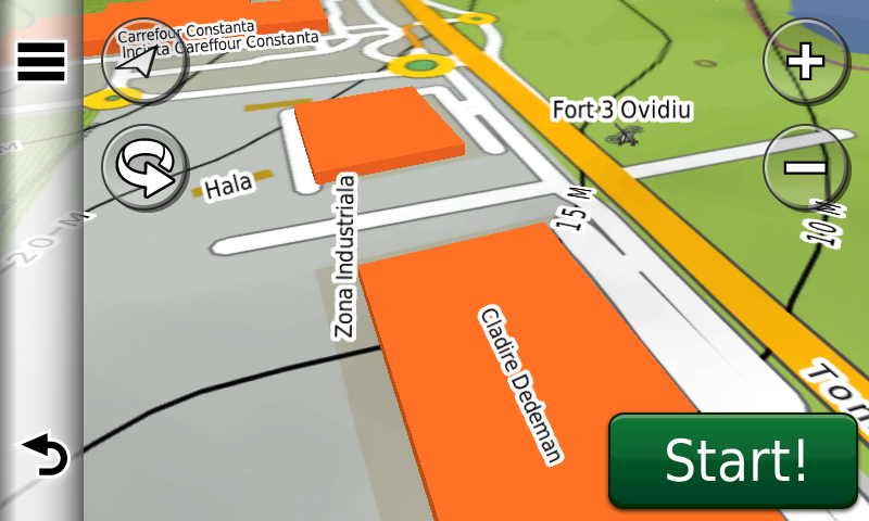
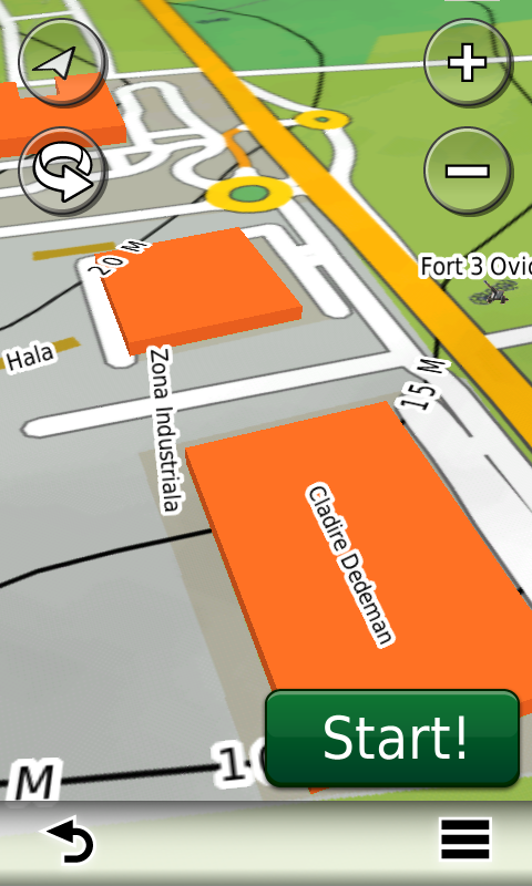
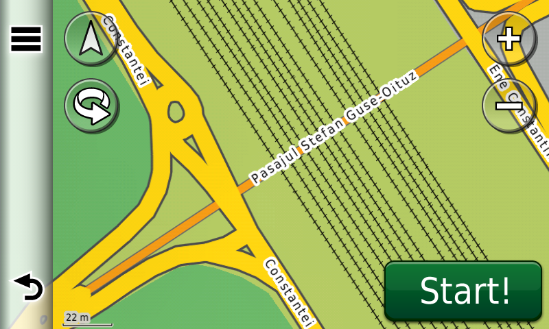
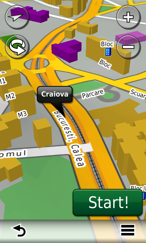
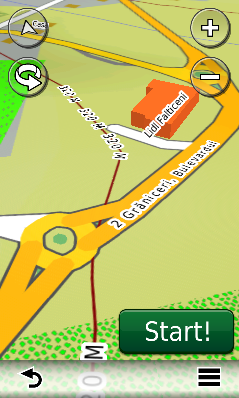
RO.A.D.2018.01 este singura hartă de navigaţie din lume care combină detalii topo cu o structură de drumuri rutabilă – la nivel inclusiv de drumuri de pământ şi poteci – cu adrese poştale de o precizie neegalată, oraşe cu blocuri 3D şi modele minuţios realizate la construcţii vechi, de patrimoniu, sau noi, definitorii pentru peisajul urban actual. Actualizările la hartă sunt constante şi consistente de la o ediţie la alta şi sunt documentate în Jurnalul Hărţii, în care sunt trecute contribuţiile şi autorii acestora, datele la care s-au efectuat precum şi denumirile localităţilor şi planşelor afectate.

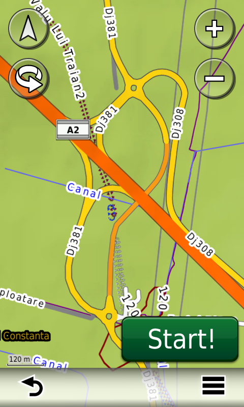
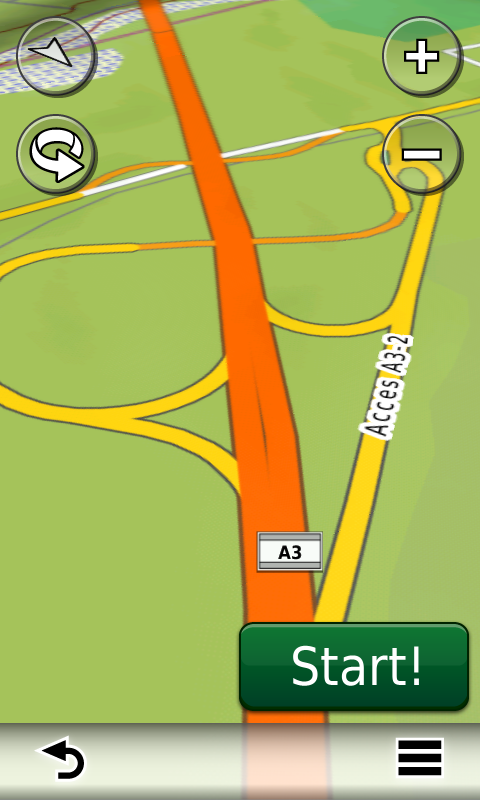
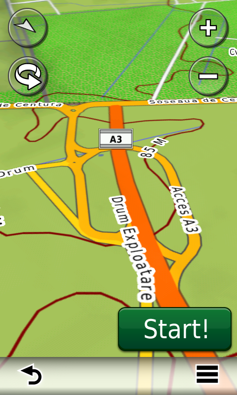
Faţă de hărţile comune de pe piaţă, Atlasul Digital al României are un grad de detaliu şi actualitate fără egal, în această ediţie fiind introduse, printre multe altele loturile 3 şi 4 ale autostrăzii A10 (fără rutabilitate), pasajul nou peste calea ferată de la Vinţu de Jos, Centura Caracal (fără rutabilitate), viitoarea deviere a DN68 pentru descărcarea temporară a A1 de la Holdea (fără rutabilitate), Centura Turnu Măgurele, sensul dublu din Timişoara spre Şag, sensul dublu între sensul giratoriu din Hărman şi cel de sub varianta ocolitoare Braşov, forma definitivă a intersecţiei A1 x DNCB, sensul dublu din Afumaţi, sensul dublu din Şoseaua Alexandriei, Şoseaua Colentina şi cel de pe Sergent Niţu Vasile şi s-a reintrodus accesul rutier pe strada Valea Ialomiţei din Bucureşti.

S-au cartat fermele solare de la Slobozia, Vieru, Malu, Şag, Burila Mică, Slatina, Linia din Vale, Valea Plopilor şi Valter Mărăcineanu, s-a început cartarea câmpurilor de sonde petroliere din Videle, împreună cu accesul la acestea.

În această ediţie s-au introdus şi completat adrese poştale în localităţile DUDAŞU SCHELEI, Schela Cladovei, DROBETA-TURNU SEVERIN, BEREŞTI-MERIA, BEREŞTI, LĂŢEŞTI, SĂRĂŢENI, SCHINENI, FLORENI, BÂRLAD, TURCENI, JILŢU, MURGEŞTI, GÂRBOVU, VALEA VIEI, STRÂMBA-JIU, MENŢI, HORĂŞTI, LEURDA, VÂRŢ, ROVINARI, Curteana, MĂCEŞU, CREŢEŞTI, FLOREŞTENI, ŢICLENI, VÂRTEJU, MĂGURELE, ALUNIŞU, JILAVA, BRAGADIRU, ROŞU, MOGOŞOAIA, ODĂILE, OTOPENI, VOLUNTARI, CORBEANCA, TAMAŞI, OSTRATU, PETREŞTI, BALOTEŞTI, SĂFTICA, DUMBRĂVENI, CĂCIULAŢI, GAGU, DASCĂLU, RUNCU, DIMIENI, TUNARI, POPEŞTI-LEORDENI, CREAŢA, VÂNĂTORI, STOENOAIA, PETRĂCHIOAIA, COREEA, SURLARI, MĂINEASCA, GRĂDIŞTEA, AFUMAŢI, GĂNEASA, ŞINDRILIŢA, PITEASCA, COZIENI, GĂNEASA, MOARA DOMNEASCĂ, BRĂNEŞTI, ISLAZ, VADU ANEI, POŞTA, BĂLĂCEANCA, TÂNGANU, CĂLDĂRARU, MANOLACHE, GLINA, POPEŞTI-LEORDENI, CĂŢELU, FUNDENI, DOBROEŞTI, PANTELIMON, ŞTEFĂNEŞTII DE SUS, ŞTEFĂNEŞTII DE JOS, CREŢULEASCA, MURGENI, CÂRJA şi RAIU.

S-au introdus de asemenea denumirile blocurilor şi adresele la nivel de scară de bloc în Medgidia şi nodul feroviar din Videle.

S-a introdus accesul detaliat la centrele comerciale Dedeman Turda şi Penny Ocna Mureş, Afi Palace Braşov, Penny Market Deva, Lidl str. Bâlea din Sibiu, Penny Market Tudor Vladimirescu din Alba Iulia, Penny Market Constantin Ene din Bacău, Lidl Şoseaua Mangaliei din Constanţa, Kaufland, Deichmann, Penny şi Lidl Medgidia, Dedeman Bistriţa, Lidl Bărnuţiu din Timişoara, Lidl şi Kaufland Drobeta, Lidl şi Kaufland Artileriei Slatina, Lidl şi Penny Market Oraviţa, Lidl şi Penny Market Petroşani, Lidl şi Carrefour Reghin, Lidl şi Carrefour Market din Sighetu Marmaţiei, Carrefour Market Satu Mare, Shopping City Râmnicu Vâlcea, Lidl Vălenii de Munte, Carrefour Market Militari Residence, Penny Market Pipera, Lidl Voluntari, Pipera Plaza, Deichmann Voluntari, Lidl Otopeni, Mega Image Otopeni şi Lidl Prelungirea Ghencea din Bucureşti. S-au adăugat unele sensuri unice noi, restricţii de viteză precum şi 56 (cinzecişişase) sensuri giratorii noi.

S-a continuat de asemenea cartarea monumentelor istorice reşedinţe istorice (reşedinţa nobiliară Lo-Presti din Sculia, conacul familiei Delavrancea din Goeşti) precum şi a schiturilor şi mănăstirilor de rit ortodox de pe întreg teritoriul ţării. S-au cartat de asemenea monumentele de for public din Hârlău şi Monumentul Maghiarilor de Pretutindeni din Moacşa.

Pasionaţii de istorie vor descoperi în această ediţie în premieră elementele de detaliu (valul) ale fortificaţiei inedite de la Feleag-Vârful Nucilor, elementele de detaliu (val şi şanţ) ale AŞEZĂRII FORTIFICATE DE EP. FIERULUI DE LA VICTORIA-ŞANŢUL CATERINEI, elementele de detaliu (val, şanţ, posibile alte două şanţuri) ale cetăţii getice de la Buhalniţa-Cetăţuie, ale cetăţii getice (valuri şi şanţ) de la Scobinţi-Dealul lui Vodă şi ale cetăţii getice (cinci valuri şi şanţuri) de la Todireşti-La Şanţuri, actualizat forma cetăţii getice (val, şanţ) de la Criveşti-La Cetate. S-au introdus bastioanele (ca puncte) la castrele XXIII, XXIV şi XVIII, s-a revizuit aspectul castrelor 13, 14, 15, IV şi IX şi la castellum-urile g, new şi h, s-a introdus valul castrului romano-bizantin de la Ovidiu, elementele de detaliu (val, şanţ) ale 3 fortificaţii inedite de factură romană în Vâlcele-Dealul Vârşei (pe lângă cea deja publicată -nr. 2- din aceeaşi zonă), 2 posibile castre romane la Dâlnic-Poiana Berzele şi Dâlnic-Poiana Nezobei, elementele de detaliu (val, şanţ) ale fortificaţiei de epocă nedeterminată (probabil castru roman auxiliar de marş) de la Pianu de Jos-Dealu de Sus, elementele de detaliu (val, şanţ) ale unui posibil castru roman legionar de marş inedit la Turia-Turia Vest. S-au introdus termele de la Breţcu ca punct, 2 turnuri romane la Breţcu, elementele de detaliu (val, şanţ) ale burgus-ului roman de la Ocland-Cetatea de Ceapă şi elementele de detaliu (val, şanţ) ale castrului roman de marş de la Feleac-Vârful Cetăţii. S-au introdus elementele de detaliu (valuri, şanţuri) ale cetăţii medievale de pământ Dobra Schantz-Nuovo Fortino de la Lăpugiu de Jos, ale Fortificaţiei Medievale Târzii DE LA CORLĂŢENI-DEALUL CETĂŢII, fortificaţia medievală timpurie de la Caţa-Dealul Rarira (punct) şi elementele de detaliu (valuri, şanţuri, ziduri) ale cetăţii medievale de la Odorheiu Secuiesc-Budvar. S-au introdus tranşeele din al doilea război mondial din Ovidiu, fortul austriac? de la Moacşa-Pădurea Frumoasă, tranşeele, probabil româneşti, din primul război mondial de la Lemnia-Muntele Chisău, au fost introduse monumente comemorative din primul şi al doilea război mondial (cimitirul eroilor români din Primul Război Mondial din Pădurea Lenţea, cimitirul eroilor germani din primul război mondial din Drobeta, cimitirul eroilor din primul război mondial de la Slănic Moldova, cimitirul şi monumentul eroilor sovietici din Deleni, monumentul comemorativ al 100 de ani de la intervenţia Crucii Roşii Americane în România din Iaşi, etc. )

Dispunând de un concept original, cu actualizări trianuale, rodul muncii timp de paisprezece ani fără întrerupere a pasionaţilor şi specialiştilor din echipa Proiectului România Digitală, Atlasul Digital al României este opţiunea profesioniştilor din toate domeniile şi unealta preferată de navigaţie a amatorilor de drumeţii în aer liber.

Ediţia actuală are 1,02 GB mărime şi rulează exclusiv pe echipamente de navigaţie Garmin, o listă a acestora fiind disponibilă la linkul de mai jos
http://www.rqa.ro/produs.php?id=442&subcat_id=39&cat_id=19

Atenţionare!
Utilizarea hărţii RO.A.D.2018.01 poate crea dependenţă de calitate, valoare, funcţionalitate şi frumos!

RO.A.D.2018.01 Launch

RQA, a Garmin equipment importer in Romania, has the pleasure to announce the availability of the new edition of the Digital Atlas of Romania v10.01, RO.A.D.2018.01.

Continuing in the well known tradition for the Romanian Garmin customers, the Digital Atlas of Romania holds on to the number one place in the GPS road navigation map charts by bringing an extra 5,772.67 km of roads up to a grand total of 412,385.25 km, having significant increased coverage added in the counties of Gorj, Mehedinţi, Ilfov and Vaslui and the number of POIs raises in this edition to a staggering 852,928 points divided into 518 categories.

RO.A.D.2018.01 is the only GPS navigation map in the world that combines topographic details with a routable road network – including dirt roads and trails – with postal addresses of unequaled precision, towns with extruded 3D blocks of flats and detailed 3D textured models for both old patrimony buildings and new skyscrapers, true landmarks of today’s urban space. Map updates are constant and consistent from one edition to another and are documented in the Map Diaries, where all the contributions and their respective authors are mentioned together with the names of the cities and the map tiles that have changed.

Compared with common maps on the market, the Digital Atlas of Romania has an unequaled level of detail and actuality, featuring the lots 3 and 4 of the A10 motorway (without rutability), the new passage over the railway from Vinţu de Jos, the Caracal Ring (without rutability), the future deviation of DN68 for the temporary A1 connection from Holdea (without rutability), the Turnu Măgurele Ring, the roadlines separations from Timişoara to Şag, from the Hărman roundabout until the Braşov Ring roundabout, from Afumaţi, Şoseaua Alexandriei, Şoseaua Colentina and Sergent Niţu Vasile, the final routing solution of the A1 x DNCB intersection and vehicle access was reintroduced on Valea Ialomiţei street in Bucureşti.

The solar farms from Slobozia, Vieru, Malu, Şag, Burila Mică, Slatina, Linia din Vale, Valea Plopilor and Valter Mărăcineanu were introduced and the oilfields from Videle have begun to be mapped, together with access to them.

In this edition we have postal addresses added in the following towns: DUDAŞU SCHELEI, Schela Cladovei, DROBETA-TURNU SEVERIN, BEREŞTI-MERIA, BEREŞTI, LĂŢEŞTI, SĂRĂŢENI, SCHINENI, FLORENI, BÂRLAD, TURCENI, JILŢU, MURGEŞTI, GÂRBOVU, VALEA VIEI, STRÂMBA-JIU, MENŢI, HORĂŞTI, LEURDA, VÂRŢ, ROVINARI, Curteana, MĂCEŞU, CREŢEŞTI, FLOREŞTENI, ŢICLENI, VÂRTEJU, MĂGURELE, ALUNIŞU, JILAVA, BRAGADIRU, ROŞU, MOGOŞOAIA, ODĂILE, OTOPENI, VOLUNTARI, CORBEANCA, TAMAŞI, OSTRATU, PETREŞTI, BALOTEŞTI, SĂFTICA, DUMBRĂVENI, CĂCIULAŢI, GAGU, DASCĂLU, RUNCU, DIMIENI, TUNARI, POPEŞTI-LEORDENI, CREAŢA, VÂNĂTORI, STOENOAIA, PETRĂCHIOAIA, COREEA, SURLARI, MĂINEASCA, GRĂDIŞTEA, AFUMAŢI, GĂNEASA, ŞINDRILIŢA, PITEASCA, COZIENI, GĂNEASA, MOARA DOMNEASCĂ, BRĂNEŞTI, ISLAZ, VADU ANEI, POŞTA, BĂLĂCEANCA, TÂNGANU, CĂLDĂRARU, MANOLACHE, GLINA, POPEŞTI-LEORDENI, CĂŢELU, FUNDENI, DOBROEŞTI, PANTELIMON, ŞTEFĂNEŞTII DE SUS, ŞTEFĂNEŞTII DE JOS, CREŢULEASCA, MURGENI, CÂRJA and RAIU.

Detailed acces to the retail stores: Dedeman Turda, Penny Ocna Mureş, Afi Palace Braşov, Penny Market Deva, Lidl Bâlea st. from Sibiu, Penny Market Tudor Vladimirescu from Alba Iulia, Penny Market Constantin Ene from Bacău, Lidl Şoseaua Mangaliei from Constanţa, Kaufland, Deichmann, Penny şi Lidl Medgidia, Dedeman Bistriţa, Lidl Bărnuţiu from Timişoara, Lidl and Kaufland Drobeta, Lidl and Kaufland Artileriei Slatina, Lidl and Penny Market Oraviţa, Lidl and Penny Market Petroşani, Lidl and Carrefour Reghin, Lidl and Carrefour Market Sighetu Marmaţiei, Carrefour Market Satu Mare, Shopping City Râmnicu Vâlcea, Lidl Vălenii de Munte, Carrefour Market Militari Residence, Penny Market Pipera, Lidl Voluntari, Pipera Plaza, Deichmann Voluntari, Lidl Otopeni, Mega Image Otopeni and Lidl Prelungirea Ghencea from Bucureşti. New oneway streets and speed restrictions have been added together with 56 (fiftysix) new roundabouts.

The names and addresses of the blocks from Medgidia and the railway junction from Videle have been introduced.

We also continued mapping the aristocratic mansions representing historical monuments (Lo-Presti residence from Sculia, the Delavrancea family mansion from Goeşti), as well as orthodox monasteries from all over the country. We also mapped the urban forum monuments from Hârlău and the Hungarians from Everywhere Monument from Moacşa.

History aficionados will discover in this edition in premiere the detailed elements (rampart) of the previously unknown fortified settlement from Feleag-Vârful Nucilor, the detailed elements (rampart and ditch) of the iron age fortified settlement from VICTORIA-ŞANŢUL CATERINEI, of the getic fortification (rampart, ditch, 2 possible other ditches) from Buhalniţa-Cetăţuie, of the getic fortification (ramparts and ditch) from Scobinţi-Dealul lui Vodă, of the getic fortification (five ramparts and corresponding ditches) from Todireşti-La Şanţuri, revised the form of the getic fortification (rampart, ditch) from Criveşti-La Cetate. The bastions (points) of the castra XXIII, XXIV and XVIII have been introduced, the aspect of the castra 13, 14, 15, IV and IX and of the castella g, new and h has been revised, the vallum of the roman byzantine castrum from Ovidiu has been introduced together with the detail elements (vallum, ditch) of the 3 previously unknown fortification of possible roman descent from Vâlcele-Dealul Vârşei (besides the one already published -no. 2- from the same area), 2 possible roman castra from Dâlnic-Poiana Berzele and Dâlnic-Poiana Nezobei, the detail elements (vallum, ditch) of the fortification of undetermined age (probably auxiliary roman march castrum) from Pianu de Jos-Dealu de Sus, the detail elements (vallum, ditch) of the previously unknown possible roman legion castrum from Turia-Turia Vest. The roman baths from Breţcu have been introduced as points as well as 2 roman towers from Breţcu together with the detail elements (vallum, ditch) of the roman burgus from Ocland-Cetatea de Ceapă together with the detail elements (vallum, ditch) of the roman march castrum from Feleac-Vârful Cetăţii. The detail elements (ramparts, ditches) of the medieval earthen fortification Dobra Schantz-Nuovo Fortino from Lăpugiu de Jos, of the late medieval fortification from CORLĂŢENI-DEALUL CETĂŢII, the early medieval fortification from Caţa-Dealul Rarira (point) and the detail elements (ramparts, ditches, walls) of the medieval fortress from Odorheiu Secuiesc-Budvar. The second world war trenches from Ovidiu, the Austrian fort from Moacşa-Pădurea Frumoasă, the First World War trenches, probably Romanian, from Lemnia-Muntele Chisău, monuments from the first and second world wars and military cemeteries (the First World War Romanian Heroes cemetery from Pădurea Lenţea, the First World War German Heroes cemetery from Drobeta, the First World War Heroes cemetery from Slănic Moldova, the Second World War Soviet Heroes cemetery from Deleni, the 100 year commemoration monument of the American Red Cross intervention in Romania from Iaşi).

Featuring an original concept, with updates three times a year, the result of 14 years of continuous development of the experts and contributors of the Digital Romania Project team (www.romaniadigitala.ro), the Digital Atlas of Romania is the choice of professionals in all fields and the preferred navigation tool for all nature goers.

This edition has 1.02 GB in size and runs exclusively on Garmin navigation equipment, an updated list of compatibility being available at the below link:
http://www.rqa.ro/produs.php?id=442&subcat_id=39&cat_id=19

Warning!
The use of RO.A.D.2018.01 map can create addiction to quality, value, functionality and beauty!

Lansare RO.A.D.2013.20RO.A.D.2013.20 Launch

Sheba Distribution SRL, reprezentant al firmei Garmin în Romania, are plăcerea să anunţe disponibilitatea noii ediţii a Atlasului Digital al României v5.20, RO.A.D.2013.20.

Continuând în tradiţia binecunoscută deja clienţilor Garmin din România, Atlasul Digital al României se menţine în continuare pe locul I în clasamentul hărţilor de navigaţie rutieră, aducând în plus faţă de ediţia precedentă peste 16.411,54 de kilometri de drumuri, ridicând la un total de 306.162,33 km de căi de comunicaţii acoperirea în teritoriu, cu acoperire îmbogăţită în judeţele Ialomiţa, Buzău, Vrancea, Teleorman, Galaţi, Suceava şi Caraş-Severin, iar numărul de informaţii de tip punct se ridică în această ediţie la 337.531 puncte împărţite în 480 de categorii.

ROAD2013.20 este singura hartă de navigaţie din lume care combină detalii topo cu o structură de drumuri rutabilă – la nivel inclusiv de drumuri de pământ şi poteci – cu adrese poştale de o precizie neegalată, oraşe cu blocuri 3D şi modele minuţios realizate la construcţii vechi, de patrimoniu, sau noi, definitorii pentru peisajul urban actual. Actualizările la hartă sunt constante şi consistente de la o ediţie la alta şi sunt documentate în Jurnalul Hărţii, în care sunt trecute contribuţiile şi autorii acestora, datele la care s-au efectuat precum şi denumirile localităţilor şi planşelor afectate.

Faţă de hărţile comune de pe piaţă, Atlasul Digital al României are un grad de detaliu fără egal, în această ediţie fiind introduse, printre multe altele, numerotările poştale din cartierul ANL Brâncuşi Nord din Bucureşti, din zona Şoseaua Nordului din Bucureşti, din cartierele rezidenţiale Azur 1 şi 2, Domus Stil şi Oxford Gardens din Voluntari. S-a explicitat de asemenea accesul la centrele comerciale Penny Market, Obi din Sibiu, Bucharest West Park, Parcul Industrial Cefin, Divertiland, MegaDesigners Outlet, Carrefour, Bricostore si Mobexpert Militari din Chiajna, Baumax, Carrefour şi Leroy Merlin Colosseum, Ikea, Carrefour, Mobexpert, Flanco si Baneasa Shopping City din centrul comercial Feeria, Metro şi Praktiker Colentina, Metro Băneasa, Cora şi Mobexpert Pantelimon, Auchan Brăţării, Metro, Băcănia Real şi Obi Berceni, Selgros Drumul Taberei şi Selgros Berceni, Lidl Fizicienilor şi Lidl Moineşti, Dedeman Giurgiului şi Dedeman Valea Cascadelor, HD Mall si Billa Tricodava din Bucureşti, Interhome, Praktiker, Băcănia Real şi Billa din Craiova, Penny Market şi Lidl din Buftea, Hornbach din Corbeanca, Obi, Băcănia Real, centrul logistic Kaufland, Selgros, Carrefour, Bricostore, Metro, Praktiker, Kaufland si Lem’s din Ploieşti, Decathlon, Magnolia Mall, Carrefour, Bricostore, Metro, Selgros, Mediagalaxy, Macromall şi Kaufland din Braşov, Mega Image din Green City, Lidl din Olteniţa, Billa din Sfântu Gheorghe, Penny Market din Petrila, s-au actualizat punctele de interes şi restricţiile de viteză de-a lungul tuturor ieşirilor şi a Centurii Bucureştiului, s-au adăugat multe sensuri unice noi şi 51 (cincizecişiunu) sensuri giratorii noi apărute între timp.

Galeria modelelor 3D s-a îmbogăţit cu reprezentarea detaliată a Cetăţilor medievale de la Făgăraş şi de la Braşov-Citadela, a castelului Karoly de la Carei precum şi a reconstituirii quadriburgium-ului roman târziu de la Hinova.

Pasionaţii de istorie vor descoperi în această ediţie în premieră elementele de detaliu ale aşezării fortificate a Culturii Gava (epoca bronzului târziu) de la Sighetu Marmaţiei-Dealul Cetăţii, ale cetăţilor dacice Jigodin I, II şi III de la Miercurea Ciuc, ale cetăţii de pământ (probabil dacică) inedite de la Păucineşti-Dealul Carnavela, ale cetăţilor dacice de pământ de la Fizeşti-Dealul Măgulici şi Fizeşti-Dealul Fetei, ale cetăţii dacice de la Obreja-Viteazul Mic, ale valului dacic inedit de baraj de la Culmea Drugu, valului dacic inedit de pământ de la Costeşti-Dealul Făeragu, valurilor dacice de la Dealul Negru, Culmea Şureanu şi Poiana Omului, valului dacic triplu de la Sarmizegetusa Regia, valurile dacice şi medievale de pământ de la Zeicani – Tapae, ale castellum-ului roman inedit de pământ de la Meleia, castrului roman inedit de pământ de la Bucova-Dealul Floruşu, castrului roman inedit de pământ de la Petroşani-Poienile Tăii, ale castrelor romane de pământ de la Fizeşti-Dealul Robului şi Fizeşti-Dealul Măgulici, ale fortificaţiilor romane inedite de pământ (un castru şi cinci castellum-uri) de la Boşorod-Vâlcele – Dealul Voinii, ale fortificaţiilor romane inedite de pământ de la Sarmizegetusa Regia-La Porţi, ale castrului roman inedit de pământ de la Voineasa-Coasta lui Rus Mică, ale castrului roman inedit de pământ de la Ocolişu Mic, ale castrului roman de piatră de la Rădăcineşti şi thermae-le acestuia, ale aşezării fortificate de epocă romană Noviodunum de la Isaccea, ale villa rustica de la Dalboşeţ-Dragomireana, ale castrelor romano-bizantine de la Rasova-Malul Roşu şi Valea Caramancea, ale Valului Tătarilor de la Săcele, ale cetăţii medievale timpurii de pământ de la Nălaţi-Grădişte, ale cetăţii medievale de la Lişnău-Aluniş şi Cetăţii Haiducilor de la Lemnia, ale cetăţilor medievale de la Făgăraş şi de la Braşov-Citadela precum şi ale castelului medieval Karoly de la Carei.

Dispunând de un concept original, cu actualizări trimestriale, rodul muncii timp de nouă ani fără întrerupere a pasionaţilor şi specialiştilor din echipa Proiectului România Digitală , Atlasul Digital al României este opţiunea profesioniştilor din toate domeniile şi unealta preferată de navigaţie a amatorilor de drumeţii în aer liber.

Ediţia actuală are 516.7 MB mărime şi rulează exclusiv pe echipamente de navigaţie Garmin, o listă a acestora fiind disponibilă la linkul de mai jos:
http://www.rqa.ro/produs.php?id=442&subcat_id=39&cat_id=19

Atenţionare!
Utilizarea hărţii ROAD2013.20 poate crea dependenţă de calitate, valoare, funcţionalitate şi frumos!

Sheba Distribution SRL, a Garmin representative in Romania, has the pleasure to announce the availability of the new edition of the Digital Atlas of Romania v5.20, RO.A.D.2013.20.

Continuing in the well known tradition for the Romanian Garmin customers, the Digital Atlas of Romania holds on to the number one place in the GPS road navigation map charts by bringing an extra 16.411,54 km of roads up to a grand total of 306.162,33 km, having increased coverage added in the counties Ialomiţa, Buzău, Vrancea, Teleorman, Galaţi, Suceava and Caraş-Severin and the number of POIs raises in this edition to a staggering 337.531 points divided into 480 categories.

ROAD2013.20 is the only GPS navigation map in the world that combines topographic details with a routable road network – including dirt roads and trails – with postal addresses of unequaled precision, towns with extruded 3D blocks of flats and detailed 3D textured models for both old patrimony buildings and new skyscrapers, true landmarks of today’s urban space. Map updates are constant and consistent from one edition to another and are documented in the Map Diaries, where all the contributions and their respective authors are mentioned together with the names of the cities and the map tiles that have changed.

Compared with common maps on the market, the Digital Atlas of Romania has an unequaled level of detail, featuring postal numbering in ANL subdivision Brâncuşi Nord from Bucureşti, in Şoseaua Nordului area from Bucureşti, in the residential subdivisions Azur 1 and 2, Domus Stil and Oxford Gardens from Voluntari, updated POIs and speed restrictions along all Bucharest exits and across the whole Bucharest ring.

Access to the commercial centres Penny Market, Obi from Sibiu, Bucharest West Park, Parcul Industrial Cefin, Divertiland, MegaDesigners Outlet, Carrefour, Bricostore and Mobexpert Militari from Chiajna, Baumax, Carrefour şi Leroy Merlin Colosseum, Ikea, Carrefour, Mobexpert, Flanco and Baneasa Shopping City from Feeria, Metro and Praktiker Colentina, Metro Băneasa, Cora and Mobexpert Pantelimon, Auchan Brăţării, Metro, Real Grocery Store and Obi Berceni, Selgros Drumul Taberei and Selgros Berceni, Lidl Fizicienilor and Lidl Moineşti, Dedeman Giurgiului and Dedeman Valea Cascadelor, HD Mall and Billa Tricodava from Bucureşti, Interhome, Praktiker, Real Grocery Store and Billa from Craiova, Penny Market and Lidl from Buftea, Hornbach from Corbeanca, Obi, Real Grocery Store, Kaufland logistic park, Selgros, Carrefour, Bricostore, Metro, Praktiker, Kaufland and Lem’s from Ploieşti, Decathlon, Magnolia Mall, Carrefour, Bricostore, Metro, Selgros, Mediagalaxy, Macromall and Kaufland from Braşov, Mega Image from Green City, Lidl from Olteniţa, Billa from Sfântu Gheorghe, Penny Market from Petrila has been detailed, plus many new oneway streets and 51 (fiftyone) new roundabouts that have been implemented in the last four months.
The 3D model gallery has been enriched with the detailed representation of the Karoly medieval castle from Carei, of the medieval fortresses from Făgăraş and Braşov – Citadela, .and the reconstitution of the late roman quadriburgium from Hinova.

History aficionados will discover in this edition in premiere the detailed elements of the fortified settlement of the Gava Culture (late bronze age) from Sighetu Marmaţiei-Dealul Cetăţii, of the dacian strongholds Jigodin I, II and III from Miercurea Ciuc, of the earth stroghold (probably dacian) previously unknown from Păucineşti-Dealul Carnavela, of the dacian earth strongholds from Fizeşti-Dealul Măgulici and Fizeşti-Dealul Fetei, of the dacian stronghold from Obreja-Viteazul Mic, of the previously unknown dacian earth vallums from Culmea Drugu, Costeşti-Dealul Făeragu, of the dacian earth vallums from Dealul Negru, Culmea Şureanu and Poiana Omului, the triple dacian vallum from Sarmizegetusa Regia, the dacian and medieval vallums from Zeicani – Tapae, of the presumed roman earth castellum from Meleia, of the previously unknown roman castrae from Bucova-Dealul Floruşu, Petroşani-Poienile Tăii, of the roman earth castrae from Fizeşti-Dealul Robului şi Fizeşti-Dealul Măgulici, of the previously undocumented roman fortifications (a castra and five castellae) from Boşorod-Vâlcele – Dealul Voinii, of the previously unknown roman earth fortifications from Sarmizegetusa Regia-La Porţi, of the previously unknown roman earth castrae from Voineasa-Coasta lui Rus Mică and Ocolişu Mic, of the roman stone castra and its thermae from Rădăcineşti, of the fortified roman settlement Noviodunum from Isaccea, of the roman villa rustica from Dalboşeţ-Dragomireana, of the roman-byzantine castrae from Rasova-Malul Roşu and Valea Caramancea, of the early medieval vallum Valul Tătarilor from Săcele, of the early medieval earth stronghold from Nălaţi-Grădişte, of the medieval strongholds from Lişnău-Aluniş and Cetatea Haiducilor from Lemnia, of the medieval fortresses from Făgăraş and Braşov-Citadela as well of the medieval Karoly Castle from Carei

Featuring an original concept, with quarterly updates, the result of nine years of continuous development of the experts and contributors of the Digital Romania Project team , the Digital Atlas of Romania is the choice of professionals in all fields and the preferred navigation tool for all nature goers.

This edition has 516.6 MB in size and runs exclusively on Garmin navigation equipment, an updated list of compatibility being available at the below link:
http://www.rqa.ro/produs.php?id=442&subcat_id=39&cat_id=19

Warning!
The use of RO.A.D.2013.20 map can create addiction to quality, value, functionality and beauty!

Lansare RO.A.D.2013.10RO.A.D.2013.10 Launch

Sheba Distribution SRL, reprezentant al firmei Garmin în Romania, are plăcerea să anunţe disponibilitatea noii ediţii a Atlasului Digital al României v5.10, RO.A.D.2013.10.

Continuând în tradiţia binecunoscută deja clienţilor Garmin din România, Atlasul Digital al României se menţine în continuare pe locul I în clasamentul hărţilor de navigaţie rutieră, aducând în plus faţă de ediţia precedentă peste 22.488,79 de kilometri de drumuri, ridicând la un total de 289.750,79 km de căi de comunicaţii acoperirea în teritoriu, cu acoperire îmbogăţită în judeţele Alba, Bistriţa-Năsăud, Neamţ, Iaşi, Teleorman, Galaţi şi Botoşani, iar numărul de informaţii de tip punct se ridică în această ediţie la 332.233 puncte împărţite în 455 de categorii.

ROAD2013.10 este singura hartă de navigaţie din lume care combină detalii topo cu o structură de drumuri rutabilă – la nivel inclusiv de drumuri de pământ şi poteci – cu adrese poştale de o precizie neegalată, oraşe cu blocuri 3D şi modele minuţios realizate la construcţii vechi, de patrimoniu, sau noi, definitorii pentru peisajul urban actual. Actualizările la hartă sunt constante şi consistente de la o ediţie la alta şi sunt documentate în Jurnalul Hărţii, în care sunt trecute contribuţiile şi autorii acestora, datele la care s-au efectuat precum şi denumirile localităţilor şi planşelor afectate.

Faţă de hărţile comune de pe piaţă, Atlasul Digital al României are un grad de actualitate fără egal, în această ediţie aflându-se în premieră autostrada A1 între Giarmata şi Izvin şi A1 între Deva şi Simeria, noua centura a Ploieştiului şi pasajul rutier de la Metro, centura Ocolitoarea Mică a oraşului Săcele, Pasajul Colentina-Pantelimon din Bucureşti, Pasajul Independenţei din Braşov, drumul expres de acces la Uzinele Dacia Renault din Mioveni şi centura oraşului Iaşi, precum şi revizii de esenţă a numerotării poştale din Bucureşti, Constanţa şi Urziceni.

A fost explicitat accesul la centrele comerciale Cora Alexandriei, Kaufland Mihai Bravu si Auchan Constructorilor din Bucureşti, Cora şi Dedeman (centrul logistic) din Bacău, magazinele Dedeman din Slatina, Râmnicu Vâlcea şi Craiova, băcăniile Real 1 şi 2, magazinele Praktiker, City Park Mall şi Lidl din Constanţa, Cora, Carrefour, Bricostore şi Dedeman din Drobeta-Turnu Severin, Kaufland Râmnicu Vâlcea, Kaufland şi Dedeman Piatra-Neamţ, Kaufland Reghin, băcănia Real, magazinele Praktiker, Dedeman şi Kaufland 1 şi 2 din Baia Mare, Kaufland din Târgu Mureş şi Caransebeş, Lidl şi Dedeman din Braşov şi Dedeman din Bistriţa, plus sensuri unice noi şi 105 (osutăcinci) sensuri giratorii noi apărute între timp.

Galeria modelelor 3D s-a îmbogăţit cu reprezentarea detaliată a bisericilor evanghelice fortificate din Prejmer şi Câlnic, monumente aflate pe lista patrimoniului mondial UNESCO din România. În Delta Dunării a fost actualizat accesul maritim pe unele canale şi s-au adăugat toponime şi puncte de interes.

Pasionaţii de istorie vor descoperi în această ediţie în premieră elementele de detaliu ale aşezărilor fortificate e-neolitice ale Culturii Precucuteni II de la Poduri – Dealul Ghindaru, Culturii Cernavoda I de la Râmnicelu-Movila Popici, Culturii Vinca de la Miercurea Sibiului – Petriş, ale Culturii Cucuteni de la Scânteia – Dealul Bodeştilor, ale aşezărilor fortificate de epoca bronzului cultura Costişa-Monteoru de la Poduri – Dealul Ghindaru, de la Potău – La Ciuncaş, de la Mândrişca (actualmente Valea Seacă) – Dealul Titelca, ale cetăţilor de epoca fierului de la Preuţeşti – Cetate, Beidaud, Brăhăşeşti, Tilişca – Căţânaş, Neudorf – Pârâul Roşia, Braşov – Păticel, Someşu Rece – Cetatea şi Şeica Mică – Cetatea, ale cetăţilor dacice de la Popeşti – Nucet, Brad (Negri), Ardeu – Cetăţuie, Tilişca – Căţânaş, Pocreaca – Şanţuri, Geoagiu – Dealul Turiac, Piatra Craivii, Şeica Mică şi ale cetăţii dacice şi castrului roman Piroborodava de la Poiana, ale aşezării romane fortificate Colonia Aurelia Apulensis de la Alba-Iulia-Partoş, ale castrului roman de pământ de la Cătunele – Chivadarul, ale castrelor romane legionare de pământ (şi thermae-lor) Agnaviae de la Zăvoi şi Bersobis de la Berzovia, ale castrului legionar de piatră, complexului termal şi amfiteatrului roman Micia de la Veţel, ale castrelor auxiliare de piatră Samum de la Căşeiu-Cetăţele, Castra Traiana de la Sânbotin, ale castrelor auxiliare de la Sărăţeni, Călugăreni, Brâncoveneşti, Gherla şi Sânpaul, ale castellum-ului roman Pons Augusti de la Voislova, ale castrului de cărămidă şi castellum-ului de pământ de la Săpata, ale castellum-ului roman de piatră de la Comalău şi burgus-ului de la Uriu, ale amfiteatrului, basilicii, vama romana, tabernaei si multor alte constructii romane de la Moigrad-Porolissum, ale castrului roman auxiliar şi thermae-lor de la Pietroasele, ale cetăţilor romano-bizantine Vicina de la Păcuiul lui Soare, ale cetăţii Gratiana de la Dunavăţu de Jos – Cetatea Zaporojenilor, ale cetăţii Sacidava de la Alimanu – Dealul Muzait, ale cetăţilor de la Enisala – Peşteră şi ale cetăţii romane târzii Salsovia de la Mahmudia, ale cetăţilor medievale de la Deva (atât cea veche cât şi cea nouă, tip Vauban, distrusă), ale cetăţii de la Tilişca – Dealul Cetăţii, ale cetăţii Zinne/Brassovia de la Braşov–Tâmpa – Burg/Cetate, ale cetăţii Salgo de la Orlat-La Zid şi ale cetăţii medievale de pământ de la Orlat-Cetatea Scurtă, ale cetăţilor medievale de la Carasova – Grad, de la Ariuşd – Cetatea Csokas, ale cetăţii medievale (toate cele trei faze) de la Şlon – La Ciugă, ale fortificaţiei de pământ de la Roşia Montană – Dealul Islaz, ale cetăţilor medievale de la Bădeni, Piatra Craivii şi Suseni – Cetatea Colţ, ale turnului medieval circular de la Crivadia, ale cetăţilor (românească şi turcească) de la Giurgiu-Insulă, ale cetăţilor medievale bastionare turceşti şi ruseşti de la Giurgiu, ale tabiilor şi fortificaţiilor otomane ale localităţii medievale Cuzgun de la Ion Corvin, ale valurilor medievale timpurii de pământ din estul Transilvaniei, precum şi ale bisericilor evanghelice fortificate de la Câlnic şi Prejmer.

Dispunând de un concept original, cu actualizări trimestriale, rodul muncii timp de nouă ani fără întrerupere a pasionaţilor şi specialiştilor din echipa Proiectului România Digitală , Atlasul Digital al României este opţiunea profesioniştilor din toate domeniile şi unealta preferată de navigaţie a amatorilor de drumeţii în aer liber.

Ediţia actuală are 503 MB mărime şi rulează exclusiv pe echipamente de navigaţie Garmin, o listă a acestora fiind disponibilă la linkul de mai jos:
http://www.rqa.ro/produs.php?id=442&subcat_id=39&cat_id=19

Atenţionare!
Utilizarea hărţii ROAD2013.10 poate crea dependenţă de calitate, valoare, funcţionalitate şi frumos!

RO.A.D.2013.10 Launch

Sheba Distribution SRL, a Garmin representative in Romania, has the pleasure to announce the availability of the new edition of the Digital Atlas of Romania v5.10, RO.A.D.2013.10.

Continuing in the well known tradition for the Romanian Garmin customers, the Digital Atlas of Romania holds on to the number one place in the GPS road navigation map charts by bringing an extra 22.4 thousand km of roads up to a grand total of 289.750,79 km, having increased coverage added in the counties Alba, Bistriţa-Năsăud, Neamţ, Iaşi, Teleorman, Galaţi and Botoşani and the number of POIs raises in this edition to a staggering 332.233 points divided into 455 categories.

ROAD2013.10 is the only navigation map in the world that combines topographic details with a routable road network – including dirt roads and trails – with postal addresses of unequaled precision, towns with extruded 3D blocks of flats and detailed 3D textured models for both old patrimony buildings and new skyscrapers, true landmarks of today’s urban space. Map updates are constant and consistent from one edition to another and are documented in the Map Diaries, where all the contributions and their respective authors are mentioned together with the names of the cities and the map tiles that have changed.

Compared with common maps on the market, the Digital Atlas of Romania has an unequaled level of actuality, in this edition one being able to find the newest A1 motorway between Giarmata and Izvin, the A1 motorway between Deva and Simeria, the new Ploieşti ring and ruttier bypass from Metro, the Ocolitoarea Mică ring of Săcele, the Colentina-Pantelimon Passage from Bucureşti, the Independenţei Passage from Braşov, the expressway to Dacia Renault factory in Mioveni and the ring of Iaşi, as well as essential postal addressing updates in Bucureşti, Constanţa and Urziceni.

The access to the commercial centres Cora Alexandriei, Kaufland Mihai Bravu and Auchan Constructorilor from Bucureşti, Cora and Dedeman (logistic centre) from Bacău, Dedeman stores from Slatina, Râmnicu Vâlcea and Craiova, Real 1 and 2 grocery stores, the stores Praktiker, City Park Mall and Lidl from Constanţa, Cora, Carrefour, Bricostore and Dedeman from Drobeta-Turnu Severin, Kaufland Râmnicu Vâlcea, Kaufland and Dedeman from Piatra-Neamţ, Kaufland from Reghin, Real grocery store, Praktiker, Dedeman and Kaufland 1 and 2 stores from Baia Mare, Kaufland from Târgu Mureş and Caransebeş, Lidl and Dedeman from Braşov and Dedeman from Bistriţa has been detailed, plus new oneway streets and 105 (onehundredandfive) new roundabouts that have been implemented in the last four months.

The 3D model gallery has been enriched with the detailed representation of the fortified evangelic churches of Prejmer and Câlnic, monuments in the UNESCO list for Romania. In the Danube Delta.the access has been updated on some chanels and toponames and points of interest have been added.

History aficionados will discover in this edition in premiere the detailed elements of the fortified e-neolithic settlements of Precucuteni II Culture from Poduri – Dealul Ghindaru, Cernavoda I Culture from Râmnicelu-Movila Popici, Vinca Culture from Miercurea Sibiului – Petriş, Cucuteni Culture from Scânteia – Dealul Bodeştilor, of the fortified bronze age settlements of Costişa-Monteoru culture from Poduri – Dealul Ghindaru, from Potău – La Ciuncaş, from Mândrişca (nowadays Valea Seacă) – Dealul Titelca, of the iron age strongholds from Preuţeşti – Cetate, Beidaud, Brăhăşeşti, Tilişca – Căţânaş, Neudorf – Pârâul Roşia, Braşov – Păticel, Someşu Rece – Cetatea and Şeica Mică – Cetatea, of the Dacian Davae from Popeşti – Nucet, Brad (Negri), Ardeu – Cetăţuie, Tilişca – Căţânaş, Pocreaca – Şanţuri, Geoagiu – Dealul Turiac, Piatra Craivii, Şeica Mică, of the dacian stronghold and roman castra Piroborodava from Poiana, of the roman fortified settlement Colonia Aurelia Apulensis from Alba Iulia-Partoş, of the earthen roman castra of Cătunele – Chivadarul, of the roman earthen legionary castrae (and their thermae) Agnaviae from Zăvoi and Bersobis from Berzovia, of the roman stone legionary castra, thermal complex and amphitheater Micia from Veţel, of the roman auxiliary stone castrae Samum from Căşeiu-Cetăţele, Castra Traiana from Sânbotin, of the auxiliary castrae from Sărăţeni, Călugăreni, Brâncoveneşti, Gherla and Sânpaul, of the roman castellum Pons Augusti from Voislova, of the brick castra and earthen castellum from Săpata, of the roman stone castellum from Comalău (nowadays Reci) and the burgus from Uriu, of the amphitheater, basilica, roman customs house, tabernae and many other more roman constructions from Moigrad-Porolissum, of the auxiliary roman castra and the thermae from Pietroasele, of the roman byzantine fortresses Vicina from Păcuiul lui Soare, Gratiana from Dunavăţu de Jos – Cetatea Zaporojenilor, Sacidava from Alimanu – Dealul Muzait, and from Enisala – Peşteră and of the late roman fortress Salsovia from Mahmudia, of the medieval fortresses from Deva (bothe the old one and the new, Vauban type, destroyed), from Tilişca – Dealul Cetăţii, the Zinne/Brassovia fortress from Braşov–Tâmpa – Burg/Cetate, of the Salgo fortress from Orlat-La Zid and of the earthen medieval stronghold from Orlat-Cetatea Scurtă, of the stone medieval fortresses from Carasova – Grad, from Ariuşd – Cetatea Csokas, of the medieval fortress (all three phases) from Şlon – La Ciugă, of the earthen fortification from Roşia Montană – Dealul Islaz, of the medieval fortresses from Bădeni, Piatra Craivii and Suseni – Cetatea Colţ, of the circular medieval tower from Crivadia, of the fortresses (romanian and turkish) from Giurgiu-Insulă, of the medieval bastionary brick fortresses (russian and turkish) from Giurgiu, of the tabiae and turkish fortified settlement Cuzgun from Ion Corvin, of the early medieval earthen vallums from Eastern Transylvania, as well as of the fortified evangelic churches from Câlnic and Prejmer.

Featuring an original concept, with quarterly updates, the result of nine years of continuous development of the experts and contributors of the Digital Romania Project team, the Digital Atlas of Romania is the choice of professionals in all fields and the preferred navigation tool for all nature goers.

This edition has 503 MB in size and runs exclusively on Garmin navigation equipment, an updated list of compatibility being available at the below link:

http://www.rqa.ro/produs.php?id=442&subcat_id=39&cat_id=19

Warning!

The use of ROAD2013.10 map can create addiction to quality, value, functionality and beauty!


Lansare RO.A.D.2012.40RO.A.D.2012.40 Launch

Lansare RO.A.D.2012.40
Sheba Distribution SRL, reprezentant al firmei Garmin în Romania, are plăcerea să anunţe disponibilitatea noii ediţii a Atlasului Digital al României v4.40, RO.A.D.2012.40.

Continuând în tradiţia binecunoscută deja clienţilor Garmin din România, Atlasul Digital al României se menţine în continuare pe locul I în clasamentul hărţilor de navigaţie rutieră, aducând în plus faţă de ediţia precedentă 17.241,53 de kilometri de drumuri, ridicând la un total de 267.261,99 km de căi de comunicaţii acoperirea în teritoriu, cu acoperire îmbogăţită în judeţele Vaslui, Iaşi, Caraş-Severin şi Hunedoara, iar numărul de informaţii de tip punct se ridică în această ediţie la 314.941 puncte împărţite în 437 de categorii.

ROAD2012.40 este singura hartă de navigaţie din lume care combină detalii topo cu o structură de drumuri rutabilă – la nivel inclusiv de drumuri de pământ şi poteci – cu adrese poştale de o precizie neegalată, oraşe cu blocuri 3D şi modele minuţios realizate la construcţii vechi, de patrimoniu, sau noi, definitorii pentru peisajul urban actual. Actualizările la hartă sunt constante şi consistente de la o ediţie la alta şi sunt documentate în Jurnalul Hărţii, în care sunt trecute contribuţiile şi autorii acestora, datele la care s-au efectuat precum şi denumirile localităţilor şi planşelor afectate.

Faţă de hărţile comune de pe piaţă, Atlasul Digital al României are un grad de actualitate fără egal, în această ediţie aflându-se în premieră autostrada A3 între Bucureşti şi Ploieşti cu legătura de la Snagov, autostrada A2 completă, inclusiv segmentul Cernavoda-Medgidia cu legătura de la Valea Dacilor, continuarea centurii A4 si legatura la A4 din Ovidiu, pasajul subteran Ştefan Guşe-Oituz din Bacău, pasajul rutier suprateran din Craiova, pasajul subteran de acces la Prisma-Hornbach de pe DN1 din Baloteşti, pasajul subteran de acces la Carrefour Tom din Ovidiu, podul rutier nou peste Cibin din Sibiu, străpungerea Popişteanu Cristian din Bucureşti, accesul la centrele comerciale Maritimo din Constanţa şi Lidl din Fălticeni, legătura Coresi din Braşov precum şi multe cartiere rezidenţiale de dată recentă (cartierul A.N.L. Henri Coandă, zonele rezidenţiale FeliCity, Upground, Quadra Place, Greenfield Residence, etc. din Bucureşti, Militari Residence din Roşu, Ibiza Sol, Ibiza Golf si Oxford Gardens din Voluntari, etc.), sensuri unice şi 38 (treizecişiopt) sensuri giratorii apărute între timp.

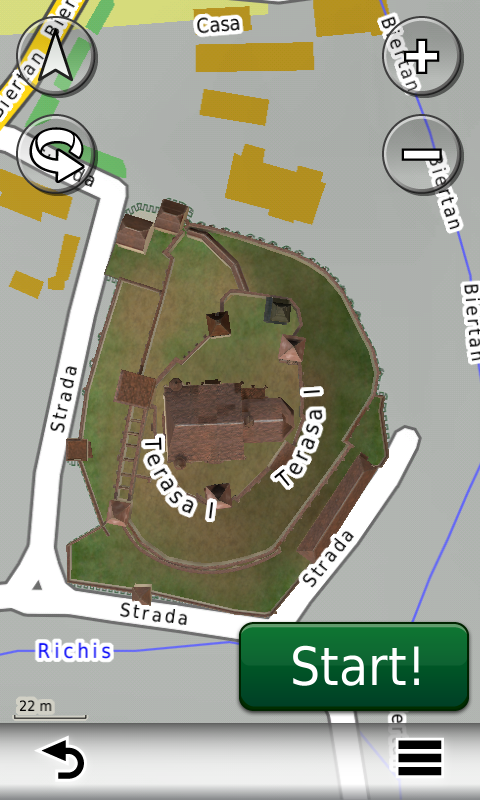
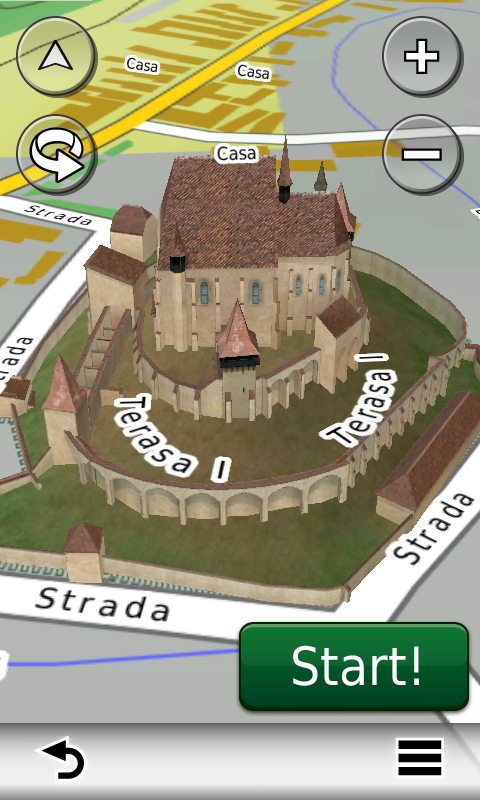
Galeria modelelor 3D s-a îmbogăţit cu reprezentarea detaliată a bisericii evanghelice fortificate din Biertan.

Graniţele, componenţa şi denumirile parcurilor şi rezervaţiilor naturale din România au fost şi acestea reactualizate după cele mai noi limite publicate de Ministerul Mediului în 2011.

Pasionaţii de istorie vor descoperi în această ediţie în premieră elementele de detaliu ale cetăţii de epoca fierului de la Herneacova, ale aşezărilor fortificate e-neolitice ale Culturilor Precucuteni de la Târpeşti – Râpa lui Bodai, Culturii Cucuteni de la Ruginoasa – Dealul Drăghici, Culturii Vădastra de la Vădastra – Dealul Cişmelei, Culturii Ceramicii Liniare de la Isaiia – Balta Popii, ale cetăţii de epoca bronzului şi dacică de la Năeni – Zănoaga, ale cetăţilor dacice de la Pietroasele – Gruiu Dării şi de la Todireşti – La Şanţuri.

Dispunând de un concept original, cu actualizări trimestriale, rodul muncii pasionaţilor şi specialiştilor din echipa Proiectului România Digitală, Atlasul Digital al României este opţiunea profesioniştilor din toate domeniile şi unealta preferată de navigaţie a pasionaţilor de drumeţii în aer liber.

Ediţia actuală are 482 MB mărime şi rulează exclusiv pe echipamente de navigaţie Garmin, o listă a acestora fiind disponibilă la linkul de mai jos
http://www.rqa.ro/produs.php?id=442&subcat_id=39&cat_id=19

Atenţionare!

Utilizarea hărţii ROAD2012.40 poate crea dependenţă de calitate, valoare, funcţionalitate şi frumos!


RO.A.D.2012.40 Launch

Sheba Distribution SRL, a Garmin representative in Romania, has the pleasure to announce the availability of the new edition of the Digital Atlas of Romania v4.40, RO.A.D.2012.40.

Continuing in the well known tradition for the Romanian Garmin customers, the Digital Atlas of Romania holds on to the number one place in the GPS road navigation map charts by bringing an extra 17 thousand km of roads up to a grand total of 267.261,99 km, having increased coverage added in the counties Vaslui, Iaşi, Caraş-Severin and Hunedoara and the number of POIs raises in this edition to a staggering 314.941 points divided into 437 categories.

ROAD2012.40 is the only navigation map in the world that combines topographic details with a routable road network – including dirt roads and trails – with postal addresses of unequaled precision, towns with extruded 3D blocks of flats and detailed 3D textured models for both old patrimony buildings and new skyscrapers, true landmarks of today’s urban space. Map updates are constant and consistent from one edition to another and are documented in the Map Diaries, where all the contributions and their respective authors are mentioned together with the names of the cities and the map tiles that have changed.

Compared with common maps on the market, the Digital Atlas of Romania has an unequaled level of actuality, in this edition one being able to find the newest A3 motorway (between Ploieşti and Bucureşti) with the complete Snagov bypass and the complete A2 motorway (from Cernavoda to Medgidia), with the ruttier bypass in Valea Dacilor, the extended A4 ring (from Constanţa to Ovidiu), the overhead passage from Craiova, the undeground passages from Bacău (between Oituz and Ştefan Guşe) and Corbeanca (Prisma), the underground passage to Carrefour Tom in Ovidiu, the ruttier bridge over the Cibin in Sibiu, the Popişteanu Cristian breakthrough in Bucureşti, the access to the commercial centres Maritimo from Constanţa and Lidl from Fălticeni, the Coresi link in Braşov together with many recent residential areas (A.N.L. subdivision Henri Coandă, the residential areas FeliCity, Upground, Quadra Place, Greenfield Residence, etc. from Bucureşti, Militari Residence from Roşu, Ibiza Sol, Ibiza Golf and Oxford Gardens from Voluntari, etc.), together with many one way streets and 38 (thirty-eight) roundabouts that have been implemented in the last three months.

The 3D model gallery has been enriched with the detailed representation of the fortified evangelic church from Biertan.

All natural parks and reserves in Romania have been updated in this edition to the latest boundaries, types and denominations published by the Ministry of the Environment in 2011.

History aficionados will discover in this edition in premiere the detailed elements of the iron age stronghold from Herneacova, the e-Neolithic fortified settlements of the Precucuteni Culture from Târpeşti – Râpa lui Bodai, the Cucuteni Culture from Ruginoasa – Dealul Drăghici, the Vădastra Culture from Vădastra – Dealul Cişmelei, the Linear Ceramics Culture from Isaiia – Balta Popii, of the bronze age and Latene fortress of Năeni – Zănoaga, of the Latene fortresses from Pietroasele – Gruiu Dării and Todireşti – La Şanţuri.

Featuring an original concept, with quarterly updates, the result of the work of the experts and contributors of the Digital Romania Project team, the Digital Atlas of Romania is the choice of professionals in all fields and the preferred navigation tool for all nature goers.

This edition has 484 MB in size and runs exclusively on Garmin navigation equipment, an updated list of compatibility being available at the below link:
http://www.rqa.ro/produs.php?id=442&subcat_id=39&cat_id=19

Warning!
The use of ROAD2012.40 map can create addiction to quality, value, functionality and beauty!


Lansare RO.A.D.2012.30RO.A.D.2012.30 Launch

Sheba Distribution SRL, reprezentant al firmei Garmin în România, are plăcerea să anunţe disponibilitatea noii ediţii a Atlasului Digital al României v4.30, RO.A.D.2012.30.
Sheba Distribution SRL, Garmin’s representative in Romania, has the pleasure to announce the availability of the newest edition of the Digital Atlas of Romania v4.02, RO.A.D.2012.30.
Continue reading →