RO.A.D.2014.10 Launch
Sheba Distribution SRL, a Garmin representative in Romania, has the pleasure to announce the availability of the new edition of the Digital Atlas of Romania v6.10, RO.A.D.2014.10.
Continuing in the well known tradition for the Romanian Garmin customers, the Digital Atlas of Romania holds on to the number one place in the GPS road navigation map charts by bringing an extra 2,629.94 km of roads up to a grand total of 328,269.79 km, having increased coverage added in the counties Alba, Argeş, Buzău, Tulcea, Brăila, Ialomiţa, Suceava, Botoşani and Bacău and the number of POIs raises in this edition to a staggering 346.936 points divided into 488 categories.
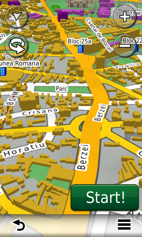
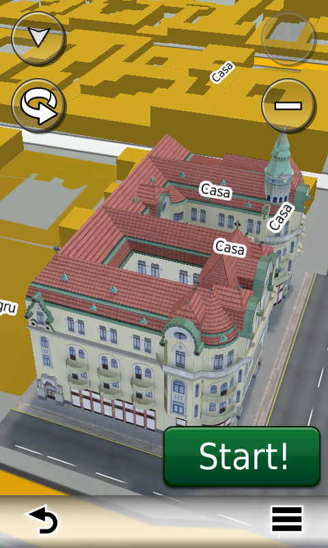
ROAD2014.10 is the only GPS navigation map in the world that combines topographic details with a routable road network – including dirt roads and trails – with postal addresses of unequaled precision, towns with extruded 3D blocks of flats and detailed 3D textured models for both old patrimony buildings and new skyscrapers, true landmarks of today’s urban space. Map updates are constant and consistent from one edition to another and are documented in the Map Diaries, where all the contributions and their respective authors are mentioned together with the names of the cities and the map tiles that have changed.
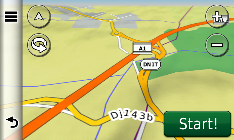
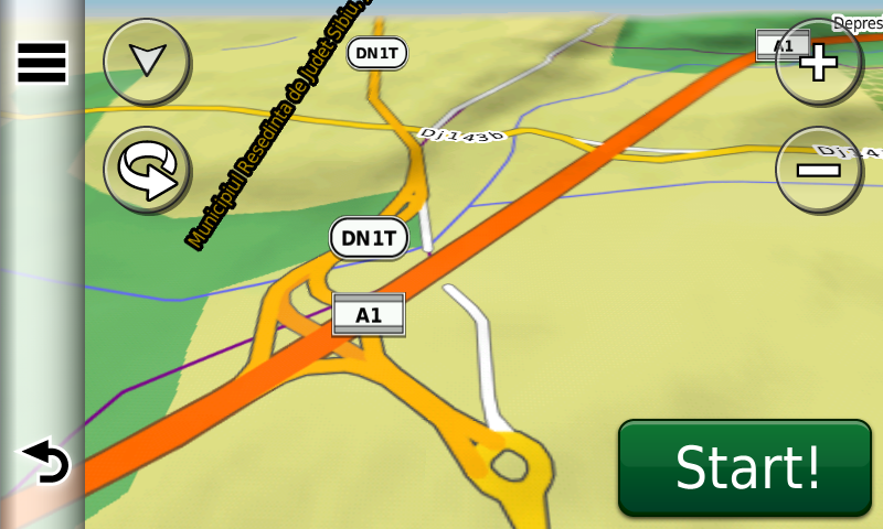
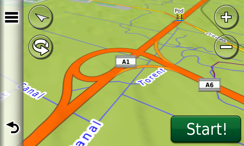
Compared with common maps on the market, the Digital Atlas of Romania has an unequaled level of detail and actuality, featuring the new North-West Ring of Braşov with its three bypasses, the A1 motorway(the Orăştie-Cunţa and Sălişte-Sibiu segments), with the ruttier nodes from Sebeş Nord-Vest, Cunţa, Sălişte and Şura Mică, the A6 motorway (the Balint-Lugoj segment) with the ruttier nodes from Balint and Dumbrava, the new segment of Uranus Blvd. from Bucureşti (inaugurated on the 12th Jan. 2014!), plus postal addresses in the following towns: ŞTEFĂNEŞTII NOI, ŞTEFĂNEŞTI, BRADU, ALBOTA, GURA VĂII, HINTEŞTI, DEALU VIILOR, SMEURA, GEAMĂNA, PITEŞTI (the new suburbs), Izvoarele, Alba, Iulia, Valea Teilor, Horia, Hamcearca (with the villages Balabancea, Nifon and Căprioara), Smârdan, Pătârlagele, COSĂMBEŞTI, GIMBĂŞANI, GHEORGHE LAZĂR şi SLOBOZIA NOUĂ and the new postal numbering implemented in Turcoaia.
Access to the commercial centres UniversAll from Sibiu, Real Grocery Store from Fabricii St. from Cluj-Napoca, Kaufland from Piteşti and Dedeman from Miroslava, plus many new oneway streets and 40 (fourty) new roundabouts that have been implemented in the last three months.
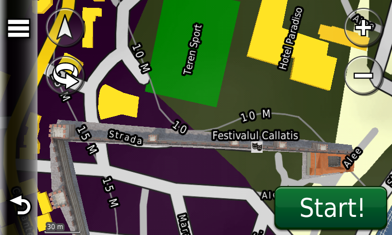
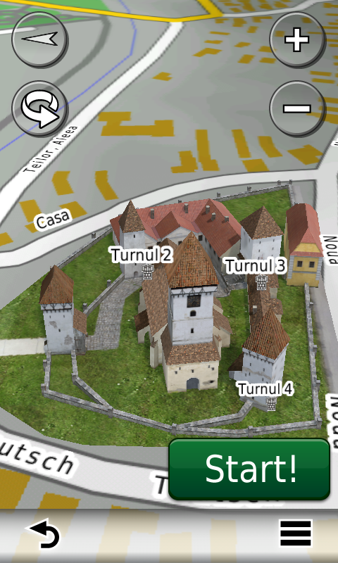
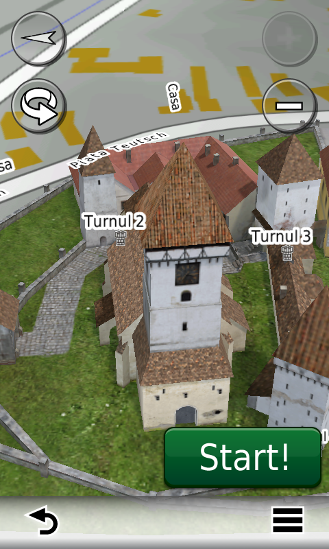
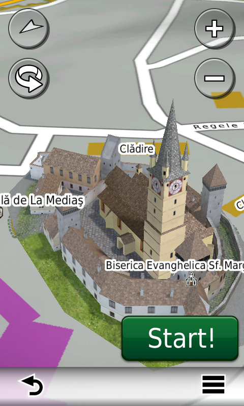
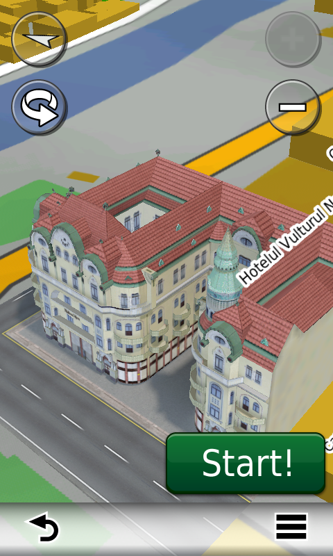
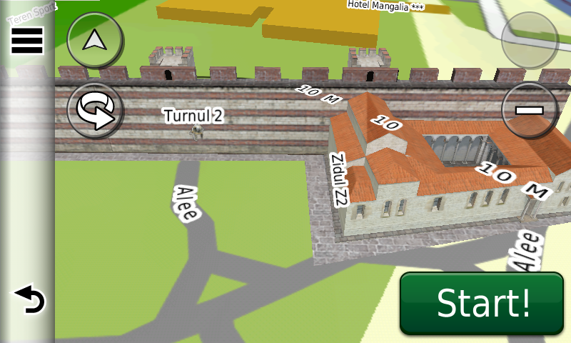
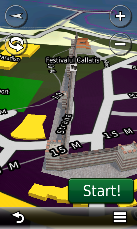
The 3D textured model gallery has been enriched with the detailed representation of the fortified evangelic churches from Agnita and Mediaş, of the exquisite Vulturul Negru Palace from Oradea and of the ideal reconstitution of the Syrian Basilica and the north and northwestern wall of the roman byzantine fortress Callatis from Mangalia.
The new European Digital Elevation Model (DEM) with 25m resolution has been implemented and the introduction of postal codes for all single postal code settlements in Romania has been completed as well.
History aficionados will discover in this edition in premiere the detailed elements of the fortified Neolithic settlement of the Banat Culture from Timişoara-8, the fortified settlement of the Cucuteni B Culture from Costeşti-Cier, of the bronze age fortified settlements from Săcueni – Cetatea Boului and Coldău-Varbă/Cetate, of the bronze age fortress from Munar, of the iron age ditch and vallum from Lipova-Coasta Rea, of the fortified Latene? settlement from Sanislău-La Păşune, of the Latene fortifications from Clopotiva-Vârful Pietrei, of the Latene strongholds from Braşov-Pietrele lui Solomon-Între Chietri and Tiseşti-Titelca, of the roman towers (Speculae) from Câmpu Cetăţii-Cetatea Săcădat, Chiheru de Jos-Dealul Pogor and Eremitu-Dealul Tompa, of the roman burgus from Ibăneşti-Cetăţuia Mică, of the roman? earth castra? from Borduşelu, of the roman Centuriatio from Ulpia Traiana Sarmizegetusa, of the roman gold mine galleries (entry point, name and polygon) from Roşia Montană, of the E1 roman public building from Roşia Montană-Carpeni, of the Syrian Basilica and roman byzantine fortress Callatis from Mangalia, of the archaeological finds from the Tomis peninsula in Constanţa (the roman-byzantine fortress Tomis, the aqueducts, the 6 basilicas, the Lentiarion (thermae) and the Mosaic Edifice), of the early medieval gepid earth stronghold from Moreşti, of the medieval earth stronghold from Săcueni and of the fortified evangelic church from Agnita.
Featuring an original concept, with quarterly updates, the result of more than 10 years of continuous development of the experts and contributors of the Digital Romania Project team, the Digital Atlas of Romania is the choice of professionals in all fields and the preferred navigation tool for all nature goers.
This edition has 626.6 MB in size and runs exclusively on Garmin navigation equipment, an updated list of compatibility being available at the below link:
http://www.rqa.ro/produs.php?id=442&subcat_id=39&cat_id=19
Warning!
The use of RO.A.D.2014.10 map can create addiction to quality, value, functionality and beauty!