Lansare RO.A.D.2018.09RO.A.D.2018.09 Launch

RQA, importator de echipamente Garmin în Romania, are plăcerea să anunţe disponibilitatea noii ediţii a Atlasului Digital al României v10.09, RO.A.D.2018.09.

Continuând în tradiţia binecunoscută deja clienţilor Garmin din România, Atlasul Digital al României se menţine în continuare pe locul I în clasamentul hărţilor de navigaţie rutieră, aducând în plus faţă de ediţia precedentă 5.279,00 km de drumuri, ridicând la un total de 417.664,25 km de căi de comunicaţii acoperirea în teritoriu, cu acoperire îmbogăţită semnificativ în judeţele Bihor, Maramureş, Harghita, Suceava, Ilfov şi Alba, iar numărul de informaţii de tip punct se ridică în această ediţie la 865.376 puncte împărţite în 518 categorii.

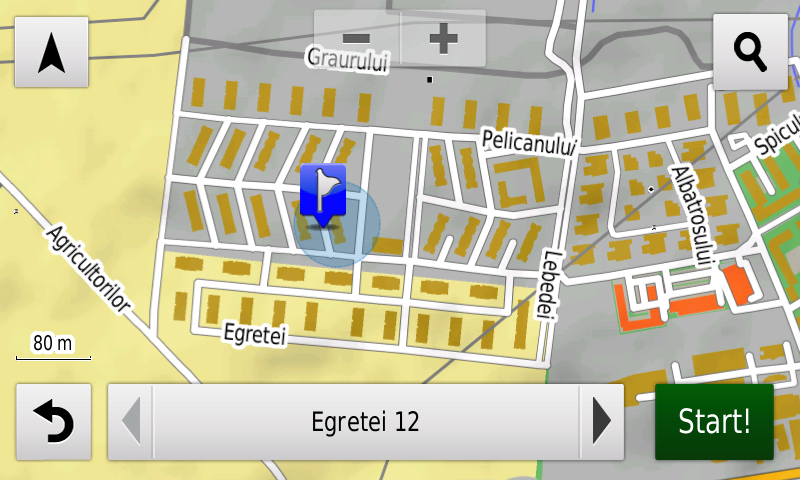
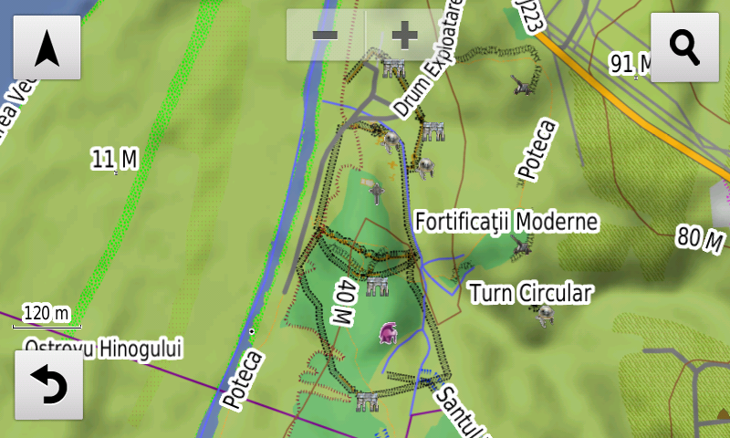
RO.A.D.2018.09 este singura hartă de navigaţie din lume care combină detalii topo cu o structură de drumuri rutabilă – la nivel inclusiv de drumuri de pământ şi poteci – cu adrese poştale de o precizie neegalată, oraşe cu blocuri 3D şi modele minuţios realizate la construcţii vechi, de patrimoniu, sau noi, definitorii pentru peisajul urban actual. Actualizările la hartă sunt constante şi consistente de la o ediţie la alta şi sunt documentate în Jurnalul Hărţii, în care sunt trecute contribuţiile şi autorii acestora, datele la care s-au efectuat precum şi denumirile localităţilor şi planşelor afectate.

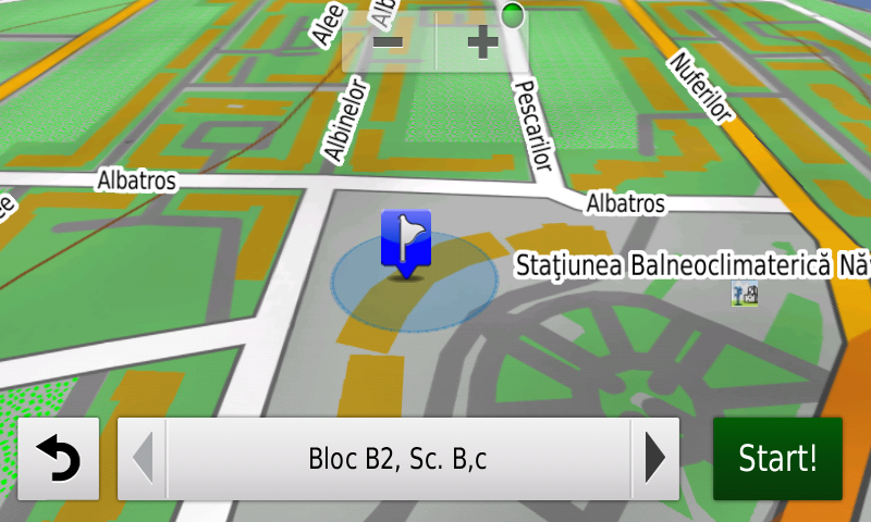
Faţă de hărţile comune de pe piaţă, Atlasul Digital al României are un grad de detaliu şi actualitate fără egal, în această ediţie fiind introduse, printre multe altele blocurile la nivel de denumire şi adresă poştală din Năvodari, din zona centrală a oraşului Popeşti-Leordeni precum şi cele din cartierele Timiş Triaj şi Avantgarde 1, 2 şi 3 din Braşov.

S-au cartat staţiile de vaporetto de pe Bega, Aqua Park din Cornişa şi Terra Park din Bucureşti, împreună cu accesul la acestea.

În această ediţie s-au introdus şi completat adrese poştale în localităţile ORADEA, Cheresig, Biharia, Sândominic, LUNCA ILVEI (est), ARGESTRU, ROŞU, VATRA DORNEI, ALBA IULIA, PÂCLIŞA, MICEŞTI, BĂRĂBANŢ, CIUMBRUD, SÂNCRAI, TEIUŞ, CĂPUD, PEŢELCA, AIUDUL DE SUS, AIUD, Gârbova de Jos, ŢIFRA, GÂRBOVA DE SUS, PETRISAT, BLAJ, VEZA, IZVOARELE, ŢIUR, OARDA, TĂUŢII-MĂGHERĂUŞ (nord), BĂIŢA, NISTRU, SĂBIŞA, SEINI, VIILE APEI, NEGREŞTI-OAŞ, ADRIAN, LIVADA MICĂ, LIVADA, DUMBRAVA, Popeşti-Leordeni şi Bragadiru.

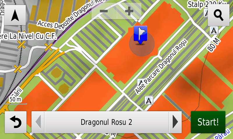
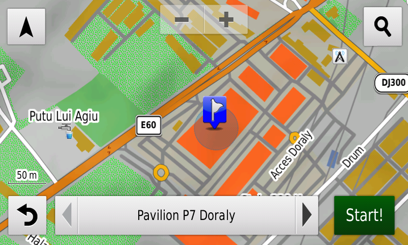
S-a introdus accesul detaliat la centrele accesul detaliat la Cora şi Lidl Brătianu, Kaufland Vivo din Constanţa, Kaufland Olteniţei, Lidl Drumul Binelui, Lidl Sergent Nuţu Vasile, Mega Image Vatra Luminoasă, Dragonul Roşu 1, Mega Image Pucheni, Lidl Teiuş din Bucureşti, Penny Market Drumul Fermei din Popeşti-Leordeni, Penny Market din Bragadiru, Expomarket Doraly 2 din Afumaţi şi complexul comercial Dragonul Roşu 2-9 din Dobroeşti. S-au adăugat unele sensuri unice noi, restricţii de viteză precum şi 18 (optsprezece) sensuri giratorii noi.

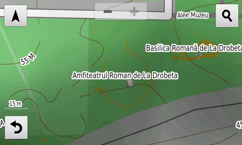
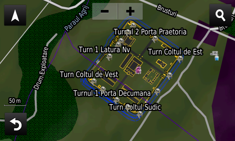
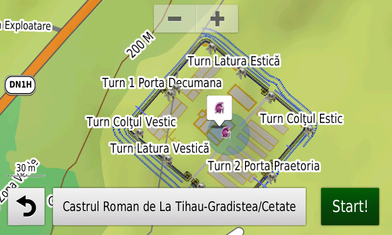
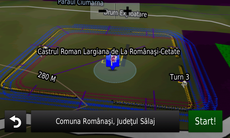
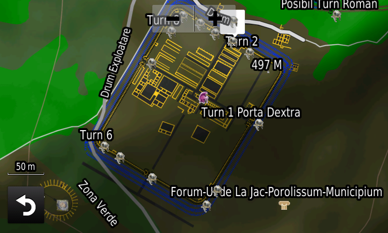
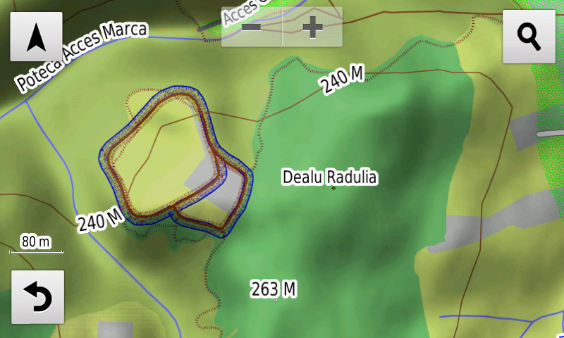
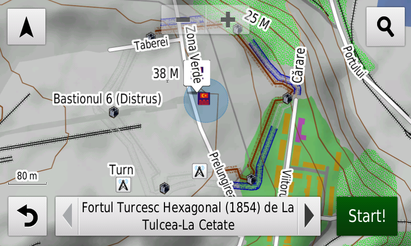
Pasionaţii de istorie vor descoperi în această ediţie în premieră elementele de detaliu (şanţurile) ale aşezării fortificate tip Tell de la Uivar, elementele de detaliu (val, şanţ) ale aşezării fortificate a Culturii Gava din Căuaş-Sigheţiu, elementele de detaliu (valuri, şanţuri) ale aşezării fortificate hallstattiene de la Marca-Iertaşul Petacilor, elementele de detaliu ale cetăţii hallstattiene târzii de la Tulcea-La Cetate/Troianul de la Tulcea (val, şanţ), planul de detaliu (val, şanţ) al fortificaţiei hallstattiene de la Jac-Dealul Cămnini, ale cetăţii dacice de la Moigrad-Măgură (şanţurile), două fortificaţii patrulatere de epocă nedeterminată la Zoreni, poligoanele de detaliu ale amfiteatrului roman de la Drobeta, poligoanele de detaliu ale Horreum-ului roman de la Şibot-Obreje, elementele de detaliu (zidurile, clădirile, turnurile, şanţurile) ale castrului roman Certiae/Cersiae de la Brusturi, elementele de detaliu (zidurile, clădirile, turnurile, şanţurile) ale castrului roman de la Tihău-Grădişte, elementele de detaliu (zidurile, clădirile, turnurile, şanţurile) ale castrului roman Largiana de la Românaşi-Cetate, fazele 1 (lemn) şi 2 (piatră), elementele de detaliu ale Burgus-ului Roman de la Zalău-Fântâna Suşigului, elementele de detaliu (clădirile, şanţul al doilea) ale castrului roman Porolissum-Pomet de la Moigrad-Porolissum, elementele de detaliu (şanţul) castrului roman? de la Lespezi, elementele de detaliu (valul) castrului roman? de la Sarighiol din Deal-Dealul Câmpul Verde, un posibil castru roman la Izvoru Crişului-Dealu Borzica, elementele de detaliu (poligoane ziduri) ale termelor castrului roman Angustia de la Breţcu, ale turnului roman (val) de la Jac-Dealul Cămnini, elementele de detaliu (poligoane edificiile E1-4, şanţ delimitare) ale Villa Rustica de la Tărtăria II, elementele de detaliu (poligoane şi linii ziduri şi incinte, puncte turnuri) ale cetăţii romano-bizantine Carsium de la Hârşova, elementele de detaliu (poligoane şi linii ziduri, porţi, basilici şi incinta nouă, puncte turnuri) ale cetăţii romano-bizantine Axiopolis de la Cernavoda, fortul? roman? de la Şendreni împreună cu o fortificaţie inedită de factură similară din vecinătatea acestuia. S-au refăcut o parte din vallum-urile Limes-ului de la Moigrad-Porollissum, s-a refăcut aspectul (valuri, şanţuri) castrelor romano-bizantine de piatră XIII de la Poarta Albă, (XXA), VII, VIII de la Murfatlar, ale castellum-ului o şi castrului romano-bizantin de pământ 20 de la Poarta Albă, 13, 14 şi 15 de pământ de la Murfatlar, ale castellum-urilor de piatră k, l şi m şi cel dintre castrele 14 şi 13 de la Murfatlar, XX, XIX, XXII de piatră de la Peştera, 30, 29 de pământ de la Peştera, ale castellum-urilor de piatră z, y şi x de la Peştera, s-a refăcut aspectul (valuri, şanţuri) castrelor romane 4,5 şi 6 de pământ şi ale castellum-urilor de piatră b, c, d, e şi f de la Valu lui Traian, s-au introdus detaliile (valuri, şanţuri) castrului romano-bizantin de pământ 3 şi castrului romano-bizantin II de piatră de la Constanţa, s-au completat traseele valurilor mare de piatră, ale valurilor mare şi mic de pământ şi s-au introdus detaliile (valuri, şanţuri) castrelor romane de pământ 2 şi 2′ de la Constanţa. S-au introdus elementele de detaliu (val, şanţ) ale tabiilor otomane Arap Tabia şi Tabia 1? (val?!?), completat jumătatea estică a Tabiei Mici (val, şanţ) de la Babadag, elementele de detaliu (val, şanţ) ale palăncii otomane din Vârfurile, şanţurile la tabiile otomane din Hârşova, o posibilă fortificaţie la Babadag-Cimitirul Evreiesc, ale fortului hexagonal otoman de la 1854 (val, şanţ, bastioane) şi ale tabiei otomane nr. 2 (val, şanţ) de la Tulcea-Dealul Tulcea Veche, conturul presupus al valului şi şanţurilor cetăţii medievale timpurii de la Ortelec/Zalău-Cetate, au fost introduse monumente comemorative din primul război mondial (cimitirul eroilor români din Primul Război Mondial din Porumbacu de Sus, osuarul ostaşilor români din Primul Război Mondial de la Diham şi poziţia actuală a Crucii Molomoţ, etc. )

Dispunând de un concept original, cu actualizări trianuale, rodul muncii timp de peste paisprezece ani fără întrerupere a pasionaţilor şi specialiştilor din echipa Proiectului România Digitală, Atlasul Digital al României este opţiunea profesioniştilor din toate domeniile şi unealta preferată de navigaţie a amatorilor de drumeţii în aer liber.

Ediţia actuală are 1,02 GB mărime şi rulează exclusiv pe echipamente de navigaţie Garmin, o listă a acestora fiind disponibilă la linkul de mai jos
http://www.rqa.ro/produs.php?id=442&subcat_id=39&cat_id=19

Atenţionare!
Utilizarea hărţii RO.A.D.2018.09 poate crea dependenţă de calitate, valoare, funcţionalitate şi frumos!


RQA, a Garmin equipment importer in Romania, has the pleasure to announce the availability of the new edition of the Digital Atlas of Romania v10.09, RO.A.D.2018.09.

Continuing in the well known tradition for the Romanian Garmin customers, the Digital Atlas of Romania holds on to the number one place in the GPS road navigation map charts by bringing an extra 5,279.00 km of roads up to a grand total of 417,664.25 km, having significant increased coverage added in the counties of Bihor, Maramureş, Harghita, Suceava, Ilfov and Alba and the number of POIs raises in this edition to a staggering 865,376 points divided into 518 categories.

RO.A.D.2018.09 is the only GPS navigation map in the world that combines topographic details with a routable road network – including dirt roads and trails – with postal addresses of unequaled precision, towns with extruded 3D blocks of flats and detailed 3D textured models for both old patrimony buildings and new skyscrapers, true landmarks of today’s urban space. Map updates are constant and consistent from one edition to another and are documented in the Map Diaries, where all the contributions and their respective authors are mentioned together with the names of the cities and the map tiles that have changed.

Compared with common maps on the market, the Digital Atlas of Romania has an unequaled level of detail and actuality, featuring, among others, the residential areas at block name-postal address level from Năvodari, the center of Popeşti-Leordeni town as well as from the Timiş Triaj and Avantgarde 1, 2 and 3 from Braşov.

The Bega vaporetto stations, Aqua Park from Cornişa and Terra Park from Bucureşti have been mapped, together with access to them.

In this edition we have postal addresses added in the following towns: ORADEA, Cheresig, Biharia, Sândominic, LUNCA ILVEI (East), ARGESTRU, ROŞU, VATRA DORNEI, ALBA IULIA, PÂCLIŞA, MICEŞTI, BĂRĂBANŢ, CIUMBRUD, SÂNCRAI, TEIUŞ, CĂPUD, PEŢELCA, AIUDUL DE SUS, AIUD, Gârbova de Jos, ŢIFRA, GÂRBOVA DE SUS, PETRISAT, BLAJ, VEZA, IZVOARELE, ŢIUR, OARDA, TĂUŢII-MĂGHERĂUŞ (North), BĂIŢA, NISTRU, SĂBIŞA, SEINI, VIILE APEI, NEGREŞTI-OAŞ, ADRIAN, LIVADA MICĂ, LIVADA, DUMBRAVA, Popeşti-Leordeni and Bragadiru.

Detailed acces to the retail stores: Cora and Lidl Brătianu, Kaufland Vivo from Constanţa, Kaufland Olteniţei, Lidl Drumul Binelui, Lidl Sergent Nuţu Vasile, Mega Image Vatra Luminoasă, Dragonul Roşu 1, Mega Image Pucheni, Lidl Teiuş from Bucureşti, Penny Market Drumul Fermei from Popeşti-Leordeni, Penny Market from Bragadiru, Expomarket Doraly 2 from Afumaţi and the commercial complex Dragonul Roşu 2-9 from Dobroeşti. New oneway streets and speed restrictions have been added together with 18 (eighteen) new roundabouts.

History aficionados will discover in this edition in premiere the detailed elements (ditches) of the Tell type fortified settlement from Uivar, the detailed elements (rampart, ditch) of the Gava Culture settlement from Căuaş-Sigheţiu, the detailed elements (ramparts, ditches) of the Iron Age fortified settlement from Marca-Iertaşul Petacilor, the detailed elements (rampart, ditch) of the late Iron Age fortified settlement from Tulcea-La Cetate/Troianul from Tulcea, the detailed elements (rampart, ditch) of the Iron Age fortified settlement from Jac-Dealul Cămnini, of the La Tene stronghold from Moigrad-Măgură (ditches), two square fortifications of undetermined age from Zoreni, the detailed polygons of the Roman amphitheater from Drobeta, of the Roman Horreum from Şibot-Obreje, the detailed elements (walls, buildings, towers, ditches) of the Roman Castrum Certiae/Cersiae from Brusturi, the detailed elements (walls, buildings, towers, ditches) of the Roman Castrum from Tihău-Grădişte, the detailed elements (walls, buildings, towers, ditches) of the Roman Castrum Largiana from Românaşi-Cetate, phase 1 (wood) and 2 (stone), the detailed elements (rampart, ditch) of the Roman Burgus from Zalău-Fântâna Suşigului, ), the detailed elements (buildings, ballistarium, second ditch) of the Roman castrum Porolissum-Pomet from Moigrad-Porolissum, the detailed elements (ditch) of the Roman? castrum from Lespezi, the detailed elements (rampart) of the Roman? castrum from Sarighiol din Deal-Dealul Câmpul Verde, a possible Roman castrum at Izvoru Crişului-Dealu Borzica, the detailed elements (wall polygons) of the thermae of the Angustia Roman castrum from Breţcu, of the Roman tower (rampart) from Jac-Dealul Cămnini, the detailed elements (buildings E1-4 polygons, delimitation ditch) of the Villa Rustica from Tărtăria II, the detailed elements (polygons and lines walls and incints, tower points) of the Roman-Byzantine fortress Carsium from Hârşova, the detailed elements (polygons and lines walls and precincts, gates, the two Basilica and the late precinct, tower points) of the Roman-Byzantine fortress Axiopolis from Cernavoda, the Roman? fortlet? from Şendreni together with a previously unknown similar fortification in its vicinity. Parts of the Moigrad-Porollissum Limes valla have been reconfigured, revisions were made to the aspect (ramparts, ditches) of the Roman-Byzantine stone castra XIII from Poarta Albă, (XXA), VII, VIII from Murfatlar, of the castellum o and the Roman-Byzantine earthen castra 20 from Poarta Albă, 13, 14 and 15 from Murfatlar, of the stone castella k, l, m and the one between the 14 and 13 castra from Murfatlar, the XX, XIX, XXII stone castra from Peştera, the earthen 30, 29 castra from Peştera, the stone castella z, y and x from Peştera, of the roman earthen 4, 5 and 6 castra and of the stone castella b, c, d, e and f from Valu lui Traian. The detailed elements (ramparts, ditches) of the Roman-Byzantine earthen castrum 3,2 and 2′ and stone castrum II from Constanţa were introduced together with additions to the trajectory of the stone vallum, and large and small earthen valla from Constanţa. From the Medieval period the detailed elements (rampart, ditch) of the ottoman Tabyas Arap Tabia and Tabia 1? (rampart?!?), the eastern half of the Small Tabya (rampart, ditch) from Babadag, the detailed elements (rampart, ditch) of the Turkish Palanka from Vârfurile, the ditches of the ottoman Tabyas from Hârşova, a possible fortification at Babadag-Cimitirul Evreiesc, the detailed elements of the hexagonal 1854 ottoman fort (rampart, ditch, bastions) and of the Tabya number 2 (rampart, ditch) from Tulcea-Dealul Tulcea Veche, the supposed contour of the rampart and ditches of the early medieval stronghold from Ortelec/Zalău-Cetate, comemorative World War I monuments (the WWI romanian heroes cemetery from Porumbacu de Sus, the WWI romanian soldiers osuary from Diham and the current position of the Molomoţ cross, etc. ).

Featuring an original concept, with updates three times a year, the result of over 14 years of continuous development of the experts and contributors of the Digital Romania Project team, the Digital Atlas of Romania is the choice of professionals in all fields and the preferred navigation tool for all nature goers.

This edition has 1.02 GB in size and runs exclusively on Garmin navigation equipment, an updated list of compatibility being available at the below link:
http://www.rqa.ro/produs.php?id=442&subcat_id=39&cat_id=19

Warning!
The use of RO.A.D.2018.09 map can create addiction to quality, value, functionality and beauty!

Lansare RO.A.D.2014.30RO.A.D.2014.30 Launch

Lansare RO.A.D.2014.30

Sheba Distribution SRL, reprezentant al firmei Garmin în Romania, are plăcerea să anunţe disponibilitatea noii ediţii a Atlasului Digital al României v6.30, RO.A.D.2014.30.
RO.A.D.2014.30 Launch

Sheba Distribution SRL, a Garmin representative in Romania, has the pleasure to announce the availability of the newest edition of the Digital Atlas of Romania v6.30, RO.A.D.2014.30.
Continue reading →

Lansare RO.A.D.2013.40RO.A.D.2013.40 Launch

Sheba Distribution SRL, reprezentant al firmei Garmin în Romania, are plăcerea să anunţe disponibilitatea noii ediţii a Atlasului Digital al României v5.40, RO.A.D.2013.40.

Continuând în tradiţia binecunoscută deja clienţilor Garmin din România, Atlasul Digital al României se menţine în continuare pe locul I în clasamentul hărţilor de navigaţie rutieră, aducând în plus faţă de ediţia precedentă 7.477,94 de kilometri de drumuri, ridicând la un total de 325.639,85 km de căi de comunicaţii acoperirea în teritoriu, cu acoperire îmbogăţită în judeţele Buzău, Sibiu, Alba, Tulcea şi Constanţa, iar numărul de informaţii de tip punct se ridică în această ediţie la 345.966 puncte împărţite în 489 de categorii.

ROAD2013.40 este singura hartă de navigaţie din lume care combină detalii topo cu o structură de drumuri rutabilă – la nivel inclusiv de drumuri de pământ şi poteci – cu adrese poştale de o precizie neegalată, oraşe cu blocuri 3D şi modele minuţios realizate la construcţii vechi, de patrimoniu, sau noi, definitorii pentru peisajul urban actual. Actualizările la hartă sunt constante şi consistente de la o ediţie la alta şi sunt documentate în Jurnalul Hărţii, în care sunt trecute contribuţiile şi autorii acestora, datele la care s-au efectuat precum şi denumirile localităţilor şi planşelor afectate.

Faţă de hărţile comune de pe piaţă, Atlasul Digital al României are un grad de detaliu şi actualitate fără egal, în această ediţie fiind introduse, printre multe altele, Centura Ocolitoare a Alexandriei, Pasajul Subteran din Craiova, DJ713B (TransBucegi) între cabana Piatra Arsă şi Sinaia Cota 1400 şi adrese poştale în localităţile Năvodari (sud), zona Mamaia, 2 Mai, 23 August, Vama Veche, Ovidiu, Lazu, Agigea, Valu lui Traian, EFORIE SUD, CUMPĂNA, Tuzla, Limanu, MEŞENDORF, STEJĂRENII, CRIŞ, MĂLÂNCRAV, NOU SĂSESC, ROANDOLA, VALCHID, MERCHEAŞA, JIMBOR, JIBERT, CRIŢ, BUNEŞTI, ROADEŞ, FIŞER, RUPEA, DACIA, VISCRI, BOARTA, ŞOALA, AGÂRBICIU, MOTIŞ, VALEA VIILOR, COPSA MICĂ (fosta TÂRNĂVIOARA), TÂRNAVA, COLONIA TÂRNAVA, IGHIŞU NOU, MEDIAŞ, ALMA VII, MOŞNA, BUZD, MOARDAŞ, RĂVĂŞEL, METIŞ, SADÂNCA, HAŞAG, RUŞI, SLIMNIC, BIERTAN, ŞEICA MARE, MICASASA, ŢAPU, SOROŞTIN, PETIŞ, ŞEICA MICĂ, COPŞA MICĂ, AXENTE SEVER, I. C. Brătianu, Grindu şi Garvăn.

S-a explicitat de asemenea accesul la centrele comerciale Kaufland şi Lidl din Giurgiu, Selgros Pantelimon, magazinele Metro, Băcănia Real şi Obi Titan din Bucureşti, Selgros Someşeni din Cluj-Napoca, Jupiter şi EuroMall din Piteşti, Băcănia Real din Şcheia precum şi Kaufland şi Lidl din Sebeş, s-au adăugat unele sensuri unice noi şi 28 (douăzecişiopt) sensuri giratorii noi apărute între timp şi date complete de contact la magazinele Cora Alexandriei şi Sun City din Bucureşti şi Cora City Park şi Brătianu din Constanţa.

Galeria modelelor 3D texturate s-a îmbogăţit cu reprezentarea detaliată ale Bisericilor Evanghelice Fortificate de la Bistriţa, Codlea şi Hărman, a reconstituirii Castelului Medieval Bastionar Sukosd-Bethlen de la Racoş precum şi a turnurilor Alb şi Negru din Braşov.

Pasionaţii de istorie vor descoperi în această ediţie în premieră elementele de detaliu ale aşezării fortificate Neolitice Cult. Starcevo-Criş de la Cristian-Cristian III, ale aşezării fortificate neolitice Cultura Turdaş de la Turdaş-În Luncă, ale fortificaţiilor? recent descoperite de la Giuvărăşti, Islaz, Săgeata, Lanurile, Perişoru, Bălăceanu, Viziru, Căzaşu, Sergent Ionel Ştefan, restul şanţului aşezării Tell Gumelniţa de la Mavrodin-La Cetate, ale tell-ului? de la Vâlcelele, ale fortificaţiei? circulare inedite de la Moţăţei, ale fortificaţiei de epoca bronzului? de la Constantin Gabrielescu, ale fortificaţiei de ep. Bronzului ? de la Udupu-Valea Zidului, ale aşezării fortificate de epoca fierului Cultura Basarabi ? de la Cristian-Cristian III, ale celor trei cetăţi dacice de la Ocniţa-Coşota, ale cetăţilor dacice de la Tetoiu-Piscul Şasa/Piscul cu Jidovi, Pietroasa Mică-Gruiu Dării şi Târcov-Piatra cu Lilieci, ale aşezărilor fortificate dacice de la Căuieşti-Cetăţuia, Rapoltu Mare-Măgura Uroiului, Agrişu Mare-Pârâul Valea Mare şi Bârca– Cetatea, ale aşezărilor fortificate getice? de la Mărculeşti-Valea Grecilor şi Crăsanii de Jos-Dealul Copuzu, ale fortificaţiei de la Cocargeaua (actualmente Borcea)-La Cetăţue, ale fortificaţiei liniare de la Csanadpalota (porţiunea românească), ale burgus-ului ? roman ? de la Moşniţa-Obiectiv 13, ale castrului roman legionar de pământ de la Filipeşti-Cetăţuia/Başa, ale castrului roman legionar de pământ de la Dichiseni/Gara Mărculeşti/Mărculeşti Gară – Movila Hotar/La Cetăţuia, ale castrul roman de pământ de la Cugir-Bătrâna, ale castellum-urilor romane de la Drumul Carului-La Cetate/Grădişte, Rucăr-Scărişoara şi Măgureni-Culmea Muncelului, ale castrului roman inedit de pământ de la Cetate-Şanţul Vechi/Alte Schanz (judeţul Dolj), ale castrul roman de pământ de la Gârcov-Pichetul Plopilor, ale Castellum-ului roman New de la Valu lui Traian, ale castellum-ului roman de la Poieni şi vallum-ul de acolo, ale aşezării romane fortificate de la Şibot-În Obrej, ale castellum-ului? roman? de pâmânt inedit de la nord de castrul roman de la Petroşani-Jigorul Mare, ale castrului roman multiplu de pământ de la Vinerea-Brazdă, ale cetăţilor medievale de pământ Lempesch de la Agnita-Dealul Lempeş, Castrum Cuculensi de la Cetatea de Baltă şi de la Mălâncrav, ale Bisericilor Evanghelice Fortificate din Hărman şi Codlea, ale castelului medieval bastionar Sukosd-Bethlen din Racoş, ale turnului medieval de la Ciacova-Cula Turcească, ale fortului austriac de pământ de la Moieciu de Jos-La Cetăţuie/Cetatea Carului, ale cetăţii medievale bastionare austriece Arxavia de la Câinenii Mari, ale tabiei turceşti de la Mangalia, ale Culelor Duca şi Grecescu din Măldăreşti, ale bateriilor ruseşti de la Atârnaţi şi de la Gogoşu-Ostrovu Mare şi ale celor două fortificaţii moderne de pământ, probabil turceşti, de la Cireşu.

Dispunând de un concept original, cu actualizări trimestriale, rodul muncii timp de aproape zece ani fără întrerupere a pasionaţilor şi specialiştilor din echipa Proiectului România Digitală , Atlasul Digital al României este opţiunea profesioniştilor din toate domeniile şi unealta preferată de navigaţie a amatorilor de drumeţii în aer liber.

Ediţia actuală are 538.6 MB mărime şi rulează exclusiv pe PC şi pe echipamente de navigaţie Garmin, o listă a acestora fiind disponibilă la linkul de mai jos:
http://www.rqa.ro/produs.php?id=442&subcat_id=39&cat_id=19

Atenţionare!
Utilizarea hărţii RO.A.D.2013.40 poate crea dependenţă de calitate, valoare, funcţionalitate şi frumos!


Sheba Distribution SRL, a Garmin representative in Romania, has the pleasure to announce the availability of the new edition of the Digital Atlas of Romania v5.40, RO.A.D.2013.40.

Continuing in the well known tradition for the Romanian Garmin customers, the Digital Atlas of Romania holds on to the number one place in the GPS road navigation map charts by bringing an extra 7.477,94 km of roads up to a grand total of 325.639,85 km, having increased coverage added in the counties Buzău, Sibiu, Alba, Tulcea and Constanţa and the number of POIs raises in this edition to a staggering 345.966 points divided into 489 categories.

ROAD2013.40 is the only GPS navigation map in the world that combines topographic details with a routable road network – including dirt roads and trails – with postal addresses of unequaled precision, towns with extruded 3D blocks of flats and detailed 3D textured models for both old patrimony buildings and new skyscrapers, true landmarks of today’s urban space. Map updates are constant and consistent from one edition to another and are documented in the Map Diaries, where all the contributions and their respective authors are mentioned together with the names of the cities and the map tiles that have changed.

Compared with common maps on the market, the Digital Atlas of Romania has an unequaled level of detail and actuality, featuring the new Ring of Alexandria, the Underground Passage from Craiova, and the new DJ713B (TransBucegi) link between Cabana Piatra Arsă and Sinaia Cota 1400, plus postal addresses in the following towns: Năvodari (south), the Mamaia area, 2 Mai, 23 August, Vama Veche, Ovidiu, Lazu, Agigea, Valu lui Traian, EFORIE SUD, CUMPĂNA, Tuzla, Limanu, MEŞENDORF, STEJĂRENII, CRIŞ, MĂLÂNCRAV, NOU SĂSESC, ROANDOLA, VALCHID, MERCHEAŞA, JIMBOR, JIBERT, CRIŢ, BUNEŞTI, ROADEŞ, FIŞER, RUPEA, DACIA, VISCRI, BOARTA, ŞOALA, AGÂRBICIU, MOTIŞ, VALEA VIILOR, COPSA MICĂ (the former TÂRNĂVIOARA part), TÂRNAVA, COLONIA TÂRNAVA, IGHIŞU NOU, MEDIAŞ, ALMA VII, MOŞNA, BUZD, MOARDAŞ, RĂVĂŞEL, METIŞ, SADÂNCA, HAŞAG, RUŞI, SLIMNIC, BIERTAN, ŞEICA MARE, MICASASA, ŢAPU, SOROŞTIN, PETIŞ, ŞEICA MICĂ, COPŞA MICĂ, AXENTE SEVER, I. C. Brătianu, Grindu and Garvăn.

Access to the commercial centres Kaufland and Lidl from Giurgiu, Selgros Pantelimon, the Metro, Real Grocery and Obi Titan stores from Bucureşti, Selgros Someşeni from Cluj-Napoca, Jupiter and EuroMall from Piteşti, Real Grocery Store from Şcheia as well as Kaufland and Lidl from Sebeş has been detailed, together with complete details for Cora Alexandriei and Sun City from Bucureşti and Cora City Park and Brătianu from Constanţa, plus many new oneway streets and 28 (twentyeight) new roundabouts that have been implemented in the last three months.

The 3D textured model gallery has been enriched with the detailed representation of the Fortified Evangelic Churches from Bistriţa, Codlea and Hărman, of the reconstitution of the Sukosd-Bethlen Medieval Bastionary Castle from Racoş as well as the White and Black Towers from Braşov.

History aficionados will discover in this edition in premiere the detailed elements of the fortified Neolithic settlement of the Starcevo-Criş Culture from Cristian-Cristian III, fortified Neolithic settlement of the Turdaş Culture from Turdaş-În Luncă, of the recently discovered fortifications? from Giuvărăşti, Islaz, Săgeata, Lanurile, Perişoru, Bălăceanu, Viziru, Căzaşu, Sergent Ionel Ştefan, the remainder of the Chalcolithic ditch of the Gumelniţa Tell settlement from Mavrodin-La Cetate, of the tell? from Vâlcelele, of the previously unknown circular fortification? from Moţăţei, of the bronze age? settlements from Constantin Gabrielescu and Udupu-Valea Zidului, of the fortified iron age Basarabi? Culture settlement from Cristian-Cristian III, of the three Latene fortresses from Ocniţa-Coşota, of the Latene strongholds from Tetoiu-Piscul Şasa/Piscul cu Jidovi, Pietroasa Mică-Gruiu Dării and Târcov-Piatra cu Lilieci, of the fortified Latene settlements from Căuieşti-Cetăţuia, Rapoltu Mare-Măgura Uroiului, Agrişu Mare-Pârâul Valea Mare and Bârca– Cetatea, of the fortified Latene? settlements from Mărculeşti-Valea Grecilor and Crăsanii de Jos-Dealul Copuzu, of the fortification from Cocargeaua (nowadays Borcea)-La Cetăţue, the linear vallum of the Csanadpalota fortification (the romanian side), of the roman? burgus? from Moşniţa-Obiectiv 13, of the roman legion earth castrae from Filipeşti-Cetăţuia/Başa and Dichiseni/Gara Mărculeşti/Mărculeşti Gară – Movila Hotar/La Cetăţuia, of the roman earth castra from Cugir-Bătrâna, of the roman castellae from Drumul Carului-La Cetate/Grădişte, Rucăr-Scărişoara and Măgureni-Culmea Muncelului, of the previously unknown earth roman? castra from Cetate-Şanţul Vechi/Alte Schanz (Dolj county), of the roman? earth castra from Gârcov-Pichetul Plopilor, of the roman? castellum New from Valu lui Traian, of the roman castellum from Poieni and its associated vallum, of the roman fortified settlement from Şibot-În Obrej, of the previously unknown earth roman? castellum? at the north of the roman castra from Petroşani-Jigorul Mare, of the roman? multiple earth castra from Vinerea-Brazdă, of the early medieval earth strongholds Lempesch from Agnita-Dealul Lempeş, Castrum Cuculensi from Cetatea de Baltă and Mălâncrav, of the fortified evangelic churches from Hărman and Codlea, of the Sukosd-Bethlen medieval bastionary castle from Racoş, of the medieval tower from Ciacova-Cula Turcească, of the austrian fort from Moieciu de Jos-La Cetăţuie/Cetatea Carului, of the Arxavia austrian medieval bastionary fortress from Câinenii Mari, of the turkish tabia from Mangalia, of the Duca and Grecescu fortified mansions (Cule) from Măldăreşti, of the russian artillery batteries from Atârnaţi and Gogoşu-Ostrovu Mare and of the two modern earth fortifications, probably turkish, from Cireşu.

Featuring an original concept, with quarterly updates, the result of almost 10 years of continuous development of the experts and contributors of the Digital Romania Project team, the Digital Atlas of Romania is the choice of professionals in all fields and the preferred navigation tool for all nature goers.

This edition has 538.6 MB in size and runs exclusively on PC and Garmin navigation equipment, an updated list of compatibility being available at the below link:
http://www.rqa.ro/produs.php?id=442&subcat_id=39&cat_id=19

Warning!
The use of RO.A.D.2013.40 map can create addiction to quality, value, functionality and beauty!

Lansare RO.A.D.2013.20RO.A.D.2013.20 Launch

Sheba Distribution SRL, reprezentant al firmei Garmin în Romania, are plăcerea să anunţe disponibilitatea noii ediţii a Atlasului Digital al României v5.20, RO.A.D.2013.20.

Continuând în tradiţia binecunoscută deja clienţilor Garmin din România, Atlasul Digital al României se menţine în continuare pe locul I în clasamentul hărţilor de navigaţie rutieră, aducând în plus faţă de ediţia precedentă peste 16.411,54 de kilometri de drumuri, ridicând la un total de 306.162,33 km de căi de comunicaţii acoperirea în teritoriu, cu acoperire îmbogăţită în judeţele Ialomiţa, Buzău, Vrancea, Teleorman, Galaţi, Suceava şi Caraş-Severin, iar numărul de informaţii de tip punct se ridică în această ediţie la 337.531 puncte împărţite în 480 de categorii.

ROAD2013.20 este singura hartă de navigaţie din lume care combină detalii topo cu o structură de drumuri rutabilă – la nivel inclusiv de drumuri de pământ şi poteci – cu adrese poştale de o precizie neegalată, oraşe cu blocuri 3D şi modele minuţios realizate la construcţii vechi, de patrimoniu, sau noi, definitorii pentru peisajul urban actual. Actualizările la hartă sunt constante şi consistente de la o ediţie la alta şi sunt documentate în Jurnalul Hărţii, în care sunt trecute contribuţiile şi autorii acestora, datele la care s-au efectuat precum şi denumirile localităţilor şi planşelor afectate.

Faţă de hărţile comune de pe piaţă, Atlasul Digital al României are un grad de detaliu fără egal, în această ediţie fiind introduse, printre multe altele, numerotările poştale din cartierul ANL Brâncuşi Nord din Bucureşti, din zona Şoseaua Nordului din Bucureşti, din cartierele rezidenţiale Azur 1 şi 2, Domus Stil şi Oxford Gardens din Voluntari. S-a explicitat de asemenea accesul la centrele comerciale Penny Market, Obi din Sibiu, Bucharest West Park, Parcul Industrial Cefin, Divertiland, MegaDesigners Outlet, Carrefour, Bricostore si Mobexpert Militari din Chiajna, Baumax, Carrefour şi Leroy Merlin Colosseum, Ikea, Carrefour, Mobexpert, Flanco si Baneasa Shopping City din centrul comercial Feeria, Metro şi Praktiker Colentina, Metro Băneasa, Cora şi Mobexpert Pantelimon, Auchan Brăţării, Metro, Băcănia Real şi Obi Berceni, Selgros Drumul Taberei şi Selgros Berceni, Lidl Fizicienilor şi Lidl Moineşti, Dedeman Giurgiului şi Dedeman Valea Cascadelor, HD Mall si Billa Tricodava din Bucureşti, Interhome, Praktiker, Băcănia Real şi Billa din Craiova, Penny Market şi Lidl din Buftea, Hornbach din Corbeanca, Obi, Băcănia Real, centrul logistic Kaufland, Selgros, Carrefour, Bricostore, Metro, Praktiker, Kaufland si Lem’s din Ploieşti, Decathlon, Magnolia Mall, Carrefour, Bricostore, Metro, Selgros, Mediagalaxy, Macromall şi Kaufland din Braşov, Mega Image din Green City, Lidl din Olteniţa, Billa din Sfântu Gheorghe, Penny Market din Petrila, s-au actualizat punctele de interes şi restricţiile de viteză de-a lungul tuturor ieşirilor şi a Centurii Bucureştiului, s-au adăugat multe sensuri unice noi şi 51 (cincizecişiunu) sensuri giratorii noi apărute între timp.

Galeria modelelor 3D s-a îmbogăţit cu reprezentarea detaliată a Cetăţilor medievale de la Făgăraş şi de la Braşov-Citadela, a castelului Karoly de la Carei precum şi a reconstituirii quadriburgium-ului roman târziu de la Hinova.

Pasionaţii de istorie vor descoperi în această ediţie în premieră elementele de detaliu ale aşezării fortificate a Culturii Gava (epoca bronzului târziu) de la Sighetu Marmaţiei-Dealul Cetăţii, ale cetăţilor dacice Jigodin I, II şi III de la Miercurea Ciuc, ale cetăţii de pământ (probabil dacică) inedite de la Păucineşti-Dealul Carnavela, ale cetăţilor dacice de pământ de la Fizeşti-Dealul Măgulici şi Fizeşti-Dealul Fetei, ale cetăţii dacice de la Obreja-Viteazul Mic, ale valului dacic inedit de baraj de la Culmea Drugu, valului dacic inedit de pământ de la Costeşti-Dealul Făeragu, valurilor dacice de la Dealul Negru, Culmea Şureanu şi Poiana Omului, valului dacic triplu de la Sarmizegetusa Regia, valurile dacice şi medievale de pământ de la Zeicani – Tapae, ale castellum-ului roman inedit de pământ de la Meleia, castrului roman inedit de pământ de la Bucova-Dealul Floruşu, castrului roman inedit de pământ de la Petroşani-Poienile Tăii, ale castrelor romane de pământ de la Fizeşti-Dealul Robului şi Fizeşti-Dealul Măgulici, ale fortificaţiilor romane inedite de pământ (un castru şi cinci castellum-uri) de la Boşorod-Vâlcele – Dealul Voinii, ale fortificaţiilor romane inedite de pământ de la Sarmizegetusa Regia-La Porţi, ale castrului roman inedit de pământ de la Voineasa-Coasta lui Rus Mică, ale castrului roman inedit de pământ de la Ocolişu Mic, ale castrului roman de piatră de la Rădăcineşti şi thermae-le acestuia, ale aşezării fortificate de epocă romană Noviodunum de la Isaccea, ale villa rustica de la Dalboşeţ-Dragomireana, ale castrelor romano-bizantine de la Rasova-Malul Roşu şi Valea Caramancea, ale Valului Tătarilor de la Săcele, ale cetăţii medievale timpurii de pământ de la Nălaţi-Grădişte, ale cetăţii medievale de la Lişnău-Aluniş şi Cetăţii Haiducilor de la Lemnia, ale cetăţilor medievale de la Făgăraş şi de la Braşov-Citadela precum şi ale castelului medieval Karoly de la Carei.

Dispunând de un concept original, cu actualizări trimestriale, rodul muncii timp de nouă ani fără întrerupere a pasionaţilor şi specialiştilor din echipa Proiectului România Digitală , Atlasul Digital al României este opţiunea profesioniştilor din toate domeniile şi unealta preferată de navigaţie a amatorilor de drumeţii în aer liber.

Ediţia actuală are 516.7 MB mărime şi rulează exclusiv pe echipamente de navigaţie Garmin, o listă a acestora fiind disponibilă la linkul de mai jos:
http://www.rqa.ro/produs.php?id=442&subcat_id=39&cat_id=19

Atenţionare!
Utilizarea hărţii ROAD2013.20 poate crea dependenţă de calitate, valoare, funcţionalitate şi frumos!

Sheba Distribution SRL, a Garmin representative in Romania, has the pleasure to announce the availability of the new edition of the Digital Atlas of Romania v5.20, RO.A.D.2013.20.

Continuing in the well known tradition for the Romanian Garmin customers, the Digital Atlas of Romania holds on to the number one place in the GPS road navigation map charts by bringing an extra 16.411,54 km of roads up to a grand total of 306.162,33 km, having increased coverage added in the counties Ialomiţa, Buzău, Vrancea, Teleorman, Galaţi, Suceava and Caraş-Severin and the number of POIs raises in this edition to a staggering 337.531 points divided into 480 categories.

ROAD2013.20 is the only GPS navigation map in the world that combines topographic details with a routable road network – including dirt roads and trails – with postal addresses of unequaled precision, towns with extruded 3D blocks of flats and detailed 3D textured models for both old patrimony buildings and new skyscrapers, true landmarks of today’s urban space. Map updates are constant and consistent from one edition to another and are documented in the Map Diaries, where all the contributions and their respective authors are mentioned together with the names of the cities and the map tiles that have changed.

Compared with common maps on the market, the Digital Atlas of Romania has an unequaled level of detail, featuring postal numbering in ANL subdivision Brâncuşi Nord from Bucureşti, in Şoseaua Nordului area from Bucureşti, in the residential subdivisions Azur 1 and 2, Domus Stil and Oxford Gardens from Voluntari, updated POIs and speed restrictions along all Bucharest exits and across the whole Bucharest ring.

Access to the commercial centres Penny Market, Obi from Sibiu, Bucharest West Park, Parcul Industrial Cefin, Divertiland, MegaDesigners Outlet, Carrefour, Bricostore and Mobexpert Militari from Chiajna, Baumax, Carrefour şi Leroy Merlin Colosseum, Ikea, Carrefour, Mobexpert, Flanco and Baneasa Shopping City from Feeria, Metro and Praktiker Colentina, Metro Băneasa, Cora and Mobexpert Pantelimon, Auchan Brăţării, Metro, Real Grocery Store and Obi Berceni, Selgros Drumul Taberei and Selgros Berceni, Lidl Fizicienilor and Lidl Moineşti, Dedeman Giurgiului and Dedeman Valea Cascadelor, HD Mall and Billa Tricodava from Bucureşti, Interhome, Praktiker, Real Grocery Store and Billa from Craiova, Penny Market and Lidl from Buftea, Hornbach from Corbeanca, Obi, Real Grocery Store, Kaufland logistic park, Selgros, Carrefour, Bricostore, Metro, Praktiker, Kaufland and Lem’s from Ploieşti, Decathlon, Magnolia Mall, Carrefour, Bricostore, Metro, Selgros, Mediagalaxy, Macromall and Kaufland from Braşov, Mega Image from Green City, Lidl from Olteniţa, Billa from Sfântu Gheorghe, Penny Market from Petrila has been detailed, plus many new oneway streets and 51 (fiftyone) new roundabouts that have been implemented in the last four months.
The 3D model gallery has been enriched with the detailed representation of the Karoly medieval castle from Carei, of the medieval fortresses from Făgăraş and Braşov – Citadela, .and the reconstitution of the late roman quadriburgium from Hinova.

History aficionados will discover in this edition in premiere the detailed elements of the fortified settlement of the Gava Culture (late bronze age) from Sighetu Marmaţiei-Dealul Cetăţii, of the dacian strongholds Jigodin I, II and III from Miercurea Ciuc, of the earth stroghold (probably dacian) previously unknown from Păucineşti-Dealul Carnavela, of the dacian earth strongholds from Fizeşti-Dealul Măgulici and Fizeşti-Dealul Fetei, of the dacian stronghold from Obreja-Viteazul Mic, of the previously unknown dacian earth vallums from Culmea Drugu, Costeşti-Dealul Făeragu, of the dacian earth vallums from Dealul Negru, Culmea Şureanu and Poiana Omului, the triple dacian vallum from Sarmizegetusa Regia, the dacian and medieval vallums from Zeicani – Tapae, of the presumed roman earth castellum from Meleia, of the previously unknown roman castrae from Bucova-Dealul Floruşu, Petroşani-Poienile Tăii, of the roman earth castrae from Fizeşti-Dealul Robului şi Fizeşti-Dealul Măgulici, of the previously undocumented roman fortifications (a castra and five castellae) from Boşorod-Vâlcele – Dealul Voinii, of the previously unknown roman earth fortifications from Sarmizegetusa Regia-La Porţi, of the previously unknown roman earth castrae from Voineasa-Coasta lui Rus Mică and Ocolişu Mic, of the roman stone castra and its thermae from Rădăcineşti, of the fortified roman settlement Noviodunum from Isaccea, of the roman villa rustica from Dalboşeţ-Dragomireana, of the roman-byzantine castrae from Rasova-Malul Roşu and Valea Caramancea, of the early medieval vallum Valul Tătarilor from Săcele, of the early medieval earth stronghold from Nălaţi-Grădişte, of the medieval strongholds from Lişnău-Aluniş and Cetatea Haiducilor from Lemnia, of the medieval fortresses from Făgăraş and Braşov-Citadela as well of the medieval Karoly Castle from Carei

Featuring an original concept, with quarterly updates, the result of nine years of continuous development of the experts and contributors of the Digital Romania Project team , the Digital Atlas of Romania is the choice of professionals in all fields and the preferred navigation tool for all nature goers.

This edition has 516.6 MB in size and runs exclusively on Garmin navigation equipment, an updated list of compatibility being available at the below link:
http://www.rqa.ro/produs.php?id=442&subcat_id=39&cat_id=19

Warning!
The use of RO.A.D.2013.20 map can create addiction to quality, value, functionality and beauty!

Lansare RO.A.D.2012.30RO.A.D.2012.30 Launch

Sheba Distribution SRL, reprezentant al firmei Garmin în România, are plăcerea să anunţe disponibilitatea noii ediţii a Atlasului Digital al României v4.30, RO.A.D.2012.30.
Sheba Distribution SRL, Garmin’s representative in Romania, has the pleasure to announce the availability of the newest edition of the Digital Atlas of Romania v4.02, RO.A.D.2012.30.
Continue reading →

Lansare RO.A.D.2012.20RO.A.D.2012.20 Launch


Sheba Distribution SRL, reprezentant al firmei Garmin înRomania, are plăcerea să anunţe disponibilitatea noii ediţii a Atlasului Digital al României v4.02, RO.A.D.2012.20.

Continuând în tradiţia binecunoscută deja clienţilor Garmin din România, Atlasul Digital al României se menţine în continuare pe locul I în clasamentul hărţilor de navigaţie rutieră, aducând în plus faţă de ediţia precedentă peste 11 mii de kilometri de drumuri, ridicând la un total de 236.802,97 km de căi de comunicaţii acoperirea în teritoriu, iar numărul de informaţii de tip punct se ridică în această ediţie la 299.184 puncte împărţite în 435 de categorii.

 ROAD2012.20 este singura hartă de navigaţie din lume care combină detalii topo cu o structură de drumuri rutabilă – la nivel inclusiv de drumuri de pământ şi poteci – cu adrese poştale de o precizie neegalată, oraşe cu blocuri 3D şi modele minuţios realizate la construcţii vechi, de patrimoniu, sau noi, definitorii pentru peisajul urban actual.

Faţă de hărţile obişnuite de pe piaţă, Atlasul Digital al României are un grad de actualitate fără egal, în această ediţie găsindu-şi locul binemeritat centurile de la Domaşnea, Caransebeş şi Drobeta Turnu Severin, Pasajul Pipera 2 precum şi multe sensuri unice şi giratorii apărute între timp.

Galeria modelelor 3D s-a îmbogăţit cu reprezentările detaliate ale Universităţii de Apărare Carol I din Bucureşti, ale Arenei Naţionale, restaurantului Capşa si Bisericii Patriarhiei Române din Bucureşti.

Pasionaţii de istorie vor descoperi în această ediţie în premieră elementele de detaliu ale Cetăţii de epoca fierului de la Teleac, ale cetăţilor medievale de la Enisala şi de la Cluj-Napoca şi ale aşezării fortificate de epoca bronzului de la Corneşti  precum şi ale multor alte obiective de interes istoric sau arheologic.

Dispunând de un concept original, cu actualizări trimestriale, rodul muncii pasionaţilor şi specialiştilor din echipa Proiectului România Digitală (www.romaniadigitala.ro), Atlasul Digital al României este opţiunea profesioniştilor din toate domeniile şi unealta preferată de navigaţie a pasionaţilor de drumeţii în aer liber.

Ediţia actuală are 480 MB mărime şi rulează exclusiv pe echipamente de navigaţie Garmin, o listă a acestora fiind disponibilă la linkul de mai jos

http://www.rqa.ro/produs.php?id=442&subcat_id=39&cat_id=19

O versiune pentru PC pe platforma MapSource este în lucru şi planificată să fie lansată spre sfârşitul lunii martie 2012. 

Sheba Distribution SRL, Garmin’s representative in Romania, has the pleasure to announce the availability of the new edition of the Digital Atlas of Romania v4.02, RO.A.D.2012.20.

Continuing in the well known tradition for the Romanian Garmin customers, the Digital Atlas of Romania holds on to the number one place in the GPS road navigation map charts by bringing an extra 11 thousand km of roads up to a grand total of 236.802,97 km and the number of POIs raises in this edition to a staggering 299.184 points divided into 435 categories.

ROAD2012.20 is the only navigation map in the world that combines topographic details with a routable road network – including dirt roads and trails – with postal addresses of unequaled precision, towns with extruded 3D blocks of flats and detailed 3D textured models for both old patrimony buildings and new skyscrapers, true landmarks of today’s urban space.

Compared to usual maps on the market, the Digital Atlas of Romania has an unequaled level of actuality, in this edition one being able to find the newest rings of Domaşnea, Caransebeş and Drobeta Turnu-Severin, the Pipera 2 Passage together with many one way streets and roundabouts that have been implemented in the last three months.

The 3D model gallery has been enriched with the minute representations of the Defense University Carol I, the National Arena, the Capşa restaurant and the Romanian Patriarchy Church from Bucharest.

History aficionados will discover in this edition in premiere the detailed elements of the iron age earth fortress from Teleac, the medieval stone fortresses of Enisala and Cluj-Napoca and of the bronze age earth fortress from Corneşti – one of the largest in Europe – together with many other objectives of historic or archaeological interest.

Featuring an original concept, with quarterly updates, the result of the work of the experts and contributors of the Digital Romania Project team (www.romaniadigitala.ro), the Digital Atlas of Romania is the choice of professionals in all fields and the preferred navigation tool for all nature goers.

This edition has 480 MB in size and runs exclusively on Garmin navigation equipment, an updated list of compatibility being available at the below link:

http://www.rqa.ro/produs.php?id=442&subcat_id=39&cat_id=19