RO.A.D.2012.40 Launch
Sheba Distribution SRL, a Garmin representative in Romania, has the pleasure to announce the availability of the new edition of the Digital Atlas of Romania v4.40, RO.A.D.2012.40.
Continuing in the well known tradition for the Romanian Garmin customers, the Digital Atlas of Romania holds on to the number one place in the GPS road navigation map charts by bringing an extra 17 thousand km of roads up to a grand total of 267.261,99 km, having increased coverage added in the counties Vaslui, Iaşi, Caraş-Severin and Hunedoara and the number of POIs raises in this edition to a staggering 314.941 points divided into 437 categories.
ROAD2012.40 is the only navigation map in the world that combines topographic details with a routable road network – including dirt roads and trails – with postal addresses of unequaled precision, towns with extruded 3D blocks of flats and detailed 3D textured models for both old patrimony buildings and new skyscrapers, true landmarks of today’s urban space. Map updates are constant and consistent from one edition to another and are documented in the Map Diaries, where all the contributions and their respective authors are mentioned together with the names of the cities and the map tiles that have changed.
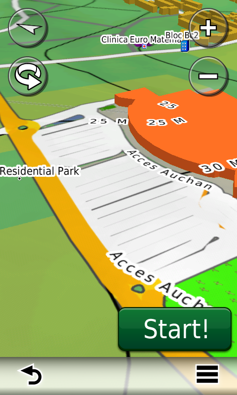
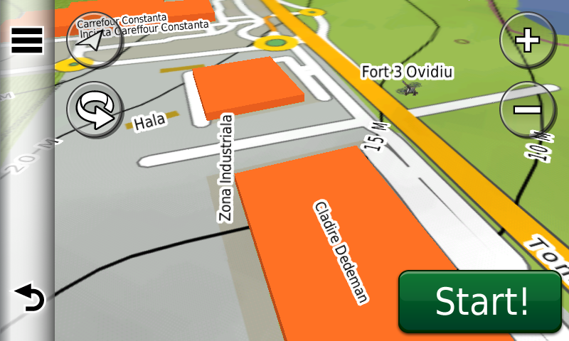
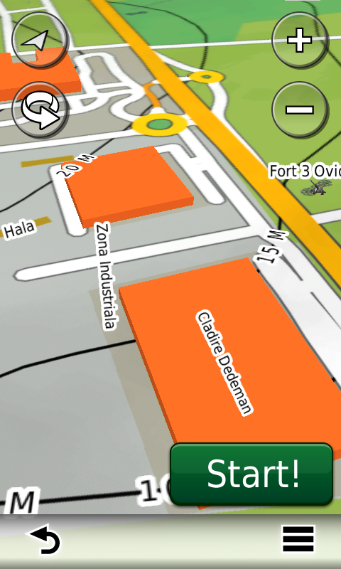
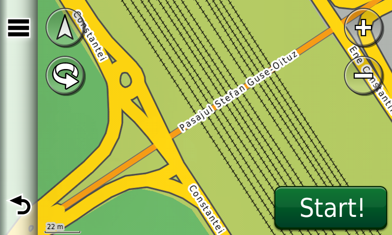
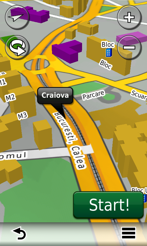
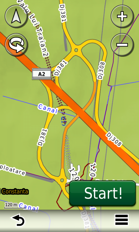
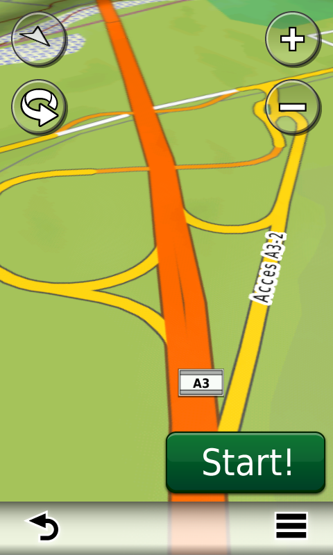
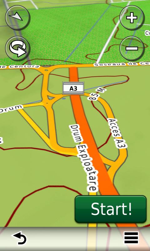
Compared with common maps on the market, the Digital Atlas of Romania has an unequaled level of actuality, in this edition one being able to find the newest A3 motorway (between Ploieşti and Bucureşti) with the complete Snagov bypass and the complete A2 motorway (from Cernavoda to Medgidia), with the ruttier bypass in Valea Dacilor, the extended A4 ring (from Constanţa to Ovidiu), the overhead passage from Craiova, the undeground passages from Bacău (between Oituz and Ştefan Guşe) and Corbeanca (Prisma), the underground passage to Carrefour Tom in Ovidiu, the ruttier bridge over the Cibin in Sibiu, the Popişteanu Cristian breakthrough in Bucureşti, the access to the commercial centres Maritimo from Constanţa and Lidl from Fălticeni, the Coresi link in Braşov together with many recent residential areas (A.N.L. subdivision Henri Coandă, the residential areas FeliCity, Upground, Quadra Place, Greenfield Residence, etc. from Bucureşti, Militari Residence from Roşu, Ibiza Sol, Ibiza Golf and Oxford Gardens from Voluntari, etc.), together with many one way streets and 38 (thirty-eight) roundabouts that have been implemented in the last three months.
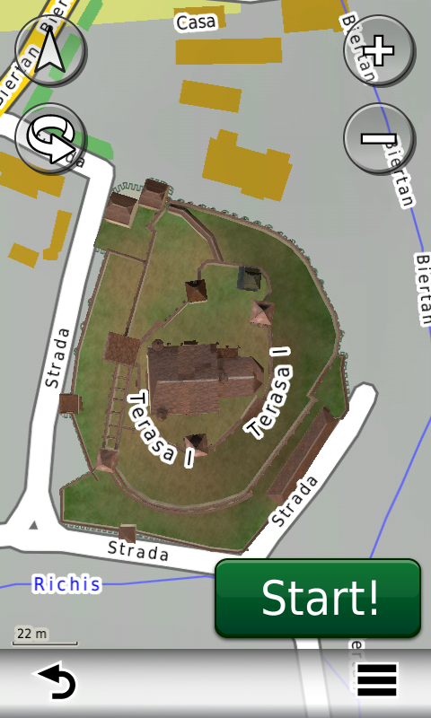
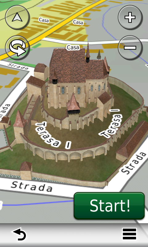
The 3D model gallery has been enriched with the detailed representation of the fortified evangelic church from Biertan.
All natural parks and reserves in Romania have been updated in this edition to the latest boundaries, types and denominations published by the Ministry of the Environment in 2011.
History aficionados will discover in this edition in premiere the detailed elements of the iron age stronghold from Herneacova, the e-Neolithic fortified settlements of the Precucuteni Culture from Târpeşti – Râpa lui Bodai, the Cucuteni Culture from Ruginoasa – Dealul Drăghici, the Vădastra Culture from Vădastra – Dealul Cişmelei, the Linear Ceramics Culture from Isaiia – Balta Popii, of the bronze age and Latene fortress of Năeni – Zănoaga, of the Latene fortresses from Pietroasele – Gruiu Dării and Todireşti – La Şanţuri.
Featuring an original concept, with quarterly updates, the result of the work of the experts and contributors of the Digital Romania Project team, the Digital Atlas of Romania is the choice of professionals in all fields and the preferred navigation tool for all nature goers.
This edition has 484 MB in size and runs exclusively on Garmin navigation equipment, an updated list of compatibility being available at the below link:
http://www.rqa.ro/produs.php?id=442&subcat_id=39&cat_id=19
Warning!
The use of ROAD2012.40 map can create addiction to quality, value, functionality and beauty!


Pingback: RO.A.D.2012, noile hărți GPS pentru România de la Garmin
Buna . am si eu harta si as avea unele “probleme ” cu ea . Acum sa fie din cauza hartii sau nu este calibrat bine GPS cu harta .
In mers la viteze destul de ok 20 30 Km /h mie imi arata ca mai am pana ajung in intersectie sau pana cand apare in drum la dreapta dar in realitate sunt deja in intersectie sau in dreptul drumului care o ia la dreapta .
Stimate Domnule Radu,
M-ar ajuta ceva mai multe informatii apropo de locatia unde ati intampinat asemenea “probleme”.
Cat mai precis posibil. Banuiesc ca e vorba de undeva in Romania, ca aveati/nu aveati alta harta bifata, etc.
Multumesc.
daca imi furnizati o adresa de mail o sa va atasez poze si locatia exacta .
Ca si idee mi se intampla in zona transilvaniei ( Sighisoara , Rupea si Brasov (aici putin ca nu am putut sa fiu atent la el )
Adresa de email este cea de pe care ati primit pana acum toate actualizarile la harta.
va voi trimite pe acea adresa .
Buna ziua,din pacate harta Deltei Dunarii este la pamant…am fost acum doua saptamani si in afara de bratele principale nu-mi arata nimic altceva,gen canale,ghioluri,lacuri,etc.In afara de asta locatia GPS este cu mult in afara punctului real in care ma aflu eu.Exemplu:daca sunt pe Sf.Gheorghe,pe mijlocul bratului,cu salupa,stationand,GPS-ul imi arata ca sunt pe mal,undeva la 200 de metri.Am achizitionat acest Garmin strict pentru harta Deltei,dar din pacate dezamagirile au aparut destul de repede…Va doresc numai bine si sper ca intr-un viitor foarte apropiat sa redati utilizatorilor de Garmin increderea mult asteptata!
Stimate Domnule Busca,
Din ce-mi spuneti Dvs. aici este evident ca ati uitat sa bifati harta ROAD pe aparatul Dvs. si ati navigat in Delta cu harta de baza…
Pe când o variantă pentru smartphone?
Bună dimineaţa,
Atâta vreme cât ne vom ocupa de distribuţia Garmin în România, această opţiune este exclusă.
Cele bune,
Bogdan Condurăţeanu
Buna ziua,
mai aveti o estimare pentru varianta mapsource?
Imi place sa planific urmatoarea tura in fata computerului,
pe o rezolutie decenta, sa uploadez ruta in echipamentul garmin,
ca apoi sa o urmez.
Buna Ziua,
Nu.
Buna ziua
Cine a cumparat Road 2012.10 beneficiaza gratuit de update-urile .20, .30, .40 ?
Eu am o harta mai veche (de care sunt inca multumit) si as vrea sa stiu daca cumpar Road 2012.40 voi beneficia si de update-urile ulterioare.. ori mai astept pana mai apar ceva update-uri sa am o harta cat mai noua avand in vedere ca cea actuala face deocadmata fata onorabil.
Bună Ziua,
În general, nu. Doar dacă a cumpărat aparatul de la noi cu actualizări gratuite la ROAD. Altminteri, metoda de a obţine actualizări gratuite la harta ROAD, în condiţiile în care respectivul deţine deja o licenţă de ROAD mai veche, este achiziţionarea unui abonament AllROAD
http://www.garmin.ro/produs.php?id=444&subcat_id=39&cat_id=19:
Cu fiecare actualizare aducem foarte mult conţinut nou şi corecţii şi adăugiri la cel existent. Este foarte posibil aşadar ca ultima actualizare pe care o vom scoate să fie cea mai bună… Până atunci, ROAD2012.40 este cea mai bună hartă de navigaţie din România.
Cele bune,
Bogdan Condurăţeanu
Buna ziua,
Am un Oregon 550 si un Zumo 660. Vreau sa cumpar ROAD 2012.40.
Voi putea sa-l folosesc pe ambele?
Multumesc!
Doua aparate necesita doua licente de ROAd2012.40.
Cele bune,
Bogdan Condurateanu
BUNA ZIUA,
Am in prezent un sistem multimedia Kenwood, pe care am instalata versiunea ro.a.d. 2008. Aparatul are integrat sistemul Garmin. Pot achizitiona si folosi ro.a.d. 2012? Va multumesc.
Buna Ziua,
Deocamdata nu. Ce model de Kenwood, mai exact?
Cele bune,
Bogdan Condurateanu
Buna ziua, este vorba de KENWOOD model 5240BT. Multumesc.
Buna Ziua,
O sa-l avem in vedere cu prioritate, daca o sa ajungem la stadiul acela.
Cele bune,
Bogdan Condurateanu