RQA, a Garmin technology dealer in Romania, has the pleasure to announce the availability of the new edition of the Digital Atlas of Romania v14.10, RO.A.D.2022.10.
Continuing in the well known tradition for the Romanian Garmin customers, the Digital Atlas of Romania holds on to the number one place in the GPS road navigation map charts by bringing an extra 1,818.39 km of roads up to a grand total of 469,398.3 km and the number of POIs raises in this edition to a staggering 980,947 points divided into 536 categories.
RO.A.D.2022.10 is the only GPS navigation map in the world that combines topographic details with a routable road network – including dirt roads and trails – with postal addresses of unequaled precision, towns with extruded 3D blocks of flats and detailed 3D textured models for both old patrimony buildings and new skyscrapers, true landmarks of today’s urban space. Map updates are constant and consistent from one edition to another and are documented in the Map Diaries, where all the contributions and their respective authors are mentioned together with the names of the cities and the map tiles that have changed.
Compared with common maps on the market, the Digital Atlas of Romania has an unequaled level of detail, coverage and actuality, featuring the final configuration of the the new bridge over Mureş towards Şeuşa, the new bridge from Bulz as well as the official trails, roads and tourist markings from Bihor county.
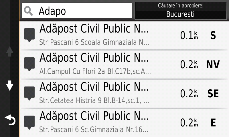
The railroads from marshalling yards from Cernavodă, Craiova-Nord, Filiaşi, Fundulea, Lehliu-Gară, Săruleşti-Gară and Balş have been mapped. Introduced the public fallout shelters from Romania as points of interest with addresses and the most recent version of Romanian administrative boundaries as line and polygon based on data from ANCPI dated 23.12.2021.
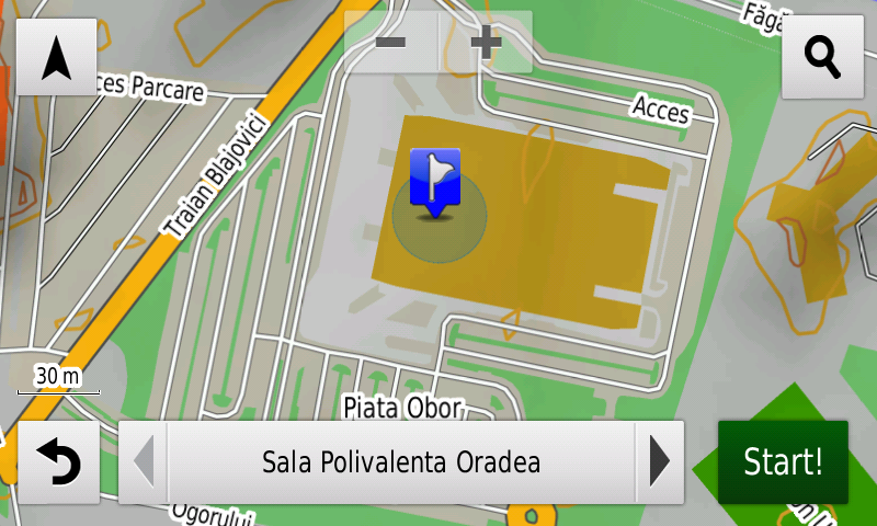
The villages Teşila, Trăisteni, Bâldana, Tărtăşeşti, Boteni, Biţina-Pământeni, Biţina-Ungureni, Chiroiu-Ungureni, Gherghina, Ţibrinu, Mircea Vodă, Satu Nou (Mircea Vodă), Nisipari, Castelu, Remus Opreanu, Peştera, Veteranu, Izvoru Mare, Ivrinezu Mic, Ivrinezu Mare, Saligny (partially), Făclia (partially), Mihail Kogălniceanu, Oituz, Darabani şi Cernavodă (including individual block stairs) have been introduced at individual street The Traditional Fishing Village from Tulcea and detailed access to the Mihail Kogălniceanu Airport, CNE Cernavodă, Carrefour Logistic Deva, Parcul Industrial Sud from Bistriţa and the new Sală Polivalentă from Oradea have also been mapped.
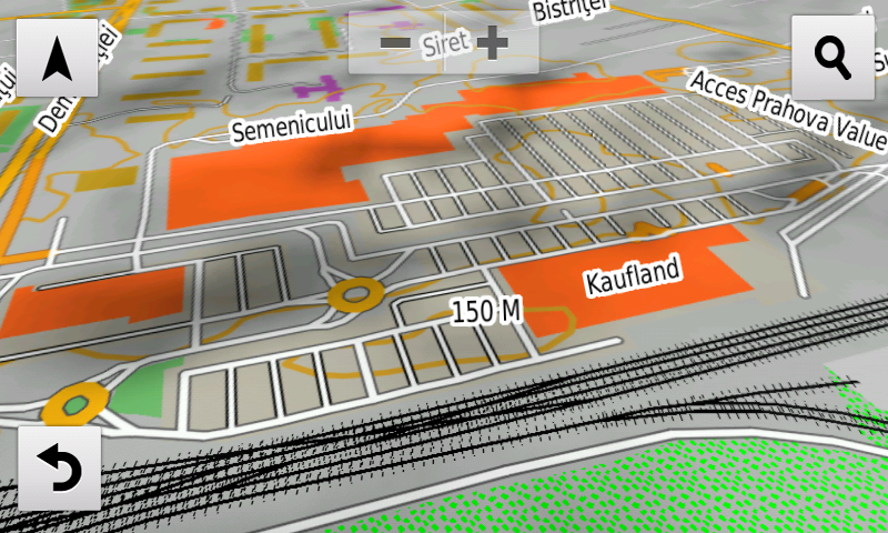
Detailed acces to the retail stores: Penny Siret, Lidl Poienilor from Braşov, Carrefour Market Cernavodă, Intercora, Lidl and Penny Tulcea, Penny Market Filiaşi, Brick Mangalia, Kaufland Tudor Vladimirescu from Alba Iulia, Prahova Value Centre from Ploieşti, Profi Adjud, Shoping Park and Profi Calea Călăraşilor from Brăila, Penny Market, Jysk, Unicarm and Lidl from Carei, the two Penny Market stores from Zalău as well as the Zalău Value Centre, Lidl, Penny Market and Mega Image from Giroc, Lidl Calea Torontalului from Timişoara, Lidl Belşugului from Bucureşti, Penny Cloşca, Lucian Blaga and Henri Coadă from Satu Mare and Penny Market Bolintin-Deal. New oneway streets and speed restrictions have been added together with 41 (fortyone) new roundabouts.
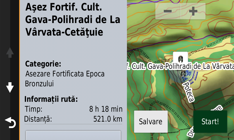
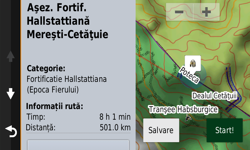
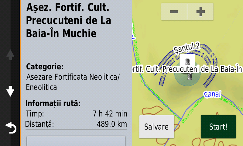
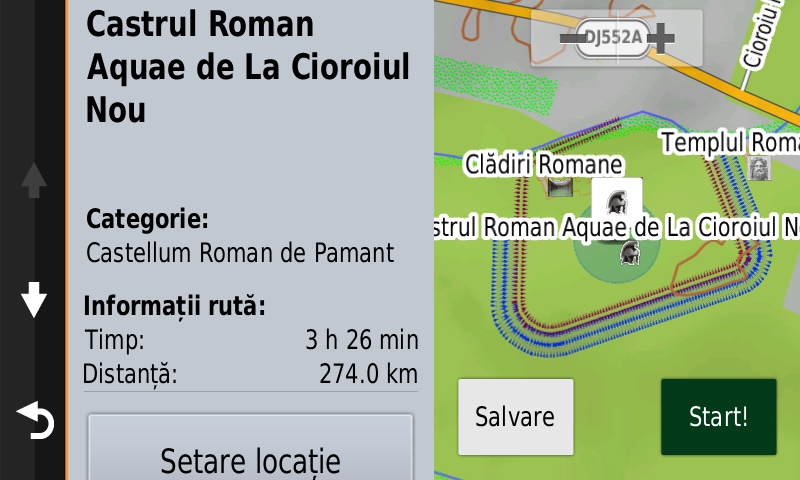
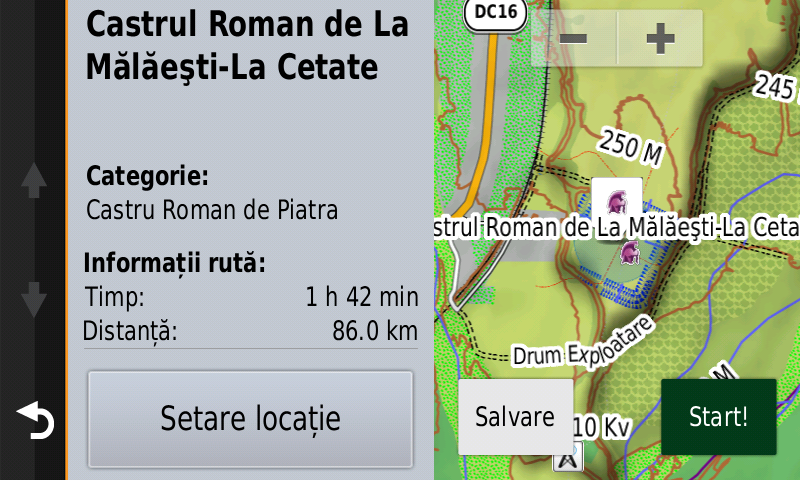
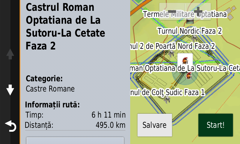
History aficionados will discover in this edition in premiere the detailed elements of the Precucuteni fortified settlement from Adâncata-Dealul Lipovanului (point, ditches), of the Cucuteni B fortified settlement from Varvata-Cetăţuie (point, ditches), of the Precucuteni fortified settlement from Baia-În Muchie (point, ditches), of the Hallstatt fortified settlement from Mereşti-Cetăţuie (point, ramparts, ditches), the Siret-Cărămidăria Beill/Horodiştea/Zamca fortified settlement’s point has been re-positioned. The detailed elements from the late Hallstatt fortifications from Şendriceni-Dealul Ţiclău/Cetate and Văculeşti-Dealul Podiş (point, rampart, ditch), of a previously unknown fortification of an undetermined age from Brăeşti-Dealul Palanca (point, ditch), of what appears to be a previously unknown prehistoric fortification of barred promontory type from Râmnicu Vâlcea-Dealul Cetate (point, rampart, ditch) and of a what appears to be a previously unknown prehistoric fortification of barred promontory type from Cheia (point, rampart, ditch) were mapped. There were also added the detailed elements of a previously unknown presumed roman fort at Gălbiori (point, rampart, fossa), of the Roman castrum and thermae from Sfârleanca-Mălăeştii de Sus (fossae, walls), of the two Roman castra, civilian thermae, roads and other various roman buildings from Sutoru-Optatiana (points, fossae, walls), of the Aquae Roman castrum from Cioroiu Nou (vallum, fossae, thermae and various other buildings and kiln), of the newly discovered tower and thermae of the Roman-Byzantine fortress of Capidava as points of interest and polygons. The Roman late castrum from Izvoarele-Dealul Consul has been repositioned and what appears to be a Roman fortification as well as the modern trenches and the antitank ditch from Iulia were added together with a previously unknown artillery battery from Cernavodă (point, rampart), the modern trenches from Târguşor, a previously unknown artillery fort from Ţibrinu (point, rampart, ditch), and two previously unknown fortifications, most likely modern, at Pantelimon – Valea Seacă (point, rampart, ditch). The detailed elements (points, lines, polygons) of the tumulus Slavic necropolis from Nuşfalău-Vulpişte were mapped together with the Habsburg trenches (point, line) from Mereşti-Cetăţuie, the Hungarian WW2 fortifications from Huedin as well as the trace of the antitank ditch from Brăeşti-Dealul Cerinca and the temporary state boundary between Romania and Hungary due to the 1940 Wien Diktate. The commemorative heroes monuments and cemeteries from Iaşi county were introduced as points together with the First World War monument and cemetery from Finta. Various other heroes’ commemorative monuments from the two world wars have been mapped as well.
Featuring an original concept, with updates three times a year, the result of more than 18 years of continuous development of the experts and contributors of the Digital Romania Project team, the Digital Atlas of Romania is the choice of professionals in all fields and the preferred navigation tool for all nature goers.
This edition has 1.64 GB in size and runs exclusively on Garmin navigation equipment, an updated list of compatibility being available at the below link:
http://www.rqa.ro/produs.php?id=442&subcat_id=39&cat_id=19
Warning!
The use of RO.A.D.2022.10 map can create addiction to quality, value, functionality and beauty!