RO.A.D.2020.30 Launch
RQA, a Garmin technology dealer in Romania, has the pleasure to announce the availability of the new edition of the Digital Atlas of Romania v12.30, RO.A.D.2020.30.
RO.A.D.2020.30 is the only GPS navigation map in the world that combines topographic details with a routable road network – including dirt roads and trails – with postal addresses of unequaled precision, towns with extruded 3D blocks of flats and detailed 3D textured models for both old patrimony buildings and new skyscrapers, true landmarks of today’s urban space. Map updates are constant and consistent from one edition to another and are documented in the Map Diaries, where all the contributions and their respective authors are mentioned together with the names of the cities and the map tiles that have changed.
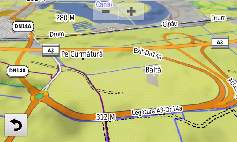
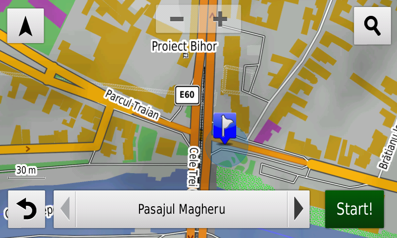
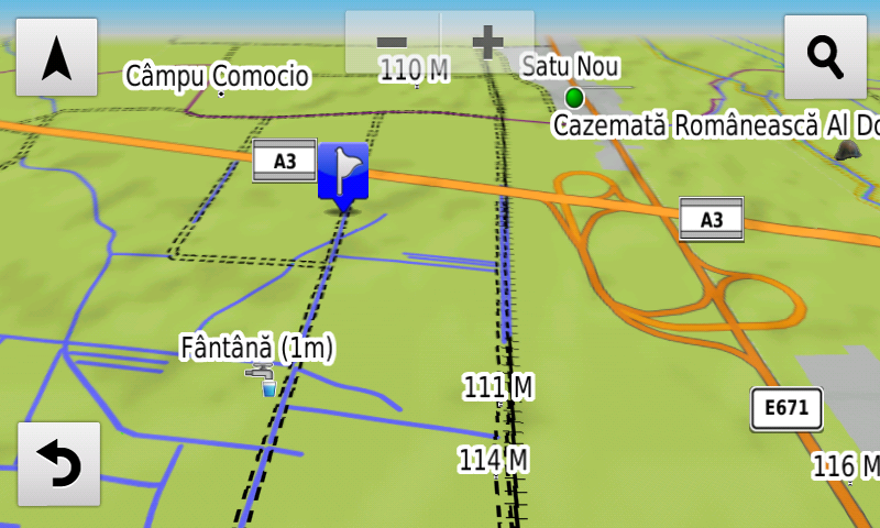
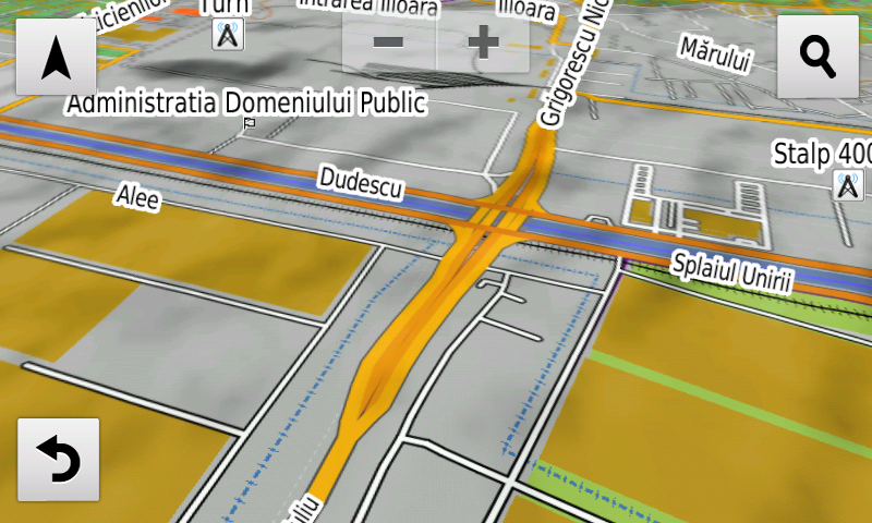
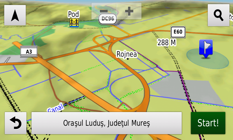
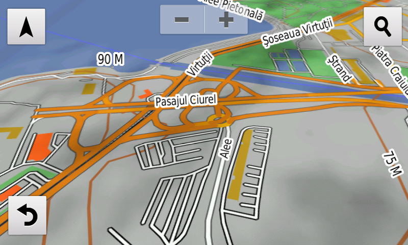
Compared with common maps on the market, the Digital Atlas of Romania has an unequaled level of detail, coverage and actuality, featuring, the North Eastern ringlet of Caracal, the A3 overpass from Iernut, the reintroduction of automatic routing at the Dobra A3 node, the expressway with E671 label North of Oradea, the Borş-Biharia lot of the A3 motorway, the Magheru underground passage from Oradea, the alternate temporary deviation of E81 on the future A10 link at Alba Iulia Nord, the DN2F deviation from Bacău, the Vinerea ring road, the new bridge over Suceava river from Suceava, the Cheţani-Iernut segment from A3 motorway, the routier node from Cheţani, the service exits from Luduş, the Nicolae Grigorescu, Ciurel şi Doamna Ghica-Petricani overpasses, two separate ways on Fabrica de Glucoză, Şoseaua Alexandriei, Prelungirea Ghencea şi Calea Şerban Vodă arteries from Bucureşti.
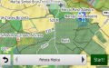
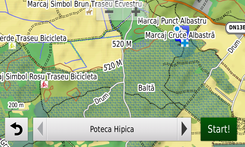
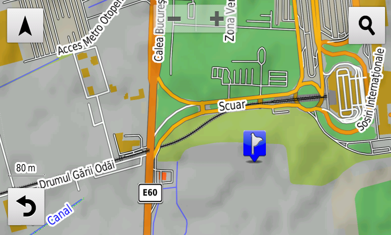
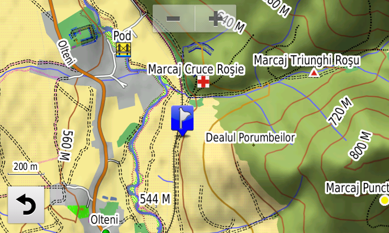
The touristic trails and markings have been introduced in Retezat, Bodoc and Ciomatul Mountains and in the Mestecănişurile reserve from Reci, the wooden trailway from the Sic reserve, the Via Transilvanica markings and the introduction of tourist markings for all roads certified as such in the Bistriţa-Năsăud county. Legal speed limits have been introduced in the entire map for high importance roads. The train marshalling yards from Caracal, Reghin, the train overpass from Henri Coandă airport at Otopeni, the tramway marshalling yard from Colentina have been introduced together with the underground stations of Drumul Taberei from Bucureşti.
Detailed acces to the retail stores: Penny Market Roman, Penny and Lidl Haţeg, Lidl and Penny Market from Motru, Shopping City Târgu Mureş, Lidl Rădăuţi, Lidl and Penny Market Caracal, Lidl Roman, Penny Market Mangalia, Lidl and Penny Market Galaţi, Lidl ex 1Mai from Ploieşti, Lidl Deva, Lidl and Kaufland Gherla, Profi Sântandrei and Dedeman Oradea shop + logistic center andLidl Calea Borşului, Penny Market Râmnicu Vâlcea, Dâmboviţa Mall from Târgovişte, Altex Calea Radnei Timişoara, Lidl Suceava and Iulius Mall Suceava, Lidl Blejoi, Lidl Coralilor Bucureşti and Lidl and La Strada from Bragadiru. New oneway streets and speed restrictions have been added together with 54 (fiftyfour) new roundabouts.
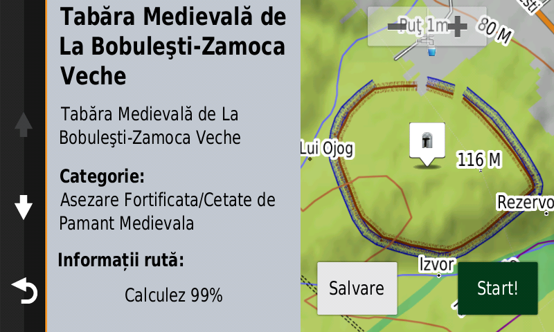
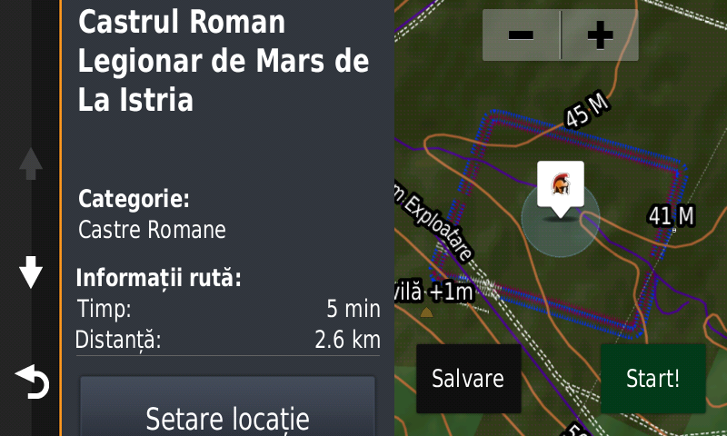
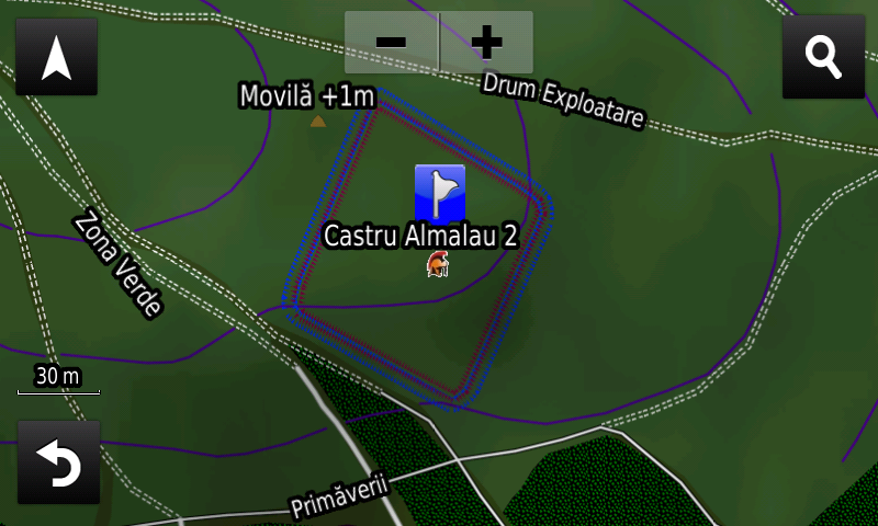
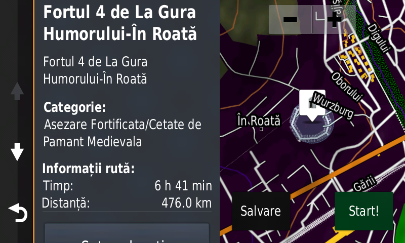
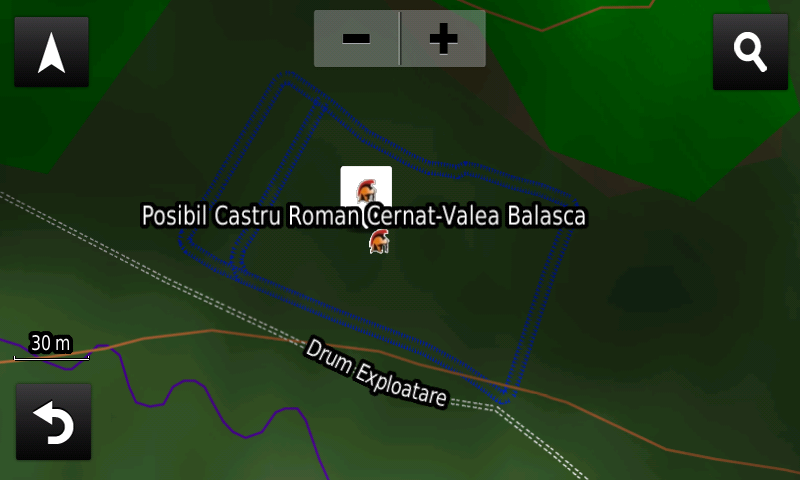
History aficionados will discover in this edition in premiere the detailed elements (ramparts, ditch) of the iron age fortress from Dochia-Cetăţuia Sărăţica/La Movilă, the detailed elements (ditches) of a possible Roman march castrum previously unknown at Cernat-Valea Balaşca, the detailed elements (earthen vallum) of Brazda lui Novac de Nord from Piscupia Forest, it was mapped what look like the remains of the Roman road Drumul de Rouă South of Reşca, the detailed elements (ditches) of two fortifications, possibly Roman, at Viile, the detailed elements (rampart, ditch) of the Roman march castrum from Almalău 2, the detailed elements (rampart, ditch, western gate) of the roman legion march castrum from Istria, the Roman earthen vallum from Mirşid-Dealul Fericea, the detailed elements (rampart, ditch) of the Roman Burgi from Uriu and Sita-Dealu Sâtii, the detailed elements (tower, gates, walls, interior buildings) of the Russian medieval fortress from Iaşi, the detailed elements (ramparts) of the medieval stronghold Kika Roşie from Sadoveni, the detailed elements (rampart, ditch) of the fortified medieval camp from Bobuleşti-Zamoca Veche and were also added the detailed elements (rampart, ditch) of the 4 Habsburg pre-modern forts from Gura Humorului. Various heroes commemorative monuments from the two world wars have been mapped as well.
Featuring an original concept, with updates three times a year, the result of almost 17 years of continuous development of the experts and contributors of the Digital Romania Project team (www.romaniadigitala.ro), the Digital Atlas of Romania is the choice of professionals in all fields and the preferred navigation tool for all nature goers.
This edition has 1.03 GB in size and runs exclusively on Garmin navigation equipment, an updated list of compatibility being available at the below link:
https://www.rqa.ro/produs.php?id=442&subcat_id=39&cat_id=19
Warning!
The use of RO.A.D.2020.30 map can create addiction to quality, value, functionality and beauty!
-

- NODUL RUTIER IERNUT, AUTOSTRADA A3, ÎN-ROAD2020.30 PE NUVICAM
-

- PASAJUL SUBTERAN MAGHERU DIN ORADEA ÎN ROAD2020.30 PE NUVICAM
-
- NODUL RUTIER BIHARIA, AUTOSTRADA A3, ÎN ROAD2020.30 PE NUVICAM
-
- PASAJUL SUPRATERAN NICOLAE GRIGORESCU DIN BUCUREŞTI ÎN ROAD2020.30 PE NUVICAM
-

- NODUL RUTIER CHEŢANI AUTOSTRADA A3 ÎN ROAD2020.30 PE NUVICAM
-
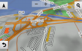
- PASAJUL CIUREL DIN BUCUREŞTI ÎN ROAD2020.30 PE NUVICAM
-
- MARCAJE TURISTICE ÎN REZERVAŢIA MESTECĂNIŞURILE-RECI ÎN ROAD2020.30 PE NUVICAM
-
- CASTRUL ROMAN LEGIONAR DE MARŞ DE LA ISTRIA ÎN ROAD2020.30 PE NUVICAM
-
- NOUL POD DIN SUCEAVA ÎN ROAD2020.30 PE NUVICAM
-
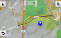
- PASAJUL FEROVIAR DE LA OTOPENI ÎN ROAD2020.30 PE NUVICAM
-
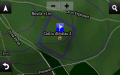
- CASTRUL ROMAN DE LA ALMALĂU 2 ÎN ROAD2020.30 PE NUVICAM
-

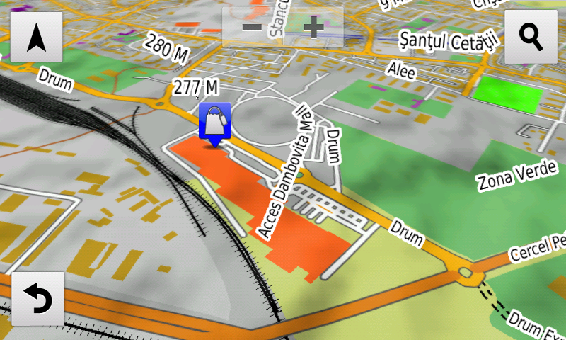
- DÂMBOVIŢA MALL TÂRGOVIŞTE ÎN ROAD2020.30 PE NUVICAM
-

- FORTUL 4 DE LA GURA HUMORULUI-ÎN ROATĂ ÎN ROAD2020.30 PE NUVICAM
-
- MARCAJE TURISTICE ÎN MUNŢII BODOC ÎN ROAD2020.30 PE NUVICAM
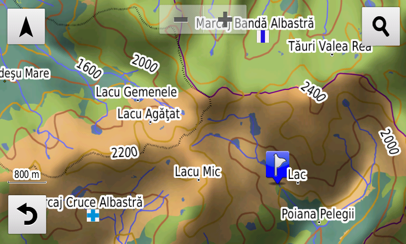
-
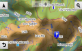
- MARCAJE TURISTICE ÎN REZERVAŢIA NATURALĂ RETEZAT ÎN ROAD2020.30 PE NUVICAM
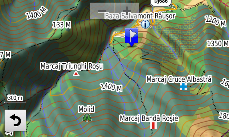
-
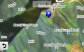
- MARCAJE TURISTICE ÎN RETEZAT-RÂUŞOR ÎN ROAD2020.30 PE NUVICAM
-
- POSIBIL CASTRU ROMAN DE MARŞ INEDIT LA CERNAT-VALEA BALAŞCA ÎN ROAD2020.30 PE NUVICAM
-
- TABĂRA MEDIEVALĂ DE LA BOBULEŞTI-ZAMOCA VECHE ÎN ROAD2020.30 PE NUVICAM