RO.A.D.2021.01 Launch
RQA, a Garmin technology dealer in Romania, has the pleasure to announce the availability of the new edition of the Digital Atlas of Romania v13.01, RO.A.D.2021.01.
Continuing in the well known tradition for the Romanian Garmin customers, the Digital Atlas of Romania holds on to the number one place in the GPS road navigation map charts by bringing an extra 1,907.52 km of roads up to a grand total of 462,681.85 km and the number of POIs raises in this edition to a staggering 940,591 points divided into 531 categories.
RO.A.D.2021.01 is the only GPS navigation map in the world that combines topographic details with a routable road network – including dirt roads and trails – with postal addresses of unequaled precision, towns with extruded 3D blocks of flats and detailed 3D textured models for both old patrimony buildings and new skyscrapers, true landmarks of today’s urban space. Map updates are constant and consistent from one edition to another and are documented in the Map Diaries, where all the contributions and their respective authors are mentioned together with the names of the cities and the map tiles that have changed.
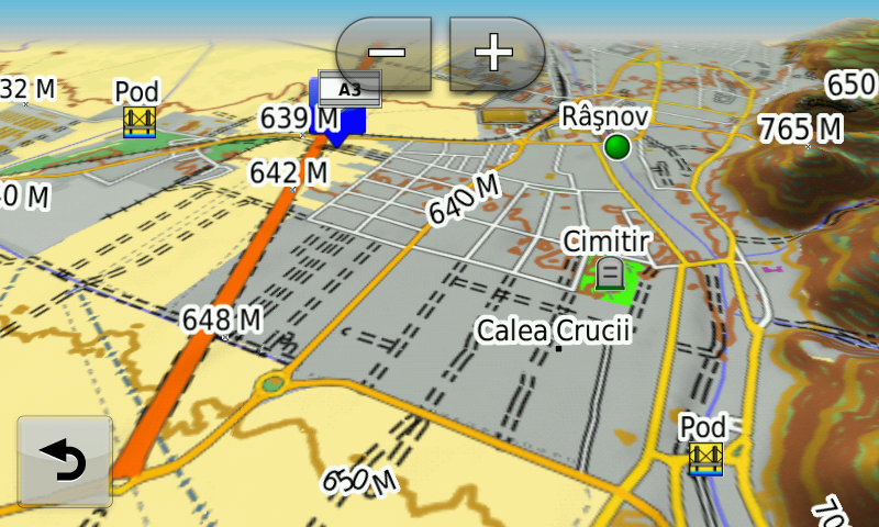
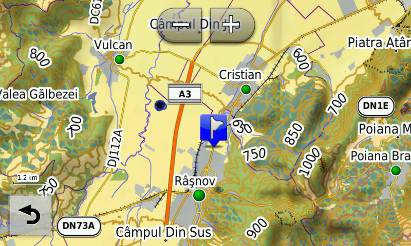
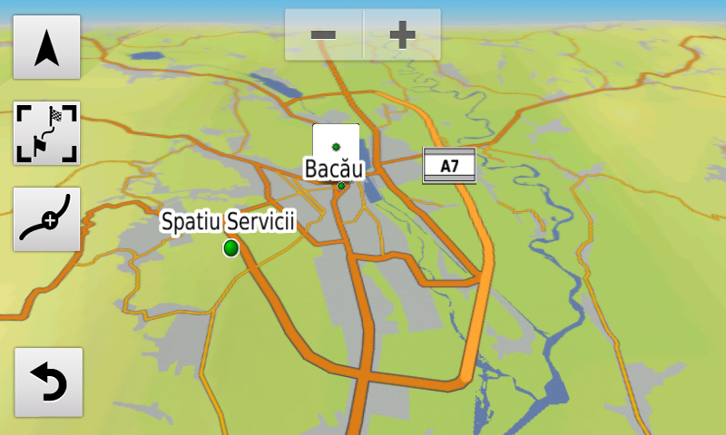
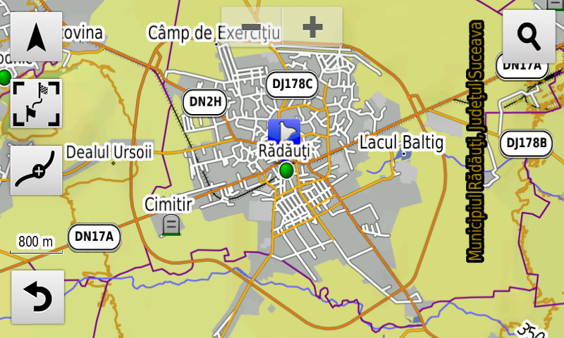
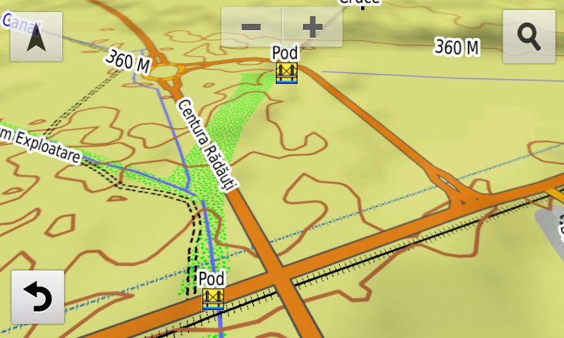
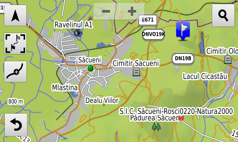
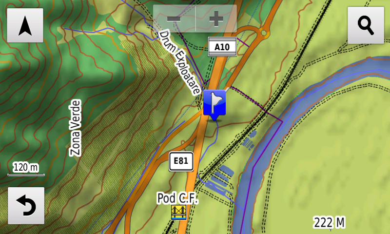
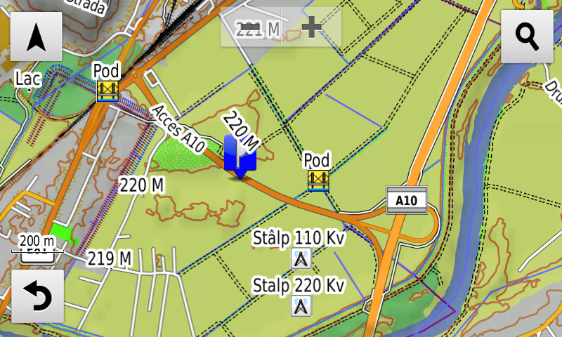
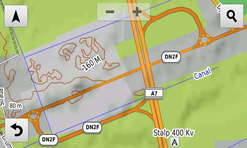
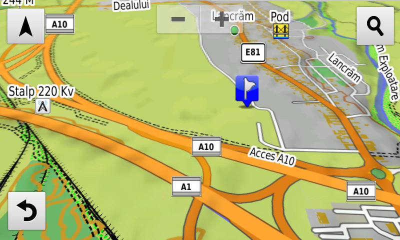
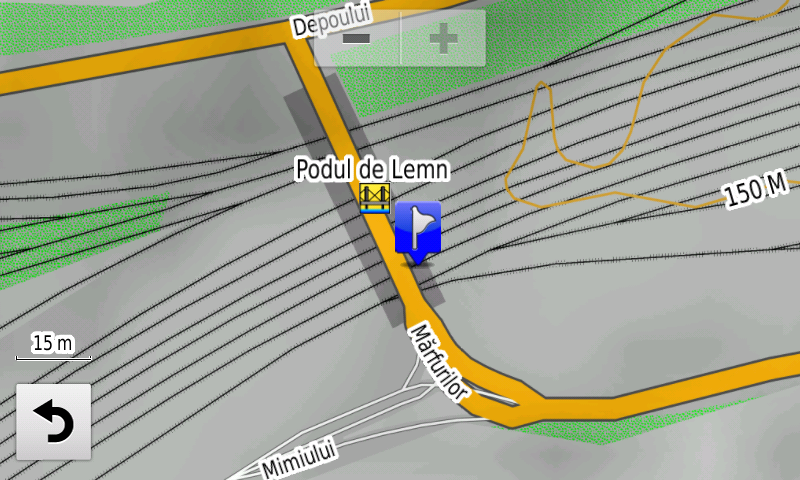
Compared with common maps on the market, the Digital Atlas of Romania has an unequaled level of detail, coverage and actuality, featuring the Rings of Rădăuţi, Săcueni, Bacău – including the A7 motorway portion – the DN2F node from Bacău on the A7 motorway, the 1st lot of the A10 motorway with Alba Iulia South and North nodes, the Sebeş node on the 1st lot of A10 motorway, the Râşnov Ring, including the A3 motorway portion and the link to DN73, the new Arterial DJ109G from Bărcăneşti; acces has been reintroduced on the high bridge over the Argeş river South of Adunaţii-Copăceni, speed restrictions on A1 motorway on the 2nd lot Lugoj-Deva between Ilia and Holdea have been cancelled, the road passage Universităţii from Oradea, the Joiţa node from the A1 motorway and the „Wooden Bridge” from Ploieşti have also been added.
.
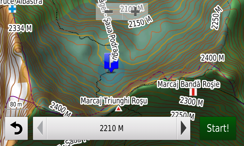
The touristic trails and markings have been introduced in the Făgăraş Mountains and in the Buila-Vânturariţa National Park.
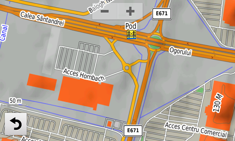
Detailed acces to the retail stores: Baia Mare Value Centre and Selgros Baia Mare, Penny Market Focşani Vâlcele, Deco Flora Snagov, Dedeman Călăraşi, Lidl 1 Decembrie, Hornbach Oradea and Kaufland Oradea Calea Clujului, Kaufland Bragadiru, Mega Image Jilava, Mega Image Roşu, Penny Market Făgăraş, Kaufland Ferentari, Mega Image Concept Store and Decathlon Băneasa, Kaufland Odăii, Penny Market Fizicienilor, the Dedeman Giurgiului Extension and Profi Berceni from Bucharest. New oneway streets and speed restrictions have been added together with 43 (fortythree) new roundabouts.
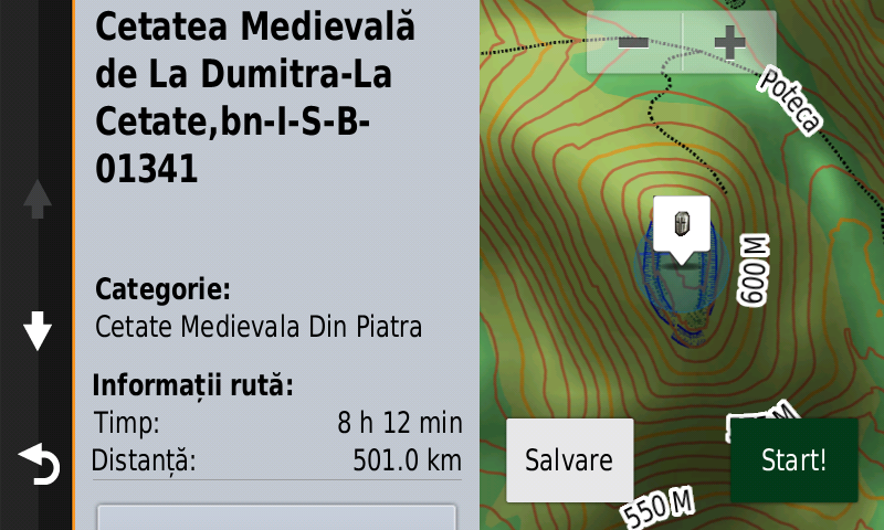
History aficionados will discover in this edition in premiere the detailed elements (rampart, ditch) of the prehistoric stronghold from Valea Leşului-Cetăţuia, the detailed elements (rampart, ditch) of an unknown bronze age fortification from Mirşid-Secătura, the detailed elements (rampart, ditches) of a previously unknown prehistoric fortification at Ghinda-Dealul Corbului, the detailed elements (wall) of the roman tower and the rampart of the Dacian stronghold from Mirşid-Poguior, a previosly unknown earthen vallum, probably Dacian, at Mirşid-Poguior, several tumuli on the ridge of the Pietros Hill, two possible Roman march castra at Mirşid and Creaca previously unknown, a possible Roman tower at Băbeni, the detailed elements (ramparts, ditch) of the Roman Burgus from Hurez-Poic, two possible Roman towers, previously unknown, at Dumitra and a possible Roman tower, previously unknown, at Rebrişoara-Pădurea Hohen Eichen, the detailed elements (rampart, ditch) of the Roman earth vallum from Zalău (Vârful Păstaie-Sub Păstaie), of the Roman earth vallum from Prodăneşti-Pe Şanţ, the detailed elements (ditch) of the Roman Burgi from Negreni-Cetatea lui Cimpoca, Hodişu-Dosu Turcului, and Hurez-Dealu Secuiului, the Roman tower from Treznea-La Şuvar, as a named point and the Roman vallum gate from Treznea-Sub Păstaie, as a point; a portion of the Roman road from Geoagiu has been mapped, the aspect of the quadriburgium from Mircea Vodă has been updated, the detailed elements (rampart) of the early medieval fortified settlement from Tărtăria-Gura Luncii, the detailed elements (point, walls, ditches) of the Medieval Fortress from Dumitra-La Cetate, a previously unknown construction from Almaşu, many trenches and what looks like an antitank ditch at Jibou, a series of casemates and addings to the antitank ditch from Techirghiol have also been mapped. Various heroes commemorative monuments from the two world wars have been mapped as well.
Featuring an original concept, with updates three times a year, the result of more than 17 years of continuous development of the experts and contributors of the Digital Romania Project team, the Digital Atlas of Romania is the choice of professionals in all fields and the preferred navigation tool for all nature goers.
This edition has 1.58 GB in size and runs exclusively on Garmin navigation equipment, an updated list of compatibility being available at the below link:
http://www.rqa.ro/produs.php?id=442&subcat_id=39&cat_id=19
Warning!
The use of RO.A.D.2021.01 map can create addiction to quality, value, functionality and beauty!