RO.A.D.2019.00 Launch
RQA, a Garmin technology dealer in Romania, has the pleasure to announce the availability of the new edition of the Digital Atlas of Romania v11.00, RO.A.D.2019.00.
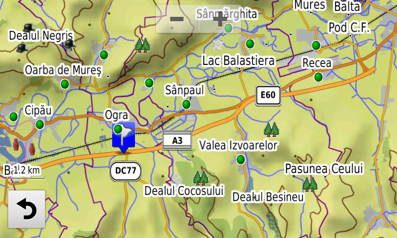
Continuing in the well known tradition for the Romanian Garmin customers, the Digital Atlas of Romania holds on to the number one place in the GPS road navigation map charts by bringing an extra 10,528.40 km of roads up to a grand total of 437,027.57 km, having significant increased coverage added in the counties of Suceava, Mureş, Maramureş, Dolj and Harghita and the number of POIs raises in this edition to a staggering 879,656 points divided into 522 categories.
RO.A.D.2019.00 is the only GPS navigation map in the world that combines topographic details with a routable road network – including dirt roads and trails – with postal addresses of unequaled precision, towns with extruded 3D blocks of flats and detailed 3D textured models for both old patrimony buildings and new skyscrapers, true landmarks of today’s urban space. Map updates are constant and consistent from one edition to another and are documented in the Map Diaries, where all the contributions and their respective authors are mentioned together with the names of the cities and the map tiles that have changed.
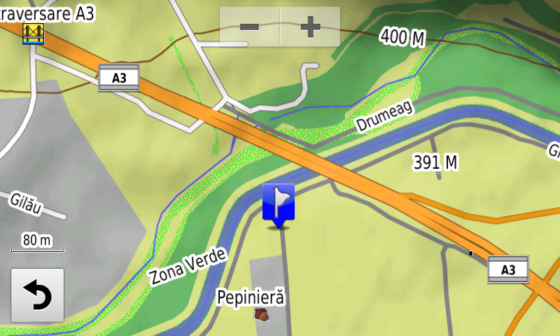
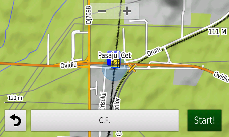
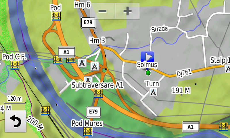
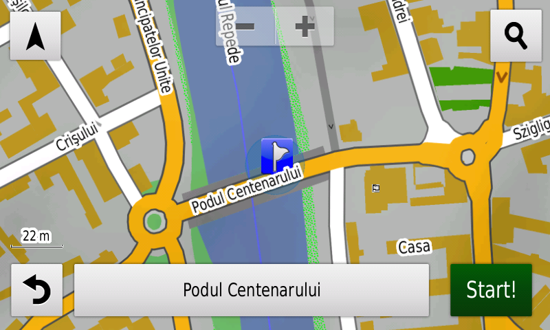
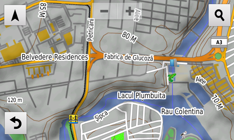
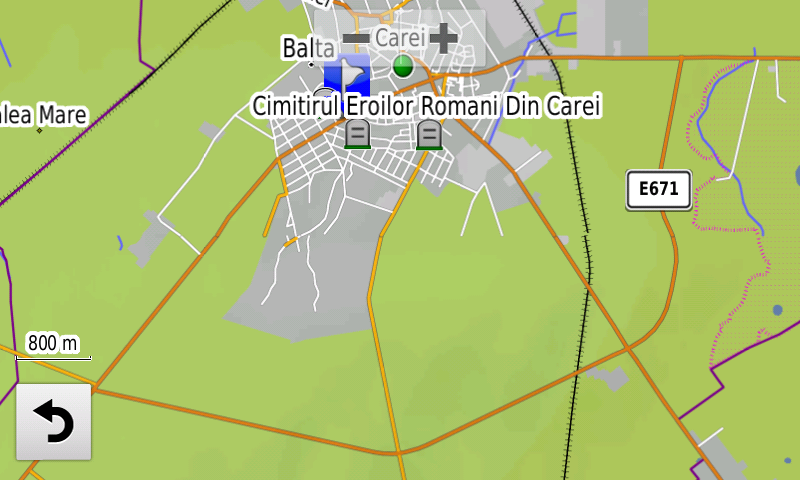
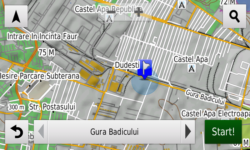
Compared with common maps on the market, the Digital Atlas of Romania has an unequaled level of detail, coverage and actuality, featuring, among others, the bridge over Someş at Gilău on the A3 motorway, the Centennial Bridge from Oradea, the CET overpass across the railroad from Arad, the railroad overpass from Turdaş, the E81 deviation from Pârâu Iovului, the new exclusive pedestrian areas from Hunedoara, the new configuration of the Şoimuş A1 node, the Carei Ring, the A3 motorway Iernut-Ungheni segment, the A1 overpasses from Sinteşti and Zorani, the new rebuilt bridge from Milişăuţi, the new link road between Cazaban street from Oradea and Râturi street from Sântandrei, the access to the A3 motorway from Petricani street and the “urban motorway” between the Gherghiţei and Popasului roundabouts, the two new bridges over Dâmboviţa that service the penetration Nicolae Grigorescu-Dudescu plus double oneway streets on several arterial roads from Bucharest where the two directions of travel were already or have recently been physically separated.
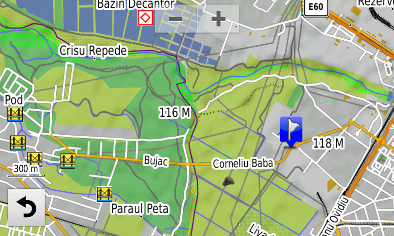
Work has been continued at the Routable Danube Delta v2, that allows automatic rutability for small boats in the Danube Delta and on the Danube between Brăila and Tulcea, with the completion of the legal speed limits for boats implemented on the lakes and canals identified in the ARBDD document, valid from the 15th June 2018. Boat access has been forbidden inside natural reserves Prundu cu Păsări Islands and Ceaplace Island.
In this edition we have postal addresses added in the following towns: SUCEAVA (south), VĂRATEC, SALCEA, PRELIPCA, PLOPENI, MERENI, SILIŞTEA, FĂLTICENI, ŢARNA MARE, LUDUŞ, ROŞIORI, AVRĂMEŞTI, GHEJA, IERNUT, LECHINŢA, SFÂNTU GHEORGHE, CIPĂU, TÂRNĂVENI, SĂLCUD, DEAG, CERGHID, BAHNEA, UNGHENI, MOREŞTI, SĂUŞA, MERIŞOR, BUŞAG, Tăuţii-Măgherăuş (south), BOZÂNTA MARE, MOTIŞ, ULCIUG, SOMEŞ-UILEAC, VICEA, ARDUZEL, CEHU SILVANIEI, ŢICĂU, CHELINŢA, ULMENI, TOHAT, MĂNĂU, ŞOMCUTA MARE, BUCIUMI, VĂLENII ŞOMCUTEI, FINTEUŞU MARE, NADIŞ, BĂILEŞTI, BASARABI, GOLENŢI, BĂLĂŞAN, GHEORGHENI and BORSEC. The block names from FĂLTICENI şi Iernut have been added.
Detailed acces to the retail stores: Dedeman Abatorului from Bacău, Penny Market Sovata and Lidl Alexandru Averescu from Oradea, Lidl and Kaufland from Brăila, Lidl Micro 21 from Galaţi, Lidl Tudor Vladimirescu from Alba Iulia, Roman Value Center from Roman, Kaufland from Carei, Profi and Nepi from Satu Mare, Selgros from Suceava, Lidl and Penny Market from Călăraşi, Penny Market Amaradiei from Craiova, Lidl Berceni, Lidl Şoseaua Sălajului from Bucharest and Lidl from Baloteşti. New oneway streets and speed restrictions have been added together with 47 (fortyseven) new roundabouts.
The solar parks from Copşa Mică, Cristian, Chirileu, Vidrasău, Ucea de Sus and Ucea have been introduced together with the logistic centres Ploieşti Industrial Park, Parcul Industrial Sud from Satu Mare, Parcul Industrial Mureş from Ungheni, the runway from Balta Verde light aircraft airfield, and detailed access to the Poiana Mică Park&Ride and the Silver Mountain from Poiana Braşov.
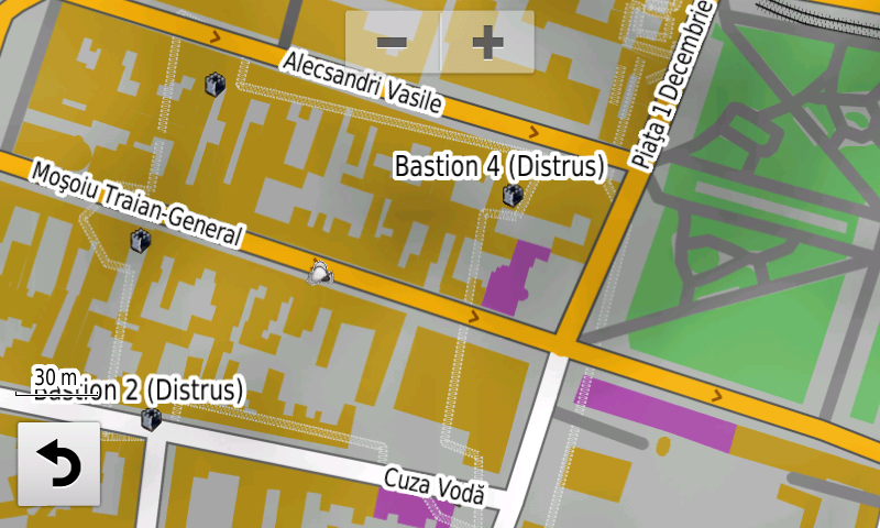
History aficionados will discover in this edition in premiere the detailed elements of a previously unknown fortified settlement, probably prehistoric, from Băzga-Cetăţue (point, ditch), the Gumelniţa Culture settlement from Urlaţi (point), the iron age and medieval fortresses from Bâra-La Cetate (point, ramparts, ditches), the iron age fortress from Moşna-Dealul Cetăţuia (point, ramparts, ditches), the iron age fortress from Vutcani-Vladnic (point, ramparts, ditches), the iron age fortress from Arsura-Mogoşeşti (point, ramparts, ditches), of the geto-dacian stronghold from Dobrovăţ-Cetăţuie (point, ramparts, ditch), of the geto-dacian stronghold from Dagâţa-Cetatea cea Mică a Dagâţei (point, rampart, ditch), of the geto-dacian stronghold from Todirel-Dealul Bobeica (point, presumed rampart, ditches). Two previously unknown fortifications – probably roman burgi – have been discovered and mapped at Gura Văii (point, ramparts, ditches), together with the roman castellum from Răşnov-Cumidava (point, ditch), the thermae of the roman castrum from Hoghiz (point, polygons) the roman harbor APULUM (point), the roman quadriburgium from Greci (point, walls), what appears to be the old roman road in the eastern vicinity of the fortification, the aspect of the basilica from Luncaviţa has been updated, the aspect and position of the roman-byzantine castra XVII, 27, XVI, 26, 25, XV, 24, XIV, 23, 22, 21, XXIX, 35 and XXVIII and of the w, v, u, t and s castella (points, ramparts, ditches) have been updated. The detailed elements (rampart, ditch) of the early medieval stronghold from Dobrovăţ-Palanca have been added together with the destroyed walls, towers and bastions of the Turkish fortifications from Oradea as well as the fort and redoubt 18 north of the city, the First World War German trenches from Ilimbav-La Brazi, the two antiaircraft Flak and the 3 German? casemates from the second world war from Sfântu Gheorghe, the German batteries from the second world war from Patru Fraţi (points and ramparts), the heroes commemoration ensemble from Brăila and other various heroes commemorative monuments from the two world wars.
Featuring an original concept, with updates three times a year, the result of 15 years of continuous development of the experts and contributors of the Digital Romania Project team, the Digital Atlas of Romania is the choice of professionals in all fields and the preferred navigation tool for all nature goers.
This edition has 1.02 GB in size and runs exclusively on Garmin navigation equipment, an updated list of compatibility being available at the below link:
http://www.rqa.ro/produs.php?id=442&subcat_id=39&cat_id=19
Warning!
The use of RO.A.D.2019.00 map can create addiction to quality, value, functionality and beauty!