RO.A.D.2019.17 Launch
RQA, a Garmin technology dealer in Romania, has the pleasure to announce the availability of the new edition of the Digital Atlas of Romania v11.17, RO.A.D.2019.17.
Continuing in the well known tradition for the Romanian Garmin customers, the Digital Atlas of Romania holds on to the number one place in the GPS road navigation map charts by bringing an extra 8,629.47 km of roads up to a grand total of 452,390.87 km, having significant increased coverage added in the counties of Arad, Ilfov, Teleorman, Bihor, Constanţa and Olt and the number of POIs raises in this edition to a staggering 901.514 points divided into 522 categories.
RO.A.D.2019.17 is the only GPS navigation map in the world that combines topographic details with a routable road network – including dirt roads and trails – with postal addresses of unequaled precision, towns with extruded 3D blocks of flats and detailed 3D textured models for both old patrimony buildings and new skyscrapers, true landmarks of today’s urban space. Map updates are constant and consistent from one edition to another and are documented in the Map Diaries, where all the contributions and their respective authors are mentioned together with the names of the cities and the map tiles that have changed.
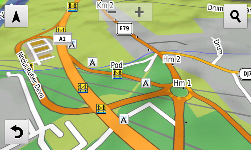
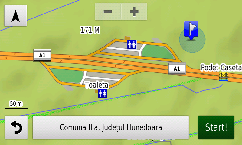
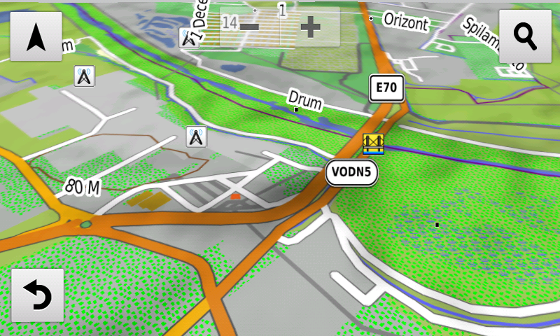
Compared with common maps on the market, the Digital Atlas of Romania has an unequaled level of detail, coverage and actuality, featuring, among others, the new A1 motorway segment between Ilia and Deva and the Maintenance and Coordination center from Şoimuş node on A1 motorway, the VO DN5 South of 1 Decembrie, the new service exits from A1 motorway from Ilia, the A1 acces from Holdea (without automatic routing) and the deviation of DJ105G from Racoviţă. Routability has been denied on the Vereşti bridge and on some Bucharest routes affected by long term construction works.
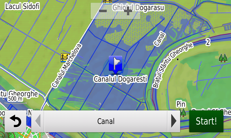
The Mahmudia renaturated area has been introduced.
In this edition we have postal addresses added in the following towns: LIPOVA, ŞOIMOŞ, RADNA, PÂNCOTA, MĂDERAT, MIHĂILEŞTI, POPEŞTI, NOVACI, PRUNI, DUMITRANA, CORNETU, VIDELE, Salonta, Corbu, Vadu, Luminiţa, PIATRA-OLT, ENOŞEŞTI, PIATRA, CRIVA DE JOS, CRIVA DE SUS, TEIŞ, CORBENI, ROMÂNA, ZLĂTĂREI, CONSTANTINEŞTI, CIREAŞOV, BALŞ, SLATINA, SPINENI, DRĂGĂŞANI and BISTRIŢA NOUĂ.
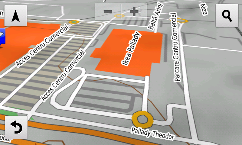
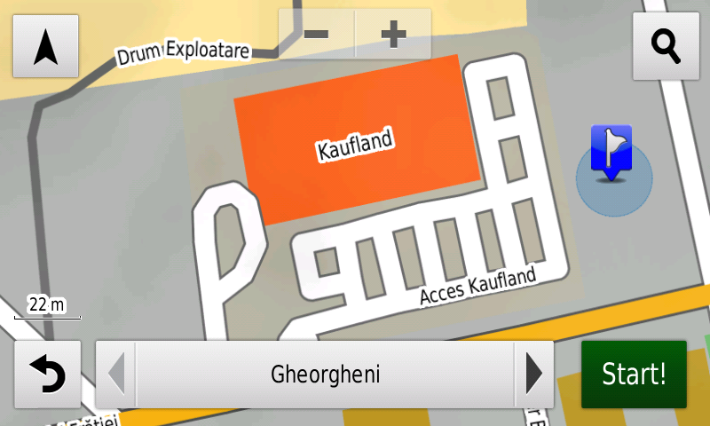
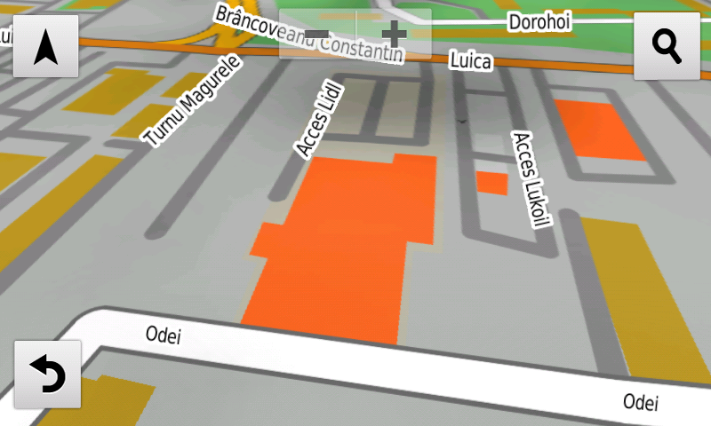
Detailed acces to the retail stores: Kaufland and Penny Market Gheorgheni, Ikea Pallady and Lidl Turnu Măgurele from Bucureşti and Lidl and Penny from Baia Mare. New oneway streets and speed restrictions have been added together with 26 (twentysix) new roundabouts.
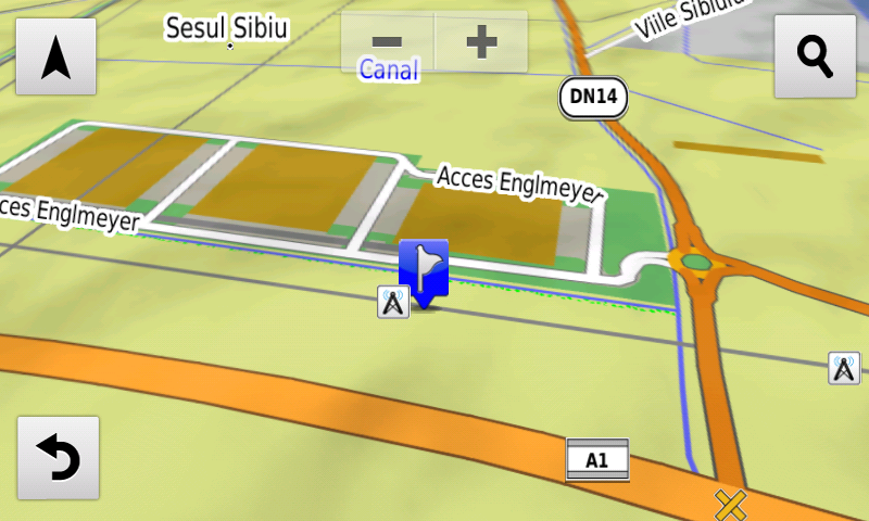
The detailed acces to the Sema Park and the logistical center from Englmeyer Sibiu have been introduced.
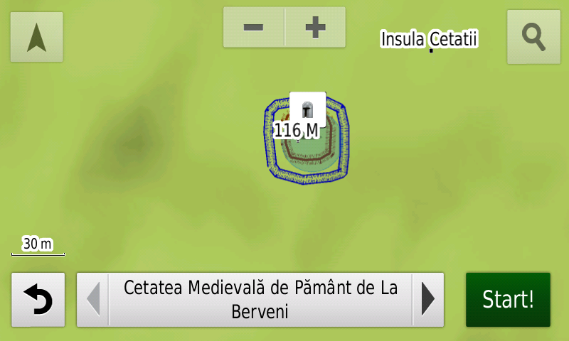
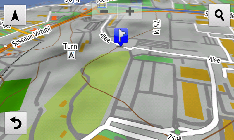
History aficionados will discover in this edition in premiere the detailed elements (ditch, rampart) of the medieval earthen stronghold from Berveni. Various heroes comemorative monuments from the two world wars have been mapped.
Featuring an original concept, with updates three times a year, the result of more than 15 years of continuous development of the experts and contributors of the Digital Romania Project team (www.romaniadigitala.ro), the Digital Atlas of Romania is the choice of professionals in all fields and the preferred navigation tool for all nature goers.
This edition has 1.03 GB in size and runs exclusively on Garmin navigation equipment, an updated list of compatibility being available at the below link:
https://www.rqa.ro/produs.php?id=442&subcat_id=39&cat_id=19
Warning!
The use of RO.A.D.2019.17 map can create addiction to quality, value, functionality and beauty!
-
- C.I.C. Şoimuş în ROAD2019.17 pe NuviCam
-
- Cetatea Medievală de Pământ de la Berveni în ROAD2019.17 pe NuviCam
-
- Englmeyer Sibiu în ROAD2019.17 pe NuviCam
-
- Ikea Pallady în ROAD2019.17 pe NuviCam
-
- Kaufland Gheorgheni în ROAD2019.17 pe Nuvicam
-
- Lidl str. Turnu Măgurele din Bucureşti în ROAD2019.17 pe NuviCam
-
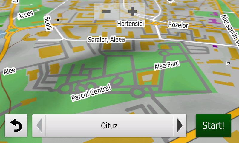
- Parcul Central din Baia Mare in ROAD2019.17 pe NuviCam
-
- SemaPark în ROAD2019.17 pe NuviCam
-
- Spaţiu Servicii Ilia autostrada A1 în ROAD2019.17 pe Nuvicam
-
- VO DN5 în ROAD2019.17 pe NuviCam
-
- Zona renaturată Mahmudia în ROAD2019.17 pe NuviCam