RO.A.D.2016.10 Launch
Sheba Distribution SRL, a Garmin representative in Romania, has the pleasure to announce the availability of the new edition of the Digital Atlas of Romania v8.10, RO.A.D.2016.10.
Continuing in the well known tradition for the Romanian Garmin customers, the Digital Atlas of Romania holds on to the number one place in the GPS road navigation map charts by bringing an extra 1,360.63 km of roads up to a grand total of 376,600.92 km, having significant increased coverage added in the counties Prahova and Dâmboviţa and the number of POIs raises in this edition to a staggering 685,066 points divided into 510 categories.
RO.A.D.2016.10 is the only GPS navigation map in the world that combines topographic details with a routable road network – including dirt roads and trails – with postal addresses of unequaled precision, towns with extruded 3D blocks of flats and detailed 3D textured models for both old patrimony buildings and new skyscrapers, true landmarks of today’s urban space. Map updates are constant and consistent from one edition to another and are documented in the Map Diaries, where all the contributions and their respective authors are mentioned together with the names of the cities and the map tiles that have changed.
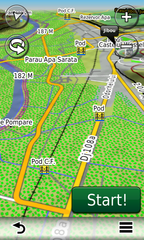
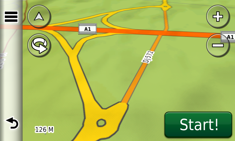
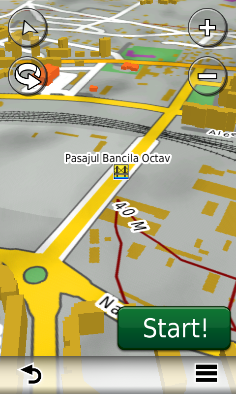
Compared with common maps on the market, the Digital Atlas of Romania has an unequaled level of detail and actuality, featuring the A1 motorway segment Timişoara-Lugoj, batch 2, the express road Ecaterina Teodoroiu and overhead passages over DN76 and DN79 from Oradea, the Octav Băncilă railway passage from Iaşi, the A1 motorway bypass from Iosifalău, the A3 motorway bypass from Gherghiţa, the northern ring of Roman, the suspended roundabout from Blejoi (first time ever in a GPS navigation map), the „Shopping Ring” from Braşov, the north-eastern Ring of Jibou (first time ever in a GPS navigation map) and the west ring of Zalău, plus the wind farms from Oraviţa, Corni, Topolog, Dorobanţu, Casimcea, the wind turbines from the Catalan park from Vânători, the wind turbines from Vutcani, Drânceni, Gemenele, Nălbanţ, Valea Nucarilor, Beştepe, Nufăru, Mahmudia, Mihai Bravu and Babadag, additions to the wind park from Mihai Bravu, the oilfields from the NW of Timişoara,the wind turbines and oilfields from Slobozia Conachi and Schela, together with access to them.
In this edition we have postal addresses added in the following towns: BUCOV, PLOIEŞTIORI, GHIGHIU, MOARA NOUĂ, DÂMBU, CORLĂŢEŞTI, BLEJOI, TĂTĂRANI, BĂRCĂNEŞTI, PLOIEŞTI, ŢÂNŢĂRENI, BOLDEŞTI – SCĂENI, SECIU, MIZIL, SLĂNIC, PRĂJANI, GROŞANI, PODU VADULUI, IRIMEŞTI, SURDEŞTI, VALEA TÂRSEI, FRĂSINET, NISTOREŞTI, PODU CORBULUI, PODU LUNG, POIANA, GURA BELIEI, BREAZA, COMARNIC, POSADA, GHIOŞEŞTI, CÂMPINA, SINAIA, BĂICOI, PLOPENI, GĂGENI, PĂULEŞTI, COCOŞESTI, BLEJOI, TÂRGŞORU VECHI, ZAHANAUA, STÂNCEŞTI, TÂRGŞORU NOU, STOENEŞTI, NEDELEA, BUDA (ARICEŞTII RAHTIVANI), ARICEŞTII RAHTIVANI, PĂULEŞTII NOI, STREJNICU, MORENI and URLAŢI.
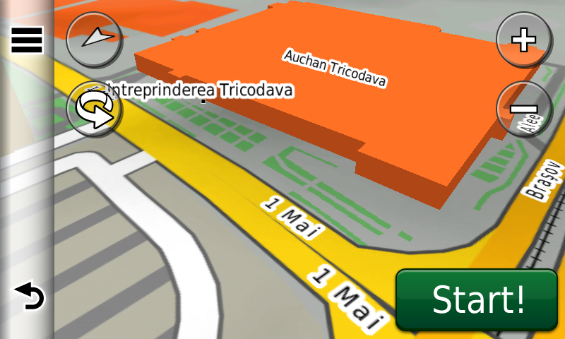
Detailed acces to the retail stores: 2 x Kaufland stores, Penny, Oradea Shopping City and Baumax from Oradea, Penny Adjud, Lidl Vaslui, the Selgros, Hornbach and Decathlon stores from Timişoara, Lidl Huşi, Kaufland Brăila 2, Kaufland, Altex, Deichman and Lidl Făgăraş, Lidl Victoria, Dedeman, Carrefour and Praktiker Târgu Jiu, Profi Hârlău, Lidl Deva, Kaufland and Penny Ploieşti, Kaufland and Lidl Odorheiu Secuiesc, Leroy-Merlin, Lidl, Piaţa Agroalimentară and Mega Image Bragadiru, Auchan Tricodava, Kaufland 1 Mai, Kaufland Basarab, Lidl and Kaufland Valea Cascadelor, Kaufland Valea Oltului, Promenada Mall, Penny Market Timişoara Blvd. from Bucureşti, the detailed access to Dedeman Alba Iulia, Ploieşti Shopping City and Promenada Brăila was reconfigured plus many new oneway streets have been added together with 69 (sixtynine) new roundabouts.
We also continued mapping the aristocratic mansions representing historical monuments from Transylvania, as well as orthodox monasteries from all over the country.
History aficionados will discover in this edition in premiere the detailed elements of the fortified settlements from Turnu-Turnu Sud and Turnu-Pusta Sionda, Curtici-Curtici 4 and Sânpaul-Sânpaul Est, the earth vallums between Aluniş and Zăbrani, additions to the roman? fortification from Secusigiu-La Cimitir, the medieval? rectangular fortification from Secusigiu-Cariera de Lut, the First World War German casemates and the second world war German bridge pillars from Jijila, a Second World War casemate from Târgu Neamţ, tens of monuments from the first and second world wars and military cemeteries.
Featuring an original concept, with updates three times a year, the result of more than 12 years of continuous development of the experts and contributors of the Digital Romania Project team (www.romaniadigitala.ro), the Digital Atlas of Romania is the choice of professionals in all fields and the preferred navigation tool for all nature goers.
This edition has 838.4 MB in size and runs exclusively on Garmin navigation equipment, an updated list of compatibility being available at the below link:
http://www.rqa.ro/produs.php?id=442&subcat_id=39&cat_id=19
Warning!
The use of RO.A.D.2016.10 map can create addiction to quality, value, functionality and beauty!