RO.A.D.2020.18 Launch
RQA, a Garmin technology dealer in Romania, has the pleasure to announce the availability of the new edition of the Digital Atlas of Romania v12.18, RO.A.D.2020.18.
Continuing in the well known tradition for the Romanian Garmin customers, the Digital Atlas of Romania holds on to the number one place in the GPS road navigation map charts by bringing an extra 2,088.70 km of roads up to a grand total of 455,477.01 km and the number of POIs raises in this edition to a staggering 928,090 points divided into 524 categories.
RO.A.D.2020.18 is the only GPS navigation map in the world that combines topographic details with a routable road network – including dirt roads and trails – with postal addresses of unequaled precision, towns with extruded 3D blocks of flats and detailed 3D textured models for both old patrimony buildings and new skyscrapers, true landmarks of today’s urban space. Map updates are constant and consistent from one edition to another and are documented in the Map Diaries, where all the contributions and their respective authors are mentioned together with the names of the cities and the map tiles that have changed.
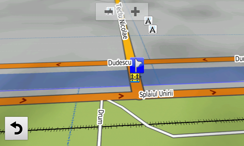
Compared with common maps on the market, the Digital Atlas of Romania has an unequaled level of detail, coverage and actuality, featuring The West Ring of Bacău, object 3, the new Teclu Nicolae bridge over Dâmboviţa river, a segment of the Grind node A1 connection has been closed for public circulation, accessibility has been restored on the Grant bridge, in the Rezervelor street and on Râul Doamnei street and Aleea Lacului from Bucureşti has been closed for public circulation.
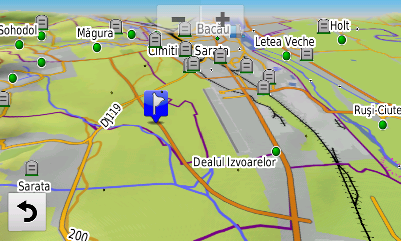
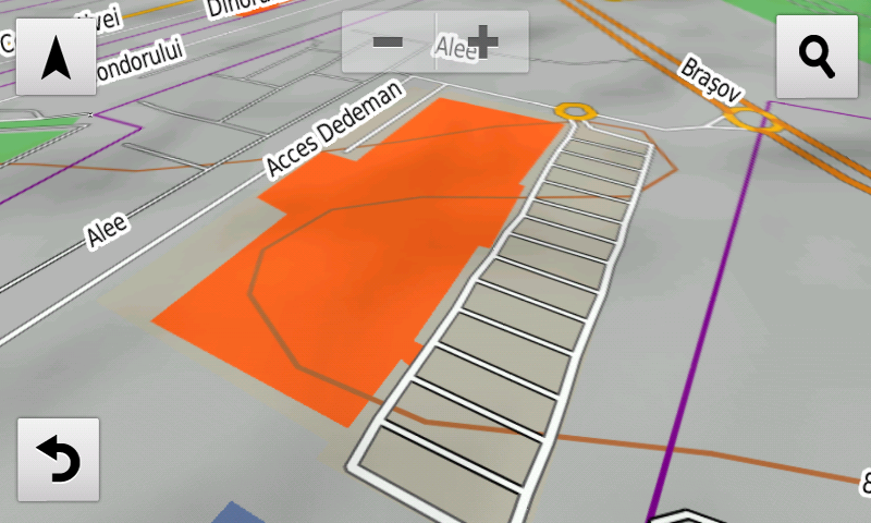
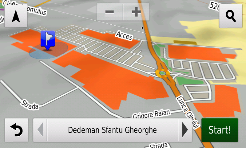
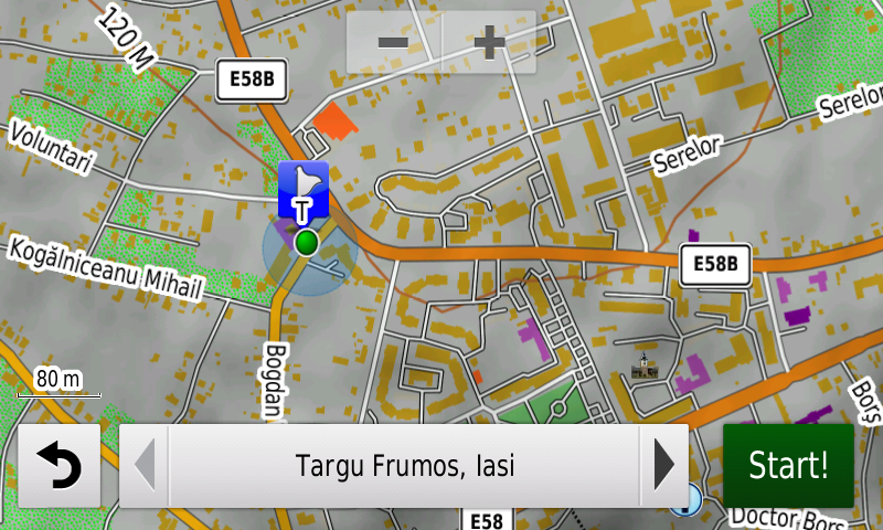
Address-ability at individual block stairs level as well as individual postal number have been introduced in Târgu Frumos, Ţăndărei and Găeşti. Detailed access to Craiova and Bacău airports has been introduced together with access to the South Eastern Industrial platform from Drobeta-Turnu Severin and the Dedeman Logistic Center from Techirghiol, two solar farms at Uieşti and one from Feţeni.
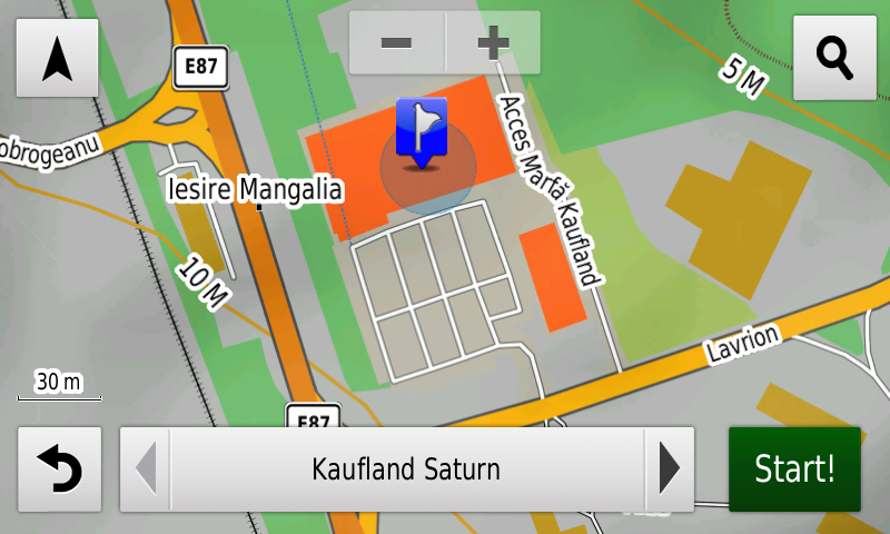
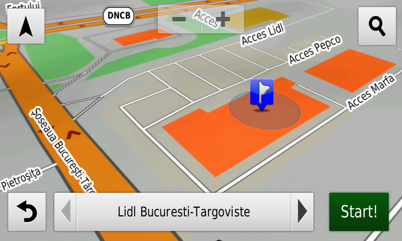
Detailed access to the retail stores: Penny Market from Târgu Frumos, 2 Penny Market shops from Târgovişte, Lidl Topoloveni, Promenada Mall from Sibiu, Lidl Nicolae Labiş from Braşov, Sepsi Value Center (Carrefour, Dedeman) and Kaufland, Altex, Tacco and C&A from Sfântu Gheorghe, Kaufland, Altex, Deichman and Electroputere Mall from Craiova, Lidl Tuzla, Penny Market Cumpăna, Kaufland Chimiştilor awell asnd Kaufland Calea Martirilor as well as Lidl Buziaşului from Timişoara, Kaufland Saturn, Lidl Mangalia, Lidl, Kaufland and Pepco Narciselor as well as Kaufland Milcov from Bacău, Penny and Lidl from Brad, Dedeman Ghencea, Lidl Tudor Vladimirescu, Lidl and Pepco Şoseaua Bucureşti Târgovişte from Bucureşti. New oneway streets and speed restrictions have been added together with 33 (thirty three) new roundabouts.
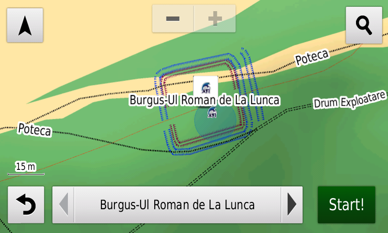
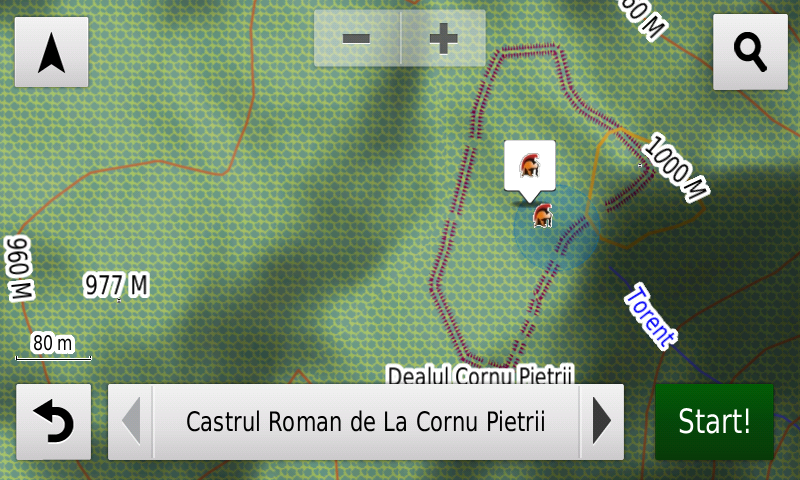
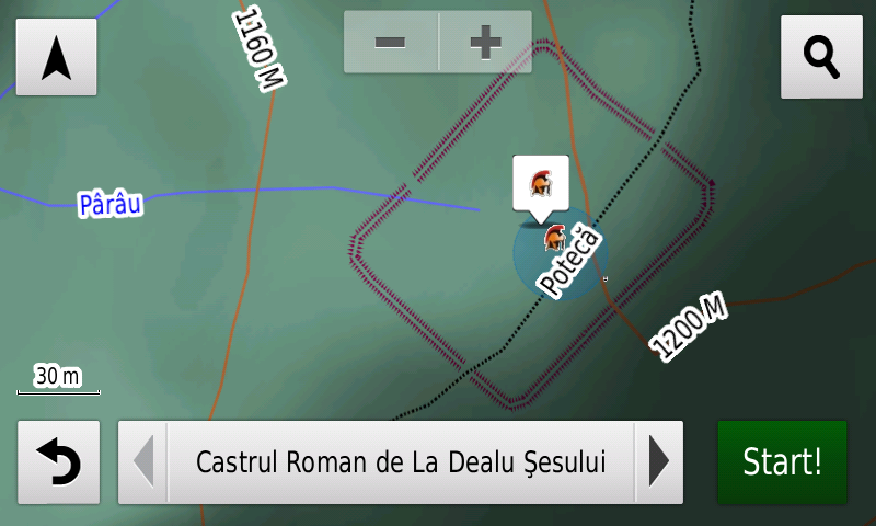
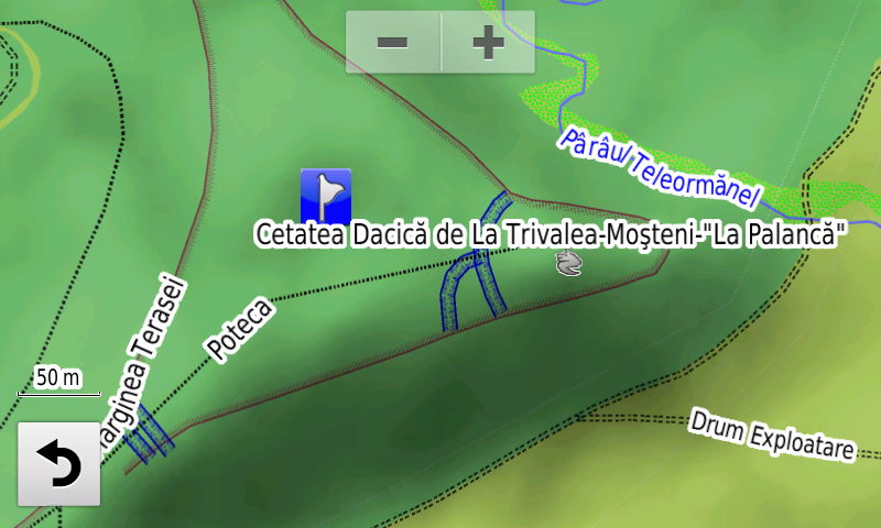
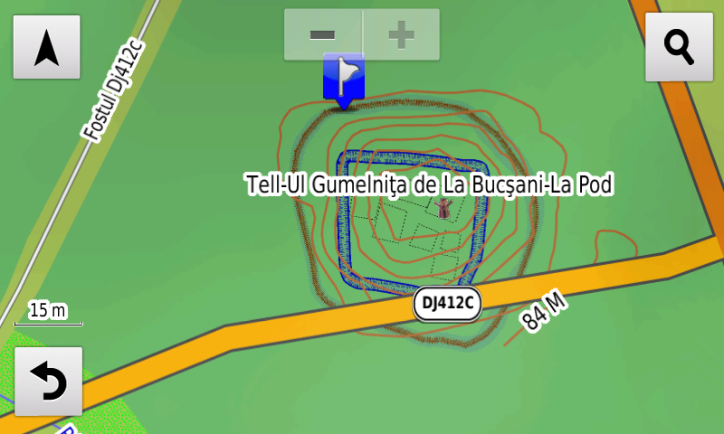
History aficionados will discover in this edition in premiere the detailed elements (ditches, palisade, burnt buildings) of the Gumelniţa Culture Tell from Bucşani-La Pod, the detailed elements (rampart, ditch) of the fortified neolithic/Bronze Age settlement from Dârvari-Cetăţuie, the detailed elements (ditches) of the Dacian stronghold from Trivalea-Moşteni, the detailed elements (vallum) of the Roman earthen castra from Dealu Şesului and Cornu Pietrii, the Roman burgus from Şoimuşeni – La Cărămidă and the Roman tower from Şoimuşeni – Din Deal în Jos have been placed as points, the detailed elements (vallum, ditches) of the Roman burgus from Lunca, the detailed elements (vallum, ditch) of a possibly previously unknown Roman earthen castellum at Buneşti (Cotmeana)-Dealul Fetelor. Various heroes commemorative monuments from the two world wars have been mapped, the 14 crosses on the road to the Nemţişor-Bobeuca Mausoleum have been charted. There were also charted the administrative lots and individual locations of the personalities’ graves from the Hajongard Central Cemetery from Cluj-Napoca.
Featuring an original concept, with updates three times a year, the result of more than 16 years of continuous development of the experts and contributors of the Digital Romania Project team (www.romaniadigitala.ro), the Digital Atlas of Romania is the choice of professionals in all fields and the preferred navigation tool for all nature goers.
This edition has 1.03 GB in size and runs exclusively on Garmin navigation equipment, an updated list of compatibility being available at the below link:
https://www.rqa.ro/produs.php?id=442&subcat_id=39&cat_id=19
Warning!
The use of RO.A.D.2020.18 map can create addiction to quality, value, functionality and beauty!