


Sheba Distribution SRL, a Garmin representative in Romania, has the pleasure to announce the availability of the new edition of the Digital Atlas of Romania v7.20, RO.A.D.2015.20.
Continuing in the well known tradition for the Romanian Garmin customers, the Digital Atlas of Romania holds on to the number one place in the GPS road navigation map charts by bringing an extra 8,635.29 km of roads up to a grand total of 374,020.52 km, having significant increased coverage added in the counties Braşov, Mureş, Covasna, Harghita and Constanţa and the number of POIs raises in this edition to a staggering 516,642 points divided into 509 categories.
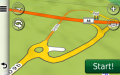
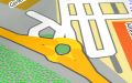
RO.A.D.2015.20 is the only GPS navigation map in the world that combines topographic details with a routable road network – including dirt roads and trails – with postal addresses of unequaled precision, towns with extruded 3D blocks of flats and detailed 3D textured models for both old patrimony buildings and new skyscrapers, true landmarks of today’s urban space. Map updates are constant and consistent from one edition to another and are documented in the Map Diaries, where all the contributions and their respective authors are mentioned together with the names of the cities and the map tiles that have changed.
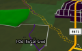
Compared with common maps on the market, the Digital Atlas of Romania has an unequaled level of detail and actuality, featuring the A1 motorway segment between the Romanian-Hungarian border and Nădlac, the A1 motorway segment between Pecica and Arad, the Underground Passage from Piaţa Presei Libere in Bucharest, the A2 link from Cernica, the A1 link from Nădlac, the A1 link from Seceani, the A6 link from Păru, the A1 service spaces from Susani, Pecica and Pianu de Jos, plus the wind farms from the communes Tortoman, Săliştea, Nicolae Bălcescu, Târguşor, Crucea, Pantelimon, Saligny, Peştera, Ciocârlia, Pecineaga, Chirnogeni, Independenţa and Coronini, the solar farms from Hălchiu, the oil fields from Sederhat and many other together with access to them.
In this edition we have postal addresses added in the following towns: HILIB, PETENI, IMENI, HĂŢUICA, MĂRTINENI, DOBOLII DE SUS, PACHIA, HARALE, LĂDĂUŢI, Zagon, Valea Mare, PĂPĂUŢI, MĂRCUŞA, CERNATU DE JOS, CERNATU DE SUS, ALBIŞ, BARCANI, GHELINŢA, ZĂBALA, HÂRJA, POIANA SĂRATĂ, BREŢCU, LEMNIA, OITUZ, ESTELNIC, VALEA SCURTĂ, MERENI, LUTOASA, BEALNI, POIAN, VALEA SEACĂ, PETRICENI, CAŞINU MIC, SÂNZIENI, MĂRTĂNUŞ, LUNGĂ, TURIA, ALUNGENI, BĂŢANII MICI, CĂPENI, BIBORŢENI, AITA SEACĂ, VALEA ZĂLANULUI, MALNAŞ BĂI, BĂŢANII MARI, ARINI, SFÂNTU GHEORGHE, HĂGHIG, VALEA CRIŞULUI, ARCUŞ, OLTENI, VÂLCELE, ARACI, IARĂŞ, ZĂLAN, ZOLTAN, FOTOŞ, GHIDFALĂU, BODOC BUZĂIEL, SITA BUZĂULUI, ZĂBRĂTAU, CRASNA, ACRIŞ, VAMA BUZĂULUI, BRĂDET, LIVEZENI, SÂNCRAIU DE MUREŞ, REMETEA, CORUNCA, GHEJA, MOREŞTI, SĂŞA, Vidrasău, CERGHIZEL, CERGHID, PĂUCIŞOARA, GĂNEŞTI, CIPĂIENI, BARZA, SÂNGER, ICLANDU MARE, ICLĂNZEL, GHIDĂŞTEU, CĂPUŞU DE CÎMPIE, FÂNEŢELE CĂPUŞULUI, DOBRA, IERNUT, LECHINŢA, MOARA DE JOS, TĂURENI, BĂRBOŞI, CIRETEA, TĂU, PRIPOANE, RANTA, LUDUŞ, TÂRNĂVENI, CORDOŞ, CRISTEŞTI, UNGHENI, OGRA, VALEA IZVOARELOR, SÂNMARGHITA, SÂNPAUL, DILEUL VECHI, RECEA, CHIRILEU, SOMOŞTELNIC, CUCERDEA, LASCUD, IERNUT, CIPĂU, ŞEULIA DE MUREŞ, CUCI, GIULUŞ, NĂVODARI, MAMAIA SAT, OVIDIU, LUMINA, EFORIE-SUD, TECHIRGHIOL and POIANA.
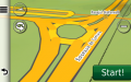
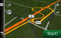
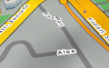
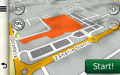
Detailed acces to the retail stores Kaufland, Altex and Lidl from Arad, Kaufland 2 Timişoara, the commercial center Coresi from Braşov, Baumax, Profi Mărăşti and Billa from Cluj-Napoca, Kaufland and Altex from Alba Iulia, Penny Botoşani, Altex and Kaufland from Petroşani, Penny Sinaia together with Penny and Lidl Mioveni plus many new oneway streets have been added together with 52 (fiftytwo) new roundabouts.
We also started mapping the aristocratic mansions representing historical monuments from Transylvania, the Hungarian bunkers and casemates from the Arpad fortified line from the second world war as well as orthodox monasteries from all over the country.
History aficionados will discover in this edition in premiere the location of the Şoplea medieval stronghold, the detailed elements of the medieval earth stronghold from Cozmeni-Piscul cu Şa, the position of the Romanian casemates and antitank ditches the Traian fortified line between Târgu Neamţ and Strunga, the details of the so called Carol II fortified line segments between Diosig and Nojorid, between Seini and Valea Vinului and between Otomani and Săcueni together with the Adjud-Focşani-Nămoloasa segments of the Focşani-Nămoloasa-Brăila Fortified Line, almost all the known German and Romanian casemates and bunkers from second world war and later on from Constanţa and south of it, tens of monuments from the first and second world wars, the public forum monuments and military cemeteries together with almost all of the monuments from the towns of Bucharest and Giurgiu. The mapping of the historical monuments from Bacău county has been completed with the help of the Nemirăm association.
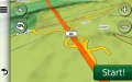
Featuring an original concept, with updates three times a year, the result of more than 11 years of continuous development of the experts and contributors of the Digital Romania Project team, the Digital Atlas of Romania is the choice of professionals in all fields and the preferred navigation tool for all nature goers.
This edition has 810.3 MB in size and runs exclusively on Garmin navigation equipment, an updated list of compatibility being available at the below link:
http://www.rqa.ro/produs.php?id=442&subcat_id=39&cat_id=19
Warning!
The use of RO.A.D.2015.20 map can create addiction to quality, value, functionality and beauty!