About Bogdan Condurăţeanu

Bogdan Condurăţeanu - Manager Proiect

Lansare RO.A.D.2021.01RO.A.D.2021.01 Launch

Lansare RO.A.D.2021.01

RQA, dealer de tehnologie Garmin în Romania, are plăcerea să anunţe disponibilitatea noii ediţii a Atlasului Digital al României v13.01, RO.A.D.2021.01.

Continuând în tradiţia binecunoscută deja clienţilor Garmin din România, Atlasul Digital al României se menţine în continuare pe locul I în clasamentul hărţilor de navigaţie rutieră, aducând în plus faţă de ediţia precedentă 1.907,52 km de drumuri, ridicând la un total de 462.681,85 km de căi de comunicaţii rutiere şi navale acoperirea în teritoriu, iar numărul de informaţii de tip punct se ridică în această ediţie la 940.591 puncte împărţite în 531 categorii.

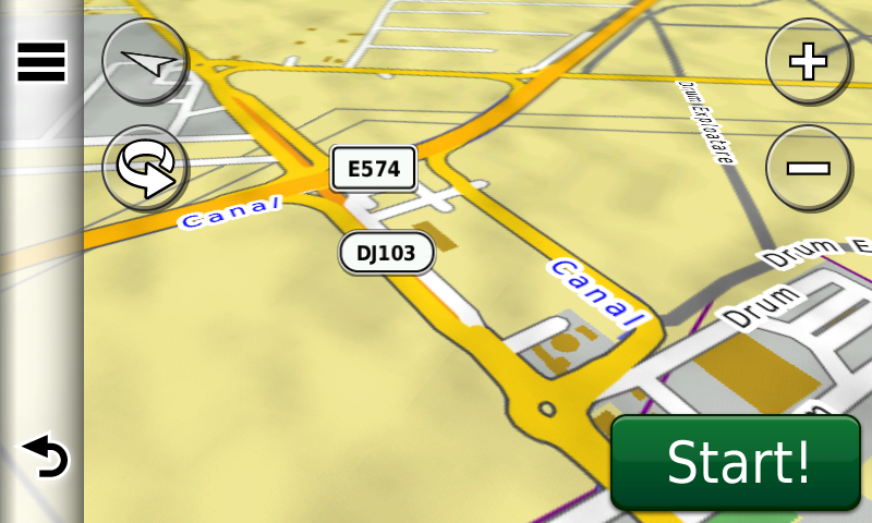
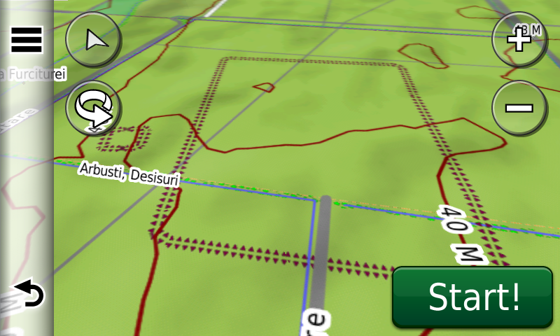
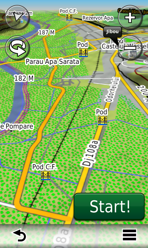
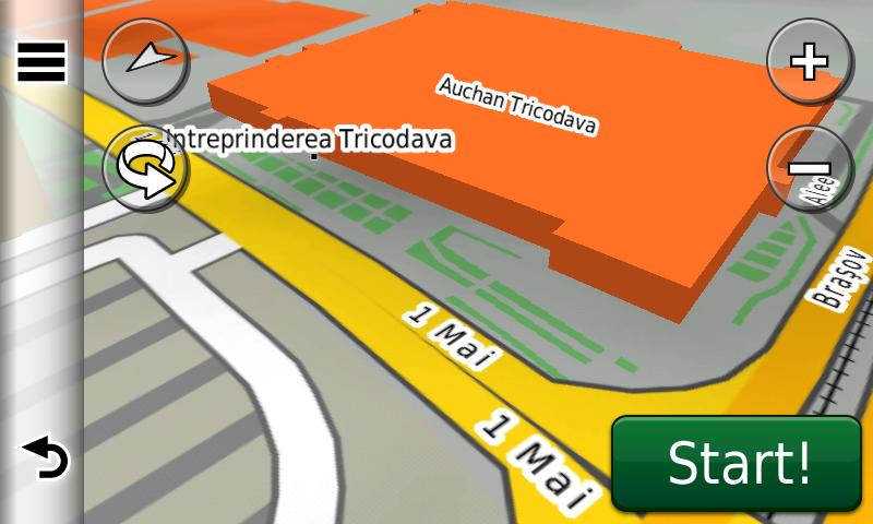
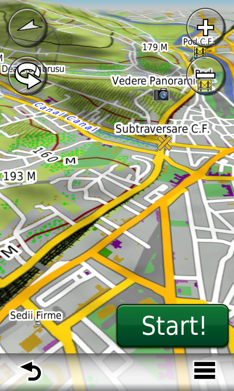
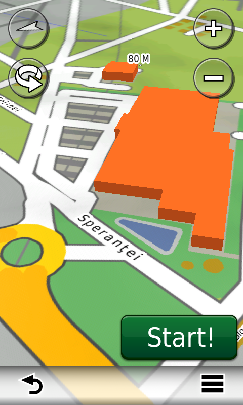
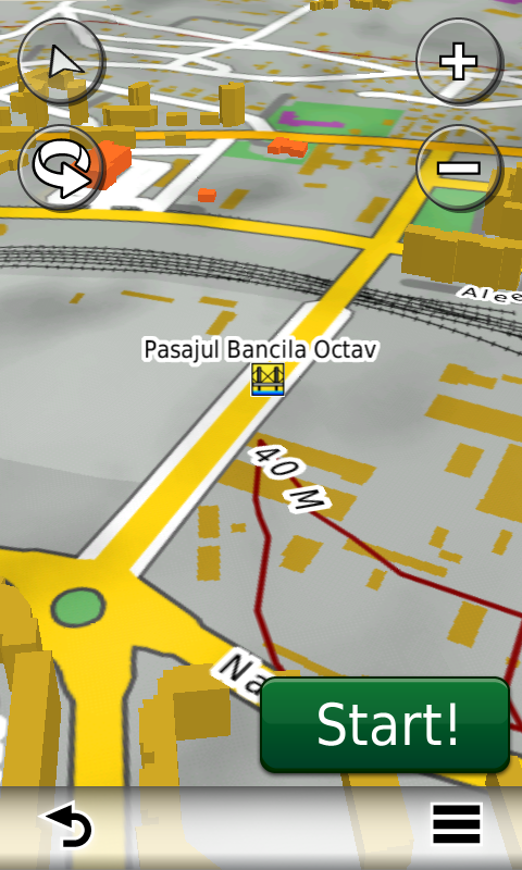
RO.A.D.2021.01 este singura hartă de navigaţie din lume care combină detalii topo cu o structură de drumuri rutabilă – la nivel inclusiv de drumuri de pământ şi poteci – cu adrese poştale de o precizie neegalată, oraşe cu blocuri 3D şi modele minuţios realizate la construcţii vechi, de patrimoniu, sau noi, definitorii pentru peisajul urban actual. Actualizările la hartă sunt constante şi consistente de la o ediţie la alta şi sunt documentate în Jurnalul Hărţii, în care sunt trecute contribuţiile şi autorii acestora, datele la care s-au efectuat precum şi denumirile localităţilor şi planşelor afectate.

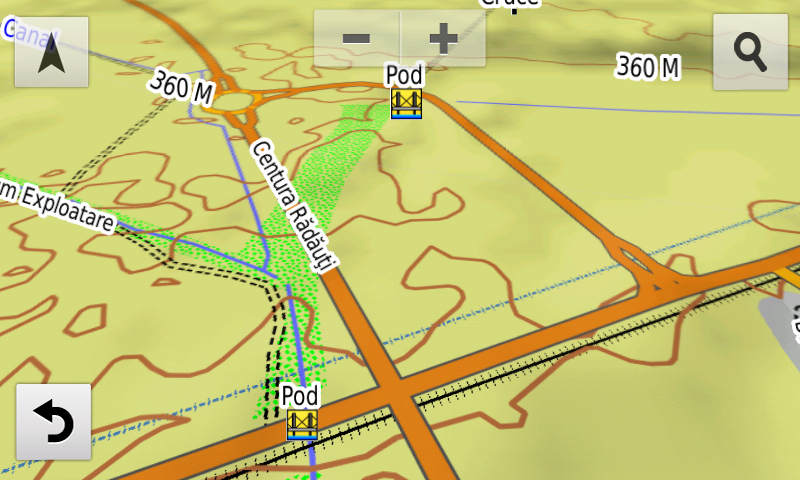
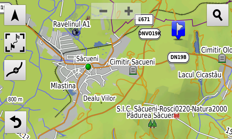
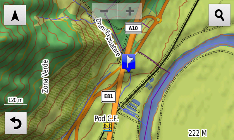
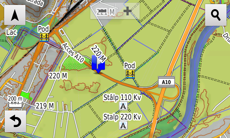
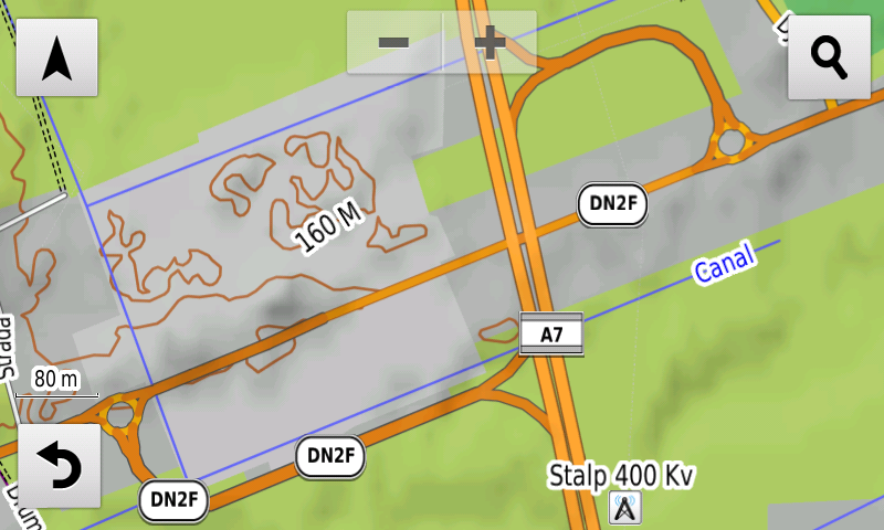
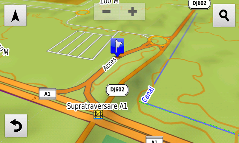
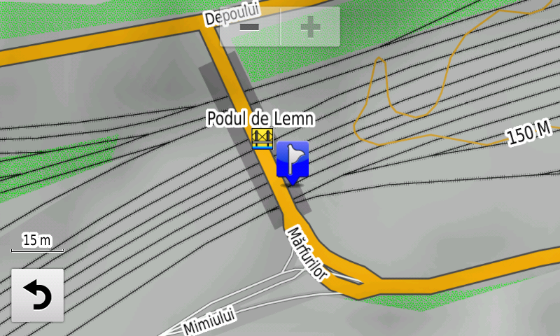
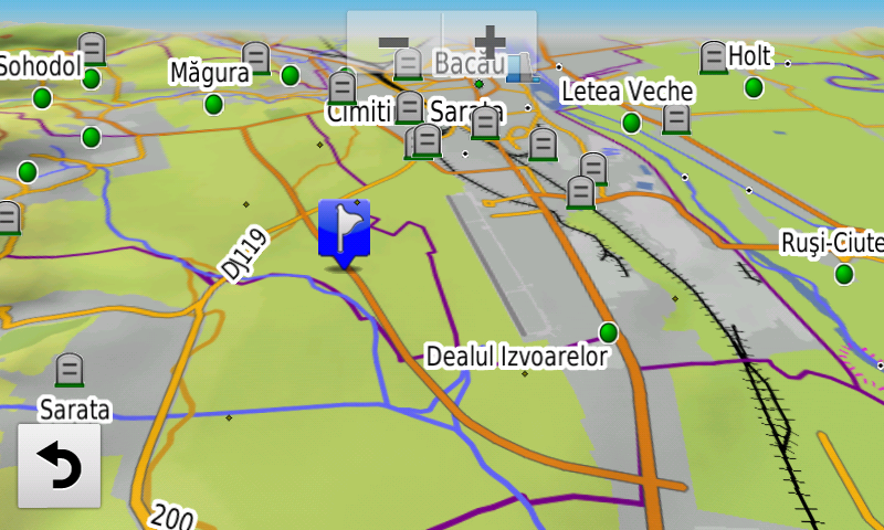
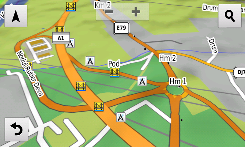
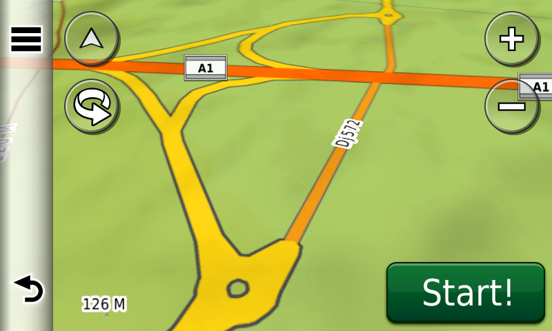
Faţă de hărţile comune de pe piaţă, Atlasul Digital al României are un grad de detaliu, acoperire şi actualitate fără egal, în această ediţie fiind introduse traseul Centurii Rădăuţi, al Centurii Săcueni, al Centurii Bacăului, inclusiv porţiunea în regim de austostradă A7, nodul DN2F de la Bacău pe autostrada A7, lotul 1 autostrada A10 cu nodurile Alba Iulia Sud şi Nord, nodul Sebeş din lotul 1 al autostrăzii A10, traseul Centurii Râşnovului, inclusiv porţiunea în regim de autostradă A3 şi drumul de legătură la DN73, traseul noului DJ109G la Bărcăneşti, s-a reintrodus accesul pe podul mare peste Argeş la sud de Adunaţii-Copăceni, s-au eliminat restricţiile de viteză de pe autostrada A1 lotul 2 Lugoj-Deva între Ilia şi Holdea, s-au introdus pasajul rutier Universităţii din Oradea, nodul Joiţa de pe autostrada A1 şi „Podul de Lemn” din Ploieşti.

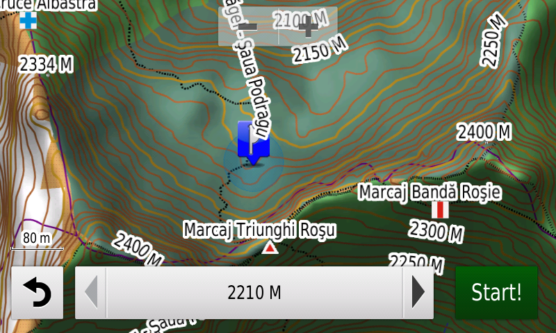
S-au introdus potecile şi marcajele turistice din Munţii Făgăraş şi din Parcul Naţional Buila-Vânturariţa. A fost generalizată echidistanţa curbelor de nivel la 10 m în toată harta.

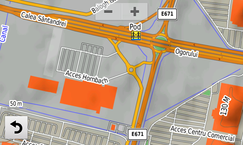
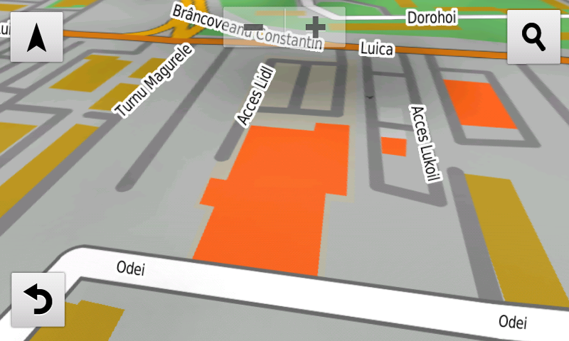
S-a introdus accesul detaliat la Baia Mare Value Centre şi Selgros Baia Mare, Penny Market Focşani Vâlcele, Deco Flora Snagov, Dedeman Călăraşi, Lidl 1 Decembrie, Hornbach Oradea şi Kaufland Oradea Calea Clujului, Kaufland Bragadiru, Mega Image Jilava, Mega Image Roşu, Penny Market Făgăraş, Kaufland Ferentari, Mega Image Concept Store şi Decathlon Băneasa, Kaufland Odăii, Penny Market Fizicienilor, Extinderea Dedeman Giurgiului şi Profi Berceni din Bucureşti. S-au adăugat multe sensuri unice noi, restricţii de viteză precum şi 43 (patruzecişitrei) sensuri giratorii noi.

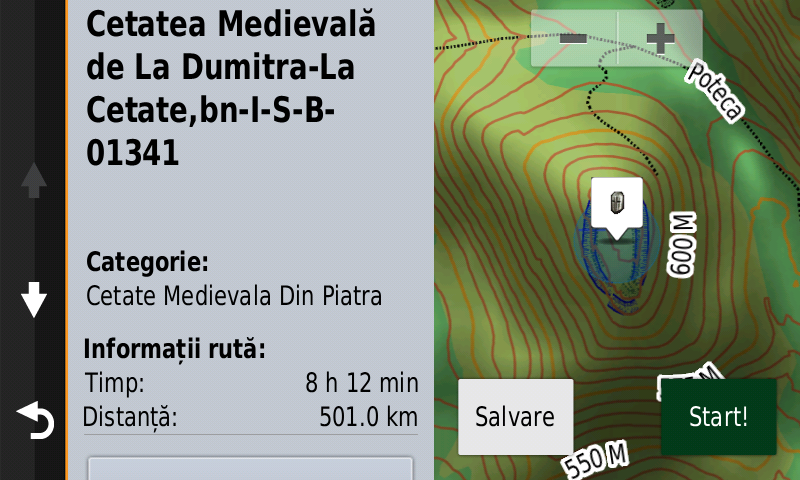
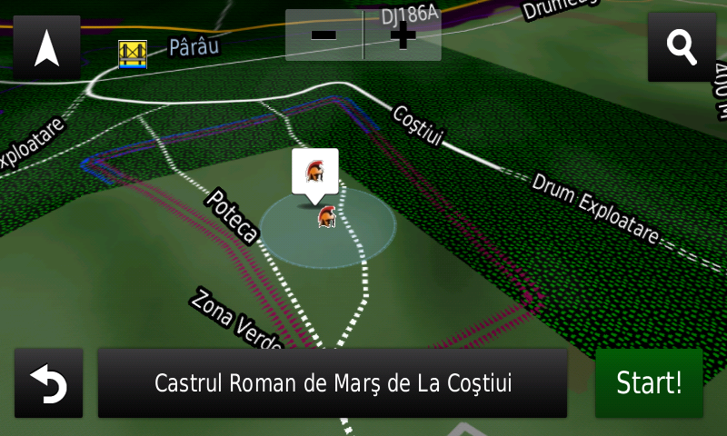
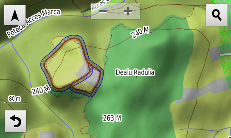
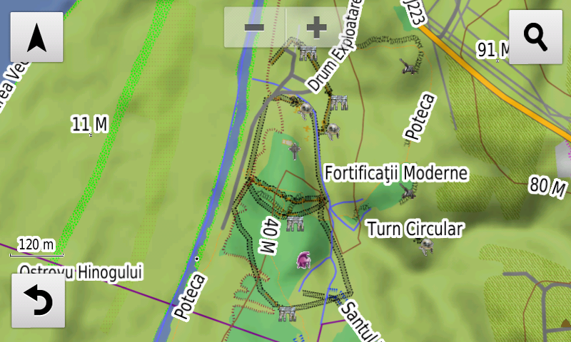
Pasionaţii de istorie vor descoperi în această ediţie în premieră elementele de detaliu (val, şanţ) ale cetăţii preistorice de la Valea Leşului-Cetăţuia, elementele de detaliu (val, şanţ) ale unei fortificaţii inedite de epoca bronzului la Mirşid-Secătura, elementele de detaliu (val, şanţuri) ale unei fortificaţii preistorice inedite la Ghinda-Dealul Corbului, elementele de detaliu (zidul) ale turnului roman şi cetăţii dacice de la Mirşid-Poguior, un val de pământ inedit, probabil dacic, la Mirşid-Poguior, mai mulţi tumuli pe coama dealului Pietros, două posibile castre romane inedite la Mirşid şi Creaca, un posibil turn roman inedit la Băbeni, elementele de detaliu (valuri, şanţ) ale Burgus-ului Roman de la Hurez-Poic, două posibile turnuri romane inedite la Dumitra şi un posibil turn roman inedit la Rebrişoara-Pădurea Hohen Eichen, elementele de detaliu (val, şanţ) ale valului roman de pământ de la Zalău (Vârful Păstaie-Sub Păstaie), ale valului roman de pământ de la Prodăneşti-Pe Şanţ, elementele de detaliu (şanţul) Burgus-ului roman de la Negreni-Cetatea lui Cimpoca, elementele de detaliu (şanţul) Burgus-ului roman de la Hodişu-Dosu Turcului, elementele de detaliu (şanţul) Burgus-ului roman de la Hurez-Dealu Secuiului, Turnul roman de la Treznea-La Şuvar, ca denumire şi poarta în valul roman de la Treznea-Sub Păstaie, ca punct, s-a introdus o porţiune din drumul roman de la Geoagiu, s-a corectat aspectul quadriburgium-ului de la Mircea Vodă, elementele de detaliu (val) ale aşezării fortificate medievale timpurii de la Tărtăria-Gura Luncii, elementele de detaliu (punct, ziduri, şanţuri) de la Cetatea Medievală de la Dumitra-La Cetate, o construcţie inedită la Almaşu, mai multe tranşee şi ceea ce pare un şanţ anticar la Jibou, s-au introdus o serie de cazemate şi completări la şanţul anticar de la Techirghiol. S-au introdus de asemenea varii monumente comemorative ale eroilor din cele două războaie mondiale.

Dispunând de un concept original, cu actualizări trianuale, rodul muncii timp de peste şaptesprezece ani fără întrerupere a pasionaţilor şi specialiştilor din echipa Proiectului România Digitală, Atlasul Digital al României este opţiunea profesioniştilor din toate domeniile şi unealta preferată de navigaţie a amatorilor de drumeţii în aer liber.

Ediţia actuală are 1,58 GB mărime şi rulează exclusiv pe echipamentele de navigaţie Garmin din linkul de mai jos
http://www.rqa.ro/produs.php?id=442&subcat_id=39&cat_id=19

Atenţionare!
Utilizarea hărţii RO.A.D.2021.01 poate crea dependenţă de calitate, valoare, funcţionalitate şi frumos!

RO.A.D.2021.01 Launch

RQA, a Garmin technology dealer in Romania, has the pleasure to announce the availability of the new edition of the Digital Atlas of Romania v13.01, RO.A.D.2021.01.

Continuing in the well known tradition for the Romanian Garmin customers, the Digital Atlas of Romania holds on to the number one place in the GPS road navigation map charts by bringing an extra 1,907.52 km of roads up to a grand total of 462,681.85 km and the number of POIs raises in this edition to a staggering 940,591 points divided into 531 categories.

RO.A.D.2021.01 is the only GPS navigation map in the world that combines topographic details with a routable road network – including dirt roads and trails – with postal addresses of unequaled precision, towns with extruded 3D blocks of flats and detailed 3D textured models for both old patrimony buildings and new skyscrapers, true landmarks of today’s urban space. Map updates are constant and consistent from one edition to another and are documented in the Map Diaries, where all the contributions and their respective authors are mentioned together with the names of the cities and the map tiles that have changed.

Compared with common maps on the market, the Digital Atlas of Romania has an unequaled level of detail, coverage and actuality, featuring the Rings of Rădăuţi, Săcueni, Bacău – including the A7 motorway portion – the DN2F node from Bacău on the A7 motorway, the 1st lot of the A10 motorway with Alba Iulia South and North nodes, the Sebeş node on the 1st lot of A10 motorway, the Râşnov Ring, including the A3 motorway portion and the link to DN73, the new Arterial DJ109G from Bărcăneşti; acces has been reintroduced on the high bridge over the Argeş river South of Adunaţii-Copăceni, speed restrictions on A1 motorway on the 2nd lot Lugoj-Deva between Ilia and Holdea have been cancelled, the road passage Universităţii from Oradea, the Joiţa node from the A1 motorway and the „Wooden Bridge” from Ploieşti have also been added.
.
The touristic trails and markings have been introduced in the Făgăraş Mountains and in the Buila-Vânturariţa National Park.

Detailed acces to the retail stores: Baia Mare Value Centre and Selgros Baia Mare, Penny Market Focşani Vâlcele, Deco Flora Snagov, Dedeman Călăraşi, Lidl 1 Decembrie, Hornbach Oradea and Kaufland Oradea Calea Clujului, Kaufland Bragadiru, Mega Image Jilava, Mega Image Roşu, Penny Market Făgăraş, Kaufland Ferentari, Mega Image Concept Store and Decathlon Băneasa, Kaufland Odăii, Penny Market Fizicienilor, the Dedeman Giurgiului Extension and Profi Berceni from Bucharest. New oneway streets and speed restrictions have been added together with 43 (fortythree) new roundabouts.

History aficionados will discover in this edition in premiere the detailed elements (rampart, ditch) of the prehistoric stronghold from Valea Leşului-Cetăţuia, the detailed elements (rampart, ditch) of an unknown bronze age fortification from Mirşid-Secătura, the detailed elements (rampart, ditches) of a previously unknown prehistoric fortification at Ghinda-Dealul Corbului, the detailed elements (wall) of the roman tower and the rampart of the Dacian stronghold from Mirşid-Poguior, a previosly unknown earthen vallum, probably Dacian, at Mirşid-Poguior, several tumuli on the ridge of the Pietros Hill, two possible Roman march castra at Mirşid and Creaca previously unknown, a possible Roman tower at Băbeni, the detailed elements (ramparts, ditch) of the Roman Burgus from Hurez-Poic, two possible Roman towers, previously unknown, at Dumitra and a possible Roman tower, previously unknown, at Rebrişoara-Pădurea Hohen Eichen, the detailed elements (rampart, ditch) of the Roman earth vallum from Zalău (Vârful Păstaie-Sub Păstaie), of the Roman earth vallum from Prodăneşti-Pe Şanţ, the detailed elements (ditch) of the Roman Burgi from Negreni-Cetatea lui Cimpoca, Hodişu-Dosu Turcului, and Hurez-Dealu Secuiului, the Roman tower from Treznea-La Şuvar, as a named point and the Roman vallum gate from Treznea-Sub Păstaie, as a point; a portion of the Roman road from Geoagiu has been mapped, the aspect of the quadriburgium from Mircea Vodă has been updated, the detailed elements (rampart) of the early medieval fortified settlement from Tărtăria-Gura Luncii, the detailed elements (point, walls, ditches) of the Medieval Fortress from Dumitra-La Cetate, a previously unknown construction from Almaşu, many trenches and what looks like an antitank ditch at Jibou, a series of casemates and addings to the antitank ditch from Techirghiol have also been mapped. Various heroes commemorative monuments from the two world wars have been mapped as well.

Featuring an original concept, with updates three times a year, the result of more than 17 years of continuous development of the experts and contributors of the Digital Romania Project team, the Digital Atlas of Romania is the choice of professionals in all fields and the preferred navigation tool for all nature goers.

This edition has 1.58 GB in size and runs exclusively on Garmin navigation equipment, an updated list of compatibility being available at the below link:
http://www.rqa.ro/produs.php?id=442&subcat_id=39&cat_id=19

Warning!
The use of RO.A.D.2021.01 map can create addiction to quality, value, functionality and beauty!

Lansare RO.A.D.2020.30RO.A.D.2020.30 Launch

Lansare RO.A.D.2020.30

RQA, dealer de tehnologie Garmin în Romania, are plăcerea să anunţe disponibilitatea noii ediţii a Atlasului Digital al României v12.30, RO.A.D.2020.30.

RO.A.D.2020.30 este singura hartă de navigaţie din lume care combină detalii topo cu o structură de drumuri rutabilă – la nivel inclusiv de drumuri de pământ şi poteci – cu adrese poştale de o precizie neegalată, oraşe cu blocuri 3D şi modele minuţios realizate la construcţii vechi, de patrimoniu, sau noi, definitorii pentru peisajul urban actual. Actualizările la hartă sunt constante şi consistente de la o ediţie la alta şi sunt documentate în Jurnalul Hărţii, în care sunt trecute contribuţiile şi autorii acestora, datele la care s-au efectuat precum şi denumirile localităţilor şi planşelor afectate.

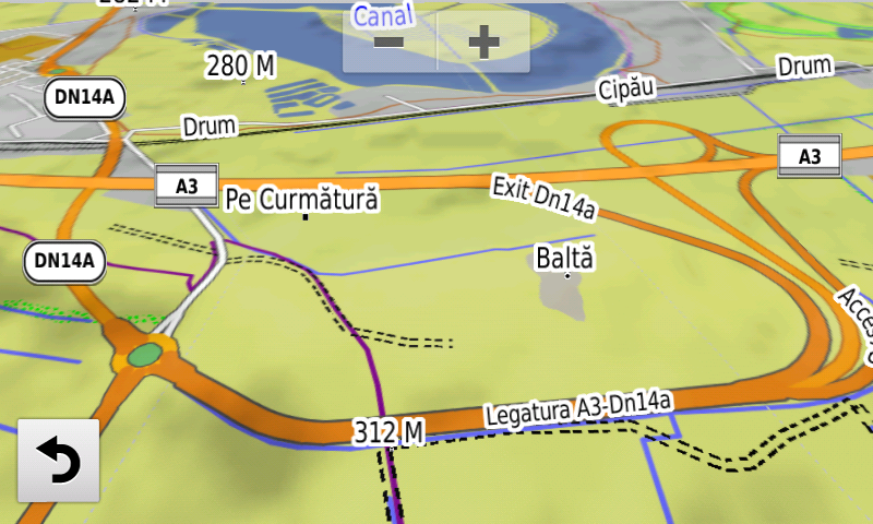
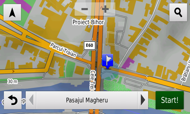
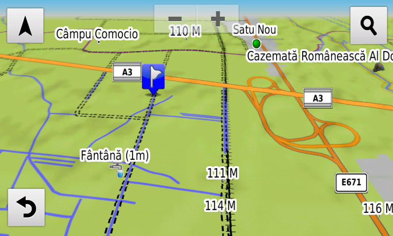
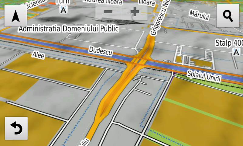
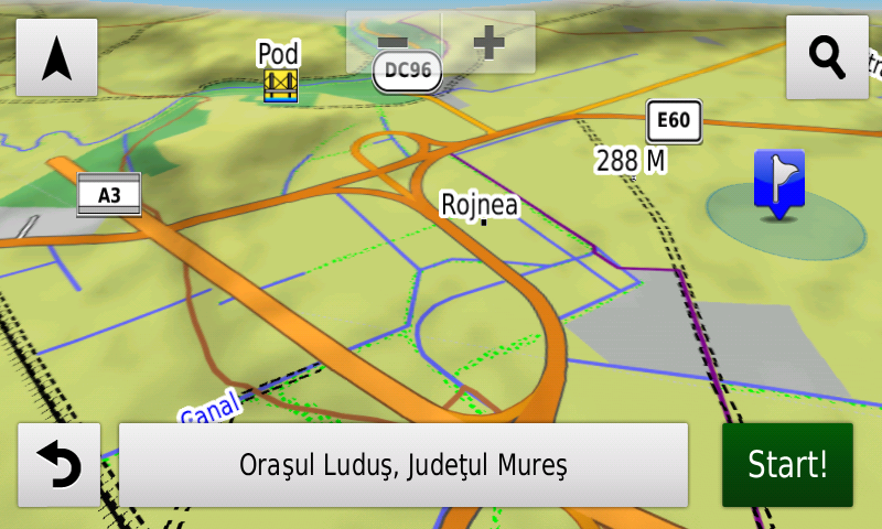
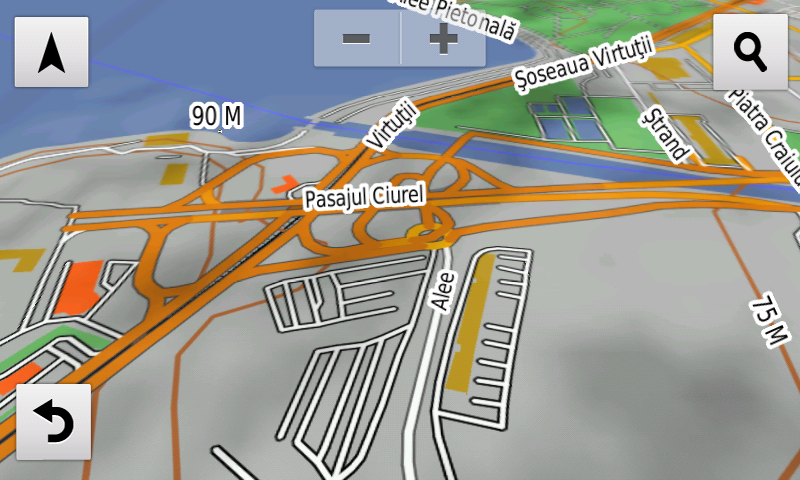
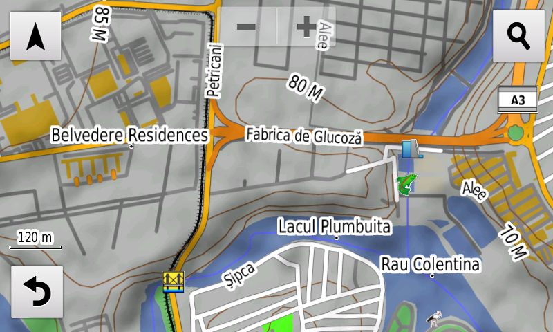
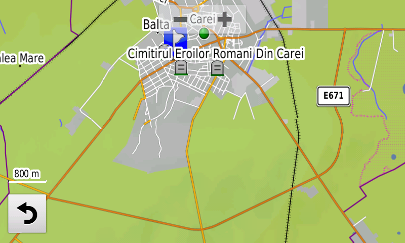
Faţă de hărţile comune de pe piaţă, Atlasul Digital al României are un grad de detaliu, acoperire şi actualitate fără egal, în această ediţie fiind introduse minicentura de nord est a Caracalului, pasajul nodului A3 de la Iernut, s-a reintrodus capacitatea de calcul automat rute în nodul Dobra, s-a adăugat porţiunea de drum express cu eticheta E671 la nordul Oradei, porţiunea Borş-Biharia a autostrăzii A3, pasajul Magheru din Oradea, accesul alternativ temporar la E81 pe viitoarea bretea de legătură la A10 la Alba Iulia Nord, devierea de pe DN2F din Bacău, Centura Vinerea, s-a introdus podul nou peste râul Suceava din Suceava, segmentul Cheţani-Iernut din autostrada A3, nodul rutier de la Cheţani, spaţiile de servicii de la Luduş, Pasajele Nicolae Grigorescu, Ciurel şi Doamna Ghica-Petricani, sens dublu de parcurgere pe Fabrica de Glucoză, Şoseaua Alexandriei, Prelungirea Ghencea şi Calea Şerban Vodă din Bucureşti.

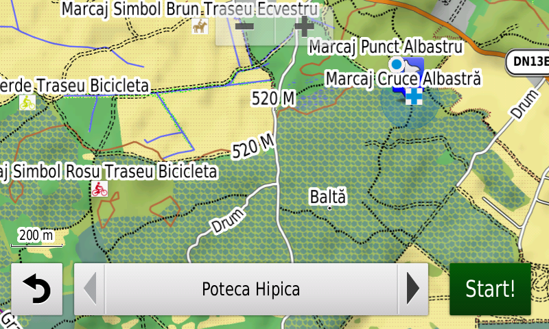
S-au introdus potecile şi marcajele turistice din Retezat, din munţii Bodoc şi Ciomatul şi din rezervaţia Mestecănişurile de la Reci, pasarela de lemn prin rezervaţia de la Sic, marcajele Via Transilvanica şi s-a finalizat introducerea marcajelor traseelor turistice omologate din judeţul Bistriţa-Năsăud. S-au introdus în toată harta restricţii de viteză generice pentru drumurile de importanţă ridicată. S-au introdus triajele de la Caracal, triajul gării Reghin, pasajul feroviar de la Aeroportul Henri Coandă din Otopeni, triajul depoului de tramvaie Colentina şi s-au introdus staţiile de metrou din Drumul Taberei din Bucureşti.

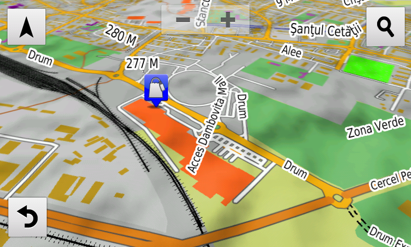
S-a introdus accesul detaliat la Penny Market Roman, Penny şi Lidl Haţeg, Lidl şi Penny Market din Motru, Shopping City Târgu Mureş, Lidl Rădăuţi, Lidl şi Penny Market Caracal, Lidl Roman, Penny Market Mangalia, Lidl şi Penny Market Galaţi, Lidl fosta 1Mai din Ploieşti, Lidl Deva, Lidl şi Kaufland Gherla, Profi Sântandrei şi Dedeman Oradea magazin + centru logistic şi Lidl Calea Borşului, Penny Market Râmnicu Vâlcea, Dâmboviţa Mall din Târgovişte, Altex Calea Radnei, Lidl Suceava şi Iulius Mall Suceava, Lidl Blejoi, Lidl Coralilor Bucureşti, Lidl şi La Strada Bragadiru. S-au adăugat multe sensuri unice noi, restricţii de viteză precum şi 54 (cincizecişipatru) sensuri giratorii noi.

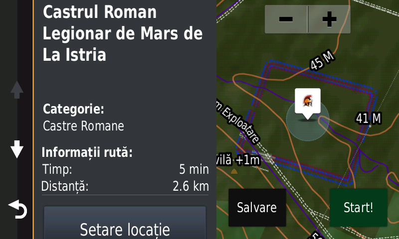
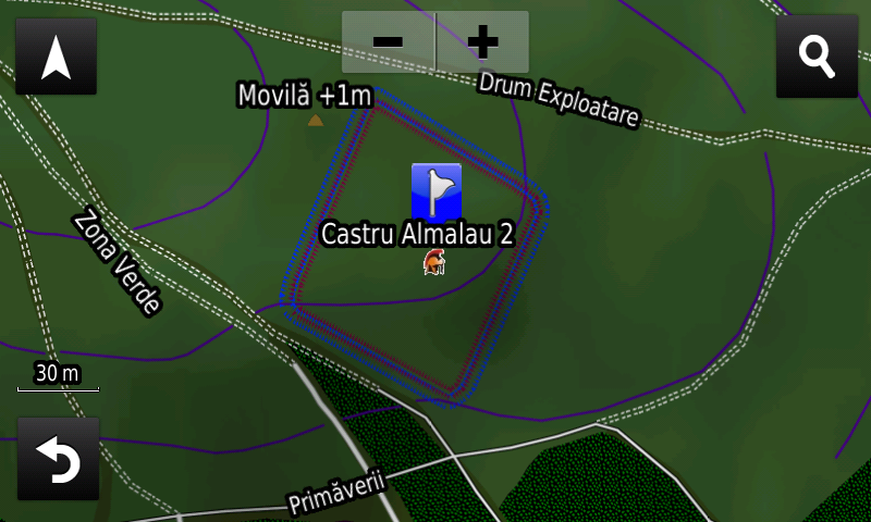
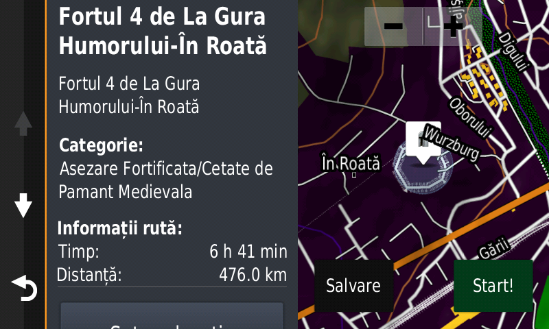
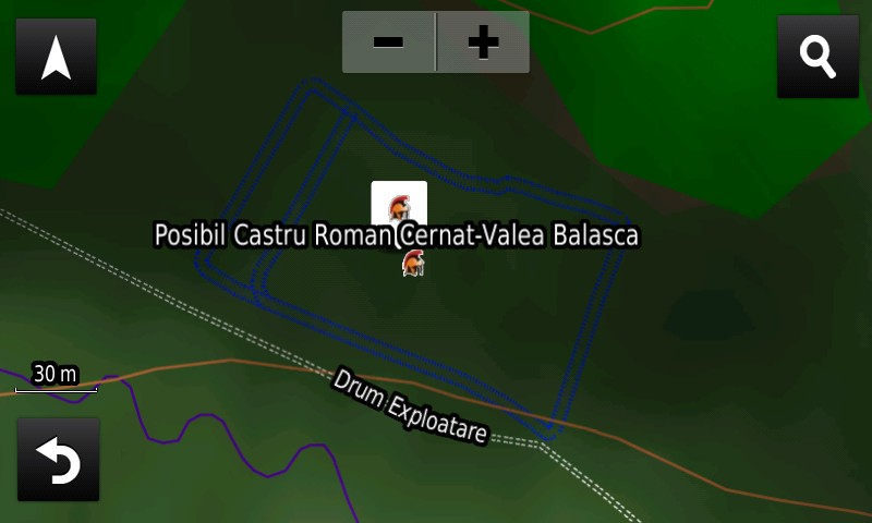
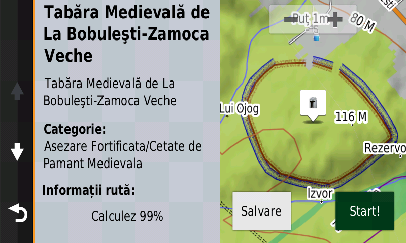
Pasionaţii de istorie vor descoperi în această ediţie în premieră elementele de detaliu (valuri, şanţ) ale cetăţii de epoca fierului de la Dochia-Cetăţuia Sărăţica/La Movilă, elementele de detaliu (şanţurile) unui posibil castru roman inedit de marş la Cernat-Valea Balaşca, elementele de detaliu (valul) Brazdei lui Novac de Nord de la Pădurea Piscupia, s-a cartat ceea ce pare a fi urma Drumului de Rouă (roman) la sud de Reşca, elementele de detaliu (şanţurile) a două fortificaţii, posibil romane, la Viile, elementele de detaliu (val, şanţ) ale castrul roman de marş de la Almalău 2, elementele de detaliu (val, şanţ, poarta vestică) ale castrul roman legionar de marş de la Istria, valul roman de pământ de la Mirşid-Dealul Fericea, elementele de detaliu (val, şanţ) ale burgus-urilor romane de la Uriu şi Sita-Dealu Sâtii, elementele de detaliu (turn, porţi, ziduri, construcţii interioare) ale cetăţii medievale ruseşti de la Iaşi, elementele de detaliu (valurile) ale Cetăţii Medievale Kika Roşie de la Sadoveni, s-au introdus elementele de detaliu (val, şanţ) ale taberei medievale de la Bobuleşti-Zamoca Veche şi s-au adăugat şi elementele de detaliu (val, şanţ) ale celor 4 forturi habsburgice premoderne de la Gura Humorului. S-au introdus de asemenea varii monumente comemorative ale eroilor din cele două războaie mondiale.

Dispunând de un concept original, cu actualizări trianuale, rodul muncii timp de aproape şaptesprezece ani fără întrerupere a pasionaţilor şi specialiştilor din echipa Proiectului România Digitală, Atlasul Digital al României este opţiunea profesioniştilor din toate domeniile şi unealta preferată de navigaţie a amatorilor de drumeţii în aer liber.

Ediţia actuală are 1,03 GB mărime şi rulează exclusiv pe echipamentele de navigaţie Garmin din linkul de mai jos
https://www.rqa.ro/produs.php?id=442&subcat_id=39&cat_id=19

Atenţionare!
Utilizarea hărţii RO.A.D.2020.30 poate crea dependenţă de calitate, valoare, funcţionalitate şi frumos!

RO.A.D.2020.30 Launch

RQA, a Garmin technology dealer in Romania, has the pleasure to announce the availability of the new edition of the Digital Atlas of Romania v12.30, RO.A.D.2020.30.

RO.A.D.2020.30 is the only GPS navigation map in the world that combines topographic details with a routable road network – including dirt roads and trails – with postal addresses of unequaled precision, towns with extruded 3D blocks of flats and detailed 3D textured models for both old patrimony buildings and new skyscrapers, true landmarks of today’s urban space. Map updates are constant and consistent from one edition to another and are documented in the Map Diaries, where all the contributions and their respective authors are mentioned together with the names of the cities and the map tiles that have changed.

Compared with common maps on the market, the Digital Atlas of Romania has an unequaled level of detail, coverage and actuality, featuring, the North Eastern ringlet of Caracal, the A3 overpass from Iernut, the reintroduction of automatic routing at the Dobra A3 node, the expressway with E671 label North of Oradea, the Borş-Biharia lot of the A3 motorway, the Magheru underground passage from Oradea, the alternate temporary deviation of E81 on the future A10 link at Alba Iulia Nord, the DN2F deviation from Bacău, the Vinerea ring road, the new bridge over Suceava river from Suceava, the Cheţani-Iernut segment from A3 motorway, the routier node from Cheţani, the service exits from Luduş, the Nicolae Grigorescu, Ciurel şi Doamna Ghica-Petricani overpasses, two separate ways on Fabrica de Glucoză, Şoseaua Alexandriei, Prelungirea Ghencea şi Calea Şerban Vodă arteries from Bucureşti.

The touristic trails and markings have been introduced in Retezat, Bodoc and Ciomatul Mountains and in the Mestecănişurile reserve from Reci, the wooden trailway from the Sic reserve, the Via Transilvanica markings and the introduction of tourist markings for all roads certified as such in the Bistriţa-Năsăud county. Legal speed limits have been introduced in the entire map for high importance roads. The train marshalling yards from Caracal, Reghin, the train overpass from Henri Coandă airport at Otopeni, the tramway marshalling yard from Colentina have been introduced together with the underground stations of Drumul Taberei from Bucureşti.

Detailed acces to the retail stores: Penny Market Roman, Penny and Lidl Haţeg, Lidl and Penny Market from Motru, Shopping City Târgu Mureş, Lidl Rădăuţi, Lidl and Penny Market Caracal, Lidl Roman, Penny Market Mangalia, Lidl and Penny Market Galaţi, Lidl ex 1Mai from Ploieşti, Lidl Deva, Lidl and Kaufland Gherla, Profi Sântandrei and Dedeman Oradea shop + logistic center andLidl Calea Borşului, Penny Market Râmnicu Vâlcea, Dâmboviţa Mall from Târgovişte, Altex Calea Radnei Timişoara, Lidl Suceava and Iulius Mall Suceava, Lidl Blejoi, Lidl Coralilor Bucureşti and Lidl and La Strada from Bragadiru. New oneway streets and speed restrictions have been added together with 54 (fiftyfour) new roundabouts.

History aficionados will discover in this edition in premiere the detailed elements (ramparts, ditch) of the iron age fortress from Dochia-Cetăţuia Sărăţica/La Movilă, the detailed elements (ditches) of a possible Roman march castrum previously unknown at Cernat-Valea Balaşca, the detailed elements (earthen vallum) of Brazda lui Novac de Nord from Piscupia Forest, it was mapped what look like the remains of the Roman road Drumul de Rouă South of Reşca, the detailed elements (ditches) of two fortifications, possibly Roman, at Viile, the detailed elements (rampart, ditch) of the Roman march castrum from Almalău 2, the detailed elements (rampart, ditch, western gate) of the roman legion march castrum from Istria, the Roman earthen vallum from Mirşid-Dealul Fericea, the detailed elements (rampart, ditch) of the Roman Burgi from Uriu and Sita-Dealu Sâtii, the detailed elements (tower, gates, walls, interior buildings) of the Russian medieval fortress from Iaşi, the detailed elements (ramparts) of the medieval stronghold Kika Roşie from Sadoveni, the detailed elements (rampart, ditch) of the fortified medieval camp from Bobuleşti-Zamoca Veche and were also added the detailed elements (rampart, ditch) of the 4 Habsburg pre-modern forts from Gura Humorului. Various heroes commemorative monuments from the two world wars have been mapped as well.

Featuring an original concept, with updates three times a year, the result of almost 17 years of continuous development of the experts and contributors of the Digital Romania Project team (www.romaniadigitala.ro), the Digital Atlas of Romania is the choice of professionals in all fields and the preferred navigation tool for all nature goers.

This edition has 1.03 GB in size and runs exclusively on Garmin navigation equipment, an updated list of compatibility being available at the below link:
https://www.rqa.ro/produs.php?id=442&subcat_id=39&cat_id=19

Warning!
The use of RO.A.D.2020.30 map can create addiction to quality, value, functionality and beauty!

Lansare RO.A.D.2020.18RO.A.D.2020.18 Launch

Lansare RO.A.D.2020.18

RQA, dealer de tehnologie Garmin în Romania, are plăcerea să anunţe disponibilitatea noii ediţii a Atlasului Digital al României v12.18, RO.A.D.2020.18.

Continuând în tradiţia binecunoscută deja clienţilor Garmin din România, Atlasul Digital al României se menţine în continuare pe locul I în clasamentul hărţilor de navigaţie rutieră, aducând în plus faţă de ediţia precedentă 2.088,70 km de drumuri, ridicând la un total de 455.477,01 km de căi de comunicaţii rutiere şi navale acoperirea în teritoriu, iar numărul de informaţii de tip punct se ridică în această ediţie la 928.090 puncte împărţite în 524 categorii.

RO.A.D.2020.18 este singura hartă de navigaţie din lume care combină detalii topo cu o structură de drumuri rutabilă – la nivel inclusiv de drumuri de pământ şi poteci – cu adrese poştale de o precizie neegalată, oraşe cu blocuri 3D şi modele minuţios realizate la construcţii vechi, de patrimoniu, sau noi, definitorii pentru peisajul urban actual. Actualizările la hartă sunt constante şi consistente de la o ediţie la alta şi sunt documentate în Jurnalul Hărţii, în care sunt trecute contribuţiile şi autorii acestora, datele la care s-au efectuat precum şi denumirile localităţilor şi planşelor afectate.

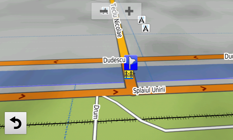
Faţă de hărţile comune de pe piaţă, Atlasul Digital al României are un grad de detaliu, acoperire şi actualitate fără egal, în această ediţie fiind introduse Centura de vest a Bacăului, obiectul 3, noul Pod Teclu Nicolae peste Dâmboviţa, s-a închis un segment circulaţiei publice la nodul Grind, s-au scos restricţia de pe Podul Grant, din cartierul Rezervelor şi cea de pe Râul Doamnei şi s-a introdus restricţia de acces pe Aleea Lacului din Bucureşti.

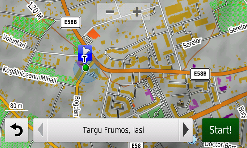
S-au introdus adresabilitatea la nivel de scară de bloc şi număr poştal individual în Târgu Frumos şi Ţăndărei precum şi adresabilitatea la nivel de scară de bloc (aprox. 50%) şi număr poştal individual în Găeşti. S-a cartat accesul detaliat la aeroporturile Craiova şi Bacău, la Platforma Industrială Sud-Est din Drobeta-Turnu Severin şi la Centrul Logistic Dedeman din Techirghiol, două ferme solare la Uieşti şi parcul fotovoltaic de la Feţeni.

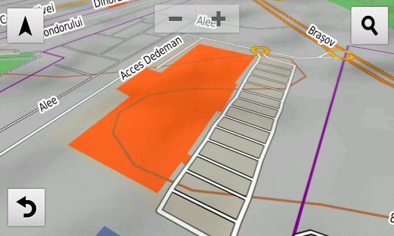
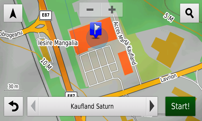
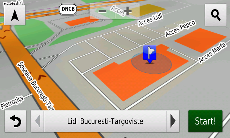
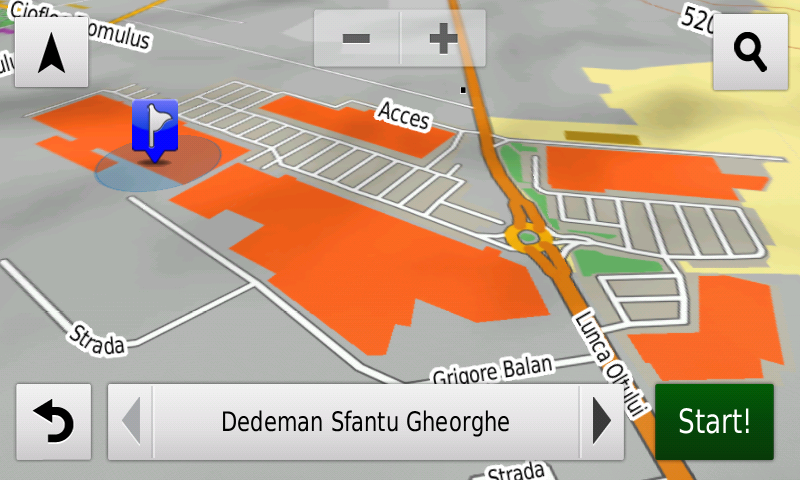
S-a introdus accesul detaliat la Penny Market din Târgu Frumos, la 2 magazine Penny Market din Târgovişte, Lidl Topoloveni, Promenada Mall din Sibiu, Lidl Nicolae Labiş din Braşov, Sepsi Value Center (Carrefour, Dedeman) şi Kaufland, Altex, Tacco şi C&A din Sfântu Gheorghe, Kaufland, Altex, Deichman şi Electroputere Mall din Craiova, Lidl Tuzla, Penny Market Cumpăna, Kaufland Chimiştilor şi Kaufland Calea Martirilor precum şi Lidl Buziaşului din Timişoara, Kaufland Saturn, Lidl Mangalia, Lidl, Kaufland şi Pepco Narciselor precum şi Kaufland Milcov din Bacău, Penny şi Lidl din Brad, Dedeman Ghencea, Lidl Tudor Vladimirescu, Lidl şi Pepco Şoseaua Bucureşti Târgovişte din Bucureşti. S-au adăugat multe sensuri unice noi, restricţii de viteză precum şi 33 (treizecişitrei) sensuri giratorii noi.

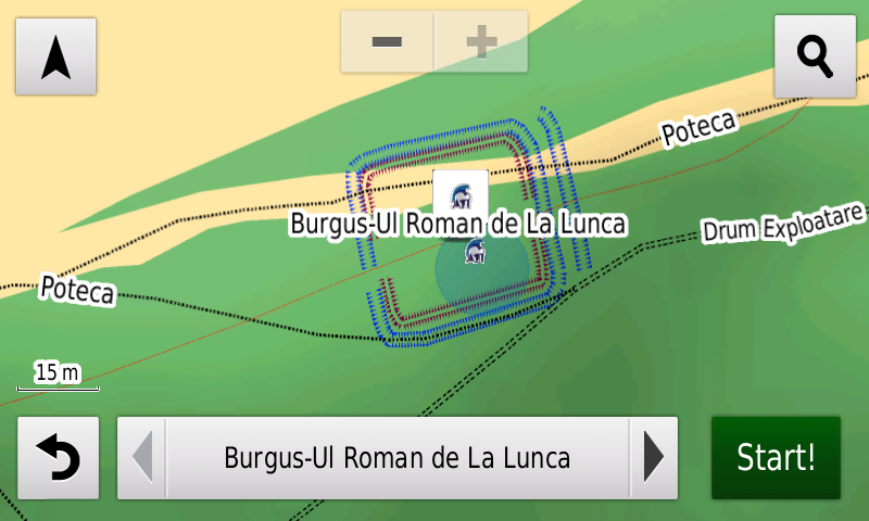
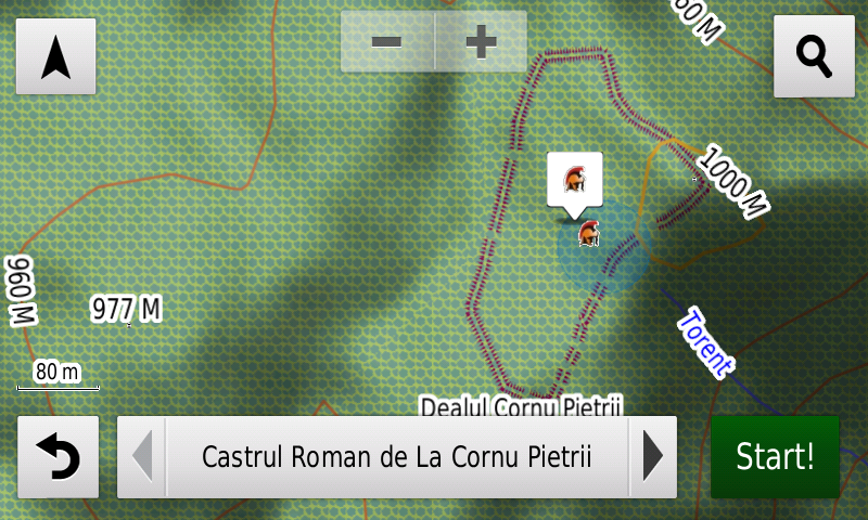
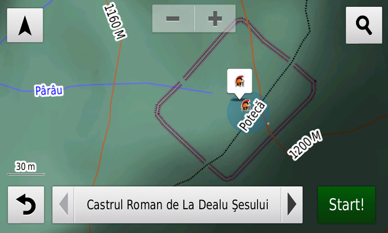
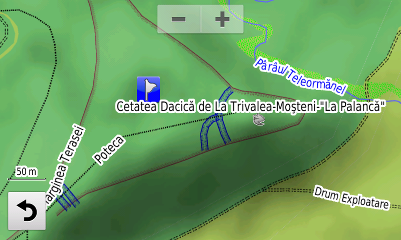
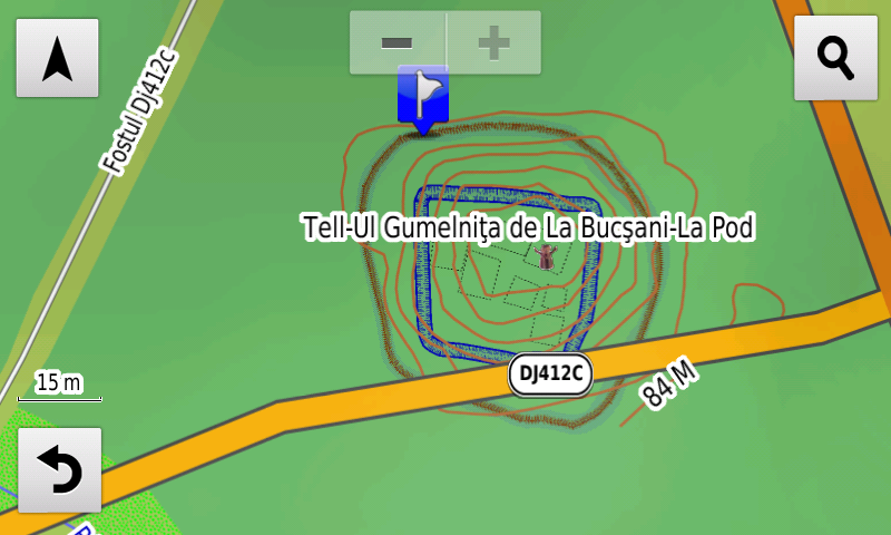
Pasionaţii de istorie vor descoperi în această ediţie în premieră elementele de detaliu (şanţuri, palisadă, clădiri incendiate) ale Tell-ului Culturii Gumelniţa de la Bucşani-La Pod, elementele de detaliu (val, şanţ) ale aşezării fortificate neolitice/epoca bronzului de la Dârvari-Cetăţuie, elementele de detaliu (şanţurile) ale cetăţii getice de la Trivalea-Moşteni, elementele de detaliu (valurile) ale castrelor romane de pământ de la Dealu Şesului şi Cornu Pietrii, s-a reamplasat burgus-ul roman de la Şoimuşeni – La Cărămidă şi s-a poziţionat turnul roman de la Şoimuşeni – Din Deal în Jos, elementele de detaliu (valuri, şanţuri) ale burgus-ului roman de la Lunca, elementele de detaliu (val, şanţ) ale unui posibil castellum roman inedit la Buneşti (Cotmeana)-Dealul Fetelor. S-au introdus varii monumente comemorative ale eroilor din cele două războaie mondiale, s-au cartat cele 14 cruci de pe drumul către Mausoleul de la Nemţişor-Bobeuca. S-au cartat de asemenea parcelele şi mormintele personalităţilor din Cimitirul Central Hajongard din Cluj-Napoca.

Dispunând de un concept original, cu actualizări trianuale, rodul muncii timp de peste şaisprezece ani fără întrerupere a pasionaţilor şi specialiştilor din echipa Proiectului România Digitală, Atlasul Digital al României este opţiunea profesioniştilor din toate domeniile şi unealta preferată de navigaţie a amatorilor de drumeţii în aer liber.

Ediţia actuală are 1,03 GB mărime şi rulează exclusiv pe echipamente de navigaţie Garmin, o listă a acestora fiind disponibilă la linkul de mai jos
http://www.rqa.ro/produs.php?id=442&subcat_id=39&cat_id=19

Atenţionare!
Utilizarea hărţii RO.A.D.2020.18 poate crea dependenţă de calitate, valoare, funcţionalitate şi frumos!

RO.A.D.2020.18 Launch

RQA, a Garmin technology dealer in Romania, has the pleasure to announce the availability of the new edition of the Digital Atlas of Romania v12.18, RO.A.D.2020.18.

Continuing in the well known tradition for the Romanian Garmin customers, the Digital Atlas of Romania holds on to the number one place in the GPS road navigation map charts by bringing an extra 2,088.70 km of roads up to a grand total of 455,477.01 km and the number of POIs raises in this edition to a staggering 928,090 points divided into 524 categories.

RO.A.D.2020.18 is the only GPS navigation map in the world that combines topographic details with a routable road network – including dirt roads and trails – with postal addresses of unequaled precision, towns with extruded 3D blocks of flats and detailed 3D textured models for both old patrimony buildings and new skyscrapers, true landmarks of today’s urban space. Map updates are constant and consistent from one edition to another and are documented in the Map Diaries, where all the contributions and their respective authors are mentioned together with the names of the cities and the map tiles that have changed.

Compared with common maps on the market, the Digital Atlas of Romania has an unequaled level of detail, coverage and actuality, featuring The West Ring of Bacău, object 3, the new Teclu Nicolae bridge over Dâmboviţa river, a segment of the Grind node A1 connection has been closed for public circulation, accessibility has been restored on the Grant bridge, in the Rezervelor street and on Râul Doamnei street and Aleea Lacului from Bucureşti has been closed for public circulation.

Address-ability at individual block stairs level as well as individual postal number have been introduced in Târgu Frumos, Ţăndărei and Găeşti. Detailed access to Craiova and Bacău airports has been introduced together with access to the South Eastern Industrial platform from Drobeta-Turnu Severin and the Dedeman Logistic Center from Techirghiol, two solar farms at Uieşti and one from Feţeni.

Detailed access to the retail stores: Penny Market from Târgu Frumos, 2 Penny Market shops from Târgovişte, Lidl Topoloveni, Promenada Mall from Sibiu, Lidl Nicolae Labiş from Braşov, Sepsi Value Center (Carrefour, Dedeman) and Kaufland, Altex, Tacco and C&A from Sfântu Gheorghe, Kaufland, Altex, Deichman and Electroputere Mall from Craiova, Lidl Tuzla, Penny Market Cumpăna, Kaufland Chimiştilor awell asnd Kaufland Calea Martirilor as well as Lidl Buziaşului from Timişoara, Kaufland Saturn, Lidl Mangalia, Lidl, Kaufland and Pepco Narciselor as well as Kaufland Milcov from Bacău, Penny and Lidl from Brad, Dedeman Ghencea, Lidl Tudor Vladimirescu, Lidl and Pepco Şoseaua Bucureşti Târgovişte from Bucureşti. New oneway streets and speed restrictions have been added together with 33 (thirty three) new roundabouts.

History aficionados will discover in this edition in premiere the detailed elements (ditches, palisade, burnt buildings) of the Gumelniţa Culture Tell from Bucşani-La Pod, the detailed elements (rampart, ditch) of the fortified neolithic/Bronze Age settlement from Dârvari-Cetăţuie, the detailed elements (ditches) of the Dacian stronghold from Trivalea-Moşteni, the detailed elements (vallum) of the Roman earthen castra from Dealu Şesului and Cornu Pietrii, the Roman burgus from Şoimuşeni – La Cărămidă and the Roman tower from Şoimuşeni – Din Deal în Jos have been placed as points, the detailed elements (vallum, ditches) of the Roman burgus from Lunca, the detailed elements (vallum, ditch) of a possibly previously unknown Roman earthen castellum at Buneşti (Cotmeana)-Dealul Fetelor. Various heroes commemorative monuments from the two world wars have been mapped, the 14 crosses on the road to the Nemţişor-Bobeuca Mausoleum have been charted. There were also charted the administrative lots and individual locations of the personalities’ graves from the Hajongard Central Cemetery from Cluj-Napoca.

Featuring an original concept, with updates three times a year, the result of more than 16 years of continuous development of the experts and contributors of the Digital Romania Project team (www.romaniadigitala.ro), the Digital Atlas of Romania is the choice of professionals in all fields and the preferred navigation tool for all nature goers.

This edition has 1.03 GB in size and runs exclusively on Garmin navigation equipment, an updated list of compatibility being available at the below link:
https://www.rqa.ro/produs.php?id=442&subcat_id=39&cat_id=19

Warning!
The use of RO.A.D.2020.18 map can create addiction to quality, value, functionality and beauty!

Lansare RO.A.D.2020.02RO.A.D.2020.02 Launch

RQA, dealer de tehnologie Garmin în Romania, are plăcerea să anunţe disponibilitatea noii ediţii a Atlasului Digital al României v12.02, RO.A.D.2020.02.

Continuând în tradiţia binecunoscută deja clienţilor Garmin din România, Atlasul Digital al României se menţine în continuare pe locul I în clasamentul hărţilor de navigaţie rutieră, aducând în plus faţă de ediţia precedentă 997,44 km de drumuri, ridicând la un total de 453.388,31 km de căi de comunicaţii rutiere şi navale acoperirea în teritoriu, iar numărul de informaţii de tip punct se ridică în această ediţie la 905.141 puncte împărţite în 523 categorii.

RO.A.D.2020.02 este singura hartă de navigaţie din lume care combină detalii topo cu o structură de drumuri rutabilă – la nivel inclusiv de drumuri de pământ şi poteci – cu adrese poştale de o precizie neegalată, oraşe cu blocuri 3D şi modele minuţios realizate la construcţii vechi, de patrimoniu, sau noi, definitorii pentru peisajul urban actual. Actualizările la hartă sunt constante şi consistente de la o ediţie la alta şi sunt documentate în Jurnalul Hărţii, în care sunt trecute contribuţiile şi autorii acestora, datele la care s-au efectuat precum şi denumirile localităţilor şi planşelor afectate.

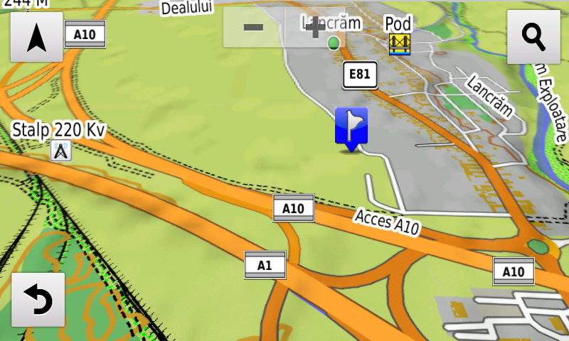
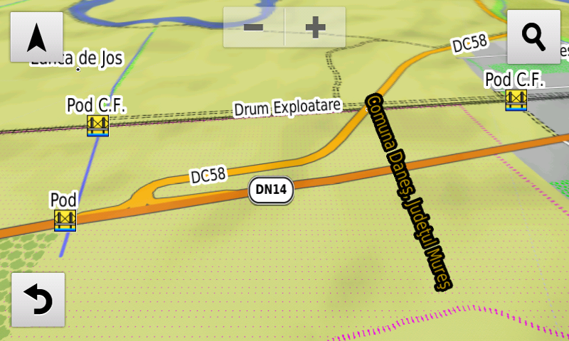
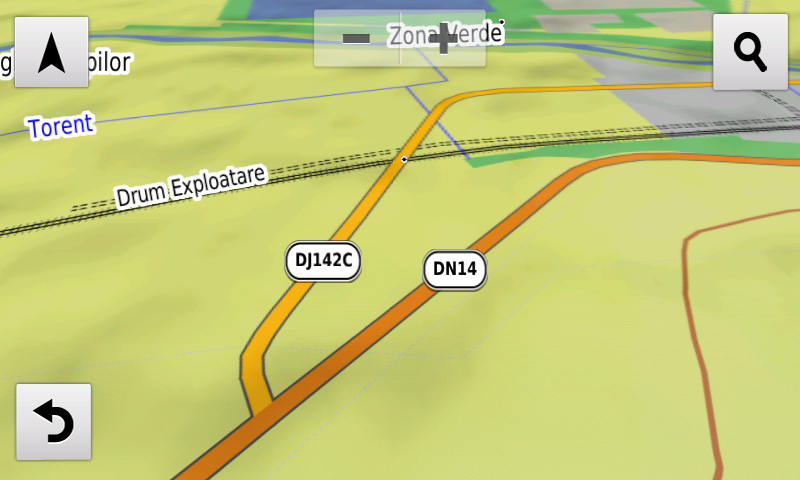
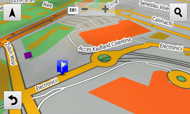
Faţă de hărţile comune de pe piaţă, Atlasul Digital al României are un grad de detaliu, acoperire şi actualitate fără egal, în această ediţie fiind introduse, printre altele Centura Suceava, nodul rutier de la pasajul Tudor Vladimirescu din Râmnicu Vâlcea, devierea de la Oiejdea, pasajul rutier de la Lancrăm, podul nou peste Mureş de la Căpud, s-a reconfigurat rutarea prin intersecţia din Şendreni (Galaţi), s-a introdus posibilitatea calculului automat de rute pe segmentul 3 Holdea-Ilia al autostrăzii A1 (deschis circulaţiei publice pe 23.12.2019), s-au introdus pasajele peste calea ferată de la Dumbrăveni şi Daneş şi străpungerea Electronicii din Bucureşti.

A fost modificat aspectul drumurilor de exploatare, al potecilor, străzilor şi al drumurilor înguste pentru a le scoate mai bine în evidenţă faţă de fundal, s-a modificat aspectul conductelor şi liniilor electrice aeriene.

S-a introdus accesul detaliat la centrele comerciale Lidl Botoşani, Lidl Găeşti, Lidl I.C. Brătianu din Târgovişte, Lidl Vladimirescu, Penny Market şi Carrefour Market din Râşnov, Supeco Focşani, Carrefour Market din Valea Călugărească, Kaufland Vivo din Constanţa, Penny Market Cernavodă, Dedeman şi Lidl Primăverii din Iaşi, Kaufland şi Pepco din Paşcani precum şi Penny Market Clinceni. S-au adăugat multe sensuri unice noi, restricţii de viteză precum şi 40 (patruzeci) sensuri giratorii noi.

Pasionaţii de istorie vor descoperi în această ediţie în premieră elementele de detaliu (şanţuri) ale aşezărilor fortificate de epocă nedeterminată de la Homiceni şi Văleni-La Cetăţue, elementele de detaliu (valuri, şanţuri) ale cetăţii de epoca fierului de la Bucecea-Pădurea Găvanului, s-a cartat un posibil turn dacic la Sarmizegetusa Regia, s-a introdus traseul posibil (inedit) al continuării Căii Sacre la vestul cetăţii, s-au introdus elementele de detaliu (val, şanţ) ale castrului roman de marş de la Coşteiu, un posibil burgus roman şi tranşeele româneşti WW1? de la Rucăr, tranşeele germane din primul război mondial de la Olăneasca. S-au introdus varii monumente comemorative ale eroilor din cele două războaie mondiale.

Dispunând de un concept original, cu actualizări trianuale, rodul muncii timp de peste şaisprezece ani fără întrerupere a pasionaţilor şi specialiştilor din echipa Proiectului România Digitală, Atlasul Digital al României este opţiunea profesioniştilor din toate domeniile şi unealta preferată de navigaţie a amatorilor de drumeţii în aer liber.

Ediţia actuală are 1,03 GB mărime şi rulează exclusiv pe echipamente de navigaţie Garmin, o listă a acestora fiind disponibilă la linkul de mai jos
https://www.rqa.ro/produs.php?id=442&subcat_id=39&cat_id=19

Atenţionare!
Utilizarea hărţii RO.A.D.2020.02 poate crea dependenţă de calitate, valoare, funcţionalitate şi frumos!

RQA, a Garmin technology dealer in Romania, has the pleasure to announce the availability of the new edition of the Digital Atlas of Romania v12.02, RO.A.D.2020.02.

Continuing in the well known tradition for the Romanian Garmin customers, the Digital Atlas of Romania holds on to the number one place in the GPS road navigation map charts by bringing an extra 997.44 km of roads up to a grand total of 453,388.31 km and the number of POIs raises in this edition to a staggering 905,141 points divided into 523 categories.

RO.A.D.2020.02 is the only GPS navigation map in the world that combines topographic details with a routable road network – including dirt roads and trails – with postal addresses of unequaled precision, towns with extruded 3D blocks of flats and detailed 3D textured models for both old patrimony buildings and new skyscrapers, true landmarks of today’s urban space. Map updates are constant and consistent from one edition to another and are documented in the Map Diaries, where all the contributions and their respective authors are mentioned together with the names of the cities and the map tiles that have changed.

Compared with common maps on the market, the Digital Atlas of Romania has an unequaled level of detail, coverage and actuality, featuring, among others, the Suceava ring, the Tudor Vladimirescu road bypass from Râmnicu Vâlcea, the road deviation from Oiejdea, the road overpass from Lancrăm, the new bridge over the Mureş from Căpud, routing through the Şendreni (Galaţi) crossing has been reconfigured, the possibility of automatic route calculations over the 3rd segment, Holdea-Ilia – opened for public traffic on the 23rd December 2019 – of the A1 motorway has been introduced, the railroad overpasses from Dumbrăveni and Daneş and the Electronicii penetration from Bucureşti have also been introduced.

The appearance of the unpaved roads, trails, residential roads and driveways has been modified so that they can stand out clearly from the environment, also the aspect of pipelines and power lines has been changed.

Detailed access to the retail stores: Lidl Botoşani, Lidl Găeşti, Lidl I.C. Brătianu from Târgovişte, Lidl Vladimirescu, Penny Market and Carrefour Market from Râşnov, Supeco Focşani, Carrefour Market from Valea Călugărească, Kaufland Vivo from Constanţa, Penny Market from Cernavodă, Dedeman and Lidl Primăverii from Iaşi, Kaufland and Pepco from Paşcani and Penny Market from Clinceni. New one way streets and speed restrictions have been added together with 40 (fourty) new roundabouts.

History aficionados will discover in this edition in premiere the detailed elements (ditches) of the fortified settlements of undetermined age from Homiceni and Văleni-La Cetăţue, the detailed elements (ramparts, ditches) of the iron age stronghold from Bucecea-Pădurea Găvanului, a possible Dacian tower was mapped at Sarmizegetusa Regia, the possible trajectory (previously unknown) of the continuation of the Sacred Way to the West of the fortress, the detailed elements (rampart, ditch) of the Roman march castrum from Coşteiu, a possible Roman burgus and the WW1? Romanian trenches from Rucăr together with the German WW1 trenches from Olăneasca. Various heroes commemorative monuments from the two world wars have been mapped.

Featuring an original concept, with updates three times a year, the result of more than 16 years of continuous development of the experts and contributors of the Digital Romania Project team (www.romaniadigitala.ro), the Digital Atlas of Romania is the choice of professionals in all fields and the preferred navigation tool for all nature goers.

This edition has 1.03 GB in size and runs exclusively on Garmin navigation equipment, an updated list of compatibility being available at the below link:
https://www.rqa.ro/produs.php?id=442&subcat_id=39&cat_id=19

Warning!
The use of RO.A.D.2020.02 map can create addiction to quality, value, functionality and beauty!

Lansare RO.A.D.2019.17RO.A.D.2019.17 Launch

RO.A.D.2019.17

RQA, dealer de tehnologie Garmin în Romania, are plăcerea să anunţe disponibilitatea noii ediţii a Atlasului Digital al României v11.17, RO.A.D.2019.17.

Continuând în tradiţia binecunoscută deja clienţilor Garmin din România, Atlasul Digital al României se menţine în continuare pe locul I în clasamentul hărţilor de navigaţie rutieră, aducând în plus faţă de ediţia precedentă 8.629,47 km de drumuri, ridicând la un total de 452.390,87 km de căi de comunicaţii rutiere şi navale acoperirea în teritoriu, cu acoperire îmbogăţită semnificativ în judeţele Arad, Ilfov, Teleorman, Bihor, Constanţa şi Olt, iar numărul de informaţii de tip punct se ridică în această ediţie la 901,514 puncte împărţite în 522 categorii.

RO.A.D.2019.17 este singura hartă de navigaţie din lume care combină detalii topo cu o structură de drumuri rutabilă – la nivel inclusiv de drumuri de pământ şi poteci – cu adrese poştale de o precizie neegalată, oraşe cu blocuri 3D şi modele minuţios realizate la construcţii vechi, de patrimoniu, sau noi, definitorii pentru peisajul urban actual. Actualizările la hartă sunt constante şi consistente de la o ediţie la alta şi sunt documentate în Jurnalul Hărţii, în care sunt trecute contribuţiile şi autorii acestora, datele la care s-au efectuat precum şi denumirile localităţilor şi planşelor afectate.

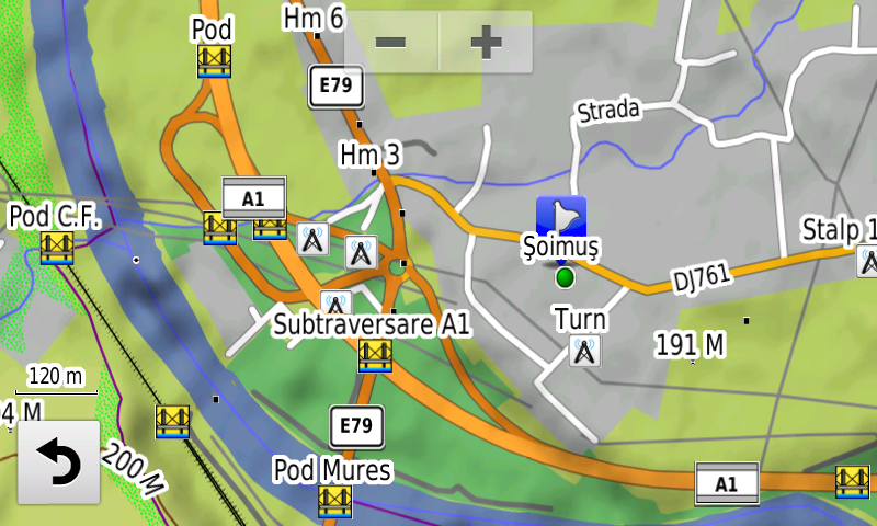
Faţă de hărţile comune de pe piaţă, Atlasul Digital al României are un grad de detaliu, acoperire şi actualitate fără egal, în această ediţie fiind introduse, printre altele segmentul de autostradă A1 dintre Ilia şi Deva şi Centrul de Întreţinere şi Coordonare de la nodul Şoimuş, VO DN5 la sud de 1 Decembrie, devierea de pe DJ105G de la Racoviţă, bretelele de acces în A1 de la Holdea, fără posibilitatea de calcul automat rute şi spaţiul de servicii de pe autostrada A1 de la Ilia. S-a interzis circulaţia pe podul de la Vereşti şi pe unele artere afectate de lucrări din Bucureşti.

S-a introdus zona renaturată Mahmudia.

În această ediţie s-au introdus şi completat adrese poştale în localităţile LIPOVA, ŞOIMOŞ, RADNA, PÂNCOTA, MĂDERAT, MIHĂILEŞTI, POPEŞTI, NOVACI, PRUNI, DUMITRANA, CORNETU, VIDELE, Salonta, Corbu, Vadu, Luminiţa, PIATRA-OLT, ENOŞEŞTI, PIATRA, CRIVA DE JOS, CRIVA DE SUS, TEIŞ, CORBENI, ROMÂNA, ZLĂTĂREI, CONSTANTINEŞTI, CIREAŞOV, BALŞ, SLATINA, SPINENI, DRĂGĂŞANI şi BISTRIŢA NOUĂ.

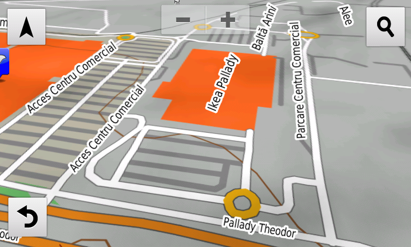
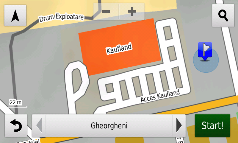
S-a introdus accesul detaliat la centrele comerciale Kaufland şi Penny Market Gheorgheni, Ikea Pallady, Lidl Turnu Măgurele din Bucureşti, Lidl şi Penny Baia Mare. S-au adăugat multe sensuri unice noi, restricţii de viteză precum şi 26 (douăzecişişase) sensuri giratorii noi.

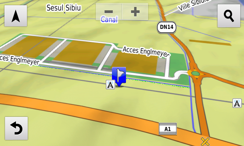
S-au introdus accesul detaliat la Sema Park Bucureşti şi Englmeyer Sibiu.

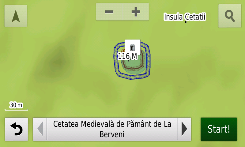
Pasionaţii de istorie vor descoperi în această ediţie în premieră elementele de detaliu (valul şi şanţul) ale cetăţii medievale de pământ de la Berveni. S-au introdus varii monumente comemorative ale eroilor din cele două războaie mondiale.

Dispunând de un concept original, cu actualizări trianuale, rodul muncii timp de peste cincisprezece ani fără întrerupere a pasionaţilor şi specialiştilor din echipa Proiectului România Digitală, Atlasul Digital al României este opţiunea profesioniştilor din toate domeniile şi unealta preferată de navigaţie a amatorilor de drumeţii în aer liber.

Ediţia actuală are 1,03 GB mărime şi rulează exclusiv pe echipamente de navigaţie Garmin, o listă a acestora fiind disponibilă la linkul de mai jos
https://www.rqa.ro/produs.php?id=442&subcat_id=39&cat_id=19

Atenţionare!
Utilizarea hărţii RO.A.D.2019.17 poate crea dependenţă de calitate, valoare, funcţionalitate şi frumos!

RO.A.D.2019.17 Launch

RQA, a Garmin technology dealer in Romania, has the pleasure to announce the availability of the new edition of the Digital Atlas of Romania v11.17, RO.A.D.2019.17.

Continuing in the well known tradition for the Romanian Garmin customers, the Digital Atlas of Romania holds on to the number one place in the GPS road navigation map charts by bringing an extra 8,629.47 km of roads up to a grand total of 452,390.87 km, having significant increased coverage added in the counties of Arad, Ilfov, Teleorman, Bihor, Constanţa and Olt and the number of POIs raises in this edition to a staggering 901.514 points divided into 522 categories.

RO.A.D.2019.17 is the only GPS navigation map in the world that combines topographic details with a routable road network – including dirt roads and trails – with postal addresses of unequaled precision, towns with extruded 3D blocks of flats and detailed 3D textured models for both old patrimony buildings and new skyscrapers, true landmarks of today’s urban space. Map updates are constant and consistent from one edition to another and are documented in the Map Diaries, where all the contributions and their respective authors are mentioned together with the names of the cities and the map tiles that have changed.

Compared with common maps on the market, the Digital Atlas of Romania has an unequaled level of detail, coverage and actuality, featuring, among others, the new A1 motorway segment between Ilia and Deva and the Maintenance and Coordination center from Şoimuş node on A1 motorway, the VO DN5 South of 1 Decembrie, the new service exits from A1 motorway from Ilia, the A1 acces from Holdea (without automatic routing) and the deviation of DJ105G from Racoviţă. Routability has been denied on the Vereşti bridge and on some Bucharest routes affected by long term construction works.

The Mahmudia renaturated area has been introduced.

In this edition we have postal addresses added in the following towns: LIPOVA, ŞOIMOŞ, RADNA, PÂNCOTA, MĂDERAT, MIHĂILEŞTI, POPEŞTI, NOVACI, PRUNI, DUMITRANA, CORNETU, VIDELE, Salonta, Corbu, Vadu, Luminiţa, PIATRA-OLT, ENOŞEŞTI, PIATRA, CRIVA DE JOS, CRIVA DE SUS, TEIŞ, CORBENI, ROMÂNA, ZLĂTĂREI, CONSTANTINEŞTI, CIREAŞOV, BALŞ, SLATINA, SPINENI, DRĂGĂŞANI and BISTRIŢA NOUĂ.

Detailed acces to the retail stores: Kaufland and Penny Market Gheorgheni, Ikea Pallady and Lidl Turnu Măgurele from Bucureşti and Lidl and Penny from Baia Mare. New oneway streets and speed restrictions have been added together with 26 (twentysix) new roundabouts.

The detailed acces to the Sema Park and the logistical center from Englmeyer Sibiu have been introduced.

History aficionados will discover in this edition in premiere the detailed elements (ditch, rampart) of the medieval earthen stronghold from Berveni. Various heroes comemorative monuments from the two world wars have been mapped.

Featuring an original concept, with updates three times a year, the result of more than 15 years of continuous development of the experts and contributors of the Digital Romania Project team (www.romaniadigitala.ro), the Digital Atlas of Romania is the choice of professionals in all fields and the preferred navigation tool for all nature goers.

This edition has 1.03 GB in size and runs exclusively on Garmin navigation equipment, an updated list of compatibility being available at the below link:
https://www.rqa.ro/produs.php?id=442&subcat_id=39&cat_id=19

Warning!
The use of RO.A.D.2019.17 map can create addiction to quality, value, functionality and beauty!

Jurnalul Hărţii RO.A.D.2019.17RO.A.D.2019.17 Map Diary

Modificări între v11.10 şi v11.17

1. Completat reţeaua stradală, adrese pe linii, alfanumerice, reţeaua de puncte de interes, inclusiv blocuri, reţeaua de poligoane, inclusiv blocuri, conform INIS, în localităţile LIPOVA , ŞOIMOŞ, RADNA, PÂNCOTA şi MĂDERAT (L34-068). Introdus integral reţeaua de străzi, puncte de interes şi poligoane în localităţile BELOTINŢ, NADĂŞ şi MINIŞEL. Completat reţeaua de drumuri de exploatare, poteci, drumuri comunale cu denumiri. (Laura Albeanu) (06.05.2019) Continue reading →

Jurnalul Hărţii RO.A.D.2019.10RO.A.D.2019.10 Map Diaries

Modificări între v11.0 şi v11.10

1. Completat reţeaua stradală, adrese pe linii, alfanumerice, reţeua de puncte de interes, inclusiv blocuri, reţeua de poligoane, inclusiv blocuri, conform INIS, în localităţile DĂRMĂNEŞTI, DĂRMĂNEASCA, LAPOŞ, PODEI, SĂLĂTRUC, COMĂNEŞTI, VERMEŞTI şi MOINEŞTI (L35-053). Introdus integral reţeua de străzi, puncte de interes şi poligoane în localităţile ZEMEŞ, SCHITU FRUMOASA, LUNCA ASĂU, ASĂU, APA ASĂU, PĂLTINIŞ, CIOBĂNUŞ şi BOLĂTĂU. Completat reţeua de drumuri de exploatare, poteci, drumuri comunale cu denumiri. (Laura Albeanu) (31.12.2018) Continue reading →

Lansare RO.A.D.2019.10RO.A.D.2019.10 Launch

Lansare RO.A.D.2019.10

RQA, dealer de tehnologie Garmin în Romania, are plăcerea să anunţe disponibilitatea noii ediţii a Atlasului Digital al României v11.10, RO.A.D.2019.10.

Continuând în tradiţia binecunoscută deja clienţilor Garmin din România, Atlasul Digital al României se menţine în continuare pe locul I în clasamentul hărţilor de navigaţie rutieră, aducând în plus faţă de ediţia precedentă 6.733,83 km de drumuri, ridicând la un total de 443.761,40 km de căi de comunicaţii rutiere şi navale acoperirea în teritoriu, cu acoperire îmbogăţită semnificativ în judeţele Bacău, Constanţa, Suceava, Dâmboviţa, Argeş şi Bihor, iar numărul de informaţii de tip punct se ridică în această ediţie la 890,983 puncte împărţite în 522 categorii.

RO.A.D.2019.10 este singura hartă de navigaţie din lume care combină detalii topo cu o structură de drumuri rutabilă – la nivel inclusiv de drumuri de pământ şi poteci – cu adrese poştale de o precizie neegalată, oraşe cu blocuri 3D şi modele minuţios realizate la construcţii vechi, de patrimoniu, sau noi, definitorii pentru peisajul urban actual. Actualizările la hartă sunt constante şi consistente de la o ediţie la alta şi sunt documentate în Jurnalul Hărţii, în care sunt trecute contribuţiile şi autorii acestora, datele la care s-au efectuat precum şi denumirile localităţilor şi planşelor afectate.

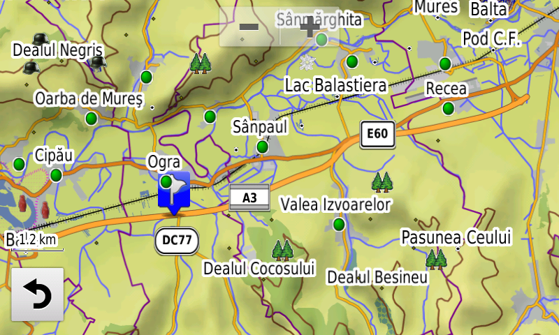
Faţă de hărţile comune de pe piaţă, Atlasul Digital al României are un grad de detaliu, acoperire şi actualitate fără egal, în această ediţie fiind introduse, printre altele sensul giratoriu suspendat şi Centrul de Întreţinere şi Coordonare de la nodul Poiana de pe autostrada A4, pasajul peste C.F. de la Curtici şi spaţiul de servicii de pe autostrada A3 de la Sânpaul. S-a introdus adresabilitatea la nivel de scară de bloc în Constanţa la peste 1.700 de blocuri.

În această ediţie s-au introdus şi completat adrese poştale în localităţile DĂRMĂNEŞTI, DĂRMĂNEASCA, LAPOŞ, PODEI, SĂLĂTRUC, COMĂNEŞTI, VERMEŞTI, MOINEŞTI, CERNAVODĂ (sud), VALEA DACILOR, SIMINOC, MURFATLAR, POIANA, REMUS OPREANU, MEDGIDIA, HOLDA, COTÂRGAŞI, PIETROASA, FRASIN (BROŞTENI), HĂLEASA, LUNGENI, BROŞTENI, NEAGRA, HOLDIŢA, IESLE, DÂRMOXA, PUCIOASA, PUCIOASA-SAT, GLODENI (PUCIOASA), MALURILE, MICULEŞTI, DIACONEŞTI, BELA, BEREVOEŞTI, FIENI, COSTEŞTI, CÂMPULUNG, VALEA RUMÂNEŞTILOR, BEIUŞ (nord) şi DELANI.

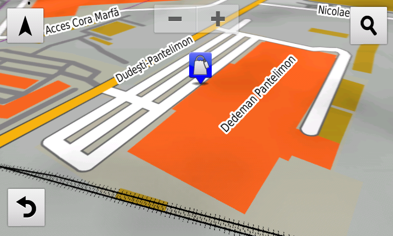
S-a introdus accesul detaliat la centrele comerciale Lidl Aurel Vlaicu din Arad, Dedeman Pantelimon şi Kaufland Şos. Alexandriei din Bucureşti, Penny Bolintin-Vale şi La Strada Militari din Chiajna, Mega Image şi Carrefour din comuna Berceni. S-au adăugat foarte multe sensuri unice noi, restricţii de viteză precum şi 17 (şaptesprezece) sensuri giratorii noi.

S-au introdus accesul detaliat la Renault Bucharest Connected şi centrele logistice de la Aeroportul Otopeni.

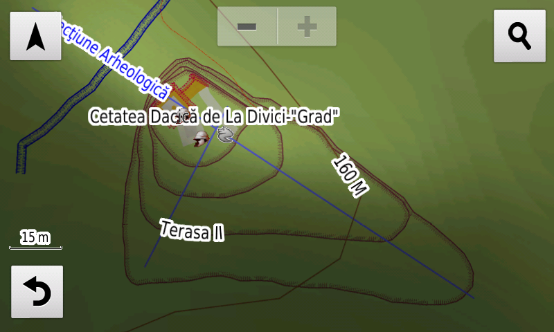
Pasionaţii de istorie vor descoperi în această ediţie în premieră elementele de detaliu (şanţ, ziduri, turnuri locuinţă) ale cetăţii dacice de la Divici-Grad, poziţia probabilă ca punct a castrului roman Mudava?!? de la Moldova Veche-Selişte, valul şi punctul castrului roman? de la Iam precum şi o fortificaţie inedită (punct, val, şanţ) la Divici, probabil castru roman. S-a cartat fosta graniţă de stat între România şi Imperiul Habsburgic şi s-au introdus pichetele româneşti şi austriece de-a lungul ei în planşa L35-017. S-au introdus varii monumente comemorative ale eroilor din cele două războaie mondiale.

Dispunând de un concept original, cu actualizări trianuale, rodul muncii timp de peste cincisprezece ani fără întrerupere a pasionaţilor şi specialiştilor din echipa Proiectului România Digitală, Atlasul Digital al României este opţiunea profesioniştilor din toate domeniile şi unealta preferată de navigaţie a amatorilor de drumeţii în aer liber.

Ediţia actuală are 1,02 GB mărime şi rulează exclusiv pe echipamente de navigaţie Garmin, o listă a acestora fiind disponibilă la linkul de mai jos
http://www.rqa.ro/produs.php?id=442&subcat_id=39&cat_id=19

Atenţionare!
Utilizarea hărţii RO.A.D.2019.10 poate crea dependenţă de calitate, valoare, funcţionalitate şi frumos!

RO.A.D.2019.10 Launch

RQA, a Garmin technology dealer in Romania, has the pleasure to announce the availability of the new edition of the Digital Atlas of Romania v11.10, RO.A.D.2019.10.

Continuing in the well known tradition for the Romanian Garmin customers, the Digital Atlas of Romania holds on to the number one place in the GPS road navigation map charts by bringing an extra 6,733.83 km of roads up to a grand total of 443,761.40 km, having significant increased coverage added in the counties of Bacău, Constanţa, Suceava, Dâmboviţa, Argeş and Bihor and the number of POIs raises in this edition to a staggering 890.983 points divided into 522 categories.

RO.A.D.2019.10 is the only GPS navigation map in the world that combines topographic details with a routable road network – including dirt roads and trails – with postal addresses of unequaled precision, towns with extruded 3D blocks of flats and detailed 3D textured models for both old patrimony buildings and new skyscrapers, true landmarks of today’s urban space. Map updates are constant and consistent from one edition to another and are documented in the Map Diaries, where all the contributions and their respective authors are mentioned together with the names of the cities and the map tiles that have changed.

Compared with common maps on the market, the Digital Atlas of Romania has an unequaled level of detail, coverage and actuality, featuring, among others, the suspended roundabout and the Maintenance and Coordination center from Poiana node on A4 motorway, the passage over the railway from Curtici and the new service exits from A3 motorway from Sânpaul. Address-ability at block stair level has been introduced in Constanţa at over 1,700 blocks of flats.

In this edition we have postal addresses added in the following towns: DĂRMĂNEŞTI, DĂRMĂNEASCA, LAPOŞ, PODEI, SĂLĂTRUC, COMĂNEŞTI, VERMEŞTI, MOINEŞTI, CERNAVODĂ (south), VALEA DACILOR, SIMINOC, MURFATLAR, POIANA, REMUS OPREANU, MEDGIDIA, HOLDA, COTÂRGAŞI, PIETROASA, FRASIN (BROŞTENI), HĂLEASA, LUNGENI, BROŞTENI, NEAGRA, HOLDIŢA, IESLE, DÂRMOXA, PUCIOASA, PUCIOASA-SAT, GLODENI (PUCIOASA), MALURILE, MICULEŞTI, DIACONEŞTI, BELA, BEREVOEŞTI, FIENI, COSTEŞTI, CÂMPULUNG, VALEA RUMÂNEŞTILOR, BEIUŞ (north) and DELANI.

Detailed access to the retail stores: Lidl Aurel Vlaicu from Arad, Dedeman Pantelimon and Kaufland Şos. Alexandriei from Bucureşti, Penny Bolintin-Vale and La Strada Militari from Chiajna, Mega Image and Carrefour from Berceni has been introduced. New one way streets and speed restrictions have been added together with 17 (seventeen) new roundabouts.

The detailed access to the Renault Bucharest Connected and the logistical centers from the Otopeni Airport have been introduced.

History aficionados will discover in this edition in premiere the detailed elements (ditch, walls, towers) of the Dacian fortress from Divici-Grad, the probable location of the roman castrum Mudava?!? from Moldova Veche-Selişte, the rampart and point of the roman castrum? from Iam as well as a previously unknown fortification (point, rampart, ditch) from Divici, probably a roman castrum. The former state boundary between Romania and the Habsburg Empire and the Romanian and Austrian guard posts along it have been mapped in the L35-017 map tile and other various heroes commemorative monuments from the two world wars.

Featuring an original concept, with updates three times a year, the result of more than 15 years of continuous development of the experts and contributors of the Digital Romania Project team, the Digital Atlas of Romania is the choice of professionals in all fields and the preferred navigation tool for all nature goers.

This edition has 1.02 GB in size and runs exclusively on Garmin navigation equipment, an updated list of compatibility being available at the below link:
http://www.rqa.ro/produs.php?id=442&subcat_id=39&cat_id=19

Warning!
The use of RO.A.D.2019.10 map can create addiction to quality, value, functionality and beauty!

Jurnalul Hărții RO.A.D.2019.00RO.A.D.2019.00 Map Diary

Modificări între v10.25 şi 11.00

1. Corecţii şi completări la denumirile cu diacritice româneşti ale poligoanelor din Delta Dunării în planşele L35-105, L35-106, L35-107, L35-094, L35-095, L35-096, L35-108, L35-120, L35-119, L35-118 şi L35-130. (Bogdan Condurăţeanu) (04-05.08.2018) Continue reading →

Lansare RO.A.D.2019.00RO.A.D.2019.00 Launch

RQA, dealer de tehnologie Garmin în Romania, are plăcerea să anunţe disponibilitatea noii ediţii a Atlasului Digital al României v11.00, RO.A.D.2019.00.

Continuând în tradiţia binecunoscută deja clienţilor Garmin din România, Atlasul Digital al României se menţine în continuare pe locul I în clasamentul hărţilor de navigaţie rutieră, aducând în plus faţă de ediţia precedentă 10.528,40 km de drumuri, ridicând la un total de 437.027,57 km de căi de comunicaţii rutiere şi navale acoperirea în teritoriu, cu acoperire îmbogăţită semnificativ în judeţele Suceava, Mureş, Maramureş, Dolj şi Harghita, iar numărul de informaţii de tip punct se ridică în această ediţie la 879.656 puncte împărţite în 522 categorii.

RO.A.D.2019.00 este singura hartă de navigaţie din lume care combină detalii topo cu o structură de drumuri rutabilă – la nivel inclusiv de drumuri de pământ şi poteci – cu adrese poştale de o precizie neegalată, oraşe cu blocuri 3D şi modele minuţios realizate la construcţii vechi, de patrimoniu, sau noi, definitorii pentru peisajul urban actual. Actualizările la hartă sunt constante şi consistente de la o ediţie la alta şi sunt documentate în Jurnalul Hărţii, în care sunt trecute contribuţiile şi autorii acestora, datele la care s-au efectuat precum şi denumirile localităţilor şi planşelor afectate.

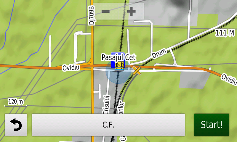
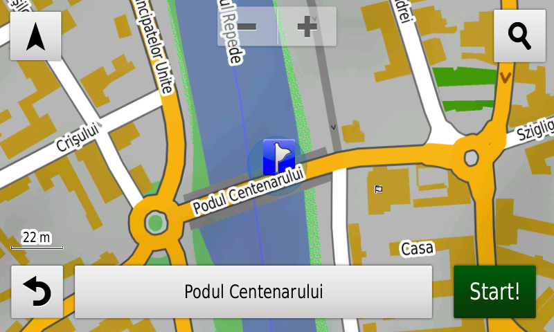
Faţă de hărţile comune de pe piaţă, Atlasul Digital al României are un grad de detaliu, acoperire şi actualitate fără egal, în această ediţie fiind introduse, printre altele, Podul peste Someş de la Gilău de pe autostrada A3, Podul Centenarului din Oradea, Pasajul CET peste calea ferată de la Arad, pasajul peste CF de la Turdaş, devierea pe E81 de la Pârâu Iovului, noile zone pietonale exclusive din Hunedoara, noua configuraţie a nodului Şoimuş de pe A1, Centura Careiului, segmentul Iernut-Ungheni de pe autostrada A3, pasajele peste A1 de la Sinteşti şi Zorani, podul refăcut de la Milişăuţi, noul drum de legătură între strada Cazaban din Oradea şi strada Râturi din Sântandrei, accesul la autostrada A3 din str. Petricani, segmentul de autostradă “urbană” între sensul giratoriu Gherghiţei şi sensul giratoriu de la Popasului, cele două poduri noi peste Dâmboviţa care deservesc prelungirea Nicolae Grigorescu-Dudescu şi sens dublu de parcurgere pe mai multe artere din Bucureşti unde sensurile de mers erau sau au fost despărţite fizic recent.

S-a continuat lucrul la Delta Dunării Rutabilă v2, care permite rutabilitatea pentru bărci şi şalupe în Delta Dunării şi pe Dunăre între Brăila şi Tulcea, completându-se limitele legale de viteză ambarcaţiuni pe canalele şi lacurile identificate pe documentul ARBDD, intrate în vigoare pe 15 iunie 2018. S-a interzis accesul cu barca în rezervaţiile naturale Insulele Prundu cu Păsări şi Insula Ceaplace.

În această ediţie s-au introdus şi completat adrese poştale în localităţile SUCEAVA (sud), VĂRATEC, SALCEA, PRELIPCA, PLOPENI, MERENI, SILIŞTEA, FĂLTICENI, ŢARNA MARE, LUDUŞ, ROŞIORI, AVRĂMEŞTI, GHEJA, IERNUT, LECHINŢA, SFÂNTU GHEORGHE, CIPĂU, TÂRNĂVENI, SĂLCUD, DEAG, CERGHID, BAHNEA, UNGHENI, MOREŞTI, SĂUŞA, MERIŞOR, BUŞAG, Tăuţii-Măgherăuş (sud), BOZÂNTA MARE, MOTIŞ, ULCIUG, SOMEŞ-UILEAC, VICEA, ARDUZEL, CEHU SILVANIEI, ŢICĂU, CHELINŢA, ULMENI, TOHAT, MĂNĂU, ŞOMCUTA MARE, BUCIUMI, VĂLENII ŞOMCUTEI, FINTEUŞU MARE, NADIŞ, BĂILEŞTI, BASARABI, GOLENŢI, BĂLĂŞAN, GHEORGHENI şi BORSEC. S-au adăugat denumiri la blocuri în FĂLTICENI şi Iernut.

S-a introdus accesul detaliat la centrele comerciale Dedeman str. Abatorului din Bacău, Penny Market Sovata şi Lidl Alexandru Averescu din Oradea, Lidl şi Kaufland Brăila, Lidl Micro 21 din Galaţi, Lidl Tudor Vladimirescu din Alba Iulia, Roman Value Center din Roman, Kaufland Carei, Profi şi Nepi Satu Mare, Selgros Suceava, Lidl şi Penny Market Călăraşi, Penny Market Amaradiei din Craiova, Lidl Berceni, Lidl Şoseaua Sălajului din Bucureşti şi Lidl Baloteşti. S-au adăugat foarte multe sensuri unice noi, restricţii de viteză precum şi 47 (patruzecişişapte) sensuri giratorii noi.

S-au introdus parcurile fotovoltaice din Copşa Mică, Cristian, Chirileu, Vidrasău, Ucea de Sus şi Ucea, centrele logistice Ploieşti Industrial Park, Parcul Industrial Sud din Satu Mare, Parcul Industrial Mureş din Ungheni, pista de la Aerodromul Balta Verde, accesul detaliat la Park&Ride Poiana Mică şi Silver Mountain din Poiana Braşov.

Pasionaţii de istorie vor descoperi în această ediţie în premieră elementele de detaliu ale unei aşezări fortificate inedite, probabil preistorică, de la Băzga-Cetăţue (punct, şanţ), aşezarea culturii Gumelniţa de la Urlaţi (punct), ale cetăţilor hallstattiană şi medievală de la Bâra-La Cetate (puncte, valuri, şanţuri), ale cetăţii hallstattiene de la Moşna-Dealul Cetăţuia (punct, valuri, şanţuri), ale cetăţii hallstattiene de la Vutcani-Vladnic (punct, valuri, şanţuri), ale cetăţii hallstattiene de la Arsura-Mogoşeşti (punct, valuri, şanţuri), ale cetăţii geto-dacice de la Dobrovăţ-Cetăţuie (punct, valuri, şanţ), ale cetăţii geto-dacice de la Dagâţa-Cetatea cea Mică a Dagâţei (punct, val, şanţ), ale cetăţii geto-dacice de la Todirel-Dealul Bobeica (punct, val presupus, şanţuri), două fortificaţii inedite-probabil burgus-uri romane la Gura Văii (puncte, valuri, şanţuri), castellum-ul roman de la Răşnov-Cumidava (punct şi şanţ), termele castrului roman de la Hoghiz (punct, poligoane), PORTUL ANTIC ROMAN APULUM (punct), ale quadriburgium-ului roman de la Greci (punct, ziduri), s-a cartat ceea ce pare drumul roman vechi în vecinătatea estică a fortificaţiei, s-a refăcut aspectul basilicii de la Luncaviţa, s-au reamplasat şi s-a refăcut aspectul (puncte, linii) castrelor romano-bizantine XVII, 27, XVI, 26, 25, XV, 24, XIV, 23, 22, 21 şi al castellum-urilor w, v, u, t şi s, al castrelor XXIX, 35 şi XXVIII. S-au introdus elementele de detaliu (val, şanţ) ale cetăţii medievale timpurii de la Dobrovăţ-Palanca, zidurile, turnurile şi bastioanele distruse ale fortificaţiilor medievale otomane ale Oradei precum şi ale redutei şi fortului 18 la nord de localitate, tranşeele germane din primul război mondial de la Ilimbav-La Brazi, cele două baterii Flak AA şi cele 3 cazemate germane? din al doilea război mondial de la Sfântu Gheorghe, bateriile germane din al doilea război mondial de la Patru Fraţi (linii şi puncte), ansamblul comemorativ al eroilor din Brăila, varii monumente comemorative ale eroilor din cele două războaie mondiale.

Dispunând de un concept original, cu actualizări trianuale, rodul muncii timp de cincisprezece ani fără întrerupere a pasionaţilor şi specialiştilor din echipa Proiectului România Digitală, Atlasul Digital al României este opţiunea profesioniştilor din toate domeniile şi unealta preferată de navigaţie a amatorilor de drumeţii în aer liber.

Ediţia actuală are 1,02 GB mărime şi rulează exclusiv pe echipamente de navigaţie Garmin, o listă a acestora fiind disponibilă la linkul de mai jos
https://www.rqa.ro/produs.php?id=442&subcat_id=39&cat_id=19

Atenţionare!
Utilizarea hărţii RO.A.D.2019.00 poate crea dependenţă de calitate, valoare, funcţionalitate şi frumos!


RO.A.D.2019.00 Launch

RQA, a Garmin technology dealer in Romania, has the pleasure to announce the availability of the new edition of the Digital Atlas of Romania v11.00, RO.A.D.2019.00.

Continuing in the well known tradition for the Romanian Garmin customers, the Digital Atlas of Romania holds on to the number one place in the GPS road navigation map charts by bringing an extra 10,528.40 km of roads up to a grand total of 437,027.57 km, having significant increased coverage added in the counties of Suceava, Mureş, Maramureş, Dolj and Harghita and the number of POIs raises in this edition to a staggering 879,656 points divided into 522 categories.

RO.A.D.2019.00 is the only GPS navigation map in the world that combines topographic details with a routable road network – including dirt roads and trails – with postal addresses of unequaled precision, towns with extruded 3D blocks of flats and detailed 3D textured models for both old patrimony buildings and new skyscrapers, true landmarks of today’s urban space. Map updates are constant and consistent from one edition to another and are documented in the Map Diaries, where all the contributions and their respective authors are mentioned together with the names of the cities and the map tiles that have changed.

Compared with common maps on the market, the Digital Atlas of Romania has an unequaled level of detail, coverage and actuality, featuring, among others, the bridge over Someş at Gilău on the A3 motorway, the Centennial Bridge from Oradea, the CET overpass across the railroad from Arad, the railroad overpass from Turdaş, the E81 deviation from Pârâu Iovului, the new exclusive pedestrian areas from Hunedoara, the new configuration of the Şoimuş A1 node, the Carei Ring, the A3 motorway Iernut-Ungheni segment, the A1 overpasses from Sinteşti and Zorani, the new rebuilt bridge from Milişăuţi, the new link road between Cazaban street from Oradea and Râturi street from Sântandrei, the access to the A3 motorway from Petricani street and the “urban motorway” between the Gherghiţei and Popasului roundabouts, the two new bridges over Dâmboviţa that service the penetration Nicolae Grigorescu-Dudescu plus double oneway streets on several arterial roads from Bucharest where the two directions of travel were already or have recently been physically separated.

Work has been continued at the Routable Danube Delta v2, that allows automatic rutability for small boats in the Danube Delta and on the Danube between Brăila and Tulcea, with the completion of the legal speed limits for boats implemented on the lakes and canals identified in the ARBDD document, valid from the 15th June 2018. Boat access has been forbidden inside natural reserves Prundu cu Păsări Islands and Ceaplace Island.

In this edition we have postal addresses added in the following towns: SUCEAVA (south), VĂRATEC, SALCEA, PRELIPCA, PLOPENI, MERENI, SILIŞTEA, FĂLTICENI, ŢARNA MARE, LUDUŞ, ROŞIORI, AVRĂMEŞTI, GHEJA, IERNUT, LECHINŢA, SFÂNTU GHEORGHE, CIPĂU, TÂRNĂVENI, SĂLCUD, DEAG, CERGHID, BAHNEA, UNGHENI, MOREŞTI, SĂUŞA, MERIŞOR, BUŞAG, Tăuţii-Măgherăuş (south), BOZÂNTA MARE, MOTIŞ, ULCIUG, SOMEŞ-UILEAC, VICEA, ARDUZEL, CEHU SILVANIEI, ŢICĂU, CHELINŢA, ULMENI, TOHAT, MĂNĂU, ŞOMCUTA MARE, BUCIUMI, VĂLENII ŞOMCUTEI, FINTEUŞU MARE, NADIŞ, BĂILEŞTI, BASARABI, GOLENŢI, BĂLĂŞAN, GHEORGHENI and BORSEC. The block names from FĂLTICENI şi Iernut have been added.

Detailed acces to the retail stores: Dedeman Abatorului from Bacău, Penny Market Sovata and Lidl Alexandru Averescu from Oradea, Lidl and Kaufland from Brăila, Lidl Micro 21 from Galaţi, Lidl Tudor Vladimirescu from Alba Iulia, Roman Value Center from Roman, Kaufland from Carei, Profi and Nepi from Satu Mare, Selgros from Suceava, Lidl and Penny Market from Călăraşi, Penny Market Amaradiei from Craiova, Lidl Berceni, Lidl Şoseaua Sălajului from Bucharest and Lidl from Baloteşti. New oneway streets and speed restrictions have been added together with 47 (fortyseven) new roundabouts.

The solar parks from Copşa Mică, Cristian, Chirileu, Vidrasău, Ucea de Sus and Ucea have been introduced together with the logistic centres Ploieşti Industrial Park, Parcul Industrial Sud from Satu Mare, Parcul Industrial Mureş from Ungheni, the runway from Balta Verde light aircraft airfield, and detailed access to the Poiana Mică Park&Ride and the Silver Mountain from Poiana Braşov.

History aficionados will discover in this edition in premiere the detailed elements of a previously unknown fortified settlement, probably prehistoric, from Băzga-Cetăţue (point, ditch), the Gumelniţa Culture settlement from Urlaţi (point), the iron age and medieval fortresses from Bâra-La Cetate (point, ramparts, ditches), the iron age fortress from Moşna-Dealul Cetăţuia (point, ramparts, ditches), the iron age fortress from Vutcani-Vladnic (point, ramparts, ditches), the iron age fortress from Arsura-Mogoşeşti (point, ramparts, ditches), of the geto-dacian stronghold from Dobrovăţ-Cetăţuie (point, ramparts, ditch), of the geto-dacian stronghold from Dagâţa-Cetatea cea Mică a Dagâţei (point, rampart, ditch), of the geto-dacian stronghold from Todirel-Dealul Bobeica (point, presumed rampart, ditches). Two previously unknown fortifications – probably roman burgi – have been discovered and mapped at Gura Văii (point, ramparts, ditches), together with the roman castellum from Răşnov-Cumidava (point, ditch), the thermae of the roman castrum from Hoghiz (point, polygons) the roman harbor APULUM (point), the roman quadriburgium from Greci (point, walls), what appears to be the old roman road in the eastern vicinity of the fortification, the aspect of the basilica from Luncaviţa has been updated, the aspect and position of the roman-byzantine castra XVII, 27, XVI, 26, 25, XV, 24, XIV, 23, 22, 21, XXIX, 35 and XXVIII and of the w, v, u, t and s castella (points, ramparts, ditches) have been updated. The detailed elements (rampart, ditch) of the early medieval stronghold from Dobrovăţ-Palanca have been added together with the destroyed walls, towers and bastions of the Turkish fortifications from Oradea as well as the fort and redoubt 18 north of the city, the First World War German trenches from Ilimbav-La Brazi, the two antiaircraft Flak and the 3 German? casemates from the second world war from Sfântu Gheorghe, the German batteries from the second world war from Patru Fraţi (points and ramparts), the heroes commemoration ensemble from Brăila and other various heroes commemorative monuments from the two world wars.

Featuring an original concept, with updates three times a year, the result of 15 years of continuous development of the experts and contributors of the Digital Romania Project team, the Digital Atlas of Romania is the choice of professionals in all fields and the preferred navigation tool for all nature goers.

This edition has 1.02 GB in size and runs exclusively on Garmin navigation equipment, an updated list of compatibility being available at the below link:
http://www.rqa.ro/produs.php?id=442&subcat_id=39&cat_id=19

Warning!
The use of RO.A.D.2019.00 map can create addiction to quality, value, functionality and beauty!

Lansare RO.A.D.2018.25RO.A.D.2018.25 Launch

Lansare RO.A.D.2018.25

RQA, dealer de echipamente Garmin în Romania, are plăcerea să anunţe disponibilitatea noii ediţii a Atlasului Digital al României v10.25, RO.A.D.2018.25.

Continuând în tradiţia binecunoscută deja clienţilor Garmin din România, Atlasul Digital al României se menţine în continuare pe locul I în clasamentul hărţilor de navigaţie rutieră, aducând în plus faţă de ediţia precedentă 8.834,92 km de drumuri, ridicând la un total de 426.499,17 km de căi de comunicaţii rutiere şi navale acoperirea în teritoriu, cu acoperire îmbogăţită semnificativ în judeţele Suceava, Vâlcea, Gorj şi Mehedinţi, iar numărul de informaţii de tip punct se ridică în această ediţie la 872.792 puncte împărţite în 518 categorii.

RO.A.D.2018.25 este singura hartă de navigaţie din lume care combină detalii topo cu o structură de drumuri rutabilă – la nivel inclusiv de drumuri de pământ şi poteci – cu adrese poştale de o precizie neegalată, oraşe cu blocuri 3D şi modele minuţios realizate la construcţii vechi, de patrimoniu, sau noi, definitorii pentru peisajul urban actual. Actualizările la hartă sunt constante şi consistente de la o ediţie la alta şi sunt documentate în Jurnalul Hărţii, în care sunt trecute contribuţiile şi autorii acestora, datele la care s-au efectuat precum şi denumirile localităţilor şi planşelor afectate.

Faţă de hărţile comune de pe piaţă, Atlasul Digital al României are un grad de detaliu şi actualitate fără egal, în această ediţie fiind introduse, printre multe altele, rutabilitatea pe Centura Caracalului, rutabilitatea prin sensul girator de la Holdea, rutabilitatea pe loturile 3 şi 4 ale autostrăzii A10 între Aiud şi Câmpia Turzii, prelungirea Ecaterina Teodoroiu din Oradea, centura Miercurea Ciuc, devierea E60 de la Hădăreni, spaţiile de servicii de pe A1 de la Făget, accesul detaliat în platforma industrială Oltchim, s-a scos podul rupt de ape de peste Olt de la Crihalma şi s-a interzis rutarea pe podul afectat de inundaţii de la Milişăuţi.

În premieră mondială s-a introdus Delta Dunării Rutabilă, care permite rutabilitatea pentru bărci şi şalupe în Delta Dunării şi pe Dunăre între Brăila şi Tulcea, cu limitele legale de viteză ambarcaţiuni pe canalele şi lacurile identificate pe documentul ARBDD, intrate în vigoare pe 15 iunie 2018.

În această ediţie s-au introdus şi completat adrese poştale în localităţile SUCEAVA (nord), MILIŞĂUŢI, LUNCA, GARA, BOHOGHINA, BUCECEA, CĂLINEŞTI (BUCECEA), MĂNĂSTIOARA (SIRET), SIRET, PĂDURENI, DEALU MARE, DOROHOI, LOTURI ENESCU, MERENI, RÂMNICU VÂLCEA, COPĂCELU, STOLNICENI, STUPĂREI, RÂURENI, CĂZĂNEŞTI, TROIAN, GURA SUHAŞULUI, OCNIŢA, FĂCĂI, COŞOTA, LUNCA, SLĂTIOARELE, BUDA, POENARI, GORANU, ARANGHEL, JIBLEA NOUĂ, JIBLEA VECHE, FEŢENI, PĂUŞA, CĂLIMĂNEŞTI, LESPEZI, PRIBA, DEALU MALULUI, SEACA, CĂCIULATA, MOSOROASA, ROMÂNII DE SUS, COMANCA, PIETRIŞU, GURGUIATA, CHEIA, TISA, LIVADIA, OLĂNEŞTI, CHEIA, BĂILE GOVORA, PRAJILA, ROMÂNII DE JOS, HOREZU, STREHAIA, SLĂTINICU MARE, SLĂTINICU MIC, LUNCA BANULUI, STĂNCEŞTI, COMANDA, HURDUCEŞTI, CIOCHIUŢA, MOTRULENI şi TURCENI.

S-a introdus accesul detaliat la centrele Penny Market Cisnădie, Lidl şi Mega Image Prelungirea Ghencea, Penny Market Luica din Bucureşti şi la Penny Market Erou Iancu Nicolae din Voluntari. S-au adăugat unele sensuri unice noi, restricţii de viteză precum şi 6 (şase) sensuri giratorii noi.

Pasionaţii de istorie vor descoperi în această ediţie în premieră elementele de detaliu ale fortificaţiei medievale târzii (valuri, şanţuri) de la Ionăşeni-La Temelii.

Dispunând de un concept original, cu actualizări trianuale, rodul muncii timp de peste paisprezece ani fără întrerupere a pasionaţilor şi specialiştilor din echipa Proiectului România Digitală, Atlasul Digital al României este opţiunea profesioniştilor din toate domeniile şi unealta preferată de navigaţie a amatorilor de drumeţii în aer liber.

Ediţia actuală are 1,02 GB mărime şi rulează exclusiv pe echipamente de navigaţie Garmin, o listă a acestora fiind disponibilă la linkul de mai jos
http://www.rqa.ro/produs.php?id=442&subcat_id=39&cat_id=19

Atenţionare!
Utilizarea hărţii RO.A.D.2018.25 poate crea dependenţă de calitate, valoare, funcţionalitate şi frumos!


RO.A.D.2018.25 Launch

RQA, a Garmin equipment dealer in Romania, has the pleasure to announce the availability of the new edition of the Digital Atlas of Romania v10.25, RO.A.D.2018.25.

Continuing in the well known tradition for the Romanian Garmin customers, the Digital Atlas of Romania holds on to the number one place in the GPS road navigation map charts by bringing an extra 8,834.92 km of roads up to a grand total of 426,499.17 km, having significant increased coverage added in the counties of Suceava, Vâlcea, Gorj and Mehedinţi and the number of POIs raises in this edition to a staggering 872,792 points divided into 518 categories.

RO.A.D.2018.25 is the only GPS navigation map in the world that combines topographic details with a routable road network – including dirt roads and trails – with postal addresses of unequaled precision, towns with extruded 3D blocks of flats and detailed 3D textured models for both old patrimony buildings and new skyscrapers, true landmarks of today’s urban space. Map updates are constant and consistent from one edition to another and are documented in the Map Diaries, where all the contributions and their respective authors are mentioned together with the names of the cities and the map tiles that have changed.

Compared with common maps on the market, the Digital Atlas of Romania has an unequaled level of detail and actuality, featuring, among others, routability on the Caracal ring, routability in the Holdea roundabout, routability on the 3rd and 4th lots of the A10 motorway between Aiud and Câmpia Turzii, the Ecaterina Teodoroiu elongation from Oradea, the Miercurea Ciuc ring, the E60 deviation from Hădăreni, the A1 service exits from Făget, the detailed access to the industrial platform Oltchim; the bridge that was taken away by the Olt waters from Crihalma has been removed and routing over the Milişăuţi bridge was forbidden.

This edition is featuring in a world premiere the Routable Danube Delta, that allows automatic routability for small boats in the Danube Delta and on the Danube between Brăila and Tulcea, with the legal speed limits for boats implemented on the lakes and canals identified in the ARBDD document, valid from the 15th June 2018.

In this edition we have postal addresses added in the following towns: SUCEAVA (north), MILIŞĂUŢI, LUNCA, GARA, BOHOGHINA, BUCECEA, CĂLINEŞTI (BUCECEA), MĂNĂSTIOARA (SIRET), SIRET, PĂDURENI, DEALU MARE, DOROHOI, LOTURI ENESCU, MERENI, RÂMNICU VÂLCEA, COPĂCELU, STOLNICENI, STUPĂREI, RÂURENI, CĂZĂNEŞTI, TROIAN, GURA SUHAŞULUI, OCNIŢA, FĂCĂI, COŞOTA, LUNCA, SLĂTIOARELE, BUDA, POENARI, GORANU, ARANGHEL, JIBLEA NOUĂ, JIBLEA VECHE, FEŢENI, PĂUŞA, CĂLIMĂNEŞTI, LESPEZI, PRIBA, DEALU MALULUI, SEACA, CĂCIULATA, MOSOROASA, ROMÂNII DE SUS, COMANCA, PIETRIŞU, GURGUIATA, CHEIA, TISA, LIVADIA, OLĂNEŞTI, CHEIA, BĂILE GOVORA, PRAJILA, ROMÂNII DE JOS, HOREZU, STREHAIA, SLĂTINICU MARE, SLĂTINICU MIC, LUNCA BANULUI, STĂNCEŞTI, COMANDA, HURDUCEŞTI, CIOCHIUŢA, MOTRULENI and TURCENI.

Detailed acces to the retail stores: Penny Market Cisnădie, Lidl and Mega Image Prelungirea Ghencea, Penny Market Luica from Bucureşti and Penny Market Erou Iancu Nicolae from Voluntari. New oneway streets and speed restrictions have been added together with 6 (six) new roundabouts.

History aficionados will discover in this edition in premiere the detailed elements of the late medieval fortification (ramparts, ditches) from Ionăşeni-La Temelii.

Featuring an original concept, with updates three times a year, the result of over 14 years of continuous development of the experts and contributors of the Digital Romania Project team, the Digital Atlas of Romania is the choice of professionals in all fields and the preferred navigation tool for all nature goers.

This edition has 1.02 GB in size and runs exclusively on Garmin navigation equipment, an updated list of compatibility being available at the below link:
http://www.rqa.ro/produs.php?id=442&subcat_id=39&cat_id=19

Warning!
The use of RO.A.D.2018.25 map can create addiction to quality, value, functionality and beauty!

Lansare RO.A.D.2018.09RO.A.D.2018.09 Launch

RQA, importator de echipamente Garmin în Romania, are plăcerea să anunţe disponibilitatea noii ediţii a Atlasului Digital al României v10.09, RO.A.D.2018.09.

Continuând în tradiţia binecunoscută deja clienţilor Garmin din România, Atlasul Digital al României se menţine în continuare pe locul I în clasamentul hărţilor de navigaţie rutieră, aducând în plus faţă de ediţia precedentă 5.279,00 km de drumuri, ridicând la un total de 417.664,25 km de căi de comunicaţii acoperirea în teritoriu, cu acoperire îmbogăţită semnificativ în judeţele Bihor, Maramureş, Harghita, Suceava, Ilfov şi Alba, iar numărul de informaţii de tip punct se ridică în această ediţie la 865.376 puncte împărţite în 518 categorii.

RO.A.D.2018.09 este singura hartă de navigaţie din lume care combină detalii topo cu o structură de drumuri rutabilă – la nivel inclusiv de drumuri de pământ şi poteci – cu adrese poştale de o precizie neegalată, oraşe cu blocuri 3D şi modele minuţios realizate la construcţii vechi, de patrimoniu, sau noi, definitorii pentru peisajul urban actual. Actualizările la hartă sunt constante şi consistente de la o ediţie la alta şi sunt documentate în Jurnalul Hărţii, în care sunt trecute contribuţiile şi autorii acestora, datele la care s-au efectuat precum şi denumirile localităţilor şi planşelor afectate.

Faţă de hărţile comune de pe piaţă, Atlasul Digital al României are un grad de detaliu şi actualitate fără egal, în această ediţie fiind introduse, printre multe altele blocurile la nivel de denumire şi adresă poştală din Năvodari, din zona centrală a oraşului Popeşti-Leordeni precum şi cele din cartierele Timiş Triaj şi Avantgarde 1, 2 şi 3 din Braşov.

S-au cartat staţiile de vaporetto de pe Bega, Aqua Park din Cornişa şi Terra Park din Bucureşti, împreună cu accesul la acestea.

În această ediţie s-au introdus şi completat adrese poştale în localităţile ORADEA, Cheresig, Biharia, Sândominic, LUNCA ILVEI (est), ARGESTRU, ROŞU, VATRA DORNEI, ALBA IULIA, PÂCLIŞA, MICEŞTI, BĂRĂBANŢ, CIUMBRUD, SÂNCRAI, TEIUŞ, CĂPUD, PEŢELCA, AIUDUL DE SUS, AIUD, Gârbova de Jos, ŢIFRA, GÂRBOVA DE SUS, PETRISAT, BLAJ, VEZA, IZVOARELE, ŢIUR, OARDA, TĂUŢII-MĂGHERĂUŞ (nord), BĂIŢA, NISTRU, SĂBIŞA, SEINI, VIILE APEI, NEGREŞTI-OAŞ, ADRIAN, LIVADA MICĂ, LIVADA, DUMBRAVA, Popeşti-Leordeni şi Bragadiru.

S-a introdus accesul detaliat la centrele accesul detaliat la Cora şi Lidl Brătianu, Kaufland Vivo din Constanţa, Kaufland Olteniţei, Lidl Drumul Binelui, Lidl Sergent Nuţu Vasile, Mega Image Vatra Luminoasă, Dragonul Roşu 1, Mega Image Pucheni, Lidl Teiuş din Bucureşti, Penny Market Drumul Fermei din Popeşti-Leordeni, Penny Market din Bragadiru, Expomarket Doraly 2 din Afumaţi şi complexul comercial Dragonul Roşu 2-9 din Dobroeşti. S-au adăugat unele sensuri unice noi, restricţii de viteză precum şi 18 (optsprezece) sensuri giratorii noi.

Pasionaţii de istorie vor descoperi în această ediţie în premieră elementele de detaliu (şanţurile) ale aşezării fortificate tip Tell de la Uivar, elementele de detaliu (val, şanţ) ale aşezării fortificate a Culturii Gava din Căuaş-Sigheţiu, elementele de detaliu (valuri, şanţuri) ale aşezării fortificate hallstattiene de la Marca-Iertaşul Petacilor, elementele de detaliu ale cetăţii hallstattiene târzii de la Tulcea-La Cetate/Troianul de la Tulcea (val, şanţ), planul de detaliu (val, şanţ) al fortificaţiei hallstattiene de la Jac-Dealul Cămnini, ale cetăţii dacice de la Moigrad-Măgură (şanţurile), două fortificaţii patrulatere de epocă nedeterminată la Zoreni, poligoanele de detaliu ale amfiteatrului roman de la Drobeta, poligoanele de detaliu ale Horreum-ului roman de la Şibot-Obreje, elementele de detaliu (zidurile, clădirile, turnurile, şanţurile) ale castrului roman Certiae/Cersiae de la Brusturi, elementele de detaliu (zidurile, clădirile, turnurile, şanţurile) ale castrului roman de la Tihău-Grădişte, elementele de detaliu (zidurile, clădirile, turnurile, şanţurile) ale castrului roman Largiana de la Românaşi-Cetate, fazele 1 (lemn) şi 2 (piatră), elementele de detaliu ale Burgus-ului Roman de la Zalău-Fântâna Suşigului, elementele de detaliu (clădirile, şanţul al doilea) ale castrului roman Porolissum-Pomet de la Moigrad-Porolissum, elementele de detaliu (şanţul) castrului roman? de la Lespezi, elementele de detaliu (valul) castrului roman? de la Sarighiol din Deal-Dealul Câmpul Verde, un posibil castru roman la Izvoru Crişului-Dealu Borzica, elementele de detaliu (poligoane ziduri) ale termelor castrului roman Angustia de la Breţcu, ale turnului roman (val) de la Jac-Dealul Cămnini, elementele de detaliu (poligoane edificiile E1-4, şanţ delimitare) ale Villa Rustica de la Tărtăria II, elementele de detaliu (poligoane şi linii ziduri şi incinte, puncte turnuri) ale cetăţii romano-bizantine Carsium de la Hârşova, elementele de detaliu (poligoane şi linii ziduri, porţi, basilici şi incinta nouă, puncte turnuri) ale cetăţii romano-bizantine Axiopolis de la Cernavoda, fortul? roman? de la Şendreni împreună cu o fortificaţie inedită de factură similară din vecinătatea acestuia. S-au refăcut o parte din vallum-urile Limes-ului de la Moigrad-Porollissum, s-a refăcut aspectul (valuri, şanţuri) castrelor romano-bizantine de piatră XIII de la Poarta Albă, (XXA), VII, VIII de la Murfatlar, ale castellum-ului o şi castrului romano-bizantin de pământ 20 de la Poarta Albă, 13, 14 şi 15 de pământ de la Murfatlar, ale castellum-urilor de piatră k, l şi m şi cel dintre castrele 14 şi 13 de la Murfatlar, XX, XIX, XXII de piatră de la Peştera, 30, 29 de pământ de la Peştera, ale castellum-urilor de piatră z, y şi x de la Peştera, s-a refăcut aspectul (valuri, şanţuri) castrelor romane 4,5 şi 6 de pământ şi ale castellum-urilor de piatră b, c, d, e şi f de la Valu lui Traian, s-au introdus detaliile (valuri, şanţuri) castrului romano-bizantin de pământ 3 şi castrului romano-bizantin II de piatră de la Constanţa, s-au completat traseele valurilor mare de piatră, ale valurilor mare şi mic de pământ şi s-au introdus detaliile (valuri, şanţuri) castrelor romane de pământ 2 şi 2′ de la Constanţa. S-au introdus elementele de detaliu (val, şanţ) ale tabiilor otomane Arap Tabia şi Tabia 1? (val?!?), completat jumătatea estică a Tabiei Mici (val, şanţ) de la Babadag, elementele de detaliu (val, şanţ) ale palăncii otomane din Vârfurile, şanţurile la tabiile otomane din Hârşova, o posibilă fortificaţie la Babadag-Cimitirul Evreiesc, ale fortului hexagonal otoman de la 1854 (val, şanţ, bastioane) şi ale tabiei otomane nr. 2 (val, şanţ) de la Tulcea-Dealul Tulcea Veche, conturul presupus al valului şi şanţurilor cetăţii medievale timpurii de la Ortelec/Zalău-Cetate, au fost introduse monumente comemorative din primul război mondial (cimitirul eroilor români din Primul Război Mondial din Porumbacu de Sus, osuarul ostaşilor români din Primul Război Mondial de la Diham şi poziţia actuală a Crucii Molomoţ, etc. )

Dispunând de un concept original, cu actualizări trianuale, rodul muncii timp de peste paisprezece ani fără întrerupere a pasionaţilor şi specialiştilor din echipa Proiectului România Digitală, Atlasul Digital al României este opţiunea profesioniştilor din toate domeniile şi unealta preferată de navigaţie a amatorilor de drumeţii în aer liber.

Ediţia actuală are 1,02 GB mărime şi rulează exclusiv pe echipamente de navigaţie Garmin, o listă a acestora fiind disponibilă la linkul de mai jos
http://www.rqa.ro/produs.php?id=442&subcat_id=39&cat_id=19

Atenţionare!
Utilizarea hărţii RO.A.D.2018.09 poate crea dependenţă de calitate, valoare, funcţionalitate şi frumos!


RQA, a Garmin equipment importer in Romania, has the pleasure to announce the availability of the new edition of the Digital Atlas of Romania v10.09, RO.A.D.2018.09.

Continuing in the well known tradition for the Romanian Garmin customers, the Digital Atlas of Romania holds on to the number one place in the GPS road navigation map charts by bringing an extra 5,279.00 km of roads up to a grand total of 417,664.25 km, having significant increased coverage added in the counties of Bihor, Maramureş, Harghita, Suceava, Ilfov and Alba and the number of POIs raises in this edition to a staggering 865,376 points divided into 518 categories.

RO.A.D.2018.09 is the only GPS navigation map in the world that combines topographic details with a routable road network – including dirt roads and trails – with postal addresses of unequaled precision, towns with extruded 3D blocks of flats and detailed 3D textured models for both old patrimony buildings and new skyscrapers, true landmarks of today’s urban space. Map updates are constant and consistent from one edition to another and are documented in the Map Diaries, where all the contributions and their respective authors are mentioned together with the names of the cities and the map tiles that have changed.

Compared with common maps on the market, the Digital Atlas of Romania has an unequaled level of detail and actuality, featuring, among others, the residential areas at block name-postal address level from Năvodari, the center of Popeşti-Leordeni town as well as from the Timiş Triaj and Avantgarde 1, 2 and 3 from Braşov.

The Bega vaporetto stations, Aqua Park from Cornişa and Terra Park from Bucureşti have been mapped, together with access to them.

In this edition we have postal addresses added in the following towns: ORADEA, Cheresig, Biharia, Sândominic, LUNCA ILVEI (East), ARGESTRU, ROŞU, VATRA DORNEI, ALBA IULIA, PÂCLIŞA, MICEŞTI, BĂRĂBANŢ, CIUMBRUD, SÂNCRAI, TEIUŞ, CĂPUD, PEŢELCA, AIUDUL DE SUS, AIUD, Gârbova de Jos, ŢIFRA, GÂRBOVA DE SUS, PETRISAT, BLAJ, VEZA, IZVOARELE, ŢIUR, OARDA, TĂUŢII-MĂGHERĂUŞ (North), BĂIŢA, NISTRU, SĂBIŞA, SEINI, VIILE APEI, NEGREŞTI-OAŞ, ADRIAN, LIVADA MICĂ, LIVADA, DUMBRAVA, Popeşti-Leordeni and Bragadiru.

Detailed acces to the retail stores: Cora and Lidl Brătianu, Kaufland Vivo from Constanţa, Kaufland Olteniţei, Lidl Drumul Binelui, Lidl Sergent Nuţu Vasile, Mega Image Vatra Luminoasă, Dragonul Roşu 1, Mega Image Pucheni, Lidl Teiuş from Bucureşti, Penny Market Drumul Fermei from Popeşti-Leordeni, Penny Market from Bragadiru, Expomarket Doraly 2 from Afumaţi and the commercial complex Dragonul Roşu 2-9 from Dobroeşti. New oneway streets and speed restrictions have been added together with 18 (eighteen) new roundabouts.

History aficionados will discover in this edition in premiere the detailed elements (ditches) of the Tell type fortified settlement from Uivar, the detailed elements (rampart, ditch) of the Gava Culture settlement from Căuaş-Sigheţiu, the detailed elements (ramparts, ditches) of the Iron Age fortified settlement from Marca-Iertaşul Petacilor, the detailed elements (rampart, ditch) of the late Iron Age fortified settlement from Tulcea-La Cetate/Troianul from Tulcea, the detailed elements (rampart, ditch) of the Iron Age fortified settlement from Jac-Dealul Cămnini, of the La Tene stronghold from Moigrad-Măgură (ditches), two square fortifications of undetermined age from Zoreni, the detailed polygons of the Roman amphitheater from Drobeta, of the Roman Horreum from Şibot-Obreje, the detailed elements (walls, buildings, towers, ditches) of the Roman Castrum Certiae/Cersiae from Brusturi, the detailed elements (walls, buildings, towers, ditches) of the Roman Castrum from Tihău-Grădişte, the detailed elements (walls, buildings, towers, ditches) of the Roman Castrum Largiana from Românaşi-Cetate, phase 1 (wood) and 2 (stone), the detailed elements (rampart, ditch) of the Roman Burgus from Zalău-Fântâna Suşigului, ), the detailed elements (buildings, ballistarium, second ditch) of the Roman castrum Porolissum-Pomet from Moigrad-Porolissum, the detailed elements (ditch) of the Roman? castrum from Lespezi, the detailed elements (rampart) of the Roman? castrum from Sarighiol din Deal-Dealul Câmpul Verde, a possible Roman castrum at Izvoru Crişului-Dealu Borzica, the detailed elements (wall polygons) of the thermae of the Angustia Roman castrum from Breţcu, of the Roman tower (rampart) from Jac-Dealul Cămnini, the detailed elements (buildings E1-4 polygons, delimitation ditch) of the Villa Rustica from Tărtăria II, the detailed elements (polygons and lines walls and incints, tower points) of the Roman-Byzantine fortress Carsium from Hârşova, the detailed elements (polygons and lines walls and precincts, gates, the two Basilica and the late precinct, tower points) of the Roman-Byzantine fortress Axiopolis from Cernavoda, the Roman? fortlet? from Şendreni together with a previously unknown similar fortification in its vicinity. Parts of the Moigrad-Porollissum Limes valla have been reconfigured, revisions were made to the aspect (ramparts, ditches) of the Roman-Byzantine stone castra XIII from Poarta Albă, (XXA), VII, VIII from Murfatlar, of the castellum o and the Roman-Byzantine earthen castra 20 from Poarta Albă, 13, 14 and 15 from Murfatlar, of the stone castella k, l, m and the one between the 14 and 13 castra from Murfatlar, the XX, XIX, XXII stone castra from Peştera, the earthen 30, 29 castra from Peştera, the stone castella z, y and x from Peştera, of the roman earthen 4, 5 and 6 castra and of the stone castella b, c, d, e and f from Valu lui Traian. The detailed elements (ramparts, ditches) of the Roman-Byzantine earthen castrum 3,2 and 2′ and stone castrum II from Constanţa were introduced together with additions to the trajectory of the stone vallum, and large and small earthen valla from Constanţa. From the Medieval period the detailed elements (rampart, ditch) of the ottoman Tabyas Arap Tabia and Tabia 1? (rampart?!?), the eastern half of the Small Tabya (rampart, ditch) from Babadag, the detailed elements (rampart, ditch) of the Turkish Palanka from Vârfurile, the ditches of the ottoman Tabyas from Hârşova, a possible fortification at Babadag-Cimitirul Evreiesc, the detailed elements of the hexagonal 1854 ottoman fort (rampart, ditch, bastions) and of the Tabya number 2 (rampart, ditch) from Tulcea-Dealul Tulcea Veche, the supposed contour of the rampart and ditches of the early medieval stronghold from Ortelec/Zalău-Cetate, comemorative World War I monuments (the WWI romanian heroes cemetery from Porumbacu de Sus, the WWI romanian soldiers osuary from Diham and the current position of the Molomoţ cross, etc. ).

Featuring an original concept, with updates three times a year, the result of over 14 years of continuous development of the experts and contributors of the Digital Romania Project team, the Digital Atlas of Romania is the choice of professionals in all fields and the preferred navigation tool for all nature goers.

This edition has 1.02 GB in size and runs exclusively on Garmin navigation equipment, an updated list of compatibility being available at the below link:
http://www.rqa.ro/produs.php?id=442&subcat_id=39&cat_id=19

Warning!
The use of RO.A.D.2018.09 map can create addiction to quality, value, functionality and beauty!

Jurnalul Hărţii RO.A.D.2018.01RO.A.D.2018.01 Map Diary

Modificări între v9.25 şi v10.01

1. Adăugat sau modificat, după caz, în reţeaua de străzi, adrese pe linii, alfanumerice, reţeaua de poligoane şi puncte de interes, conform INIS, în localităţile DUDAŞU SCHELEI, Schela Cladovei şi DROBETA-TURNU SEVERIN (L34-130). Completat reţeaua de drumuri de exploatare, comunale, etc. în jurul localităţilor enumerate mai sus. Completat reţeaua de puncte de interes şi poligoane în oraşul DROBETA-TURNU SEVERIN. (Laura Albeanu) (10.09.2017)
Continue reading →

Lansare RO.A.D.2018.01RO.A.D.2018.01 Launch

Lansare RO.A.D.2018.01

RQA, importator de echipamente Garmin în Romania, are plăcerea să anunţe disponibilitatea noii ediţii a Atlasului Digital al României v10.01, RO.A.D.2018.01.

Continuând în tradiţia binecunoscută deja clienţilor Garmin din România, Atlasul Digital al României se menţine în continuare pe locul I în clasamentul hărţilor de navigaţie rutieră, aducând în plus faţă de ediţia precedentă 5.772,67 km de drumuri, ridicând la un total de 412.385,25 km de căi de comunicaţii acoperirea în teritoriu, cu acoperire îmbogăţită semnificativ în judeţele Gorj, Mehedinţi, Ilfov şi Vaslui, iar numărul de informaţii de tip punct se ridică în această ediţie la 852.928 puncte împărţite în 518 categorii.

RO.A.D.2018.01 este singura hartă de navigaţie din lume care combină detalii topo cu o structură de drumuri rutabilă – la nivel inclusiv de drumuri de pământ şi poteci – cu adrese poştale de o precizie neegalată, oraşe cu blocuri 3D şi modele minuţios realizate la construcţii vechi, de patrimoniu, sau noi, definitorii pentru peisajul urban actual. Actualizările la hartă sunt constante şi consistente de la o ediţie la alta şi sunt documentate în Jurnalul Hărţii, în care sunt trecute contribuţiile şi autorii acestora, datele la care s-au efectuat precum şi denumirile localităţilor şi planşelor afectate.

Faţă de hărţile comune de pe piaţă, Atlasul Digital al României are un grad de detaliu şi actualitate fără egal, în această ediţie fiind introduse, printre multe altele loturile 3 şi 4 ale autostrăzii A10 (fără rutabilitate), pasajul nou peste calea ferată de la Vinţu de Jos, Centura Caracal (fără rutabilitate), viitoarea deviere a DN68 pentru descărcarea temporară a A1 de la Holdea (fără rutabilitate), Centura Turnu Măgurele, sensul dublu din Timişoara spre Şag, sensul dublu între sensul giratoriu din Hărman şi cel de sub varianta ocolitoare Braşov, forma definitivă a intersecţiei A1 x DNCB, sensul dublu din Afumaţi, sensul dublu din Şoseaua Alexandriei, Şoseaua Colentina şi cel de pe Sergent Niţu Vasile şi s-a reintrodus accesul rutier pe strada Valea Ialomiţei din Bucureşti.

S-au cartat fermele solare de la Slobozia, Vieru, Malu, Şag, Burila Mică, Slatina, Linia din Vale, Valea Plopilor şi Valter Mărăcineanu, s-a început cartarea câmpurilor de sonde petroliere din Videle, împreună cu accesul la acestea.

În această ediţie s-au introdus şi completat adrese poştale în localităţile DUDAŞU SCHELEI, Schela Cladovei, DROBETA-TURNU SEVERIN, BEREŞTI-MERIA, BEREŞTI, LĂŢEŞTI, SĂRĂŢENI, SCHINENI, FLORENI, BÂRLAD, TURCENI, JILŢU, MURGEŞTI, GÂRBOVU, VALEA VIEI, STRÂMBA-JIU, MENŢI, HORĂŞTI, LEURDA, VÂRŢ, ROVINARI, Curteana, MĂCEŞU, CREŢEŞTI, FLOREŞTENI, ŢICLENI, VÂRTEJU, MĂGURELE, ALUNIŞU, JILAVA, BRAGADIRU, ROŞU, MOGOŞOAIA, ODĂILE, OTOPENI, VOLUNTARI, CORBEANCA, TAMAŞI, OSTRATU, PETREŞTI, BALOTEŞTI, SĂFTICA, DUMBRĂVENI, CĂCIULAŢI, GAGU, DASCĂLU, RUNCU, DIMIENI, TUNARI, POPEŞTI-LEORDENI, CREAŢA, VÂNĂTORI, STOENOAIA, PETRĂCHIOAIA, COREEA, SURLARI, MĂINEASCA, GRĂDIŞTEA, AFUMAŢI, GĂNEASA, ŞINDRILIŢA, PITEASCA, COZIENI, GĂNEASA, MOARA DOMNEASCĂ, BRĂNEŞTI, ISLAZ, VADU ANEI, POŞTA, BĂLĂCEANCA, TÂNGANU, CĂLDĂRARU, MANOLACHE, GLINA, POPEŞTI-LEORDENI, CĂŢELU, FUNDENI, DOBROEŞTI, PANTELIMON, ŞTEFĂNEŞTII DE SUS, ŞTEFĂNEŞTII DE JOS, CREŢULEASCA, MURGENI, CÂRJA şi RAIU.

S-au introdus de asemenea denumirile blocurilor şi adresele la nivel de scară de bloc în Medgidia şi nodul feroviar din Videle.

S-a introdus accesul detaliat la centrele comerciale Dedeman Turda şi Penny Ocna Mureş, Afi Palace Braşov, Penny Market Deva, Lidl str. Bâlea din Sibiu, Penny Market Tudor Vladimirescu din Alba Iulia, Penny Market Constantin Ene din Bacău, Lidl Şoseaua Mangaliei din Constanţa, Kaufland, Deichmann, Penny şi Lidl Medgidia, Dedeman Bistriţa, Lidl Bărnuţiu din Timişoara, Lidl şi Kaufland Drobeta, Lidl şi Kaufland Artileriei Slatina, Lidl şi Penny Market Oraviţa, Lidl şi Penny Market Petroşani, Lidl şi Carrefour Reghin, Lidl şi Carrefour Market din Sighetu Marmaţiei, Carrefour Market Satu Mare, Shopping City Râmnicu Vâlcea, Lidl Vălenii de Munte, Carrefour Market Militari Residence, Penny Market Pipera, Lidl Voluntari, Pipera Plaza, Deichmann Voluntari, Lidl Otopeni, Mega Image Otopeni şi Lidl Prelungirea Ghencea din Bucureşti. S-au adăugat unele sensuri unice noi, restricţii de viteză precum şi 56 (cinzecişişase) sensuri giratorii noi.

S-a continuat de asemenea cartarea monumentelor istorice reşedinţe istorice (reşedinţa nobiliară Lo-Presti din Sculia, conacul familiei Delavrancea din Goeşti) precum şi a schiturilor şi mănăstirilor de rit ortodox de pe întreg teritoriul ţării. S-au cartat de asemenea monumentele de for public din Hârlău şi Monumentul Maghiarilor de Pretutindeni din Moacşa.

Pasionaţii de istorie vor descoperi în această ediţie în premieră elementele de detaliu (valul) ale fortificaţiei inedite de la Feleag-Vârful Nucilor, elementele de detaliu (val şi şanţ) ale AŞEZĂRII FORTIFICATE DE EP. FIERULUI DE LA VICTORIA-ŞANŢUL CATERINEI, elementele de detaliu (val, şanţ, posibile alte două şanţuri) ale cetăţii getice de la Buhalniţa-Cetăţuie, ale cetăţii getice (valuri şi şanţ) de la Scobinţi-Dealul lui Vodă şi ale cetăţii getice (cinci valuri şi şanţuri) de la Todireşti-La Şanţuri, actualizat forma cetăţii getice (val, şanţ) de la Criveşti-La Cetate. S-au introdus bastioanele (ca puncte) la castrele XXIII, XXIV şi XVIII, s-a revizuit aspectul castrelor 13, 14, 15, IV şi IX şi la castellum-urile g, new şi h, s-a introdus valul castrului romano-bizantin de la Ovidiu, elementele de detaliu (val, şanţ) ale 3 fortificaţii inedite de factură romană în Vâlcele-Dealul Vârşei (pe lângă cea deja publicată -nr. 2- din aceeaşi zonă), 2 posibile castre romane la Dâlnic-Poiana Berzele şi Dâlnic-Poiana Nezobei, elementele de detaliu (val, şanţ) ale fortificaţiei de epocă nedeterminată (probabil castru roman auxiliar de marş) de la Pianu de Jos-Dealu de Sus, elementele de detaliu (val, şanţ) ale unui posibil castru roman legionar de marş inedit la Turia-Turia Vest. S-au introdus termele de la Breţcu ca punct, 2 turnuri romane la Breţcu, elementele de detaliu (val, şanţ) ale burgus-ului roman de la Ocland-Cetatea de Ceapă şi elementele de detaliu (val, şanţ) ale castrului roman de marş de la Feleac-Vârful Cetăţii. S-au introdus elementele de detaliu (valuri, şanţuri) ale cetăţii medievale de pământ Dobra Schantz-Nuovo Fortino de la Lăpugiu de Jos, ale Fortificaţiei Medievale Târzii DE LA CORLĂŢENI-DEALUL CETĂŢII, fortificaţia medievală timpurie de la Caţa-Dealul Rarira (punct) şi elementele de detaliu (valuri, şanţuri, ziduri) ale cetăţii medievale de la Odorheiu Secuiesc-Budvar. S-au introdus tranşeele din al doilea război mondial din Ovidiu, fortul austriac? de la Moacşa-Pădurea Frumoasă, tranşeele, probabil româneşti, din primul război mondial de la Lemnia-Muntele Chisău, au fost introduse monumente comemorative din primul şi al doilea război mondial (cimitirul eroilor români din Primul Război Mondial din Pădurea Lenţea, cimitirul eroilor germani din primul război mondial din Drobeta, cimitirul eroilor din primul război mondial de la Slănic Moldova, cimitirul şi monumentul eroilor sovietici din Deleni, monumentul comemorativ al 100 de ani de la intervenţia Crucii Roşii Americane în România din Iaşi, etc. )

Dispunând de un concept original, cu actualizări trianuale, rodul muncii timp de paisprezece ani fără întrerupere a pasionaţilor şi specialiştilor din echipa Proiectului România Digitală, Atlasul Digital al României este opţiunea profesioniştilor din toate domeniile şi unealta preferată de navigaţie a amatorilor de drumeţii în aer liber.

Ediţia actuală are 1,02 GB mărime şi rulează exclusiv pe echipamente de navigaţie Garmin, o listă a acestora fiind disponibilă la linkul de mai jos
http://www.rqa.ro/produs.php?id=442&subcat_id=39&cat_id=19

Atenţionare!
Utilizarea hărţii RO.A.D.2018.01 poate crea dependenţă de calitate, valoare, funcţionalitate şi frumos!

RO.A.D.2018.01 Launch

RQA, a Garmin equipment importer in Romania, has the pleasure to announce the availability of the new edition of the Digital Atlas of Romania v10.01, RO.A.D.2018.01.

Continuing in the well known tradition for the Romanian Garmin customers, the Digital Atlas of Romania holds on to the number one place in the GPS road navigation map charts by bringing an extra 5,772.67 km of roads up to a grand total of 412,385.25 km, having significant increased coverage added in the counties of Gorj, Mehedinţi, Ilfov and Vaslui and the number of POIs raises in this edition to a staggering 852,928 points divided into 518 categories.

RO.A.D.2018.01 is the only GPS navigation map in the world that combines topographic details with a routable road network – including dirt roads and trails – with postal addresses of unequaled precision, towns with extruded 3D blocks of flats and detailed 3D textured models for both old patrimony buildings and new skyscrapers, true landmarks of today’s urban space. Map updates are constant and consistent from one edition to another and are documented in the Map Diaries, where all the contributions and their respective authors are mentioned together with the names of the cities and the map tiles that have changed.

Compared with common maps on the market, the Digital Atlas of Romania has an unequaled level of detail and actuality, featuring the lots 3 and 4 of the A10 motorway (without rutability), the new passage over the railway from Vinţu de Jos, the Caracal Ring (without rutability), the future deviation of DN68 for the temporary A1 connection from Holdea (without rutability), the Turnu Măgurele Ring, the roadlines separations from Timişoara to Şag, from the Hărman roundabout until the Braşov Ring roundabout, from Afumaţi, Şoseaua Alexandriei, Şoseaua Colentina and Sergent Niţu Vasile, the final routing solution of the A1 x DNCB intersection and vehicle access was reintroduced on Valea Ialomiţei street in Bucureşti.

The solar farms from Slobozia, Vieru, Malu, Şag, Burila Mică, Slatina, Linia din Vale, Valea Plopilor and Valter Mărăcineanu were introduced and the oilfields from Videle have begun to be mapped, together with access to them.

In this edition we have postal addresses added in the following towns: DUDAŞU SCHELEI, Schela Cladovei, DROBETA-TURNU SEVERIN, BEREŞTI-MERIA, BEREŞTI, LĂŢEŞTI, SĂRĂŢENI, SCHINENI, FLORENI, BÂRLAD, TURCENI, JILŢU, MURGEŞTI, GÂRBOVU, VALEA VIEI, STRÂMBA-JIU, MENŢI, HORĂŞTI, LEURDA, VÂRŢ, ROVINARI, Curteana, MĂCEŞU, CREŢEŞTI, FLOREŞTENI, ŢICLENI, VÂRTEJU, MĂGURELE, ALUNIŞU, JILAVA, BRAGADIRU, ROŞU, MOGOŞOAIA, ODĂILE, OTOPENI, VOLUNTARI, CORBEANCA, TAMAŞI, OSTRATU, PETREŞTI, BALOTEŞTI, SĂFTICA, DUMBRĂVENI, CĂCIULAŢI, GAGU, DASCĂLU, RUNCU, DIMIENI, TUNARI, POPEŞTI-LEORDENI, CREAŢA, VÂNĂTORI, STOENOAIA, PETRĂCHIOAIA, COREEA, SURLARI, MĂINEASCA, GRĂDIŞTEA, AFUMAŢI, GĂNEASA, ŞINDRILIŢA, PITEASCA, COZIENI, GĂNEASA, MOARA DOMNEASCĂ, BRĂNEŞTI, ISLAZ, VADU ANEI, POŞTA, BĂLĂCEANCA, TÂNGANU, CĂLDĂRARU, MANOLACHE, GLINA, POPEŞTI-LEORDENI, CĂŢELU, FUNDENI, DOBROEŞTI, PANTELIMON, ŞTEFĂNEŞTII DE SUS, ŞTEFĂNEŞTII DE JOS, CREŢULEASCA, MURGENI, CÂRJA and RAIU.

Detailed acces to the retail stores: Dedeman Turda, Penny Ocna Mureş, Afi Palace Braşov, Penny Market Deva, Lidl Bâlea st. from Sibiu, Penny Market Tudor Vladimirescu from Alba Iulia, Penny Market Constantin Ene from Bacău, Lidl Şoseaua Mangaliei from Constanţa, Kaufland, Deichmann, Penny şi Lidl Medgidia, Dedeman Bistriţa, Lidl Bărnuţiu from Timişoara, Lidl and Kaufland Drobeta, Lidl and Kaufland Artileriei Slatina, Lidl and Penny Market Oraviţa, Lidl and Penny Market Petroşani, Lidl and Carrefour Reghin, Lidl and Carrefour Market Sighetu Marmaţiei, Carrefour Market Satu Mare, Shopping City Râmnicu Vâlcea, Lidl Vălenii de Munte, Carrefour Market Militari Residence, Penny Market Pipera, Lidl Voluntari, Pipera Plaza, Deichmann Voluntari, Lidl Otopeni, Mega Image Otopeni and Lidl Prelungirea Ghencea from Bucureşti. New oneway streets and speed restrictions have been added together with 56 (fiftysix) new roundabouts.

The names and addresses of the blocks from Medgidia and the railway junction from Videle have been introduced.

We also continued mapping the aristocratic mansions representing historical monuments (Lo-Presti residence from Sculia, the Delavrancea family mansion from Goeşti), as well as orthodox monasteries from all over the country. We also mapped the urban forum monuments from Hârlău and the Hungarians from Everywhere Monument from Moacşa.

History aficionados will discover in this edition in premiere the detailed elements (rampart) of the previously unknown fortified settlement from Feleag-Vârful Nucilor, the detailed elements (rampart and ditch) of the iron age fortified settlement from VICTORIA-ŞANŢUL CATERINEI, of the getic fortification (rampart, ditch, 2 possible other ditches) from Buhalniţa-Cetăţuie, of the getic fortification (ramparts and ditch) from Scobinţi-Dealul lui Vodă, of the getic fortification (five ramparts and corresponding ditches) from Todireşti-La Şanţuri, revised the form of the getic fortification (rampart, ditch) from Criveşti-La Cetate. The bastions (points) of the castra XXIII, XXIV and XVIII have been introduced, the aspect of the castra 13, 14, 15, IV and IX and of the castella g, new and h has been revised, the vallum of the roman byzantine castrum from Ovidiu has been introduced together with the detail elements (vallum, ditch) of the 3 previously unknown fortification of possible roman descent from Vâlcele-Dealul Vârşei (besides the one already published -no. 2- from the same area), 2 possible roman castra from Dâlnic-Poiana Berzele and Dâlnic-Poiana Nezobei, the detail elements (vallum, ditch) of the fortification of undetermined age (probably auxiliary roman march castrum) from Pianu de Jos-Dealu de Sus, the detail elements (vallum, ditch) of the previously unknown possible roman legion castrum from Turia-Turia Vest. The roman baths from Breţcu have been introduced as points as well as 2 roman towers from Breţcu together with the detail elements (vallum, ditch) of the roman burgus from Ocland-Cetatea de Ceapă together with the detail elements (vallum, ditch) of the roman march castrum from Feleac-Vârful Cetăţii. The detail elements (ramparts, ditches) of the medieval earthen fortification Dobra Schantz-Nuovo Fortino from Lăpugiu de Jos, of the late medieval fortification from CORLĂŢENI-DEALUL CETĂŢII, the early medieval fortification from Caţa-Dealul Rarira (point) and the detail elements (ramparts, ditches, walls) of the medieval fortress from Odorheiu Secuiesc-Budvar. The second world war trenches from Ovidiu, the Austrian fort from Moacşa-Pădurea Frumoasă, the First World War trenches, probably Romanian, from Lemnia-Muntele Chisău, monuments from the first and second world wars and military cemeteries (the First World War Romanian Heroes cemetery from Pădurea Lenţea, the First World War German Heroes cemetery from Drobeta, the First World War Heroes cemetery from Slănic Moldova, the Second World War Soviet Heroes cemetery from Deleni, the 100 year commemoration monument of the American Red Cross intervention in Romania from Iaşi).

Featuring an original concept, with updates three times a year, the result of 14 years of continuous development of the experts and contributors of the Digital Romania Project team (www.romaniadigitala.ro), the Digital Atlas of Romania is the choice of professionals in all fields and the preferred navigation tool for all nature goers.

This edition has 1.02 GB in size and runs exclusively on Garmin navigation equipment, an updated list of compatibility being available at the below link:
http://www.rqa.ro/produs.php?id=442&subcat_id=39&cat_id=19

Warning!
The use of RO.A.D.2018.01 map can create addiction to quality, value, functionality and beauty!

Lansare RO.A.D.2017.25RO.A.D.2017.25 Launch

Lansare RO.A.D.2017.25

Sheba Distribution SRL, importator de echipamente Garmin în Romania, are plăcerea să anunţe disponibilitatea noii ediţii a Atlasului Digital al României v9.25, RO.A.D.2017.25.RO.A.D.2017.25 Launch

Sheba Distribution SRL, a Garmin equipment importer in Romania, has the pleasure to announce the availability of the new edition of the Digital Atlas of Romania v9.25, RO.A.D.2017.25. Continue reading →

Cei 150 ai Căpitanului IgnatCaptain Ignat’s 150

“Then out spoke brave Horatius, the Captain of the Gate:
“To every man upon this earth, death cometh soon or late;
And how can man die better than facing fearful odds,
For the ashes of his fathers, and the temples of his Gods”

(Horatius, by Lord Thomas Babington Macaulay (1800-1859) )

Continue reading →

Jurnalul Hărţii RO.A.D.2017.13RO.A.D.2017.13 Map Diary

Modificări între v8.32 şi v9.10

1. Completat, îndreptat şi adăugat străzi, puncte de interes, poligoane şi alfanumerice în localităţile TIROL, FIZEŞ, BERZOVIA, VALEAPAI, Bărbosu, DULEU, VALEA MARE, REMETEA-POGĂNICI, FÂRLIUG, RAMNA şi BINIŞ (L34-092) pe baza datelor culese de Dan Popescu. Completat, îndreptat şi adăugat străzi, puncte de interes, poligoane şi alfanumerice, conform INIS, în localităţile CÂLNIC, MONIOM, BUZIAŞ, SILAGIU şi BOCŞA. Corecţii şi adăugiri de străzi în localităţile EZERIŞ, TÂRNOVA şi OCNA DE FIER. Introdus poligoanele (blocurilor si altor poligoane importante) din localitatea BOCŞA conform INIS. Completat reţeaua de drumuri de exploatare, poteci şi drumuri comunale (acestea din urmă cu denumiri conform INIS). Îndreptat reţeaua de căi ferate unde a fost cazul. (Laura Albeanu) (27.12.2016) Continue reading →

Lansare RO.A.D.2017.13RO.A.D.2017.13 Launch

Lansare RO.A.D.2017.13

Sheba Distribution SRL, importator de echipamente Garmin în Romania, are plăcerea să anunţe disponibilitatea noii ediţii a Atlasului Digital al României v9.13, RO.A.D.2017.13.

Continuând în tradiţia binecunoscută deja clienţilor Garmin din România, Atlasul Digital al României se menţine în continuare pe locul I în clasamentul hărţilor de navigaţie rutieră, aducând în plus faţă de ediţia precedentă 9.722,60 km de drumuri, ridicând la un total de 399.465,01 km de căi de comunicaţii acoperirea în teritoriu, cu acoperire îmbogăţită semnificativ în judeţele Argeş, Olt, Gorj, Vâlcea, Hunedoara, Alba, Sibiu şi Caraş-Severin, iar numărul de informaţii de tip punct se ridică în această ediţie la 825.237 puncte împărţite în 519 categorii.

RO.A.D.2017.13 este singura hartă de navigaţie din lume care combină detalii topo cu o structură de drumuri rutabilă – la nivel inclusiv de drumuri de pământ şi poteci – cu adrese poştale de o precizie neegalată, oraşe cu blocuri 3D şi modele minuţios realizate la construcţii vechi, de patrimoniu, sau noi, definitorii pentru peisajul urban actual. Actualizările la hartă sunt constante şi consistente de la o ediţie la alta şi sunt documentate în Jurnalul Hărţii, în care sunt trecute contribuţiile şi autorii acestora, datele la care s-au efectuat precum şi denumirile localităţilor şi planşelor afectate.

Faţă de hărţile comune de pe piaţă, Atlasul Digital al României are un grad de detaliu şi actualitate fără egal, în această ediţie fiind introduse, printre multe altele, Pasajul Piaţa Sudului din Bucureşti (deschis chiar astăzi!), noua configuraţie a DC97 la vest de aeroportul Baia Mare, noua soluţie de rutare la Pasajul Otopeni peste DNCB, spaţiile de servicii de pe DN1K Varianta de Ocolire Braşov, Centura de Sud a Ineului, Pasajul Ploieşti-Vest, DJ142J între Şeica Mică şi Şeica Mare, rutabilitatea pe Pasajul din Sânpetru, devierea de pe E81 de la Lancrăm, devierea DN14B din Crăciunelu de Jos precum şi nodul A3 de la Gilău la Nădăşelu, fără rutare.

S-au cartat ferma solară din Măgurele, sondele petroliere de la Oarja, complexele energetice Turceni şi Rovinari, câmpul de sonde din Ţicleni, groapa ecologică din Şag, ferma solară din Gălbiori, ferma solară din Carei, fermele solare din Ploieşti (din cadrul Petrotel), 2 ferme solare din Berceni, 2 gropi ecologice din Ploieşti şi ferma solară de la Cristuru Secuiesc, împreună cu accesul la acestea.

În această ediţie s-au introdus şi completat adrese poştale în localităţile TIROL, FIZEŞ, BERZOVIA, VALEAPAI, Bărbosu, DULEU, VALEA MARE, REMETEA-POGĂNICI, FÂRLIUG, RAMNA, BINIŞ, CÂLNIC, MONIOM, BUZIAŞ, SILAGIU, BOCŞA, VĂRĂDIA, MERCINA, GRĂDINARI, SURDUCU MARE, COMORÂŞTE, BREZON, FOROTIC, GREONI, DOCLIN, FĂGETU, ENCULEŞTI, VALEA MARE-PODGORIA, ZĂVOI, ŞTEFĂNEŞTII NOI, IZVORANI, ŞTEFĂNEŞTI, VIIŞOARA, GOLEŞTI (ŞTEFĂNEŞTI), CLUCEREASA, RACOVIŢA, MIOVENI, COLIBAŞI, PITEŞTI, RĂHĂU, LANCRĂM, SEBEŞ, PETREŞTI, FÂNTÂNELE, SIBIEL, CRINŢ, SĂCEL, VALE, MAG, TOPÂRCEA, AMNAŞ, ACILIU, APOLDU DE SUS, DOBÂRCA, MIERCUREA SIBIULUI, GALEŞ, SĂLIŞTE, SĂLIŞTEA (MALAIA), PĂSCOAIA, Valea lui Stan, BREZOI, VĂRATICA, GOLOTRENI, CORBU, PROIENI, DRĂGĂNEŞTI (BREZOI), CĂLINESTI, TĂLMĂCEL, TĂLMACIU, VINEREA, CUGIR, BUCURU, BOCŞITURA, GOAŞELE, CĂLENE, MUGEŞTI, AUREL VLAICU, GELMAR, GEOAGIU, CIGMĂU, HOMOROD, SIMERIA VECHE, UROI, CĂRPINIŞ, SIMERIA, ORĂŞTIE, GEOAGIU-BĂI, BOZEŞ, RENGHET, BATIZ, SÂNTĂMĂRIA DE PIATRĂ, STREI-SĂCEL, VALEA SÂNGEORGIULUI, GRID, OHABA STREIULUI, STREISÂNGEORGIU, CĂLAN, FEŢENI, VĂLENI, MERMEZEU-VĂLENI, BOZOVICI, GÂRBOVĂŢ, GLOBU CRAIOVEI, BORLOVENII VECHI, BORLOVENII NOI, PĂTAŞ, PRILIPEŢ, BĂNIA, LĂPUŞNICEL, PETNIC, IABLANIŢA, BĂILE HERCULANE, PLUGOVA, BÂRZA, TOPLEŢ, MEHADIA, EFTIMIE MURGU, MOCERIŞ, ŞOPOTU VECHI, DALBOŞEŢ, LĂPUŞNICU MARE, BOINA, BÂRZ, BOINIŢA, PRISLOP (DALBOŞEŢ), REŞIŢA MICĂ, POIENILE BOINEI, PÂRVOVA, GLOBU CRAIOVEI, CUPTOARE (CORNEA), Costiş, Mesteacăn, POIANA LUNGĂ, VALEA BISTREI, VOISLOVA, în Oţelu Rosu, CIREŞA, MAL, JUPA, CARANSEBEŞ, VAMA MARGA, MARGA, ZEICANI, PĂUCINEŞTI, BREAZOVA, HOBIŢA-GRĂDIŞTE, VALEA DÂLJII, OSTROVU MIC, OSTROV, SUSENI, PEŞTEANA, PEŞTENIŢA, HĂŢĂGEL, DENSUŞ, SARMIZEGETUSA, CLOPOTIVA, BRAZI, OSTROVEL, RÂU DE MORI, BUCOVA, BĂUŢAR, NĂLAŢVAD, HAŢEG, SILVAŞU DE JOS, SILVAŞU DE SUS, IZVOARELE, Dobriţa, Pojogeni, PĂDUREŢU, ROMÂNI, BONCIU, VALEA MARE (BĂBENI), BĂBENI, CAPU DEALULUI, TĂTĂRANI, DRĂGĂŞANI, SÂNTĂMĂRIA-ORLEA, BĂRĂŞTII HAŢEGULUI, VADU, REEA, SĂCEL, SÂNPETRU, SIBIŞEL (RÂU DE MORI), OHABA-SIBIŞEL, CIOPEIA, OHABA DE SUB PIATRĂ, SĂLAŞU DE JOS, ZĂVOI, SĂLAŞU DE SUS, MĂLĂIEŞTI, NUCŞOARA, UNCIUC, CÂRNEŞTI, PĂCLIŞA, TOTEŞTI, CIULA MARE, TUŞTEA, LIVEZI, FĂRCĂDIN, GENERAL BERTHELOT, PAROŞ şi PEŞTERA (SĂLAŞU DE SUS).

S-a introdus accesul detaliat la centrele comerciale Carrefour şi Dedeman Calea Şagului din Timişoara, Lidl, Kaufland şi Atrium de pe calea Aurel Vlaicu din Arad, Piatra-Neamţ Shopping City, Lidl Bd. Decebal, Galleria Mall şi Lidl Bd. Gen. Nicolae Dăscălescu din Piatra-Neamţ, Selgros Alba Iulia, Lidl Buhuşi, Lidl, Penny Market şi Dedeman Bascov şi Lidl Prundu din Piteşti, Lidl Frunzişului şi Kaufland Fabricii de Chibrituri din Cluj-Napoca, Kaufland Barajului din Râmnicu Vâlcea, Kaufland Codlea, Kaufland Călăraşi, Dedeman şi Kaufland 2 Satu Mare, Lidl Bacău, Penny Market Sovata, Kaufland Vatra Dornei, Kaufland şi Dedeman Suceava, Dedeman Târgu Mureş, la Lidl şi Kaufland Livezeni Târgu Mureş, Kaufland şi Lidl Lugoj, Armonia, Brico-Depot, Dedeman şi Expo Arad, cele două Lidl din Bârlad, Lidl Râmnicu Vâlcea, Kaufland Avram Iancu din Braşov, Platinia Cluj-Napoca, Penny Market Şimleu Silvaniei, Penny Market Aleşd, Dedeman, Ambient şi Gold Plaza din Baia Mare, Carrefour şi Dedeman Colentina, Dedeman Pallady, Lidl Pallady, Lidl Bucureştii Noi, Mega Image Pallady şi Kaufland Bucureştii Noi, Mega Mall Pantelimon, Kaufland Pantelimon şi Park Lake Titan din Bucureşti. S-au adăugat unele sensuri unice noi, restricţii de viteză precum şi 38 (treizecişiopt) sensuri giratorii noi.

S-a continuat de asemenea cartarea monumentelor istorice reşedinţe nobiliare din Transilvania precum şi a schiturilor şi mănăstirilor de rit ortodox de pe întreg teritoriul ţării. S-au cartat de asemenea troiţele din Şcheii Braşovului, morile de apă de pe Rudăria din Eftimie Murgu şi monumentele istorice din Reghin.

Au fost actualizate limitele UAT-urilor (Unităţi Administrativ Teritoriale: comune, judeţe, graniţa de stat), conform datelor din 2016, aleile din Parcul Muncipal Ploieşti Vest, accesul exclusiv pietonal şi aleile în parcul central din Cernavoda şi Sebiş.

S-au introdus nodurile feroviare din Bistriţa, Cristeşti (Holboca), Ineu, Sântana, Vatra Dornei, Comăneşti, Vereşti, Augustin, Bârlad, Mihăileni, Izvoru Mureşului, Midia, gara Preajba din Târgu Jiu şi Dej. S-au cartat aerodromul Traian Dârjan din Dezmir şi noua configuraţie a pistei aeroportului Baia Mare.

Pasionaţii de istorie vor descoperi în această ediţie în premieră elementele de detaliu ale fortificaţiei neolitice inedite de la Hoiseşti – Dealul Plopişte, ale cetăţilor dacice de la Racu-Dealu Bogat, Covasna-Cetatea Zânelor, Cernat-Vârful Ascuţit, Biborţeni-Taborc, Bixad-Cetatea Vapa, Racoş-Piatra Detunată, Ormeniş-Tipia Ormenişului, Pinticu Tecii-Cetăţuia, ale aşezării fortificate dacice de la Liteni-Piatra Mare, ale cetăţii dacice/medievale de la Sândominic, ale castrului? roman? de la Baraolt – Cetatea Bac (inedit!), ale unui posibil Burgus roman la Luminţa-Cimitir (inedit!), ale Turnului Roman de la Negrileşti-Dealul Sflederului, ale Burgus-ului Roman de la Negrileşti-Cetatea lui Negru-Vodă, ale Turnurilor Romane de la Negrileşti-Cornul Malului, Ciceu-Poieni-Vârful Osoiului, Purcărete-Faţa Carpenului, Ciceu-Poieni-Strunga Găvojdenilor, Dobricel-Vârful Lazului, Dobricel-Locul Fătului, Sita-Casa Urieşilor, Perişor-Corobană, Perişor-Vârful Zgăului, Perişor-Vârful Colnicului şi Ciceu-Poieni-Podul Milcoiei, ale drumului roman, Burgus-ului şi turnului roman de la Băile Homorod-Foldvar şi Burgus-ului? Roman? de la Satu Mare-Cekend, ale turnurilor romane de la Vălişoara-Valea Rea, Rogna-La Bontauă, Cormeniş-Dealul Hoancelor, Cormeniş-Picioarele Andreichii şi de la Negreni-Podireu precum şi ale castrului roman auxiliar de la Viile-Cimitir. S-au introdus punctele fortificaţiei dacice de la Miercurea Ciuc-Jigodin IV, cetăţii dacice? de la Coşeiu-Poganyvar, templului dacic de la Covasna-Cetatea Zânelor, altarului roman de la Adamclisi, castrului Roman auxiliar? de la Grojdibodu, al fortificaţiei medievale turceşti cu şanţ „de la Igriş” la Ezeriş şi al fortificaţiei medievale Arcis Rudera de la Felnac. Elementele de detaliu ale cetăţii medievale de pământ de la Lunca de Sus-Alte Schanze, ale cetăţii medievale Tordavar de la Moldoveneşti – Cetatea Vămii de Sare, ale fortificaţiilor premoderne austriece de la Brădet, ale tranşeelor moderne de la Vârfu Ursoiu, ale fortului de artilerie inedit de la Cojocna-Straja Mică, ale şanţului maghiar anticar din Linia Fortificată Arpad din al doilea război mondial din Izvoru Mureşului, câteva zeci de monumente comemorative din primul şi al doilea război mondial, monumente de for public şi cimitire militare precum şi denumirile interbelice ale rafinăriilor din Ploieşti sunt de asemenea adăugate în această ediţie a hărţii.

Dispunând de un concept original, cu actualizări trianuale, rodul muncii timp de peste treisprezece ani fără întrerupere a pasionaţilor şi specialiştilor din echipa Proiectului România Digitală, Atlasul Digital al României este opţiunea profesioniştilor din toate domeniile şi unealta preferată de navigaţie a amatorilor de drumeţii în aer liber.

Ediţia actuală are 1,01 GB mărime şi rulează exclusiv pe echipamente de navigaţie Garmin, o listă a acestora fiind disponibilă la linkul de mai jos
http://www.rqa.ro/produs.php?id=442&subcat_id=39&cat_id=19

Atenţionare!
Utilizarea hărţii RO.A.D.2017.13 poate crea dependenţă de calitate, valoare, funcţionalitate şi frumos!


RO.A.D.2017.13 Launch

Sheba Distribution SRL, a Garmin equipment importer in Romania, has the pleasure to announce the availability of the new edition of the Digital Atlas of Romania v9.13, RO.A.D.2017.13.

Continuing in the well known tradition for the Romanian Garmin customers, the Digital Atlas of Romania holds on to the number one place in the GPS road navigation map charts by bringing an extra 9,722.60 km of roads up to a grand total of 399,465.01 km, having significant increased coverage added in the counties of Argeş, Olt, Gorj, Vâlcea, Hunedoara, Alba, Sibiu and Caraş-Severin and the number of POIs raises in this edition to a staggering 825,237 points divided into 519 categories.

RO.A.D.2017.13 is the only GPS navigation map in the world that combines topographic details with a routable road network – including dirt roads and trails – with postal addresses of unequaled precision, towns with extruded 3D blocks of flats and detailed 3D textured models for both old patrimony buildings and new skyscrapers, true landmarks of today’s urban space. Map updates are constant and consistent from one edition to another and are documented in the Map Diaries, where all the contributions and their respective authors are mentioned together with the names of the cities and the map tiles that have changed.

Compared with common maps on the market, the Digital Atlas of Romania has an unequaled level of detail and actuality, featuring the ability to route on the underground Piaţa Sudului Passage from Bucureşti (opened for traffic today!), the new configuration of DC97 west of Baia Mare airport, the new routing solution at Otopeni Passage over DNCB, the service spaces from DN1K Braşov, the south ring of Ineu, the Ploieşti-Vest Passage, the new DJ142J between Şeica Mică and Şeica Mare, the capability to route over the Sânpetru Passage, the E81 deviation from Lancrăm, the DN14B deviation from Crăciunelu de Jos as well as the A3 Nădăşelu Bypass (without routing).

The solar farm from Măgurele, Gălbiori, Carei, Cristuru Secuiesc, Berceni and Ploieşti, the oilfields from Oarja and Ţicleni, the energy generators from Turceni and Rovinari, the dump sites from Şag and Ploieşti have been mapped, together with access to them.

In this edition we have postal addresses added in the following towns: TIROL, FIZEŞ, BERZOVIA, VALEAPAI, Bărbosu, DULEU, VALEA MARE, REMETEA-POGĂNICI, FÂRLIUG, RAMNA, BINIŞ, CÂLNIC, MONIOM, BUZIAŞ, SILAGIU, BOCŞA, VĂRĂDIA, MERCINA, GRĂDINARI, SURDUCU MARE, COMORÂŞTE, BREZON, FOROTIC, GREONI, DOCLIN, FĂGETU, ENCULEŞTI, VALEA MARE-PODGORIA, ZĂVOI, ŞTEFĂNEŞTII NOI, IZVORANI, ŞTEFĂNEŞTI, VIIŞOARA, GOLEŞTI (ŞTEFĂNEŞTI), CLUCEREASA, RACOVIŢA, MIOVENI, COLIBAŞI, PITEŞTI, RĂHĂU, LANCRĂM, SEBEŞ, PETREŞTI, FÂNTÂNELE, SIBIEL, CRINŢ, SĂCEL, VALE, MAG, TOPÂRCEA, AMNAŞ, ACILIU, APOLDU DE SUS, DOBÂRCA, MIERCUREA SIBIULUI, GALEŞ, SĂLIŞTE, SĂLIŞTEA (MALAIA), PĂSCOAIA, Valea lui Stan, BREZOI, VĂRATICA, GOLOTRENI, CORBU, PROIENI, DRĂGĂNEŞTI (BREZOI), CĂLINESTI, TĂLMĂCEL, TĂLMACIU, VINEREA, CUGIR, BUCURU, BOCŞITURA, GOAŞELE, CĂLENE, MUGEŞTI, AUREL VLAICU, GELMAR, GEOAGIU, CIGMĂU, HOMOROD, SIMERIA VECHE, UROI, CĂRPINIŞ, SIMERIA, ORĂŞTIE, GEOAGIU-BĂI, BOZEŞ, RENGHET, BATIZ, SÂNTĂMĂRIA DE PIATRĂ, STREI-SĂCEL, VALEA SÂNGEORGIULUI, GRID, OHABA STREIULUI, STREISÂNGEORGIU, CĂLAN, FEŢENI, VĂLENI, MERMEZEU-VĂLENI, BOZOVICI, GÂRBOVĂŢ, GLOBU CRAIOVEI, BORLOVENII VECHI, BORLOVENII NOI, PĂTAŞ, PRILIPEŢ, BĂNIA, LĂPUŞNICEL, PETNIC, IABLANIŢA, BĂILE HERCULANE, PLUGOVA, BÂRZA, TOPLEŢ, MEHADIA, EFTIMIE MURGU, MOCERIŞ, ŞOPOTU VECHI, DALBOŞEŢ, LĂPUŞNICU MARE, BOINA, BÂRZ, BOINIŢA, PRISLOP (DALBOŞEŢ), REŞIŢA MICĂ, POIENILE BOINEI, PÂRVOVA, GLOBU CRAIOVEI, CUPTOARE (CORNEA), Costiş, Mesteacăn, POIANA LUNGĂ, VALEA BISTREI, VOISLOVA, în Oţelu Rosu, CIREŞA, MAL, JUPA, CARANSEBEŞ, VAMA MARGA, MARGA, ZEICANI, PĂUCINEŞTI, BREAZOVA, HOBIŢA-GRĂDIŞTE, VALEA DÂLJII, OSTROVU MIC, OSTROV, SUSENI, PEŞTEANA, PEŞTENIŢA, HĂŢĂGEL, DENSUŞ, SARMIZEGETUSA, CLOPOTIVA, BRAZI, OSTROVEL, RÂU DE MORI, BUCOVA, BĂUŢAR, NĂLAŢVAD, HAŢEG, SILVAŞU DE JOS, SILVAŞU DE SUS, IZVOARELE, Dobriţa, Pojogeni, PĂDUREŢU, ROMÂNI, BONCIU, VALEA MARE (BĂBENI), BĂBENI, CAPU DEALULUI, TĂTĂRANI, DRĂGĂŞANI, SÂNTĂMĂRIA-ORLEA, BĂRĂŞTII HAŢEGULUI, VADU, REEA, SĂCEL, SÂNPETRU, SIBIŞEL (RÂU DE MORI), OHABA-SIBIŞEL, CIOPEIA, OHABA DE SUB PIATRĂ, SĂLAŞU DE JOS, ZĂVOI, SĂLAŞU DE SUS, MĂLĂIEŞTI, NUCŞOARA, UNCIUC, CÂRNEŞTI, PĂCLIŞA, TOTEŞTI, CIULA MARE, TUŞTEA, LIVEZI, FĂRCĂDIN, GENERAL BERTHELOT, PAROŞ and PEŞTERA (SĂLAŞU DE SUS).

Detailed acces to the retail stores: Carrefour and Dedeman Calea Şagului from Timişoara, Lidl, Kaufland and Atrium from Calea Aurel Vlaicu from Arad, Piatra-Neamţ Shopping City, Lidl Bd. Decebal, Galleria Mall and Lidl Bd. Gen. Nicolae Dăscălescu from Piatra-Neamţ, Selgros Alba Iulia, Lidl Buhuşi, Lidl, Penny Market and Dedeman Bascov and Lidl Prundu from Piteşti, Lidl Frunzişului and Kaufland Fabricii de Chibrituri from Cluj-Napoca, Kaufland Barajului from Râmnicu Vâlcea, Kaufland Codlea, Kaufland Călăraşi, Dedeman and Kaufland 2 Satu Mare, Lidl Bacău, Penny Market Sovata, Kaufland Vatra Dornei, Kaufland and Dedeman Suceava, Dedeman Târgu Mureş, la Lidl and Kaufland Livezeni Târgu Mureş, Kaufland and Lidl Lugoj, Armonia, Brico-Depot, Dedeman and Expo Arad, cele două Lidl from Bârlad, Lidl Râmnicu Vâlcea, Kaufland Avram Iancu from Braşov, Platinia Cluj-Napoca, Penny Market Şimleu Silvaniei, Penny Market Aleşd, Dedeman, Ambient and Gold Plaza from Baia Mare, Carrefour and Dedeman Colentina, Dedeman Pallady, Lidl Pallady, Lidl Bucureştii Noi, Mega Image Pallady and Kaufland Bucureştii Noi, Mega Mall Pantelimon, Kaufland Pantelimon and Park Lake Titan from Bucureşti. New oneway streets and speed restrictions have been added together with 38 (thirtyeight) new roundabouts.

We also continued mapping the aristocratic mansions representing historical monuments from Transylvania, as well as orthodox monasteries from all over the country. We also mapped the historical crosses from Şcheii Braşovului, the Rudăria watermills from Eftimie Murgu and the historical monuments from Reghin.

The 2016 TUA limits (Territorial Administrative Units: commune, county and state boundaries), the alleys from the new Ploieşti Vest municipal park, the pedestrian zones and alleys from Cernavoda and Sebiş.

The railways junctions from Bistriţa, Cristeşti (Holboca), Ineu, Sântana, Vatra Dornei, Comăneşti, Vereşti, Augustin, Bârlad, Mihăileni, Izvoru Mureşului, Midia, Preajba railway station from Târgu Jiu and Dej have also been introduced. The Traian Dârjan airfield from Dezmir and the new configuration of the Baia Mare runway have been included.

History aficionados will discover in this edition in premiere the detailed elements of the previously unknown neolithic fortification from Hoiseşti – Dealul Plopişte, of the Dacian fortifications from Racu-Dealu Bogat, Covasna-Cetatea Zânelor, Cernat-Vârful Ascuţit, Biborţeni-Taborc, Bixad-Cetatea Vapa, Racoş-Piatra Detunată, Ormeniş-Tipia Ormenişului, Pinticu Tecii-Cetăţuia, of the Dacian fortified settlement from Liteni-Piatra Mare, of the Dacian/medieval fortification from Sândominic, of the Roman? Castrum? from Baraolt – Cetatea Bac (previously unknown!), of a possible Roman Burgus from Luminiţa-Cimitir (previously unknown!), of the Roman Tower from Negrileşti-Dealul Sflederului, of the Roman Burgus from Negrileşti-Cetatea lui Negru-Vodă, of the Roman towers from Negrileşti-Cornul Malului, Ciceu-Poieni-Vârful Osoiului, Purcărete-Faţa Carpenului, Ciceu-Poieni-Strunga Găvojdenilor, Dobricel-Vârful Lazului, Dobricel-Locul Fătului, Sita-Casa Urieşilor, Perişor-Corobană, Perişor-Vârful Zgăului, Perişor-Vârful Colnicului and Ciceu-Poieni-Podul Milcoiei, of the Roman road, Burgus and tower from Băile Homorod-Foldvar and of the Roman? Burgus? from Satu Mare-Cekend, of the Roman towers from Vălişoara-Valea Rea, Rogna-La Bontauă, Cormeniş-Dealul Hoancelor, Cormeniş-Picioarele Andreichii and de la Negreni-Podireu as well as the Roman auxiliary Castrum from Viile-Cimitir. The positions of the Dacian fortification from Miercurea Ciuc-Jigodin IV, Dacian? Stronghold from Coşeiu-Poganyvar, of the Dacian temple from Covasna-Cetatea Zânelor, of the Roman altar from Adamclisi, of the Roman? auxiliary Castrum from Grojdibodu, of the Turkish medieval ditch fortification „from Igriş” (sic!) from Ezeriş and of the medieval fortification Arcis Rudera from Felnac, have also been mapped as points of interest. The detailed elements of the medieval earth fortifications Tordavar from Moldoveneşti – Cetatea Vămii de Sare and from Lunca de Sus-Alte Schanze, of the pre-modern Austrian forts from Brădet, the modern trenches from Vârfu Ursoiu, the previously unknown artillery fort from Cojocna-Straja Mică, the Hungarian antitank ditch belonging to the Arpad Fortified Line from the Second World War from Izvoru Mureşului, tens of monuments from the first and second world wars and military cemeteries, as well as the interbelic names of the oil refineries from Ploieşti have also been added in this map edition.

Featuring an original concept, with updates three times a year, the result of more than 13 years of continuous development of the experts and contributors of the Digital Romania Project team (www.romaniadigitala.ro), the Digital Atlas of Romania is the choice of professionals in all fields and the preferred navigation tool for all nature goers.

This edition has 1.01 GB in size and runs exclusively on Garmin navigation equipment, an updated list of compatibility being available at the below link:
http://www.rqa.ro/produs.php?id=442&subcat_id=39&cat_id=19

Warning!
The use of RO.A.D.2017.13 map can create addiction to quality, value, functionality and beauty!

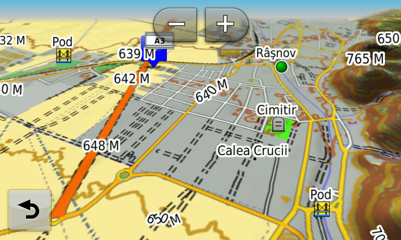
Lansare RO.A.D.2016.32RO.A.D.2016.32 Launch

Lansare RO.A.D.2016.32

Sheba Distribution SRL, importator de echipamente Garmin în România, are plăcerea să anunţe disponibilitatea noii ediţii a Atlasului Digital al României v8.32, RO.A.D.2016.32.

Continuând în tradiţia binecunoscută deja clienţilor Garmin din România, Atlasul Digital al României se menţine în continuare pe locul I în clasamentul hărţilor de navigaţie rutieră, aducând în plus faţă de ediţia precedentă 7.132,17 km de drumuri, ridicând la un total de 389.742,41 km de căi de comunicaţii acoperirea în teritoriu, cu acoperire îmbogăţită semnificativ în judeţele Argeş, Teleorman, Olt, Gorj, Harghita, Vrancea, Hunedoara, Mehedinţi şi Caraş-Severin, iar numărul de informaţii de tip punct se ridică în această ediţie la 794.856 puncte împărţite în 516 categorii.

RO.A.D.2016.32 este singura hartă de navigaţie din lume care combină detalii topo cu o structură de drumuri rutabilă – la nivel inclusiv de drumuri de pământ şi poteci – cu adrese poştale de o precizie neegalată, oraşe cu blocuri 3D şi modele minuţios realizate la construcţii vechi, de patrimoniu, sau noi, definitorii pentru peisajul urban actual. Actualizările la hartă sunt constante şi consistente de la o ediţie la alta şi sunt documentate în Jurnalul Hărţii, în care sunt trecute contribuţiile şi autorii acestora, datele la care s-au efectuat precum şi denumirile localităţilor şi planşelor afectate.

Faţă de hărţile comune de pe piaţă, Atlasul Digital al României are un grad de detaliu şi actualitate fără egal, în această ediţie fiind introduse, printre multe altele, rutabilitatea pe autostrada A1 – “autostrada demolată” – segmentul Cunţa-Sălişte, refăcut între timp, rutabilitatea pe Centura de Sud a Craiovei – aşazisă „Ford”, redeschisă şi aceasta circulaţiei publice, segmentul Traian Vuia-Margina de pe autostrada A1 şi nodurile rutiere de la Margina, Grind şi Ilia, devierea DJ107 la graniţa dintre Alba Iulia şi Ciugud, devierea E81 de la Decea, Pasajul Ciheiului din Oradea Centura Braşovului – porţiunea estică, Pasajul peste DN11, Pasajul Sânpetru – fără rutabilitate, spaţiile de servicii de la Vama Nădlac, nodul rutier de pe A3 de la Moara Vlăsiei, segmentul A3 dintre DNCB şi nodul rutier din strada Popasului precum şi versiunea finală a Centurii Bucureştiului 2+2 între Chitila-Dumbrăveni şi Chiajna-A1.

S-au cartat ferma solară şi centrala electrică din Sebeş, ferma solară din Ovidiu, turbinele eoliene de la Casimcea, parcul eolian de la Topleţ, ferma solară din Tălmaciu, patru parcuri fotovoltaice în Lechinţa, parcurile fotovoltaice din Mănăştiur şi ferma solară din Chişcani, împreună cu accesul la acestea.

În această ediţie s-au introdus şi completat adrese poştale în localităţile CORABIA, TURNU MĂGURELE, BĂDULEASA, CÂRLOMANU, PUTINEIU, BĂNEASA, SALCIA, TUDOR VLADIMIRESCU, VLĂŞCUŢA, STOLNICI, IZBĂŞEŞTI, COCHINEŞTI, PĂDUREŢI, CĂTANE, CIEŞTI, FÂLFANI, COTMEANA (STOLNICI), LUNCA CORBULUI, MĂRŢEŞTI, POPEŞTI (SĂPATA), TURCEŞTI, BĂNĂREŞTI, SĂPATA, BUMBUENI, SILIŞTENI, CERBU, MAREŞ, LĂNGEŞTI, COSTEŞTI, SMEI, PODU BROŞTENI, Broşteni (COSTEŞTI), LĂCENI, STÂRCI, PÂRVU ROŞU, CÂMPU LUI NEAG, Valea de Brazi, PLEŞA, BUMBEŞTI-JIU, ROMANEŞTI, DRĂGOENI, PREAJBA MARE, CURŢIŞOARA, TETILA, LĂZĂREŞTI, IEZURENI, SLOBOZIA, BÂRSEŞTI, Polata, URSAŢI, MERI, LAINICI, TÂRGU JIU, MIERCUREA CIUC, HOSASĂU, VLĂHIŢA, HARGHITA-BĂI, CIBA, MÂNDREŞTI-MUNTENI, MÂNDREŞTI-MOLDOVA, UNIREA, ODOBEŞTI, CĂLIMĂNEŞTI, PĂDURENI (MĂRĂŞEŞTI), HARET, MODRUZENI, SATU NOU, CRUCEA DE JOS, PANCIU, CRUCEA DE SUS, NEICU, TECUCI, SIRETU, MĂRĂŞEŞTI, FOCŞANI, ŞVINIŢA, DUBOVA, EIBENTHAL, BAIA NOUĂ, BERZASCA, LIUBCOVA, COSTENI, CELEI, ISVARNA, POCRUIA, TISMANA, VÂNĂTA, GORNOVIŢA, TOPEŞTI, VÂLCELE, SOHODOL, BREBINA, TITERLEŞTI, BRATILOVU, MĂRĂŞEŞTI, STĂNEŞTI, BÂRÂIACU, OBÂRŞIA-CLOŞANI, ORŞOVA, PECINIŞCA, BĂILE HERCULANE, EŞELNIŢA, POJEJENA, RADIMNA, SUSCA, BELOBRESCA, DIVICI, Baziaş, SOCOL, CÂMPIA, PÂRNEAURA, ZLATIŢA, BERLIŞTE, RUSOVA VECHE, RUSOVA NOUĂ, MĂCEŞTI, SFÂNTA ELENA, LIBORAJDEA, GORNEA, SICHEVIŢA, NICOLINŢ, LEŞCOVIŢA, NAIDĂŞ, MARTINOVĂŢ, STRENEAC, ZĂNOU, CRACU ALMĂJ, VALEA RAVENSCA, VALEA SICHEVIŢEI, CURMĂTURA, CÂRŞIE, FRĂSINIŞ, GÂRNIC, PADINA MATEI, LUCACEVĂŢ, CÂRŞA ROŞIE, VALEA RĂCHITEI, RAVENSCA, OGAŞU PODULUI, BRESTELNIC, CAMENIŢA, CRUŞOVIŢA, PETRILOVA, SLATINA-NERA, BOGODINŢ, SASCA ROMÂNĂ, POTOC, SOCOLARI, Ciuchici, ILIDIA, URCU, VALEA ROŞIE, MILCOVENI, IAM, CIORTEA, VRANI, VRĂNIUŢ, IERTOF, BRATOVA, VALEA MINIŞULUI, PONEASCA, CICLOVA MONTANĂ, ORAVIŢA, BROŞTENI, RĂCHITOVA, BRĂDIŞORU DE JOS, AGADICI, ŞTEIERDORF, ANINA, CUPTOARE (REŞITA), SECU, DOMAN, ŢEROVA, REŞIŢA şi BĂDEŞTI (BÂRLA).

S-a introdus accesul detaliat la centrele comerciale Takko, Deichman, Penny Market şi Kaufland din Alexandria, Lidl Oradea, Lidl şi Penny Market din Focşani, Lidl Hărmanului şi Lidl Zizinului din Braşov, Lidl şi Annabella din Râmnicu Vâlcea, Kaufland, Selgros şi Lidl Târgu Mureş, Lidl şi Penny Market Paşcani, Lidl şi Kaufland Curtea de Argeş, Veranda Mall, Lidl Găzarului şi Lidl Liviu Rebreanu din Bucureşti precum şi Mega Image Chiajna. S-au adăugat unele sensuri unice noi, restricţii de viteză precum şi 39 (treizecişinouă) sensuri giratorii noi.

S-a continuat de asemenea cartarea monumentelor istorice reşedinţe nobiliare din Transilvania precum şi a schiturilor şi mănăstirilor de rit ortodox de pe întreg teritoriul ţării.

S-au introdus nodurile feroviare din Piteşti, Goleşti (Ştefăneşti), fostul Arpechim, Bradu, Costeşti, Medgidia, Murfatlar, Poarta Albă, Castelu, Dragalina, triajul Palas, Feteşti, Dorneşti, Vicşani, Gura Motrului, Stamora Germană, Sânpetru, Râureni, Râmnicu Vâlcea, Bujoreni, Jimbolia, Bod, Petroşani, Salva, Craiova, Caransebeş, Dărmăneşti şi Curtea de Argeş.

Pasionaţii de istorie vor descoperi în această ediţie în premieră elementele de detaliu ale castellum-ului? roman? de pământ de la Cobadin (L34-141), castrului? Roman? cu şanţ dublu de la Topraisar, castrului? roman? de pământ de la Pietreni, traseului probabil al apeductului şi un posibil castru roman la Negureni, castrului? roman? de legiune şi burgus-ului? roman? de la Alexandru Odobescu-La Furcituri, castrului ? roman? de la Căscioarele, castrului? roman? de la Rupea Gară- La Hill, Burgus-ului roman din Salva-Cetăţia, turnului roman din Salva-Roata lui Todoran, turnului roman de la Salva-Dealul Belii şi turnului roman de la Salva-Dumbravă, elementele de detaliu ale aşezării medievale timpurii bulgare fortificate Onglos? de la Vlădeni-Popina Blogodeasa, fortificaţiile medievale? din Negureni, tranşeele din al doilea război mondial de la Deleni şi Haţeg (CT), şantul anticar inedit din al doilea război mondial din sudul Dobrogei pe traseul Haţeg-Abrud-Deleni-Cobadin-Ciobăniţa-Osmancea-Topraisar-Biruinţa şi mai multe cazemate din al doilea război mondial pe teritoriul comunelor Limanu şi Tuzla, câteva zeci de monumente comemorative din primul şi al doilea război mondial, monumente de for public şi cimitire militare între care merită amintit ansamblul Drumul Crucii-Calvarul Armatei Române în Primul Război Mondial de la Mănăstirea Cerbu.

Dispunând de un concept original, cu actualizări trianuale, rodul muncii timp de treisprezece ani fără întrerupere a pasionaţilor şi specialiştilor din echipa Proiectului România Digitală, Atlasul Digital al României este opţiunea profesioniştilor din toate domeniile şi unealta preferată de navigaţie a amatorilor de drumeţii în aer liber.

Ediţia actuală are 1,00 GB mărime şi rulează exclusiv pe echipamente de navigaţie Garmin, o listă a acestora fiind disponibilă la linkul de mai jos
http://www.rqa.ro/produs.php?id=442&subcat_id=39&cat_id=19

Atenţionare!
Utilizarea hărţii RO.A.D.2016.32 poate crea dependenţă de calitate, valoare, funcţionalitate şi frumos!

RO.A.D.2016.32 Launch

Sheba Distribution SRL, a Garmin representative in Romania, has the pleasure to announce the availability of the new edition of the Digital Atlas of Romania v8.32, RO.A.D.2016.32.

Continuing in the well known tradition for the Romanian Garmin customers, the Digital Atlas of Romania holds on to the number one place in the GPS road navigation map charts by bringing an extra 7,132.17 km of roads up to a grand total of 389,742.41 km, having significant increased coverage added in the counties Argeş, Teleorman, Olt, Gorj, Harghita, Vrancea, Hunedoara, Mehedinţi and Caraş-Severin and the number of POIs raises in this edition to a staggering 794,856 points divided into 516 categories.

RO.A.D.2016.32 is the only GPS navigation map in the world that combines topographic details with a routable road network – including dirt roads and trails – with postal addresses of unequaled precision, towns with extruded 3D blocks of flats and detailed 3D textured models for both old patrimony buildings and new skyscrapers, true landmarks of today’s urban space. Map updates are constant and consistent from one edition to another and are documented in the Map Diaries, where all the contributions and their respective authors are mentioned together with the names of the cities and the map tiles that have changed.

Compared with common maps on the market, the Digital Atlas of Romania has an unequaled level of detail and actuality, featuring the ability to route on the Cunţa-Sălişte segment of the A1 („the demolished motorway”) which was rebuilt in the meantime, the ability to route on the South Ring of Craiova – the so called „Ford Ring” – also opened again for public access, the A1 Traian Vuia-Margina motorway segment de pe autostrada A1 and the Margina, Grind and Ilia bypasses, the DJ107 deviation at the border between Alba Iulia and Ciugud, the E81 deviation from Decea, the Ciheiului overpass from Oradea, the Braşov Ring – the Eastern part, the DN11 overpass, the Sânpetru overpass – without ability to route over, the service areas at Nădlac Customs, the A3 motorway bypass from Moara Vlăsiei, the A3 motorway segment between DNCB and the Popasului bypass as well as the final version of the Bucharest ring 2+2 between Chitila and Dumbrăveni and Chiajna and A1 motorway.

The solar farm and electric utility from Sebeş, the solar farm from Ovidiu, the wind turbines from Casimcea and Topleţ, the solar farm from Tălmaciu, the four photovoltaic parks from Lechinţa, the photovoltaic parks Mănăştiur and Chişcani have been mapped, together with access to them.

In this edition we have postal addresses added in the following towns: CORABIA, TURNU MĂGURELE, BĂDULEASA, CÂRLOMANU, PUTINEIU, BĂNEASA, SALCIA, TUDOR VLADIMIRESCU, VLĂŞCUŢA, STOLNICI, IZBĂŞEŞTI, COCHINEŞTI, PĂDUREŢI, CĂTANE, CIEŞTI, FÂLFANI, COTMEANA (STOLNICI), LUNCA CORBULUI, MĂRŢEŞTI, POPEŞTI (SĂPATA), TURCEŞTI, BĂNĂREŞTI, SĂPATA, BUMBUENI, SILIŞTENI, CERBU, MAREŞ, LĂNGEŞTI, COSTEŞTI, SMEI, PODU BROŞTENI, Broşteni (COSTEŞTI), LĂCENI, STÂRCI, PÂRVU ROŞU, CÂMPU LUI NEAG, Valea de Brazi, PLEŞA, BUMBEŞTI-JIU, ROMANEŞTI, DRĂGOENI, PREAJBA MARE, CURŢIŞOARA, TETILA, LĂZĂREŞTI, IEZURENI, SLOBOZIA, BÂRSEŞTI, Polata, URSAŢI, MERI, LAINICI, TÂRGU JIU, MIERCUREA CIUC, HOSASĂU, VLĂHIŢA, HARGHITA-BĂI, CIBA, MÂNDREŞTI-MUNTENI, MÂNDREŞTI-MOLDOVA, UNIREA, ODOBEŞTI, CĂLIMĂNEŞTI, PĂDURENI (MĂRĂŞEŞTI), HARET, MODRUZENI, SATU NOU, CRUCEA DE JOS, PANCIU, CRUCEA DE SUS, NEICU, TECUCI, SIRETU, MĂRĂŞEŞTI, FOCŞANI, ŞVINIŢA, DUBOVA, EIBENTHAL, BAIA NOUĂ, BERZASCA, LIUBCOVA, COSTENI, CELEI, ISVARNA, POCRUIA, TISMANA, VÂNĂTA, GORNOVIŢA, TOPEŞTI, VÂLCELE, SOHODOL, BREBINA, TITERLEŞTI, BRATILOVU, MĂRĂŞEŞTI, STĂNEŞTI, BÂRÂIACU, OBÂRŞIA-CLOŞANI, ORŞOVA, PECINIŞCA, BĂILE HERCULANE, EŞELNIŢA, POJEJENA, RADIMNA, SUSCA, BELOBRESCA, DIVICI, Baziaş, SOCOL, CÂMPIA, PÂRNEAURA, ZLATIŢA, BERLIŞTE, RUSOVA VECHE, RUSOVA NOUĂ, MĂCEŞTI, SFÂNTA ELENA, LIBORAJDEA, GORNEA, SICHEVIŢA, NICOLINŢ, LEŞCOVIŢA, NAIDĂŞ, MARTINOVĂŢ, STRENEAC, ZĂNOU, CRACU ALMĂJ, VALEA RAVENSCA, VALEA SICHEVIŢEI, CURMĂTURA, CÂRŞIE, FRĂSINIŞ, GÂRNIC, PADINA MATEI, LUCACEVĂŢ, CÂRŞA ROŞIE, VALEA RĂCHITEI, RAVENSCA, OGAŞU PODULUI, BRESTELNIC, CAMENIŢA, CRUŞOVIŢA, PETRILOVA, SLATINA-NERA, BOGODINŢ, SASCA ROMÂNĂ, POTOC, SOCOLARI, Ciuchici, ILIDIA, URCU, VALEA ROŞIE, MILCOVENI, IAM, CIORTEA, VRANI, VRĂNIUŢ, IERTOF, BRATOVA, VALEA MINIŞULUI, PONEASCA, CICLOVA MONTANĂ, ORAVIŢA, BROŞTENI, RĂCHITOVA, BRĂDIŞORU DE JOS, AGADICI, ŞTEIERDORF, ANINA, CUPTOARE (REŞITA), SECU, DOMAN, ŢEROVA, REŞIŢA şi BĂDEŞTI (BÂRLA).

Detailed acces to the retail stores: Takko, Deichman, Penny Market and Kaufland from Alexandria, Lidl Oradea, Lidl and Penny Market from Focşani, Lidl Hărmanului and Lidl Zizinului from Braşov, Lidl and Annabella from Râmnicu Vâlcea, Kaufland, Selgros and Lidl Târgu Mureş, Lidl and Penny Market Paşcani, Lidl and Kaufland Curtea de Argeş, Veranda Mall, Lidl Găzarului and Lidl Liviu Rebreanu from Bucureşti as well as Mega Image Chiajna. New oneway streets and speed restrictions have been added together with 39 (thirtynine) new roundabouts.

We also continued mapping the aristocratic mansions representing historical monuments from Transylvania, as well as orthodox monasteries from all over the country.

The railways junctions from Piteşti, Goleşti (Ştefăneşti), fostul Arpechim, Bradu, Costeşti, Medgidia, Murfatlar, Poarta Albă, Castelu, Dragalina, triajul Palas, Feteşti, Dorneşti, Vicşani, Gura Motrului, Stamora Germană, Sânpetru, Râureni, Râmnicu Vâlcea, Bujoreni, Jimbolia, Bod, Petroşani, Salva, Craiova, Caransebeş, Dărmăneşti and Curtea de Argeş have also been introduced.

History aficionados will discover in this edition in premiere the detailed elements of the possible earth roman castellum from Cobadin, the double ditched roman? castrum? from Topraisar, the roman? castrum? from Pietreni, the probable layout of the aqueduct and the roman? castrum? from Negureni, the roman? legion castrum? and burgus? from Alexandru Odobescu-La Furcituri, the roman? castrum? from Căscioarele, the roman? castrum? from Rupea Gară- La Hill, the roman Burgus from Salva-Cetăţia, the roman watch tower from Salva-Roata lui Todoran, the roman watch tower from Salva-Dealul Belii and the roman watch tower from Salva-Dumbravă, the detailed elements of the early mediaeval Bulgarian fortified settlement Onglos? from Vlădeni-Popina Blogodeasa, the mediaeval? fortifications from Negureni, the world war two trenches from Deleni and Haţeg (CT), the previously unknown world war two anti tank ditch from Southern Dobrudja from Haţeg-Abrud-Deleni-Cobadin-Ciobăniţa-Osmancea-Topraisar-Biruinţa and many more world war two casemates from the territories of the Limanu and Tuzla communes, tens of monuments from the first and second world wars and military cemeteries, most worthy to mention being the ensemble „The Way of the Cross-the Calvary of the Romanian Army in the First World War” from the Cerbu Monastery.

Featuring an original concept, with updates three times a year, the result of 13 years of continuous development of the experts and contributors of the Digital Romania Project team, the Digital Atlas of Romania is the choice of professionals in all fields and the preferred navigation tool for all nature goers.

This edition has 1.00 GB in size and runs exclusively on Garmin navigation equipment, an updated list of compatibility being available at the below link:
http://www.rqa.ro/produs.php?id=442&subcat_id=39&cat_id=19

Warning!
The use of RO.A.D.2016.32 map can create addiction to quality, value, functionality and beauty!
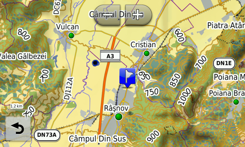
Lansare RO.A.D.2016.20RO.A.D.2016.20 Launch

Lansare RO.A.D.2016.20

Sheba Distribution SRL, importator de echipamente Garmin în Romania, are plăcerea să anunţe disponibilitatea noii ediţii a Atlasului Digital al României v8.20, RO.A.D.2016.20.

Continuând în tradiţia binecunoscută deja clienţilor Garmin din România, Atlasul Digital al României se menţine în continuare pe locul I în clasamentul hărţilor de navigaţie rutieră, aducând în plus faţă de ediţia precedentă 6.009,32 km de drumuri, ridicând la un total de 382.610,24 km de căi de comunicaţii acoperirea în teritoriu, cu acoperire îmbogăţită semnificativ în judeţele Bistriţa-Năsăud, Sălaj, Teleorman, Argeş şi Olt, iar numărul de informaţii de tip punct se ridică în această ediţie la 739.106 puncte împărţite în 511 de categorii.

RO.A.D.2016.20 este singura hartă de navigaţie din lume care combină detalii topo cu o structură de drumuri rutabilă – la nivel inclusiv de drumuri de pământ şi poteci – cu adrese poştale de o precizie neegalată, oraşe cu blocuri 3D şi modele minuţios realizate la construcţii vechi, de patrimoniu, sau noi, definitorii pentru peisajul urban actual. Actualizările la hartă sunt constante şi consistente de la o ediţie la alta şi sunt documentate în Jurnalul Hărţii, în care sunt trecute contribuţiile şi autorii acestora, datele la care s-au efectuat precum şi denumirile localităţilor şi planşelor afectate.

Faţă de hărţile comune de pe piaţă, Atlasul Digital al României are un grad de detaliu şi actualitate fără egal, în această ediţie fiind introduse, printre multe altele, Centura de SudVest Năvodari, denumirile blocurilor din Alexandria, rutabilitatea pe Pasajul Viilor din Piteşti, configuraţia nouă a DN14B la Coşlariu Nou, TransRarăul, Pasajul Nojoridului, Aquapark Nymphaea şi noua configuraţie a Pieţei Unirii din Oradea, modernizată cu bani europeni. S-au cartat ferma solară şi termocentrala de la Iernut, fermele solare din Moldoveneşti, Recaş, Topolovăţu Mare, Osorhei, Chiribiş, Sâncraiu de Mureş, Agrişteu, Tureni, Săcel, Mândruloc, gropile ecologice de la Orăştie, Simeria şi Huşi precum şi sondele petroliere de la Abram şi Măgurele, împreună cu accesul la acestea.

În această ediţie s-au introdus şi completat adrese poştale în localităţile NANOV, SPĂTĂREI, FURCULEŞTI, MOŞTENI, VOIEVODA, GROŞENI, TELEORMANU, POROŞCHIA, CALOMFIREŞTI, MÂRZĂNEŞTI, CERNETU, PURANI (VITĂNEŞTI), SEACA, NĂVODARI, VÂNĂTORI, VALEA PĂRULUI, LISA, BRÂNCENI, ŢIGĂNEŞTI, PIATRA, ALEXANDRIA, HUSIA, RONA, VAR, JIBOU, CUCEU, STANA, ZALĂU, POPENI, TURBUŢA, BECLEAN, FIGA, NĂSĂUD, LUŞCA, LIVIU REBREANU, SIGMIR, BISTRIŢA, SĂRATA, SÂMBOIENI, CUTCA, CEABA, VALEA UNGURAŞULUI, UNGURAŞ, BATIN, VÂLCELE, BEUDIU, SALVA, REBRIŞOARA, ZAGRA, PODEREI, NĂSĂUD, COLDĂU, BECLENUŢ, DOBRIC, CĂIANU MIC, SĂSARM, TAURE, ŞINTEREAG, COCIU, MOGOŞENI, FLOREŞTI, PIATRA, MIREŞ, DUMBRĂVIŢA, MITITEI, NIMIGEA DE SUS, MOCOD, NIMIGEA DE JOS, MINTIU, CHIUZA, REBRA, CORMAIA, VALEA BORCUŢULUI, SÂNGEORZ BĂI, BORŞA, MAIERU, ANIEŞ, IVĂNEASA, ILVA MARE, MĂGURA ILVEI, POIANA ILVEI, CORMAIA, RODNA, VALEA MARE, ŞANŢ, LUNCA ILVEI, SLĂTINIŢA, GHINDA, NEPOS, FELDRU, PODEREIA FELDRULUI, ILVA MICĂ, DULCENI, URLUIU, BROŞTEANCA, TROIANUL, BOGDANA, ULMENI, FLORICA, ZLATA, CERNETU, GROŞENI, TELEORMANU, VALEA PĂRULUI, MÂRZĂNEŞTI, CRÂNGU, SECARA, DRACEA, STOBORĂŞTI, TUFENI, MOZĂCENII-VALE, PODIŞORU, BRABEŢI, ZUVELCAŢI, URLUENI, HÂRSEŞTI, MALU (BÂRLA), MÂNDRA, CIOCEŞTI, BÂRLA, BUJORENI, PRUNARU, DĂRVAŞ, VITĂNEŞTI, TROIANUL, VATRA, PLOSCA, PERETU, BUZESCU, STEJARU, SCRIOAŞTEA, GRESIA, SOCETU, MÂNDRA, POPEŞTI (VĂLENI), VĂLENI, NICOLAE TITULESCU, CRÂMPOIA, GHIMPEŢENII NOI, BÂRZA şi GHIMPEŢENI.

S-a introdus accesul detaliat la centrele comerciale Kaufland Bistriţa, Lidl Năvodari, Penny Market Alba Iulia, Penny Market Streisângeorgiu, Selgros Ernei, Dedeman Oradea, Arena Mall şi Billa Bacău, Dedeman Miercurea Ciuc, Billa New Town şi Lidl Drumul Găzarului Bucureşti, Kaufland Democraţiei Ploieşti, Dedeman Tulcea, centrul logistic de la Cipău, accesul detaliat la uzina Renault-Dacia din Mioveni, s-au adăugat unele sensuri unice noi şi 38 (treizecişiopt) sensuri giratorii noi.

S-au introdus noile perimetre, coduri şi nomenclaturi ale rezervaţiilor naturale din România, versiunea 2016, ca punct, limită şi poligon.

S-a continuat de asemenea cartarea monumentelor istorice reşedinţe nobiliare din Transilvania precum şi a schiturilor şi mănăstirilor de rit ortodox de pe întreg teritoriul ţării.

S-au introdus nodurile feroviare din Lumina, Ovidiu, Năvodari, Cluj NV, Aiud, Coşlariu Nou, Sântimbru, Teiuş, Roşiori de Vede, Alexandria, Osorhei, Cristeşti, Târgu Mureş, Arad, Vladimirescu, Buftea, Gara 23 August din Bucureşti, Ciumeşti, Clucereasa, Bogdăneşti (Fălciu), Adjud şi Sfântu Gheorghe.

Pasionaţii de istorie vor descoperi în această ediţie în premieră elementele de detaliu ale posibilului castru roman de pământ de la Baraolt-Valea Nadaşului şi tranşeele româneşti din primul război mondial de pe Muntele Clăbucetul Baiului, monumentele şi cimitirele martirilor evrei ai pogromului din 1941, câteva zeci de monumente comemorative din primul şi al doilea război mondial, monumente de for public şi cimitire militare.

S-a introdus de asemenea modelul 3D texturat al Cetăţii Neamţului, pe baza reconstituirii ideale realizate de Radu Oltean.

Dispunând de un concept original, cu actualizări trianuale, rodul muncii timp de peste doisprezece ani fără întrerupere a pasionaţilor şi specialiştilor din echipa Proiectului România Digitală, Atlasul Digital al României este opţiunea profesioniştilor din toate domeniile şi unealta preferată de navigaţie a amatorilor de drumeţii în aer liber.

Ediţia actuală are 1.020,8 MB mărime şi rulează exclusiv pe echipamente de navigaţie Garmin, o listă a acestora fiind disponibilă la linkul de mai jos
http://www.rqa.ro/produs.php?id=442&subcat_id=39&cat_id=19

Atenţionare!
Utilizarea hărţii RO.A.D.2016.20 poate crea dependenţă de calitate, valoare, funcţionalitate şi frumos!

RO.A.D.2016.20 Launch

Sheba Distribution SRL, a Garmin equipment importer in Romania, has the pleasure to announce the availability of the new edition of the Digital Atlas of Romania v8.20, RO.A.D.2016.20.

Continuing in the well known tradition for the Romanian Garmin customers, the Digital Atlas of Romania holds on to the number one place in the GPS road navigation map charts by bringing an extra 6,009.32 km of roads up to a grand total of 382,610.24 km, having significant increased coverage added in the counties Bistriţa-Năsăud, Sălaj, Teleorman, Argeş and Olt and the number of POIs raises in this edition to a staggering 739,106 points divided into 511 categories.

RO.A.D.2016.20 is the only GPS navigation map in the world that combines topographic details with a routable road network – including dirt roads and trails – with postal addresses of unequaled precision, towns with extruded 3D blocks of flats and detailed 3D textured models for both old patrimony buildings and new skyscrapers, true landmarks of today’s urban space. Map updates are constant and consistent from one edition to another and are documented in the Map Diaries, where all the contributions and their respective authors are mentioned together with the names of the cities and the map tiles that have changed.

Compared with common maps on the market, the Digital Atlas of Romania has an unequaled level of detail and actuality, featuring the SouthWest Năvodari Ring, the block names in Alexandria, route calculation on the Viilor Passage in Piteşti, the new configuration of the DN14B at Coşlariu Nou, the TransRarău road, The Nojoridului Passage, Nymphaea Aquapark and the new configuration of Unirii Plaza from Oradea, modernized with EU funds, plus the solar farm and thermocentral from Iernut, the solar farms from Moldoveneşti, Recaş, Topolovăţu Mare, Osorhei, Chiribiş, Sâncraiu de Mureş, Agrişteu, Tureni, Săcel, Mândruloc, the ecological waste dumps from Orăştie, Simeria and Huşi as well as the oil fields from Abram and Măgurele, together with access to them.

In this edition we have postal addresses added in the following towns: NANOV, SPĂTĂREI, FURCULEŞTI, MOŞTENI, VOIEVODA, GROŞENI, TELEORMANU, POROŞCHIA, CALOMFIREŞTI, MÂRZĂNEŞTI, CERNETU, PURANI (VITĂNEŞTI), SEACA, NĂVODARI, VÂNĂTORI, VALEA PĂRULUI, LISA, BRÂNCENI, ŢIGĂNEŞTI, PIATRA, ALEXANDRIA, HUSIA, RONA, VAR, JIBOU, CUCEU, STANA, ZALĂU, POPENI, TURBUŢA, BECLEAN, FIGA, NĂSĂUD, LUŞCA, LIVIU REBREANU, SIGMIR, BISTRIŢA, SĂRATA, SÂMBOIENI, CUTCA, CEABA, VALEA UNGURAŞULUI, UNGURAŞ, BATIN, VÂLCELE, BEUDIU, SALVA, REBRIŞOARA, ZAGRA, PODEREI, NĂSĂUD, COLDĂU, BECLENUŢ, DOBRIC, CĂIANU MIC, SĂSARM, TAURE, ŞINTEREAG, COCIU, MOGOŞENI, FLOREŞTI, PIATRA, MIREŞ, DUMBRĂVIŢA, MITITEI, NIMIGEA DE SUS, MOCOD, NIMIGEA DE JOS, MINTIU, CHIUZA, REBRA, CORMAIA, VALEA BORCUŢULUI, SÂNGEORZ BĂI, BORŞA, MAIERU, ANIEŞ, IVĂNEASA, ILVA MARE, MĂGURA ILVEI, POIANA ILVEI, CORMAIA, RODNA, VALEA MARE, ŞANŢ, LUNCA ILVEI, SLĂTINIŢA, GHINDA, NEPOS, FELDRU, PODEREIA FELDRULUI, ILVA MICĂ, DULCENI, URLUIU, BROŞTEANCA, TROIANUL, BOGDANA, ULMENI, FLORICA, ZLATA, CERNETU, GROŞENI, TELEORMANU, VALEA PĂRULUI, MÂRZĂNEŞTI, CRÂNGU, SECARA, DRACEA, STOBORĂŞTI, TUFENI, MOZĂCENII-VALE, PODIŞORU, BRABEŢI, ZUVELCAŢI, URLUENI, HÂRSEŞTI, MALU (BÂRLA), MÂNDRA, CIOCEŞTI, BÂRLA, BUJORENI, PRUNARU, DĂRVAŞ, VITĂNEŞTI, TROIANUL, VATRA, PLOSCA, PERETU, BUZESCU, STEJARU, SCRIOAŞTEA, GRESIA, SOCETU, MÂNDRA, POPEŞTI (VĂLENI), VĂLENI, NICOLAE TITULESCU, CRÂMPOIA, GHIMPEŢENII NOI, BÂRZA and GHIMPEŢENI.

Detailed access to the retail stores: Kaufland Bistriţa, Lidl Năvodari, Penny Market Alba Iulia, Penny Market Streisângeorgiu, Selgros Ernei, Dedeman Oradea, Arena Mall and Billa Bacău, Dedeman Miercurea Ciuc, Billa New Town and Lidl Drumul Găzarului Bucureşti, Kaufland Democraţiei Ploieşti, Dedeman Tulcea, the logistical center from Cipău, detailed access to the Renault-Dacia manufacturing plant from Mioveni plus many new one way streets have been added together with 38 (thirtyeight) new roundabouts.

The new perimeters, codes and names of the nature reserves from Romania, version 2016, have been implemented as points of interest, limits and polygons.

We also continued mapping the aristocratic mansions representing historical monuments from Transylvania, as well as orthodox monasteries from all over the country.

The railways junctions from Lumina, Ovidiu, Năvodari, Cluj NW, Aiud, Coşlariu Nou, Sântimbru, Teiuş, Roşiori de Vede, Alexandria, Osorhei, Cristeşti, Târgu Mureş, Arad, Vladimirescu, Buftea, the 23 August Railway Station from Bucureşti, Ciumeşti, Clucereasa, Bogdăneşti (Fălciu), Adjud and Sfântu Gheorghe have also been introduced.

History aficionados will discover in this edition in premiere the detailed elements of the possible earth roman castrum from Baraolt-Valea Nadaşului, the Romanian trenches from World War One from Clăbucetul Baiului Mountain, the monuments and mass graves of the Jewish martyrs of the Holocaust from 1941, tens of monuments from the first and second world wars and military cemeteries.

The 3D textured model of the Neamţ Fortress has also been introduced, based on Radu Oltean’s ideal reconstitution.

Featuring an original concept, with updates three times a year, the result of more than 12 years of continuous development of the experts and contributors of the Digital Romania Project team, the Digital Atlas of Romania is the choice of professionals in all fields and the preferred navigation tool for all nature goers.

This edition has 1,020.8 MB in size and runs exclusively on Garmin navigation equipment, an updated list of compatibility being available at the below link:
http://www.rqa.ro/produs.php?id=442&subcat_id=39&cat_id=19

Warning!
The use of RO.A.D.2016.20 map can create addiction to quality, value, functionality and beauty!
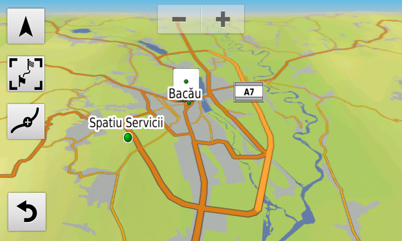
Continue reading →

Lansare RO.A.D.2016.10RO.A.D.2016.10 Launch

Lansare RO.A.D.2016.10

Sheba Distribution SRL, importator de echipamente Garmin în Romania, are plăcerea să anunţe disponibilitatea noii ediţii a Atlasului Digital al României v8.10, RO.A.D.2016.10.

Continuând în tradiţia binecunoscută deja clienţilor Garmin din România, Atlasul Digital al României se menţine în continuare pe locul I în clasamentul hărţilor de navigaţie rutieră, aducând în plus faţă de ediţia precedentă 1.360,63 km de drumuri, ridicând la un total de 376.600,92 km de căi de comunicaţii acoperirea în teritoriu, cu acoperire îmbogăţită semnificativ în judeţele Prahova şi Dâmboviţa, iar numărul de informaţii de tip punct se ridică în această ediţie la 685.066 puncte împărţite în 510 categorii.

RO.A.D.2016.10 este singura hartă de navigaţie din lume care combină detalii topo cu o structură de drumuri rutabilă – la nivel inclusiv de drumuri de pământ şi poteci – cu adrese poştale de o precizie neegalată, oraşe cu blocuri 3D şi modele minuţios realizate la construcţii vechi, de patrimoniu, sau noi, definitorii pentru peisajul urban actual. Actualizările la hartă sunt constante şi consistente de la o ediţie la alta şi sunt documentate în Jurnalul Hărţii, în care sunt trecute contribuţiile şi autorii acestora, datele la care s-au efectuat precum şi denumirile localităţilor şi planşelor afectate.

Faţă de hărţile comune de pe piaţă, Atlasul Digital al României are un grad de detaliu şi actualitate fără egal, în această ediţie fiind introduse, printre multe altele, porţiunea din autostrada A1 segmentul Timişoara-Lugoj, lotul 2, drumul expres Ecaterina Teodoroiu şi pasajele rutiere supraterane peste DN 76 şi peste DN79 din Oradea, Pasajul Octav Băncilă din Iaşi, nodul rutier de pe A1 de la Iosifalău, nodul rutier de pe A3 de la Gherghiţa, Centura de nord a Romanului, sensul giratoriu suspendat din Blejoi (inedit la data aceasta), „Centura de Shopping” din Braşov, Centura de Nord-Est a Jiboului (inedită la data aceasta) şi centura de vest a Zalăului. S-au cartat fermele eoliene din Oraviţa, Corni, Topolog, Dorobanţu şi Casimcea, turbinele eoliene din parcul eolian Catalan din Vânători, turbinele eoliene din Vutcani, Drânceni, Gemenele, Nălbanţ, Valea Nucarilor, Beştepe, Nufăru, Mahmudia, Mihai Bravu şi oraşul Babadag, completat parcul de eoliene din comuna Mihai Bravu, câmpul de sonde din NV Timişoarei, parcul de sonde petrolifere şi turbinele eoliene din comunele Slobozia Conachi şi Schela, împreună cu accesul la acestea.

În această ediţie s-au introdus şi completat adrese poştale în localităţile BUCOV, PLOIEŞTIORI, GHIGHIU, MOARA NOUĂ, DÂMBU, CORLĂŢEŞTI, BLEJOI, TĂTĂRANI, BĂRCĂNEŞTI, PLOIEŞTI, ŢÂNŢĂRENI, BOLDEŞTI – SCĂENI, SECIU, MIZIL, SLĂNIC, PRĂJANI, GROŞANI, PODU VADULUI, IRIMEŞTI, SURDEŞTI, VALEA TÂRSEI, FRĂSINET, NISTOREŞTI, PODU CORBULUI, PODU LUNG, POIANA, GURA BELIEI, BREAZA, COMARNIC, POSADA, GHIOŞEŞTI, CÂMPINA, SINAIA, BĂICOI, PLOPENI, GĂGENI, PĂULEŞTI, COCOŞESTI, BLEJOI, TÂRGŞORU VECHI, ZAHANAUA, STÂNCEŞTI, TÂRGŞORU NOU, STOENEŞTI, NEDELEA, BUDA (ARICEŞTII RAHTIVANI), ARICEŞTII RAHTIVANI, PĂULEŞTII NOI, STREJNICU, MORENI şi URLAŢI.

S-a introdus accesul detaliat la centrele comerciale 2 magazine Kaufland, 1 magazin Penny, Oradea Shopping City şi Baumax din Oradea, Penny Adjud, Lidl Vaslui, magazinele Selgros, Hornbach şi Decathlon din Timişoara, Lidl Huşi, Kaufland Brăila 2, Kaufland, Altex, Deichman şi Lidl Făgăraş, Lidl Victoria, Dedeman, Carrefour şi Praktiker Târgu Jiu, Profi Hârlău, Lidl Deva, Kaufland şi Penny Ploieşti, Kaufland şi Lidl Odorheiu Secuiesc, Leroy-Merlin, Lidl, Piaţa Agroalimentară şi Mega Image Bragadiru, Auchan Tricodava, Kaufland 1 Mai, Kaufland Basarab, Lidl şi Kaufland Valea Cascadelor, Kaufland Valea Oltului, Promenada Mall, Penny Market Bd. Timişoara din Bucureşti, s-a refăcut accesul detaliat la Dedeman Alba Iulia, Ploieşti Shopping City şi Promenada Brăila, s-au adăugat unele sensuri unice noi şi 69 (şaizecişinouă) sensuri giratorii noi.

S-a continuat de asemenea cartarea monumentelor istorice reşedinţe nobiliare din Transilvania precum şi a schiturilor şi mănăstirilor de rit ortodox de pe întreg teritoriul ţării.

Pasionaţii de istorie vor descoperi în această ediţie în premieră elementele de detaliu ale aşezărilor fortificate de la Turnu-Turnu Sud şi Turnu-Pusta Sionda, Curtici-Curtici 4 şi Sânpaul-Sânpaul Est, ale valurilor de pământ dintre Aluniş şi Zăbrani, completări ale fortificaţiei romane? De la Secusigiu-La Cimitir, ale fortificaţiei medievale? patrulatere de la Secusigiu-Cariera de Lut, cazematele germane din primul război mondial şi podurile germane din al doilea război mondial din comuna Jijila, o cazemată din al doilea război mondial din Târgu Neamţ, câteva zeci de monumente comemorative din primul şi al doilea război mondial, monumente de for public şi cimitire militare.

Dispunând de un concept original, cu actualizări trianuale, rodul muncii timp de peste doisprezece ani fără întrerupere a pasionaţilor şi specialiştilor din echipa Proiectului România Digitală, Atlasul Digital al României este opţiunea profesioniştilor din toate domeniile şi unealta preferată de navigaţie a amatorilor de drumeţii în aer liber.

Ediţia actuală are 838,4 MB mărime şi rulează exclusiv pe echipamente de navigaţie Garmin, o listă a acestora fiind disponibilă la linkul de mai jos
http://www.rqa.ro/produs.php?id=442&subcat_id=39&cat_id=19

Atenţionare!
Utilizarea hărţii RO.A.D.2016.10 poate crea dependenţă de calitate, valoare, funcţionalitate şi frumos!

RO.A.D.2016.10 Launch

Sheba Distribution SRL, a Garmin representative in Romania, has the pleasure to announce the availability of the new edition of the Digital Atlas of Romania v8.10, RO.A.D.2016.10.

Continuing in the well known tradition for the Romanian Garmin customers, the Digital Atlas of Romania holds on to the number one place in the GPS road navigation map charts by bringing an extra 1,360.63 km of roads up to a grand total of 376,600.92 km, having significant increased coverage added in the counties Prahova and Dâmboviţa and the number of POIs raises in this edition to a staggering 685,066 points divided into 510 categories.

RO.A.D.2016.10 is the only GPS navigation map in the world that combines topographic details with a routable road network – including dirt roads and trails – with postal addresses of unequaled precision, towns with extruded 3D blocks of flats and detailed 3D textured models for both old patrimony buildings and new skyscrapers, true landmarks of today’s urban space. Map updates are constant and consistent from one edition to another and are documented in the Map Diaries, where all the contributions and their respective authors are mentioned together with the names of the cities and the map tiles that have changed.

Compared with common maps on the market, the Digital Atlas of Romania has an unequaled level of detail and actuality, featuring the A1 motorway segment Timişoara-Lugoj, batch 2, the express road Ecaterina Teodoroiu and overhead passages over DN76 and DN79 from Oradea, the Octav Băncilă railway passage from Iaşi, the A1 motorway bypass from Iosifalău, the A3 motorway bypass from Gherghiţa, the northern ring of Roman, the suspended roundabout from Blejoi (first time ever in a GPS navigation map), the „Shopping Ring” from Braşov, the north-eastern Ring of Jibou (first time ever in a GPS navigation map) and the west ring of Zalău, plus the wind farms from Oraviţa, Corni, Topolog, Dorobanţu, Casimcea, the wind turbines from the Catalan park from Vânători, the wind turbines from Vutcani, Drânceni, Gemenele, Nălbanţ, Valea Nucarilor, Beştepe, Nufăru, Mahmudia, Mihai Bravu and Babadag, additions to the wind park from Mihai Bravu, the oilfields from the NW of Timişoara,the wind turbines and oilfields from Slobozia Conachi and Schela, together with access to them.

In this edition we have postal addresses added in the following towns: BUCOV, PLOIEŞTIORI, GHIGHIU, MOARA NOUĂ, DÂMBU, CORLĂŢEŞTI, BLEJOI, TĂTĂRANI, BĂRCĂNEŞTI, PLOIEŞTI, ŢÂNŢĂRENI, BOLDEŞTI – SCĂENI, SECIU, MIZIL, SLĂNIC, PRĂJANI, GROŞANI, PODU VADULUI, IRIMEŞTI, SURDEŞTI, VALEA TÂRSEI, FRĂSINET, NISTOREŞTI, PODU CORBULUI, PODU LUNG, POIANA, GURA BELIEI, BREAZA, COMARNIC, POSADA, GHIOŞEŞTI, CÂMPINA, SINAIA, BĂICOI, PLOPENI, GĂGENI, PĂULEŞTI, COCOŞESTI, BLEJOI, TÂRGŞORU VECHI, ZAHANAUA, STÂNCEŞTI, TÂRGŞORU NOU, STOENEŞTI, NEDELEA, BUDA (ARICEŞTII RAHTIVANI), ARICEŞTII RAHTIVANI, PĂULEŞTII NOI, STREJNICU, MORENI and URLAŢI.

Detailed acces to the retail stores: 2 x Kaufland stores, Penny, Oradea Shopping City and Baumax from Oradea, Penny Adjud, Lidl Vaslui, the Selgros, Hornbach and Decathlon stores from Timişoara, Lidl Huşi, Kaufland Brăila 2, Kaufland, Altex, Deichman and Lidl Făgăraş, Lidl Victoria, Dedeman, Carrefour and Praktiker Târgu Jiu, Profi Hârlău, Lidl Deva, Kaufland and Penny Ploieşti, Kaufland and Lidl Odorheiu Secuiesc, Leroy-Merlin, Lidl, Piaţa Agroalimentară and Mega Image Bragadiru, Auchan Tricodava, Kaufland 1 Mai, Kaufland Basarab, Lidl and Kaufland Valea Cascadelor, Kaufland Valea Oltului, Promenada Mall, Penny Market Timişoara Blvd. from Bucureşti, the detailed access to Dedeman Alba Iulia, Ploieşti Shopping City and Promenada Brăila was reconfigured plus many new oneway streets have been added together with 69 (sixtynine) new roundabouts.

We also continued mapping the aristocratic mansions representing historical monuments from Transylvania, as well as orthodox monasteries from all over the country.

History aficionados will discover in this edition in premiere the detailed elements of the fortified settlements from Turnu-Turnu Sud and Turnu-Pusta Sionda, Curtici-Curtici 4 and Sânpaul-Sânpaul Est, the earth vallums between Aluniş and Zăbrani, additions to the roman? fortification from Secusigiu-La Cimitir, the medieval? rectangular fortification from Secusigiu-Cariera de Lut, the First World War German casemates and the second world war German bridge pillars from Jijila, a Second World War casemate from Târgu Neamţ, tens of monuments from the first and second world wars and military cemeteries.

Featuring an original concept, with updates three times a year, the result of more than 12 years of continuous development of the experts and contributors of the Digital Romania Project team (www.romaniadigitala.ro), the Digital Atlas of Romania is the choice of professionals in all fields and the preferred navigation tool for all nature goers.

This edition has 838.4 MB in size and runs exclusively on Garmin navigation equipment, an updated list of compatibility being available at the below link:
http://www.rqa.ro/produs.php?id=442&subcat_id=39&cat_id=19

Warning!
The use of RO.A.D.2016.10 map can create addiction to quality, value, functionality and beauty!
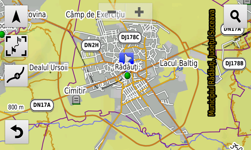
Lansare RO.A.D.2015.30RO.A.D.2015.30 Launch

Lansare RO.A.D.2015.30

Astăzi, 8 decembrie 2015, la 12 ani de la lansarea Proiectului România Digitală, Sheba Distribution SRL, reprezentant al firmei Garmin în Romania, are plăcerea să anunţe disponibilitatea noii ediţii a Atlasului Digital al României v7.30, RO.A.D.2015.30.
RO.A.D.2015.30 Launch

Today, on the 8th of December 2015, marking the 12th anniversary of our Digital Romania Project, Sheba Distribution SRL, a Garmin representative in Romania, has the pleasure to announce the availability of the new edition of the Digital Atlas of Romania v7.30, RO.A.D.2015.30.
Continue reading →